Who What Where WhenREMOVEWHO
|
Author
[Reid, John, Winterbotham, W.]
Full Title
(Title Page to) The American Atlas; Containing The Following Maps ... New-York: Published By John Reid, Bookseller And Stationer, No. 106, Water-Street. 1796.
Publisher
John Reid
Author
Humboldt, Alexander von, 1769-1859
Full Title
(Title Page to) Atlas Geographique Et Physique Du Royaume De La Nouvelle-Espagne, Fonde Sur Des Observations Astronomiques, Des Mesures Trigonometriques Et Des Nivellemens Barometriques. Par Al. De Humboldt. Paris, Chez F. Schoell, Rue Des Fosses-Saint-Germain-L'Auxerrois, No. 29. 1811. De L'Imprimerie De J.H. Stone.
Publisher
F. Schoell
Author
Jefferys, Thomas
Full Title
(Title Page to) The American Atlas: Or, A Geographical Description Of The Whole Continent Of America ... Engraved On Forty-Eight Copper Plates, By The Late Mr. Thomas Jefferys, Geographer to the King, and Others. London, Printed and Sold by R. Sayer and J. Bennett, Map and Print Sellers, No. 53, Fleet-Street. MDCCLXXVI.
Publisher
Sayer and Bennett
Author
Henshaw, Frances A.
Full Title
(Title Page to) Frances A. Henshaw's Book of Penmanship Executed at the Middlebury Female Academy April 29, 1823.
Publisher
Manuscript
Author
Schonberg & Co.
Full Title
(Title Page and Index Page to) Schonberg's Atlas of the United States and Canada with Mexico & the West Indies ... New York, Schonberg & Co. 1867. San Francisco: H.H. Bancroft & Co. Chicago: Goodspeed & Co. Entered ... 1867 by Schonberg & Co. ... New York.
Publisher
Schonberg & Co.
Author
[Akademiia nauk SSSR, L'Isle, Joseph Nicolas de, Academie der Wissenschafften, Academy of Sciences, St. Petersburg]
Full Title
(Title Page to) (Atlas Russicus) Russischer Atlas : Welcher in einer General-Charte und neunzehen Special-Charten das gesamte Russische Reich und dessen angraentzende Laender, nach den Regeln der Erd-Beschreibung und den ne Academie der Wissenschafften. St. Petersburg 1745. (Prepared under the direction of) Ivan Kirilov, and Joseph Nicolas Delisle.
Publisher
Kayserl. Academie der Wissenschafften
Author
Asher & Adams
Full Title
(Title Page to) Asher & Adams' new commercial, topographical, and statistical atlas and gazetteer of the United States: with maps showing the Dominion of Canada, Europe and the World ... Compiled, drawn, and engraved under the supervision of the publishers ... New York: Asher & Adams, 59 Beekman St. (on verso) Entered ... One Thousand Eight Hundred and Seventy-four, by Asher & Adams ... Washington. Electrotyped at the Franklin Type Foundry, Cincinnati.
Publisher
Asher and Adams
Author
Asher & Adams
Full Title
(Title Page Verso) Asher & Adams' new commercial, topographical, and statistical atlas and gazetteer of the United States: with maps showing the Dominion of Canada, Europe and the World ... Compiled, drawn, and engraved under the supervision of the publishers ... New York: Asher & Adams, 59 Beekman St. (on verso) Entered ... One Thousand Eight Hundred and Seventy-four, by Asher & Adams ... Washington. Electrotyped at the Franklin Type Foundry, Cincinnati.
Publisher
Asher and Adams
Author
Mitchell, Samuel Augustus Jr.
Full Title
(Title Page) Mitchell's New Atlas Of The United States And Territories, Together With Plans Of The Principal Cities. Designed To Accompany And Illustrate The Centennial Gazetteer Of The United States. Published By Ziegler & McCurdy, Philadelphia, Pa., Cincinnati, O., Chicago, Ill., St. Louis, Mo., And Springfield, Mass. Entered ... 1874, by S. Augustus Mitchell ... Washington.
Publisher
Ziegler & McCurdy
Author
[Breese, Samuel, 1802-1873, Morse, Sidney E. (Sidney Edwards), 1794-1871]
Full Title
(Title Page, Contents to) Morse's North American atlas. Containing the following beautifully colored maps ... New York: Published by Harper & Brothers, 82 Cliff Street. Entered ... 1842, by Sidney E. Morse and Samuel Breese ... New York.
Publisher
Harper & Brothers
Author
[Lloyd, H.H., Warner & Beers]
Full Title
(Title Page to) Atlas of Whiteside Co. and the State of Illinois To Which Is Added An Atlas Of The United States, Maps of The Hemispheres &c. &c. &c. Warner & Beers. Publishers 62 & 64 West Lake Street, Chicago. 1872. Union Lith. & Printg. Co. Chicago. Assistants: Jos. H. Cox, W.H. Bishop, G.R. Hoffman, L.W. Wight, A.D. Miner, E.C. Moore ... H.R. Belden, John I. Moore, Chas. H. Sharp, R.T. Higgins, Wm. H. Beers, Frank W. Rorh. Entered ... 1872 by Warner & Beers ... Washington D.C.
Publisher
Warner & Beers
Author
[Howe, Samuel Gridley, Ruggles, Samuel P.]
Full Title
(Title Page) atlas of the united states, Printed for the use of the blind, at the expense of John C. Cray; under the direction of s.g. howe. at the n.e. institution for the education of the blind. boston 1837.
Publisher
New England Institution for the Education of the Blind
Author
Asher & Adams
Full Title
(Title Page to) Asher & Adams' New Columbian Rail Road Atlas and Pictorial Album of American Industry, Comprising a Series of New Copper Plate Maps Exhibiting the Thirty-Seven States ... Together With Illustrations and Descriptions of Mercantile and Manufacturing Establishments, Machinery, Works of Art, Mechanism, Trade-Marks, Etc., Etc. ... Compiled, Written, Drawn and Engraved Under the Supervision Of The Publishers, By Their Own Corps of Editors, Engineers, Topographers, and Artists.... New York: Asher & Adams, No. 59 Beekman Street. 1875
Publisher
Asher & Adams.
Author
Buchon, J. A. C.
Full Title
(Title Page to) Atlas geographique, statistique, historique et chronologique des deux Ameriques et des iles adjacentes; traduit de l'atlas execute en Amerique d'apres Lesage, avec de nombreuses corrections et augmentations, par J.A. Buchon. Dedie a S.A.R. le Duc d'Orleans. A Paris, A la librairie de J. Carez, Editeur, Rue Haute feuille, No. 18. Chez Verdiere, Quai des Augustins, No. 25. Chez Bossange, pere, Rue de Richelieu, No. 60. M. D CCC XXV. (on verso) Toul, Fonderie Et Imprimerie De J. Carez.
Publisher
J. Carez
Author
Levasseur, Victor.
Full Title
(Title Page to) Atlas National Illustre des 86 Departments et des Possessions De La France. Divise par Arrondissements, Cantons et Communes Avec Le Trace De Toutes Les Routes, Chemins De Fer Et Canaux. Dresse d'apres les Travaux du Cadastre du Depot de la Guerre et des Ponts et Chaussees, par V. Levasseur, Ingenieur Geographe attache au Genie du Cadastre et de la Ville de Paris. Grave Sur Acier Par Les Meilleurs Artistes. Publie par A. Combette Editeur Paris. 1856. Rue de la Parcheminerie No. 15. (title page only) Impie. de Lemercier, Paris. Eug. Duchez.
Publisher
A. Combette
Author
Cram, George Franklin
Full Title
(Title Page to) New Commercial Atlas Of The United States and Territories: (Scale, 21 Miles To The Inch.) Showing All Railroads, Stations, Cities, Towns, Villages, Congressional Townships, Etc., Etc. A Complete Shippers' Guide. Drawn And Engraved From The Very Latest Government Surveys. Published By The Cram Atlas Company, New York And Chicago: Western Office, No. 66 Lake Street, Chicago. Entered ... 1875, by The Cram Atlas Company ... Washington, District of Columbia. Printed At The Lakeside Press, Clark And Adams Sts., Chicago.
Publisher
Cram Atlas Company
Author
Garcia Cubas, Antonio, 1832-1912
Full Title
(Title Page to) Atlas metodico para la ensenanza de la geografia de la Republica Mexicana por el Ingeniero Antonio Garcia Cubas ... Mexico. Antigua Imprenta de Eduardo Murguia. Calle del Coliseo Viejo, Num. 2. 1899.
Publisher
Eduardo Murguia
Author
Thomson, John
Full Title
(Title Page to) The atlas of Scotland, containing maps of each county, on a scale so large as to exhibit the features of the country, and places of importance; the boundaries of the shires ... Accompanied with a Memoir of the geography of Scotland, view of the comparative length of the rivers, height of the mountains, and a consulting index, to facilitate the finding out of places, &c. Edinburgh: Printed for John Thomson & Co., Edinburgh; Baldwin & Cradock, London; and John Cumming, Dublin. 1832. (contents page) Edinburgh: Printed by James Clarke & Co.
Publisher
[Baldwin & Cradock, John Cumming, John Thomson & Co.]
Author
Rand McNally and Company
Full Title
(Title Page to) Rand McNally auto road atlas of the United States and Ontario, Quebec, and the Maritime Provinces of Canada, with a brief description of the national parks and monuments. Copyright, 1927, by Rand McNally & Company.
Publisher
Rand McNally
Author
Klinckowstrom, Axel Leonhard
Full Title
Title Page to: Atlas til Friherre Klinckowstroms Bref om de Forente Staterne. (Stockholm) Stente af C. Muller, (1824)
Publisher
C. Muller
Author
Garcia Cubas, Antonio, 1832-1912
Full Title
(Title Page to) Atlas geografico y estadistico de los Estados Unidos Mexicanos por Antonio Garcia Cubas. Publicado por Debray Sucesores, Portal del Coliseo Viejo num. 6. Mexico. (1886)
Publisher
Debray Sucesores
Author
Colton, G.W.
Full Title
(Title Page to) Colton's Atlas Of America. Illustrating The Physical And Political Geography Of North And South America And The West India Islands, By George W. Colton. Accompanied By Descriptions Geographical, Statistical, And Historical, By Richard Swainson Fisher, M.D. New York: J.H. Colton And Company, No. 172 William, Corner Beekman Street. 1857. Entered ... One Thousand Eight Hundred and Fifty-five, by J.H. Colton And Company ... New York.
Publisher
J.H. Colton
Author
[Algue, P. Jose., U.S. Coast and Geodetic Survey]
Full Title
(Title Page No. 1 to:) Atlas de Filipinas. Coleccion de 30 Mapas. Trabajados por delineantes filipinos bajo la direcion del P. Jose Algue, S.J., Director del Observatorio de Manila. 1899. A Hoen & Co. Lith., Balto. Md.
Publisher
U.S. Coast and Geodetic Survey
Author
[Algue, P. Jose., U.S. Coast and Geodetic Survey]
Full Title
(Title Page No. 2 to:) Atlas of the Philippine Islands. Treasury Department, U.S. Coast and Geodetic Survey. Henry S. Pritchett, Superintendent. Special Publication No. 3. Washington: Government Printing Office. 1900. (1899)
Publisher
U.S. Coast and Geodetic Survey
Author
Finley, Anthony
Full Title
(Title Page to) A New American Atlas, Designed Principally To Illustrate The Geography Of The United States Of North America; In Which Every Country In Each State And Territory Of The Union Is Accurately Delineated, As Far As At Present Known: The Whole Compiled From The Latest And Most Authentic Information. Philadelphia: Published By Anthony Finley, At The North-East Corner Of Chestnut And Fourth Streets. 1826.
Publisher
Anthony Finley
Author
[Götz, Antonín, Československá akademie věd., Czechoslovakia. Ústřední správa geodézie a kartografie.]
Full Title
(Title Page) Atlas Ceskoslovenske Socialisticke Republiky. (Atlas of the Czechoslovakian Socialist Republic).
Publisher
Czechoslovakia. Ústřední správa geodézie a kartografie.
Author
Bradford, Thomas G.
Full Title
(Title Page One to) An Illustrated Atlas, Geographical, Statistical, And Historical, Of The United States And The Adjacent Countries. By T.G. Bradford. Boston: Weeks, Jordan, And Company. New York: Wiley And Putnam. (on verso) Entered ... 1838, by Thomas G. Bradford ... Massachusetts. Cambridge: Stereotyped And Printed By Folsom, Wells, And Thurston, Printers To The University.
Publisher
[Weeks, Jordan & Co., Wiley and Putnam.]
Author
Bradford, Thomas G.
Full Title
(Title Page Two to) An Illustrated Atlas, Geographical, Statistical, And Historical, Of The United States And The Adjacent Countries. By T.G. Bradford. Boston: Weeks, Jordan, And Company. New York: Wiley And Putnam. (on verso) Entered ... 1838, by Thomas G. Bradford ... Massachusetts. Cambridge: Stereotyped And Printed By Folsom, Wells, And Thurston, Printers To The University.
Publisher
[Weeks, Jordan & Co., Wiley and Putnam.]
Author
Mexico. Direccion de Estudios Geográficos y Climatologicos
Full Title
(Title Page 1) Atlas geografico de la Republica Mexicana : Secretaria de Agricultura y Fomento : Direccion de Estudios Geograficos y Climatologicos 1919-1921.
Publisher
Direccion de Estudion Geograficos y Climatologicos
Author
Mexico. Direccion de Estudios Geográficos y Climatologicos
Full Title
(Title Page 2) Tipos y signos convencionales usados en el Atlas geografico de la Republica Mexicana : construido y editado en la Direccion de Estudios Geograficos y Climatologicos.
Publisher
Direccion de Estudion Geograficos y Climatologicos
Author
[Great Britain. Ordnance Survey, Mudge, William (1762-1820), Colby, Thomas, Baker, Benjamin, Great Britain. Board of Ordnance]
Full Title
Title sheet for Devon, The Second Part of the General Survey of England and Wales.
Publisher
[W. Mudge; Ordnance Survey, Thomas Colby (1784-1852)]
Author
[France. Armee. Genie, Jacotin, Pierre, 1765-1827]
Full Title
(Title Page to) Carte topographique de l'Egypte et de plusieurs parties des pays limitrophes, levee pendant l'Expedition de l'Armee francaise, par les ingenieurs-geographes, les officiers du Genie Militaire et les ingenieurs des ponts et chausees, assujettie aux observations des astronomes, construite par M. Jacotin, Colonel au Corps Royal des Ingenieurs-Geographes Militaires ... Gravee au Depot General de la Guerre, a l'echelle de 1 millimetre pour 100 metres. Publiee par ordre du gouvernement. Paris [1826]
Publisher
C.L.F. Panckoucke
Author
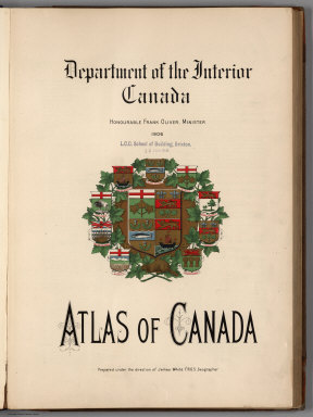
[White, James, Canada. Department of Interior]
Full Title
(Title Page to) Department of the Interior, Canada. Honorable Frank Oliver, Minister, 1906. Atlas of Canada. Prepared under the direction of James White, F.R.G.S., Geographer. (on verso) The Toronto Lithographing Company, Limited; Map engravers, and dedication note.
Publisher
Department of Interior
Author
[France. Commission des sciences et arts d'Egypte, Panckoucke, C. L. F. (Charles Louis Fleury), 1780-1844]
Full Title
(Title Page to) Description de l'Egypte ou recueil des observations et des recherches qui ont ete faites en Egypte pendant l'Expedition de l'Armee francaise. Seconde edition. Dediee au Roi. Publiee par C.L.F. Panckoucke, Chevalier de la Legion d'Honneur. Atlas geographique. Paris, Imprimerie de C.L.F. Panckoucke. MDCCCXXVI.
Publisher
C.L.F. Panckoucke
Author
[Ordnance Survey of Scotland, Farquharson, J.]
Full Title
(Title Page to) Ordnance Survey of Scotland: Scale 1 inch to a mile. Volume I. London : Edward Stanford Geographer to the Majesty. 26 & 27 Cockspur Street, Charing Cross, S.W. London agent for the sale of the Ordnance Survey maps ...
Publisher
[Ordnance survey Office, Edward Stanford]
Author
[Ordnance Survey of Scotland, Farquharson, J.]
Full Title
(Title Page to) Ordnance Survey of Scotland: Scale 1 inch to a mile. Volume II. London : Edward Stanford Geographer to the Majesty. 26 & 27 Cockspur Street, Charing Cross, S.W. London agent for the sale of the Ordnance Survey maps ...
Publisher
[Edward Stanford, Ordnance survey Office]
Author
[Ordnance Survey of Scotland, Farquharson, J.]
Full Title
(Title Page to) Ordnance Survey of Scotland: Scale 1 inch to a mile. Volume III. London : Edward Stanford Geographer to the Majesty. 26 & 27 Cockspur Street, Charing Cross, S.W. London agent for the sale of the Ordnance Survey maps ...
Publisher
[Edward Stanford, Ordnance survey Office]
Author
[Canada. Department of Interior, Chalifour, J.E.]
Full Title
(Title Page to) Department of the Interior Canada. Honourable W.J.Roche, Minister 1915. Atlas Of Canada. Revised and enlarged edition. Prepared under the direction of J.E. Chalifour, Chief Geographer. (on verso) dedication note.
Publisher
Department of Interior
Author
National Map Company
Full Title
(Title Page to) Official paved road and commercial survey of the United States. Sectional road maps covering the entire United States and lower Canada-Complete series of state maps in colors for commercial reference-A double page United States map showing main transcontinental highways ... Map and information concerning air mail and air express-Maps of principal cities in the United States showing main highways ... Descriptive gazetteer of United States and territorial possessions. National Map Company. Geographers-engravers-publishers, Indianapolis, Indiana. Edition 1262. Copyright, by National Map Company, Indianapolis, Indiana.
Publisher
National Map Company
Author
[Simpkin & Marshall, Wardle, Thomas]
Full Title
(Title Page to) An atlas of the United States of North America, corrected to the present period, accompanied by a condensed view of the history & geography of each state compiled from the latest official documents. London: Published by Simpkin & Marshall -- and Thomas Wardle, Philadelphia. 1832.
Publisher
[Simpkin & Marshall, Thomas Wardle]
Author
Poussin, Guillaume Tell, 1794-1876
Full Title
(Title Page to) Travaux d'ameliorations interieures projetes ou executes par le Gouvernement General des Etats-Unis d'Amerique, de 1824 a 1831; par Guillaume-Tell Poussin ... Atlas. Paris, Anselin, Libraire, pour l'art militaire, les sciences et les arts, rue Dauphine, No. 36, dans le passage Dauphine. Carilian-Goeury, Libraire, des ponts et chaussees et des mines, Quai des Augustins, No. 41. 1834. Imprimerie de Lachevardiere, rue du Colombier, No. 30.
Publisher
[Libraire Anselin, Libraire Carilian-Goeury]
Author
Wheeler, G.M.
Full Title
(Title Page to) Topographical Atlas Projected To Illustrate United States Geographical Surveys West Of The 100th Meridian Of Longitude Prosecuted In Accordance With Acts Of Congress Under The Authority Of The Honorable The Secretary Of War, And The Direction Of Brig. Genl. A.A. Humphreys, Chief Of Engineers, U.S. Army. Embracing Results Of the Different Expeditions Under The Command Of 1st Lieut. Geo. M. Wheeler, Corps Of Engineers. Julius Bien, lith.
Publisher
U.S.
Author
Wheeler, G.M.
Full Title
(Title Page to) Geological Atlas Projected To Illustrate Geographical Explorations And Surveys West Of The 100th Meridian Of Longitude Prosecuted In Accordance With Acts Of Congress Under The Authority Of The Honorable The Secretary Of War, And The Direction Of Brig. Genl. A.A. Humphreys, Chief Of Engineers, U.S. Army. Embracing Results Of the Different Expeditions Under The Command Of 1st Lieut. Geo. M. Wheeler, Corps Of Engineers. Julius Bien, lith.
Publisher
U.S.
Author
Morse, Sidney E. (Sidney Edwards), 1794-1871
Full Title
(Title Page to) An atlas of the United States, on an improved plan; consisting of ten maps, with a complete index to each, and a general map of the whole country. By Sidney E. Morse, A.M. New-Haven: engraved and published by N. & S.S. Jocelyn. 1823.
Publisher
N. & S.S. Jocelyn
Author
Carey, Mathew
Full Title
(Title Page to) Carey's American Pocket Atlas; Containing The Following Maps... With A Concise Description Of Each State. Philadelphia: Printed For Mathew Carey, By Lang and Ustick, 1796.
Publisher
Lang and Ustick
Author
Bradstreet Company
Full Title
(Title Page to) Bradstreet's Pocket Atlas Of The United States. Published Exclusively for Macullar, Parker & Company, Boston, Massachusetts ... New York: The Bradstreet Company, 1885. (on verso) Entered ... 1879, by The Bradstreet Company ... Washington.
Publisher
Bradstreet Co.
Author
Melish, John
Full Title
(Title Page to) A Military and Topographical Atlas of the United States; including The British Possessions & Florida ... To Which Is Added, A List Of The Military Districts, A Register Of The Army, And A List Of The Navy Of The United States. By John Melish. Philadelphia, Printed By G. Palmer. November, 1813.
Publisher
John Melish
Author
[Woerl, Joseph Edmund, Herder, Bartholomew]
Full Title
(Title Page to) Karte der Schweiz, von Dr. I. Woerl. Lithographie von B. Herder in Freiburg im Breisgau. Mitglied der königl. Academie der Kriegswissenschaften in Schweden, der königl. geographischen Societaeten zu London und Paris, der historischen Gesellschaft zu Freiburg i. B. etc.
Publisher
B. Herder
Author
[Codazzi, Agustín, 1793-1859, Paz, Manuel María, 1820-1902]
Full Title
(Title Page to) Atlas geografico e historico de la Republica de Colombia (Antigua Nueva Granada) : el cual comprende las repuublicas de Venezuela y Ecuador con arreglo a los trabajos geograficos del general de ingenieros Agustin Codazzio ejecutados en Venezuela y Nueva Granada. Construida la parte cartografica por Manuel M. Paz, Miembro de la Sociedad de Geografia de Paris. y redactado el texto explicativo por el doctor Felipe Perez. Todo de orden del Gobierno Nacional de Colombia. Paris - 1889, Imprenta A. Lahure, Calle de Fleures, 9.
Publisher
A. Lahure
|