Who What Where WhenREMOVEWHERE
|
REFINE
Browse All : National Atlas from 1831
1-32 of 32
Author
Mitchell, Samuel Augustus
Full Title
Map Of Virginia And Maryland Constructed from the Latest Authorities. Published by S. Augustus Mitchell Philadelphia. 1831. J.H. Young Sc. (inset) Plan Of Washington City & Georgetown.
Publisher
S.A. Mitchell
Author
Mitchell, Samuel Augustus
Full Title
Map Of North and South Carolina And Georgia, Constructed from the Latest Authorities. Published by S. Augustus Mitchell Philadelphia. 1831. J.H. Young Sc.
Publisher
S.A. Mitchell
Author
Mitchell, Samuel Augustus
Full Title
Map of Louisiana, Mississippi And Alabama Constructed from the Latest Authorities. Published by S. Augustus Mitchell Philadelphia. 1831. J.H. Young Sc.
Publisher
S.A. Mitchell
Author
Mitchell, Samuel Augustus
Full Title
Map of Kentucky And Tennessee Compiled from the Latest Authorities. Published by S. Augustus Mitchell Philadelphia. 1831. J.H. Young Sc.
Publisher
S.A. Mitchell
Author
Mitchell, Samuel Augustus
Full Title
Map of the States Of Ohio, Indiana & Illinois And Part Of Michigan Territory Compiled from the Latest Authorities. Published by S. Augustus Mitchell Philadelphia. 1831. J.H. Young Sc.
Publisher
S.A. Mitchell
Author
Mitchell, Samuel Augustus
Full Title
Map of the State of Missouri And Territory Of Arkansas Compiled From The Latest Authorities. Published by S. Augustus Mitchell Philadelphia. 1831. J.H. Young Sc.
Publisher
S.A. Mitchell
Author
Mitchell, Samuel Augustus
Full Title
Map Of Florida according to the Latest Authorities. Published by S. Augustus Mitchell Philadelphia. 1831. (inset below map) Comparative Elevation of the Principal Mountains Cities &c. in North & South America.
Publisher
S.A. Mitchell
Author
Mitchell, Samuel Augustus
Full Title
The West Indies from the Best Authorities. Published by S. Augustus Mitchell Philadelphia. 1831.
Publisher
S.A. Mitchell
Author
Mitchell, Samuel Augustus
Full Title
Map Of South America According To The Latest and Best Authorities. Published by S. Augustus Mitchell Philadelphia. 1831. J.H. Young Sc.
Publisher
S.A. Mitchell
Author
Mitchell, Samuel Augustus
Full Title
(Covers to) A New American Atlas, Designed Principally To Illustrate The Geography Of The United States Of North America; In Which Every Country In Each State And Territory Of The Union Is Accurately Delineated, As Far As At Present Known: The Whole Compiled From The Latest And Most Authentic Information. Philadelphia: Published By Samuel Augustus Mitchell. 1831.
Publisher
S.A. Mitchell
Author
Mitchell, Samuel Augustus
Full Title
(Title Page to) A New American Atlas, Designed Principally To Illustrate The Geography Of The United States Of North America; In Which Every Country In Each State And Territory Of The Union Is Accurately Delineated, As Far As At Present Known: The Whole Compiled From The Latest And Most Authentic Information. Philadelphia: Published By Samuel Augustus Mitchell. 1831.
Publisher
S.A. Mitchell
Author
Mitchell, Samuel Augustus
Full Title
(Index Page to) A New American Atlas, Designed Principally To Illustrate The Geography Of The United States Of North America; In Which Every Country In Each State And Territory Of The Union Is Accurately Delineated, As Far As At Present Known: The Whole Compiled From The Latest And Most Authentic Information. Philadelphia: Published By Samuel Augustus Mitchell. 1831.
Publisher
S.A. Mitchell
Author
Mitchell, Samuel Augustus
Full Title
Map Of North America Including All The Recent Geographical Discoveries. Published by S. Augustus Mitchell Philadelphia. 1831. J.H. Young Sc.
Publisher
S.A. Mitchell
Author
Mitchell, Samuel Augustus
Full Title
Map Of The United States Constructed From the latest Authorities. Published by S. Augustus Mitchell Philadelphia. 1831. J.H. Young Sc.
Publisher
S.A. Mitchell
Author
Mitchell, Samuel Augustus
Full Title
Map of Maine, New Hampshire And Vermont, Compiled From The Latest Authorities. Published by S. Augustus Mitchell Philadelphia. 1831. J.H. Young Sc. (inset) North Part of Maine.
Publisher
S.A. Mitchell
Author
Mitchell, Samuel Augustus
Full Title
Map Of Massachusetts, Connecticut And Rhode Island Constructed from the Latest Authorities. Published by S. Augustus Mitchell Philadelphia. 1831. J.H. Young Sc.
Publisher
S.A. Mitchell
Author
Mitchell, Samuel Augustus
Full Title
Map Of The State Of New York. Published by S. Augustus Mitchell Philadelphia. 1831. J.H. Young Sc. (inset) Map of the Hudson River from New York To Albany. (inset) Profile of the Levels of the Grand Erie Canal.
Publisher
S.A. Mitchell
Author
Mitchell, Samuel Augustus
Full Title
Map Of Pennsylvania, New Jersey And Delaware. Constructed from the Latest Authorities. Published by S. Augustus Mitchell Philadelphia. 1831. Engraved by J.H. Young.
Publisher
S.A. Mitchell
Author
[Hinton, Isaac Taylor, 1799-1847, Simpkin & Marshall]
Full Title
Map of the state of New York, with part of Upper Canada. (with) New York (City). London: Published April 1, 1831 by I.T. Hinton and Simpkin and Marshall. Engraved and printed by Fenner Sears & Co. (1832)
Publisher
[Simpkin & Marshall, Thomas Wardle]
Author
[Hinton, Isaac Taylor, 1799-1847, Simpkin & Marshall]
Full Title
Map of the states of Kentucky and Tennessee. London, published June 1, 1831, by I.T. Hinton and Simpkin & Marshall. Engraved & printed by Fenner Sears & Co. (1832)
Publisher
[Simpkin & Marshall, Thomas Wardle]
Author
[Hinton, Isaac Taylor, 1799-1847, Simpkin & Marshall]
Full Title
Map of the states of Virginia and Maryland. (with) Plan of Washington and Georgetown. London, published Sept. 1, 1831, by I.T. Hinton & Simpkin & Marshall. Engraved & printed by Fenner Sears & Co. (1832)
Publisher
[Simpkin & Marshall, Thomas Wardle]
Author
[Hinton, Isaac Taylor, 1799-1847, Simpkin & Marshall]
Full Title
Map of the states of Alabama and Georgia. (with) Plan of Savannah. London, published Oct. 15, 1831 by I.T. Hinton & Simpkin & Marshall. Engraved & printed by Fenner Sears & Co. (1832)
Publisher
[Simpkin & Marshall, Thomas Wardle]
Author
[Woerl, Joseph Edmund, Herder, Bartholomew]
Full Title
(Covers to)Karte der Schweiz, von Dr. I. Woerl. Lithographie von B. Herder in Freiburg im Breisgau. Mitglied der köngl. Avcademie der Kriegswissenscaften in Schweden, der königl. Geographischen Socitaeten zu London und Paris, der Historischen Gesellschaft zu Freiburg i. B. etc.
Publisher
B. Herder
Author
[Woerl, Joseph Edmund, Herder, Bartholomew]
Full Title
(Title Page to) Karte der Schweiz, von Dr. I. Woerl. Lithographie von B. Herder in Freiburg im Breisgau. Mitglied der königl. Academie der Kriegswissenschaften in Schweden, der königl. geographischen Societaeten zu London und Paris, der historischen Gesellschaft zu Freiburg i. B. etc.
Publisher
B. Herder
Author
[Woerl, Joseph Edmund, Herder, Bartholomew]
Full Title
(Index Page to) Titel der Karte. (on upper margin) Ubersichts - Karte der Schweiz, im Masstab 1:200,000. (to accompany) Karte der Schweiz, von Dr. I. Woerl. Lithographie von B. Herder in Freiburg im Breisgau.
Publisher
B. Herder
Author
[Woerl, Joseph Edmund, Herder, Bartholomew]
Full Title
Freiburg. Entworfen und bearbeitet von Woerl, in Stein gestochen unter seiner Leitung -1831. Im Herder'schen Kunst- Institut in Freiburg im Breisgau. (to accompany) Karte der Schweiz, von Dr. I. Woerl. Lithographie von B. Herder in Freiburg im Breisgau.
Publisher
B. Herder
Author
[Woerl, Joseph Edmund, Herder, Benjamin]
Full Title
Darmstadt. Entworfen und bearbeitet von Woerl in Stein gestochen unter seiner Leitung 1831. Im Herder'schen Kunst-Institut in Freburgn im Breisgan. (to accompany) Das Koenigreich Wuerttemberg Das Grossherzogthum Baden und die Fuurstenthuumer Hohenzollern.
Publisher
Herder'sche Kunst- u. Buchhandlung
Author
[Woerl, Joseph Edmund, Herder, Benjamin]
Full Title
Tubingen. Entworfen und bearbeitet von Woerl in Stein gestochen unter seiner Leitung 1831. Im Herder'schen Kunst-Institut in Freburgn im Breisgan. (to accompany) Das Koenigreich Wuerttemberg Das Grossherzogthum Baden und die Fuurstenthuumer Hohenzollern.
Publisher
Herder'sche Kunst- u. Buchhandlung
Author
[Woerl, Joseph Edmund, Herder, Benjamin]
Full Title
Ulm. Entworfen und bearbeitet von Woerl in Stein gestochen unter seiner Leitung 1831. Im Herder'schen Kunst-Institut in Freburgn im Breisgan. (to accompany) Das Koenigreich Wuerttemberg Das Grossherzogthum Baden und die Fuurstenthuumer Hohenzollern.
Publisher
Herder'sche Kunst- u. Buchhandlung
Author
[Woerl, Joseph Edmund, Herder, Benjamin]
Full Title
Freiburg. Entworfen und bearbeitet von Woerl, in Stein gestochen unter seiner Leitung 1831. Im Herder'schen Kunst- Institut in Freiburg im Bresgau. (to accompany) Das Koenigreich Wuerttemberg Das Grossherzogthum Baden und die Fuurstenthuumer Hohenzollern.
Publisher
Herder'sche Kunst- u. Buchhandlung
Author
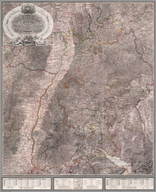
[Woerl, Joseph Edmund, Herder, Benjamin]
Full Title
(Composite of) Sheets 1 - 12 Das Koenigreich Wuerttemberg Das Grossherzogthum Baden und die Fuurstenthuumer Hohenzollern : entworfen und bearbeitet im Maasstabe 1:200 000 in 12 Blaettern von I.E. Woerl.
Publisher
Herder'sche Kunst- u. Buchhandlung
Author
[Woerl, Joseph Edmund, Herder, Benjamin]
Full Title
Assemblage zur karte von Sudwest-Deutschland u. dem Alpenlande. (to accompany) Das Koenigreich Wuerttemberg Das Grossherzogthum Baden und die Fuurstenthuumer Hohenzollern.
Publisher
Herder'sche Kunst- u. Buchhandlung
1-32 of 32
|