Browse All

1872 Atlas of Illinois, Counties of Douglas, … [National Atlas, State Atlas] Atlas of Illinois, Counties of Douglas, … |

1872 Atlas of Illinois, Counties of Jasper, C … [National Atlas, State Atlas] Atlas of Illinois, Counties of Jasper, C … |

1872 Atlas of Illinois, Counties of Fayette, … [National Atlas, State Atlas] Atlas of Illinois, Counties of Fayette, … |

1872 Atlas of Illinois, Counties of Madison, … [National Atlas, State Atlas] Atlas of Illinois, Counties of Madison, … |

1872 Atlas of Illinois, Counties of St.Clair, … [National Atlas, State Atlas] Atlas of Illinois, Counties of St.Clair, … |

1872 Atlas of Illinois, Counties of Wayne, Je … [National Atlas, State Atlas] Atlas of Illinois, Counties of Wayne, Je … |

1872 Atlas of Illinois, Counties of Saline, G … [National Atlas, State Atlas] Atlas of Illinois, Counties of Saline, G … |

1872 Atlas of Illinois, Counties of Jackson, … [National Atlas, State Atlas] Atlas of Illinois, Counties of Jackson, … |

1872 Map of the United States. [National Atlas, State Atlas] Map of the United States. Warner & Beers … |

1872 Atlas of the United States, New England, … [National Atlas, State Atlas] Atlas of the United States, New England, … |

1872 Atlas of the United States, Map of the C … [National Atlas, State Atlas] Atlas of the United States, Map of the C … |

1872 Atlas of the United States, Map of the W … [National Atlas, State Atlas] Atlas of the United States, Map of the W … |

1872 Atlas of the United States, Map of the S … [National Atlas, State Atlas] Atlas of the United States, Map of the S … |

1872 Texas. [National Atlas, State Atlas] Atlas of the United States, Map of Texas … |

1872 Territory of Dakota, Minnesota, and Nebr … [National Atlas, State Atlas] Atlas of the United States, Map of the T … |

1872 Montana, Idaho, and Wyoming. [National Atlas, State Atlas] Atlas of the United States, Map of the M … |

1872 Utah, Arizona, New Mexico, Kansas, Color … [National Atlas, State Atlas] Atlas of the United States, Map of Utah, … |

1872 Nevada and California. [National Atlas, State Atlas] Atlas of the United States, Map of Nevad … |

1872 Washington and Oregon. Territory of Alas … [National Atlas, State Atlas] Atlas of the United States, Map of the W … |

1872 West Indies. [National Atlas, State Atlas] Map of the West Indies. Warner & Beers, … |

1872 Western Hemisphere. Eastern Hemisphere [National Atlas, State Atlas] Western Hemisphere. Eastern Hemisphere. |

1872 Morrison, Whiteside County, Illinois. [National Atlas, State Atlas] Morrison. |

1872 Mt. Pleasant Township, Whiteside County, … [National Atlas, State Atlas] Mt. Pleasant. |

1872 Lyndon Township, Whiteside County, Illin … [National Atlas, State Atlas] Lyndon. (insets) Lyndon. Round Ground. |

1872 Prophetstown Township, Whiteside County, … [National Atlas, State Atlas] Prophetstown. |

1872 Newton Township, Whiteside County, Illin … [National Atlas, State Atlas] Newton. (inset) Mineral Springs. |

1872 Garden Plain Township, Whiteside County, … [National Atlas, State Atlas] Garden Plain. (inset) Unionville. |

1872 Fulton Township, Whiteside County, Illin … [National Atlas, State Atlas] Fulton. |

1872 Hopkins Township, Whiteside County, Illi … [National Atlas, State Atlas] Hopkins. (insets) Galt. Empire. |
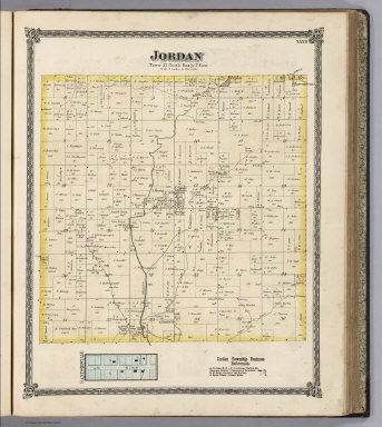
1872 Jordan Township, Whiteside County, Illin … [National Atlas, State Atlas] Jordan. (inset) Sanfordville. |

1872 58. Parts Of Eastern And Southern Nevada … National Atlas Parts Of Eastern And Southern Nevada And … |

1872 58. Parts Of Eastern & Southern Nevada A … National Atlas Parts Of Eastern & Southern Nevada And S … |

1872 66. Parts Of Eastern & Southeastern Neva … National Atlas Parts Of Eastern & Southeastern Nevada & … |

1872 49. Parts Of Eastern Nevada And Western … National Atlas Parts Of Eastern Nevada And Western Utah … |

1872 49. Parts Of Eastern Nevada And Western … National Atlas Parts Of Eastern Nevada And Western Utah … |

1872 Map Prepared to accompany the Lists of D … National Atlas Map Prepared to accompany the Lists of D … |