|
|
REFINE
Browse All : National Atlas of West Indies
1-40 of 40
Author
Mitchell, Samuel Augustus
Full Title
The West Indies from the Best Authorities. Published by S. Augustus Mitchell Philadelphia. 1831.
Publisher
S.A. Mitchell
Author
[Reid, John, Winterbotham, W.]
Full Title
An Accurate Map of the West Indies with the Adjacent Coast of America. 1796. D. Martin Sculpt. Publish'd by J. Reid New York.
Publisher
John Reid
Author
Humboldt, Alexander von, 1769-1859
Full Title
Carte Du Mexique et des Pays Limitrophes Situes Au Nord et a l'est Dressee d'apres la Grande Carte de la Nouvelle Espagne De Mr. A. De Humboldt et d'autres Materiaux par J.B. Poirson. 1811. 2. Grave par Barriere. et l'ecriture par L. Aubert. Se trouve a Paris chez F. Schoell, Libraire.
Publisher
F. Schoell
Author
Jefferys, Thomas
Full Title
An Accurate Map Of North America. Describing and distinguishing the British and Spanish Dominions on the great Continent; According to the Definitive Treaty Concluded at Paris 10th Feby. 1763. Also all the West India Islands Belonging to, and possessed by the Several European Princes and States. The whole laid down according to the latest and Most authentick Improvements, By Eman Bowen Gegr: to His Majesty and John Gibson Engraver. (with) inset map of The Passage by Land To California, Discovered by Father Eusebius Francis Kino a Jesuit. London. Printed for Robert Sayer No. 53 Fleet Street as the Act Directs 2d. July 1775.
Publisher
Sayer and Bennett
Author
Schonberg & Co.
Full Title
West Indies.
Publisher
Schonberg & Co.
Author
[Breese, Samuel, 1802-1873, Morse, Sidney E. (Sidney Edwards), 1794-1871]
Full Title
West India islands. (By Sidney E. Morse and Samuel Breese. New York: Published by Harper & Brothers, 1845)
Publisher
Harper & Brothers
Author
[Lloyd, H.H., Warner & Beers]
Full Title
Map of the West Indies. Warner & Beers, Publishers. From H.H. Lloyd & Co.'s Atlas of the United States.
Publisher
Warner & Beers
Full Title
Carte geographique, statistique et historique des Indes Occidentales. Indes Occidentales. Grave par B. de Beaupre, rue de Vaugirard, No. 81, a Paris. Fonderie et Imprimerie de J. Carez. (1825)
Publisher
J. Carez
Author
Bradford, Thomas G.
Full Title
North America. Entered ... 1838, by T.G. Bradford ... Massachusetts. Engraved by G.W. Boynton.
Publisher
[Weeks, Jordan & Co., Wiley and Putnam.]
Author
Finley, Anthony
Full Title
The West Indies from the Best Authorities. J.H. Young Sc. Philadelphia Published by A. Finley 1826.
Publisher
Anthony Finley
Author
Bradford, Thomas G.
Full Title
West Indies. (inset) Bermudas. Entered ... 1838, by T.G. Bradford ... Massachusetts. Engraved by G.W. Boynton.
Publisher
[Weeks, Jordan & Co., Wiley and Putnam.]
Author
[Johnston, Alexander Keith, 1804-1871, Rogers, Henry Darwin]
Full Title
West Indies. Island Of Cuba, (Spanish) Jamaica, (British). By Prof. H.D. Rogers & A. Keith Johnston, F.R.S.E. Entered in Sta. Hall. London ... & according to an act of Congress ... 1857, by H.D. Rogers ... Massachusetts. London, John Murray, Albemarle Street, Edinburgh, W. & A.K. Johnston. Engraved by W. & A.K. Johnston, Edinburgh.
Publisher
Edward Stanford
Author
[Paullin, Charles O., Wright, John K.]
Full Title
Plate 13. Cartography 1492-1867. Verrazano Map, 1529. (Facsimile).
Publisher
[Carnegie Institution of Washington, American Geographical Society of New York]
Author
Finley, Anthony
Full Title
Map of North America including All the Recent Geographical Discoveries, 1827.
Publisher
Anthony Finley
Author
Finley, Anthony
Full Title
The West Indies from the Best Authorities.
Publisher
Anthony Finley
Author
Gray, O.W.
Full Title
West Indies and Central America. (inset) The Burmuda Islands.
Publisher
Stedman & Brown
Author
[Morse, Sidney E., Breese, Samuel]
Full Title
West India Islands. (By Sidney E. Morse and Samuel Breese. New York: Published by Harper & Brothers, 1845). (to accompany) Morse's Cerographic Maps. No. VIII.
Publisher
Harper and Brothers
Author
Codazzi, Agustin, 1793-1859
Full Title
Mapa de las costas de Tierra-Firme, desde el Orinoco hasta Yucatan: de las islas Antillas y la mayor parte de las Lucayas con las derrotas que siguio Dn. Cristobal Colon en sus descubrimientos por estos mares y las derrotas de otros navigantes que reconocieron las costas de Venezuela. Lith. de Thierry Frs. a Paris. (Caracas 1840)
Publisher
[Agostino Codazzi, Thierry Freres.]
Author
Codazzi, Agustin, 1793-1859
Full Title
Mapa politico de Venezuela antes de la Revolucion de 1810. Mapa politico de la Republica de Venezuela en 1840. Lith. de Thierry freres a Paris. (Caracas 1840)
Publisher
[Agostino Codazzi, Thierry Freres.]
Author
Robert Sayer and John Bennett (Firm)
Full Title
A Compleat Map of the West Indies, Containing the Coasts of Florida, Louisiana, New Spain, and Terra Firma: with all the Islands. By Samuel Dunn, Mathematician. London: Printed for Robt. Sayer ... 10 January 1774.
Publisher
Sayer and Bennett
Author
Carey, Mathew
Full Title
A Chart of the West Indies, From the latest Marine Journals and Surveys. W. Barker sculp. Philada. Engraved for Carey's American Edition of Guthrie's Geography improved.
Publisher
Mathew Carey
Author
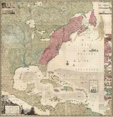
Popple, Henry
Full Title
(Composite Map of) A Map of the British Empire in America with the French and Spanish Settlements adjacent thereto. by Henry Popple.
Publisher
Willm. Henry Toms & R.W. Seale
Author
Smith, J. Calvin
Full Title
(United States, Mexico, Central America, Caribbean).
Publisher
Theodor Fischer
Author
Finley, Anthony
Full Title
Map of Florida according to the Latest Authorities. The West Indies from the Best Authorities. Comparative Elevation of the Principal Mountains, Cities, &c. in North and South America. Drawn by D.H. Vance. Published by A. Finley, Philadelphia. Engraved by J.H. Young.
Publisher
Anthony Finley
Author
Rand McNally and Company
Full Title
(Text Page) The West Indies - Islands, Lakes, Mountains, Rivers, and Towns.
Publisher
Rand McNally and Company
Author
Rand McNally and Company
Full Title
Commercial Atlas of America. Rand McNally 14 x 21 Inch Map of West Indies. (with) Jamaica (British). (with) Porto Rico (U.S.A.). (with) Lesser Antilles.
Publisher
Rand McNally and Company
Author
Rand McNally and Company
Full Title
(Text Page) Rand, McNally & Co.'s Cuba.
Publisher
Rand McNally
Author
Rand McNally and Company
Full Title
(Text Page) Rand, McNally & Co.'s Mexico.
Publisher
Rand McNally
Author
Colton, G.W.
Full Title
West Indies. Entered according to the Act of Congress in the year 1855 by J.H. Colton & Co. in the Clerk's Office of the District Court of the United States for the Southern District of New York.
Publisher
J.H. Colton
Author
Rand McNally and Company
Full Title
(Text Page) Rand, McNally Co.'s West Indies.
Publisher
Rand McNally and Company
Author
Rand McNally and Company
Full Title
Rand, McNally & Co.'s West Indies. (with) Jamaica. (with) Porto Rico. (with) (Windward Islands).
Publisher
Rand McNally and Company
Author
Rand McNally and Company
Full Title
Rand, McNally & Co.'s West Indies.
Publisher
Rand McNally
Author
[Carey, H. C., Lea, I.]
Full Title
Geographical, Historical, And Statistical Map Of The West Indies. West Indies. No. 39. Drawn by F. Lucas Jr. Engrav'd by Young & Delleker.
Publisher
H.C. Carey & I. Lea
Author
[Carey, H. C., Lea, I.]
Full Title
Geographical, Historical, And Statistical Map Of The Windward Islands. Windward Islands. No. 44. Drawn by F. Lucas Jr. Boyd sc.
Publisher
H.C. Carey & I. Lea
Author
[Carey, H. C., Lea, I.]
Full Title
Geographical, Historical, And Statistical Map Of The Leeward Islands. Leeward Islands. No. 45. J. Yeager Sculp.
Publisher
H.C. Carey & I. Lea
Author
Popple, Henry
Full Title
A Map of the British Empire in America with the French and Spanish Settlements adjacent thereto. by Henry Popple. (Sheet 14).
Publisher
Willm. Henry Toms & R.W. Seale.
Author
Popple, Henry
Full Title
A Map of the British Empire in America with the French and Spanish Settlements adjacent thereto. by Henry Popple. (Sheet 15).
Publisher
Willm. Henry Toms & R.W. Seale.
Author
Popple, Henry
Full Title
A Map of the British Empire in America with the French and Spanish Settlements adjacent thereto. by Henry Popple. (Sheet 14).
Publisher
Willm. Henry Toms & R.W. Seale
Author
Popple, Henry
Full Title
A Map of the British Empire in America with the French and Spanish Settlements adjacent thereto. by Henry Popple. (Sheet 15).
Publisher
Willm. Henry Toms & R.W. Seale
1-40 of 40
|