Browse All

1872 West Indies. [National Atlas, State Atlas] Map of the West Indies. Warner & Beers, … |

1872 Western Hemisphere. Eastern Hemisphere [National Atlas, State Atlas] Western Hemisphere. Eastern Hemisphere. |

1872 Morrison, Whiteside County, Illinois. [National Atlas, State Atlas] Morrison. |

1872 Mt. Pleasant Township, Whiteside County, … [National Atlas, State Atlas] Mt. Pleasant. |

1872 Lyndon Township, Whiteside County, Illin … [National Atlas, State Atlas] Lyndon. (insets) Lyndon. Round Ground. |

1872 Prophetstown Township, Whiteside County, … [National Atlas, State Atlas] Prophetstown. |

1872 Newton Township, Whiteside County, Illin … [National Atlas, State Atlas] Newton. (inset) Mineral Springs. |

1872 Garden Plain Township, Whiteside County, … [National Atlas, State Atlas] Garden Plain. (inset) Unionville. |

1872 Fulton Township, Whiteside County, Illin … [National Atlas, State Atlas] Fulton. |

1872 Hopkins Township, Whiteside County, Illi … [National Atlas, State Atlas] Hopkins. (insets) Galt. Empire. |
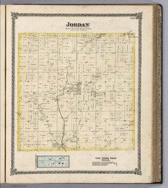
1872 Jordan Township, Whiteside County, Illin … [National Atlas, State Atlas] Jordan. (inset) Sanfordville. |

1837 Covers to: Atlas of the United States, P … [National Atlas, School Atlas] (Covers to) atlas of the united states, … |

1837 Title Page: Atlas of the United States, … [National Atlas, School Atlas] (Title Page) atlas of the united states, … |

1837 Text: Introduction. [National Atlas, School Atlas] (Text Page) Introduction. |

1837 Text: (Introduction - continued). [National Atlas, School Atlas] (Text Page) (Introduction - continued). |

1837 Maine. [National Atlas, School Atlas] (Maine). |

1837 Text: Map of Maine: Explanation. [National Atlas, School Atlas] (Text Page) Map of Maine. Explanation. |

1837 Vermont. [National Atlas, School Atlas] (Vermont). |

1837 Text: Map of Vermont: Explanation. [National Atlas, School Atlas] (Text Page) Map of Vermont. Explanation. |

1837 New Hampshire. [National Atlas, School Atlas] Map of New Hampshire. |

1837 Text: New Hampshire: Explanation. [National Atlas, School Atlas] (Text Page) New Hampshire. Explanation. |

1837 Massachusetts. [National Atlas, School Atlas] Map of Massachusetts. |

1837 Text: Massachusetts: Explanation. [National Atlas, School Atlas] (Text Page) Massachusetts: Explanation. |

1837 Rhode Island. [National Atlas, School Atlas] Map of Rhode Island. |

1837 Text: Rhode Island: Explanation. [National Atlas, School Atlas] (Text Page) Rhode Island. Explanation. |

1837 Connecticut. [National Atlas, School Atlas] Map of Connecticut. |

1837 Text: Connecticut: Explanation. [National Atlas, School Atlas] (Text Page) Connecticut. Explanation. |

1837 New York. [National Atlas, School Atlas] Map of New York. |

1837 Text: New York: Explanation. [National Atlas, School Atlas] (Text Page) New York: Explanation. |

1837 Pennsylvania. [National Atlas, School Atlas] Map of Pennsylvania. |

1837 Text: Pennsylvania: Explanation. [National Atlas, School Atlas] (Text Page) Pennsylvania: Explanation. |

1837 New Jersey. [National Atlas, School Atlas] Map of New Jersey. |

1837 Text: New Jersey: Explanation. [National Atlas, School Atlas] (Text Page) New Jersey: Explanation. |

1837 Maryland and Delaware. [National Atlas, School Atlas] Map of Maryland and Delaware. |

1837 Text: Maryland and Delaware: Explanation … [National Atlas, School Atlas] (Text Page) Maryland (and Delaware): Exp … |

1837 Virginia and Maryland [National Atlas, School Atlas] Virginia and Maryland |

1837 Text: Virginia and Maryland: Explanation … [National Atlas, School Atlas] (Text Page) Virginia and Maryland Explan … |

1837 District of Columbia. [National Atlas, School Atlas] Map of the District of Columbia. |

1837 Text: District of Columbia: Explanation. [National Atlas, School Atlas] (Text Page) District of Columbia: Explan … |

1837 North & South Carolina. [National Atlas, School Atlas] Map of North & South Carolina. |

1837 Text: North & South Carolina: Explanatio … [National Atlas, School Atlas] (Text Page) North & South Carolina: Expl … |

1837 South Carolina and Georgia. [National Atlas, School Atlas] Map of South Carolina and Georgia. |

1837 Text: South Carolina and Georgia: Explan … [National Atlas, School Atlas] (Text Page) South Carolina & Georgia Exp … |

1837 Florida. [National Atlas, School Atlas] Map of Florida. |

1837 Text: Florida: Explanation. [National Atlas, School Atlas] (Text Page) Explanation: Florida. |

1837 Mississippi. [National Atlas, School Atlas] Map of Mississippi. |

1837 Text: Mississippi. [National Atlas, School Atlas] (Text Page) Mississippi Explanation. |

1837 Alabama. [National Atlas, School Atlas] Alabama. |

1837 Text: Alabama: Explanation. [National Atlas, School Atlas] (Text Page) Alabama. Explanation. |

1837 Louisiana. [National Atlas, School Atlas] Map of Louisiana. |