Browse All

1840 Island of Natrai, Island of Angau (Gau o … Chart Map Island of Natrai, Feejee (Fiji) Group, b … |

1840 Island of (Keteira), Island of Totoia (T … Chart Map Island of Moala (Keteira), Feejee (Fiji) … |

1840 Harbours of Mbenga, Rewa-Roads, South Si … Chart Map Island and Harbours of Mbenga, South Sid … |

1840 Eastern Group, Fiji. Chart Map Eastern Group, Feejee (Fiji) Islands, by … |

1840 Western End of Viti Levu, with the Ship … Chart Map Western End of Viti Levu, with the Ship … |
1840 Island of Yendua, Nucumurry Harbour, Wai … Chart Map Island of Yendua, Feejee (Fiji) Group, b … |

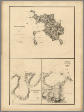
1841 Raritona Harbour, Emmons Bay, Island of … Chart Map Raritona Harbour, Island of Ya-Asaua (Ya … |

1841 Harbour of (Macuata-i-wai), Tibethe & Vi … Chart Map Harbour of Muthuata (Macuata-i-wai), Nor … |

1841 Eastern Group, Sheet 1, Feejee (Fiji) Is … Chart Map Eastern Group, Sheet 1, Feejee (Fiji) Is … |

1841 Eastern Group, Sheet 2, Feejee (Fiji) Is … Chart Map Eastern Group, Sheet 2, Feejee (Fiji) Is … |

1841 Whippy Harbour, Suva Harbour, Granby Har … Chart Map Whippy Harbour, South Side of Viti Levu, … |

1841 Island of Ovolau (Ovalau), Feejee (Fiji) … Chart Map Island of Ovolau (Ovalau), Feejee (Fiji) … |

1841 Asaua or Western Group, Feejee (Fiji) Is … Chart Map Asaua or Western Group, Feejee (Fiji) Is … |

1841 Port Safety, Island of Kea (Kioa); Fawn … Chart Map Port Safety, Island of Kea (Kioa), East … |

1841 Island of Goro (Koro), Feejee (Fiji) Gro … Chart Map Island of Goro (Koro), Feejee (Fiji) Gro … |

1841 North Side of Vanu Levu from Aramula Pas … Chart Map Channel on the North Side of Vanu Levu f … |

1841 North Side of Viti Levu from Sakau Bay t … Chart Map North Side of Viti Levu with the Ship Pa … |

1841 M'Bua or Sandalwood Bay (Savusavu Bay), … Chart Map M'Bua or Sandalwood Bay, Island of Vanua … |

1841 Channel of the North Side of Vanua Levu … Chart Map Channel of the North Side of Vanua Levu … |

1840 Channel on the South Western Side of Van … Chart Map Channel on the South Western Side of Van … |