|   
                     
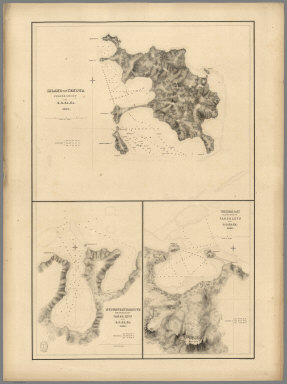
                     1839


                     Harbour of Mataatu, Island of Savaii. Ha


                     Chart Map


                     Harbour of Mataatu, Island of Savaii, (S
                     
                    | 
      
        |   
                     
                     1841


                     (Tabiteuea) Island, Peacock's Anchorage,


                     Chart Map


                     Taputeoiea (Tabiteuea) or Drummond's Isl
                     
                    | 
      
        |   
                     
                     1840


                     Island of (Keteira), Island of Totoia (T


                     Chart Map


                     Island of Moala (Keteira), Feejee (Fiji)
                     
                    | 
      
        |   
                     
                     1840


                     Harbours of Mbenga, Rewa-Roads, South Si


                     Chart Map


                     Island and Harbours of Mbenga, South Sid
                     
                    | 
      
        |   
                     
                     1840


                     Eastern Group, Fiji.


                     Chart Map


                     Eastern Group, Feejee (Fiji) Islands, by
                     
                    | 
      
        |   
                     
                     1840


                     Western End of Viti Levu, with the Ship 


                     Chart Map


                     Western End of Viti Levu, with the Ship 
                     
                    | 
      
        |   
                     
                     1840


                     Admiralty Inlet, Washington.


                     Chart Map


                     Ports Orchard and Madison including the 
                     
                    | 
      
        |   
                     
                     1839


                     Bay of Massefao, Bay of Fagitua, Island 


                     Chart Map


                     Bay of Massefao, Island of Tutuila, by t
                     
                    | 
      
        |   
                     
                     1841


                     (Nanumanga), Maraki Island, Maiana Islan


                     Chart Map


                     Hudson's Island (Nanumanga), by the U.S.
                     
                    | 
      
        |   
                     
                     1840


                     Island of Yendua, Nucumurry Harbour, Wai


                     Chart Map


                     Island of Yendua, Feejee (Fiji) Group, b
                     
                    | 
      
        |   
                     
                     1841


                     (Nonouti) Island, Makin Island, (Butarit


                     Chart Map


                     Nanouti Bishop or Sydenhams Island (Nono
                     
                    | 
      
        |   
                     
                     1841


                     Raritona Harbour, Emmons Bay, Island of 


                     Chart Map


                     Raritona Harbour, Island of Ya-Asaua (Ya
                     
                    | 
      
        |   
                     
                     1841


                     Wahiawa Harbour, Waimea Bay, Hulaia Harb


                     Chart Map


                     Wahiawa Harbour, South Side of Kauai, Ha
                     
                    | 
      
        |   
                     
                     1841


                     Fangaloa Bay, North Side of Upolu, Samoa


                     Chart Map


                     Fangaloa Bay, North Side of Upolu, by th
                     
                    | 
      
        |   
                     
                     1841


                     Apia or Charlotte Island, Tarawa or Knox


                     Chart Map


                     Apia or Charlotte Island, Kingsmill Grou
                     
                    | 
      
        |   
                     
                     1841


                     Harbour of Ewa or Pearl River, Harbour o


                     Chart Map


                     Harbour of Ewa or Pearl River, Island of
                     
                    | 
      
        |   
                     
                     1841


                     Harbour of (Macuata-i-wai), Tibethe & Vi


                     Chart Map


                     Harbour of Muthuata (Macuata-i-wai), Nor
                     
                    | 
      
        |   
                     
                     1841


                     (Fakaofo), (Nukunonu Atoll), Oatafu or D


                     Chart Map


                     Fakaafo (Fakaofo) or Bowditch Island, by
                     
                    | 
      
        |   
                     
                     1841


                     (Hereheretue Atoll), (Nukutepipi), (Anua


                     Chart Map


                     St. Pablo (Hereheretue Atoll), Paumotu G
                     
                    | 
      
        |   
                     
                     1841


                     Disappointment Group, Serle (Pukaruha or


                     Chart Map


                     Disappointment Group, by the U.S.Ex.Ex. 
                     
                    | 
      
        |   
                     
                     1841


                     Eastern Group, Sheet 1, Feejee (Fiji) Is


                     Chart Map


                     Eastern Group, Sheet 1, Feejee (Fiji) Is
                     
                    | 
      
        |   
                     
                     1841


                     Harbour of Uafatu, Harbour of Saluafata,


                     Chart Map


                     Harbour of Uafatu, Island of Upolu, U.S.
                     
                    | 
      
        |   
                     
                     1841


                     Eastern Group, Sheet 2, Feejee (Fiji) Is


                     Chart Map


                     Eastern Group, Sheet 2, Feejee (Fiji) Is
                     
                    | 
      
        |   
                     
                     1841


                     Whippy Harbour, Suva Harbour, Granby Har


                     Chart Map


                     Whippy Harbour, South Side of Viti Levu,
                     
                    | 
      
        |   
                     
                     1841


                     Island of Ovolau (Ovalau), Feejee (Fiji)


                     Chart Map


                     Island of Ovolau (Ovalau), Feejee (Fiji)
                     
                    | 
      
        |   
                     
                     1841


                     Asaua or Western Group, Feejee (Fiji) Is


                     Chart Map


                     Asaua or Western Group, Feejee (Fiji) Is
                     
                    | 
      
        |   
                     
                     1841


                     Makatea Island, Tauere, Takurea or Wolco


                     Chart Map


                     Metia (Makatea) Island, Paumotu Group by
                     
                    | 
      
        |   
                     
                     1841


                     Kawahe (Kauehi)or Vincennes Island, Rara


                     Chart Map


                     Kawahe (Kauehi)or Vincennes Island, Paum
                     
                    | 
      
        |   
                     
                     1841


                     Port Safety, Island of Kea (Kioa); Fawn 


                     Chart Map


                     Port Safety, Island of Kea (Kioa), East 
                     
                    | 
      
        |   
                     
                     1841


                     Harbour of Sanaapu (Saanapi, Safatu, Saf


                     Chart Map


                     Harbour of Sanaapu (Saanapi, Safatu, Saf
                     
                    | 
      
        |   
                     
                     1839


                     Islands of Manua (Manu'a), Ofoo (Ofu), O


                     Chart Map


                     Islands of Manua (Manu'a), Ofoo (Ofu) & 
                     
                    | 
      
        |   
                     
                     1841


                     Island of Goro (Koro), Feejee (Fiji) Gro


                     Chart Map


                     Island of Goro (Koro), Feejee (Fiji) Gro
                     
                    | 
      
        |   
                     
                     1841


                     Swains Island,Jarvis' Island, Birnies Is


                     Chart Map


                     Swains Island, by the U.S.Ex.Ex. 1841. J
                     
                    | 
      
        |   
                     
                     1841


                     Orange Harbour, Tierra del Fuego, Survey


                     Chart Map


                     Orange Harbour, Tierra del Fuego, Survey
                     
                    | 
      
        |   
                     
                     1841


                     Gardiner's or Kemins Island (Nikumaroro)


                     Chart Map


                     Gardiner's or Kemins Island (Nikumaroro)
                     
                    | 
      
        |   
                     
                     1841


                     Funafuti or Ellices Island, Nukufetau or


                     Chart Map


                     Funafuti or Ellices Island, by the U.S.E
                     
                    | 
      
        |   
                     
                     1841


                     Tatara or King's Island,Henuake, Honden,


                     Chart Map


                     Tatara or King's Island, by the U.S.Ex.E
                     
                    | 
      
        |   
                     
                     1841


                     Wollaston Island, Tierra del Fuego, by t


                     Chart Map


                     Seagull Harbour, Cretton Bay, Wollaston 
                     
                    | 
      
        |   
                     
                     1841


                     Ahii (Ahe) and Manhii (Turipaoa) or Peac


                     Chart Map


                     Ahii (Ahe) and Manhii (Turipaoa) or Peac
                     
                    | 
      
        |   
                     
                     1841


                     Hawaiian Group or Sandwich Islands.


                     Chart Map


                     Map of Hawaiian Group or Sandwich Island
                     
                    | 
      
        |   
                     
                     1841


                     Harbours of Papieti, Toanoa, Papaoa and 


                     Chart Map


                     Harbours of Papieti, Toanoa, Papaoa and 
                     
                    | 
      
        |   
                     
                     1841


                     Deans, Krusensterns, and Lazareff Island


                     Chart Map


                     Deans, Krusensterns, and Lazareff Island
                     
                    | 
      
        |   
                     
                     1841


                     Colsee-ed (Quilcene) Harbour, Suquamish 


                     Chart Map


                     Colsee-ed Harbour, Hoods Canal, Oregon T
                     
                    | 
      
        |   
                     
                     1841


                     North Side of Vanu Levu from Aramula Pas


                     Chart Map


                     Channel on the North Side of Vanu Levu f
                     
                    | 
      
        |   
                     
                     1841


                     North Side of Viti Levu from Sakau Bay t


                     Chart Map


                     North Side of Viti Levu with the Ship Pa
                     
                    | 
      
        |   
                     
                     1841


                     M'Bua or Sandalwood Bay (Savusavu Bay), 


                     Chart Map


                     M'Bua or Sandalwood Bay, Island of Vanua
                     
                    | 
      
        |   
                     
                     1841


                     New Dunginess Roads and Budds Harbour (S


                     Chart Map


                     New Dunginess Roads and Budds Harbour, S
                     
                    | 
      
        |   
                     
                     1841


                     Grays Harbour, Oregon Territory (Washing


                     Chart Map


                     Grays Harbour, Oregon Territory by the U
                     
                    | 
      
        |   
                     
                     1841


                     Harbour of Waiakea (Hilo), Island of Haw


                     Chart Map


                     Chart of the Harbour of Waiakea, Island 
                     
                    | 
      
        |   
                     
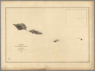
                     1841


                     Samoan or Navigator Islands.


                     Chart Map


                     Samoan or Navigator Islands by the U.S. 
                     
                    |