Browse All

1841 Asaua or Western Group, Feejee (Fiji) Is … Chart Map Asaua or Western Group, Feejee (Fiji) Is … |

1841 Makatea Island, Tauere, Takurea or Wolco … Chart Map Metia (Makatea) Island, Paumotu Group by … |

1841 Kawahe (Kauehi)or Vincennes Island, Rara … Chart Map Kawahe (Kauehi)or Vincennes Island, Paum … |

1841 Port Safety, Island of Kea (Kioa); Fawn … Chart Map Port Safety, Island of Kea (Kioa), East … |

1841 Harbour of Sanaapu (Saanapi, Safatu, Saf … Chart Map Harbour of Sanaapu (Saanapi, Safatu, Saf … |

1839 Islands of Manua (Manu'a), Ofoo (Ofu), O … Chart Map Islands of Manua (Manu'a), Ofoo (Ofu) & … |

1841 Island of Goro (Koro), Feejee (Fiji) Gro … Chart Map Island of Goro (Koro), Feejee (Fiji) Gro … |

1841 Swains Island,Jarvis' Island, Birnies Is … Chart Map Swains Island, by the U.S.Ex.Ex. 1841. J … |

1841 Orange Harbour, Tierra del Fuego, Survey … Chart Map Orange Harbour, Tierra del Fuego, Survey … |

1841 Gardiner's or Kemins Island (Nikumaroro) … Chart Map Gardiner's or Kemins Island (Nikumaroro) … |

1841 Funafuti or Ellices Island, Nukufetau or … Chart Map Funafuti or Ellices Island, by the U.S.E … |

1841 Tatara or King's Island,Henuake, Honden, … Chart Map Tatara or King's Island, by the U.S.Ex.E … |

1841 Wollaston Island, Tierra del Fuego, by t … Chart Map Seagull Harbour, Cretton Bay, Wollaston … |

1841 Ahii (Ahe) and Manhii (Turipaoa) or Peac … Chart Map Ahii (Ahe) and Manhii (Turipaoa) or Peac … |

1841 Hawaiian Group or Sandwich Islands. Chart Map Map of Hawaiian Group or Sandwich Island … |

1841 Harbours of Papieti, Toanoa, Papaoa and … Chart Map Harbours of Papieti, Toanoa, Papaoa and … |

1841 Deans, Krusensterns, and Lazareff Island … Chart Map Deans, Krusensterns, and Lazareff Island … |

1841 Colsee-ed (Quilcene) Harbour, Suquamish … Chart Map Colsee-ed Harbour, Hoods Canal, Oregon T … |

1841 North Side of Vanu Levu from Aramula Pas … Chart Map Channel on the North Side of Vanu Levu f … |

1841 North Side of Viti Levu from Sakau Bay t … Chart Map North Side of Viti Levu with the Ship Pa … |

1841 M'Bua or Sandalwood Bay (Savusavu Bay), … Chart Map M'Bua or Sandalwood Bay, Island of Vanua … |

1841 New Dunginess Roads and Budds Harbour (S … Chart Map New Dunginess Roads and Budds Harbour, S … |

1841 Grays Harbour, Oregon Territory (Washing … Chart Map Grays Harbour, Oregon Territory by the U … |

1841 Harbour of Waiakea (Hilo), Island of Haw … Chart Map Chart of the Harbour of Waiakea, Island … |
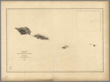
1841 Samoan or Navigator Islands. Chart Map Samoan or Navigator Islands by the U.S. … |

1841 Harbour of Pago Pago, Island of Tutuila. Chart Map Harbour of Pago Pago, Island of Tutuila … |

1841 Port Ludlow, Port Gamble, Hoods Canal, O … Chart Map Port Ludlow, Hoods Canal, Oregon Territo … |

1841 St. Juan Harbour, Straits of Fuca, Vanco … Chart Map St. Juan Harbour, Straits of Fuca, Vanco … |

1841 Channel of the North Side of Vanua Levu … Chart Map Channel of the North Side of Vanua Levu … |

1840 Channel on the South Western Side of Van … Chart Map Channel on the South Western Side of Van … |

1839 Island of Upolu, Samoan Group. Chart Map Island of Upolu, Samoan Group by the U.S … |

1841 Scabock (Seabeck) Harbour, Hooetzen Harb … Chart Map Scabock Harbour, Hoods Canal, Oregon Ter … |

1948 Great Lakes including Canals and Tributa … World Atlas The Northern and Northwestern Lakes incl … |