Browse All

1841 Ahii (Ahe) and Manhii (Turipaoa) or Peac … Chart Map Ahii (Ahe) and Manhii (Turipaoa) or Peac … |

1841 Hawaiian Group or Sandwich Islands. Chart Map Map of Hawaiian Group or Sandwich Island … |

1841 Harbours of Papieti, Toanoa, Papaoa and … Chart Map Harbours of Papieti, Toanoa, Papaoa and … |

1841 Deans, Krusensterns, and Lazareff Island … Chart Map Deans, Krusensterns, and Lazareff Island … |

1841 Colsee-ed (Quilcene) Harbour, Suquamish … Chart Map Colsee-ed Harbour, Hoods Canal, Oregon T … |

1841 North Side of Vanu Levu from Aramula Pas … Chart Map Channel on the North Side of Vanu Levu f … |

1841 North Side of Viti Levu from Sakau Bay t … Chart Map North Side of Viti Levu with the Ship Pa … |

1841 M'Bua or Sandalwood Bay (Savusavu Bay), … Chart Map M'Bua or Sandalwood Bay, Island of Vanua … |

1841 New Dunginess Roads and Budds Harbour (S … Chart Map New Dunginess Roads and Budds Harbour, S … |

1841 Grays Harbour, Oregon Territory (Washing … Chart Map Grays Harbour, Oregon Territory by the U … |

1841 Harbour of Waiakea (Hilo), Island of Haw … Chart Map Chart of the Harbour of Waiakea, Island … |
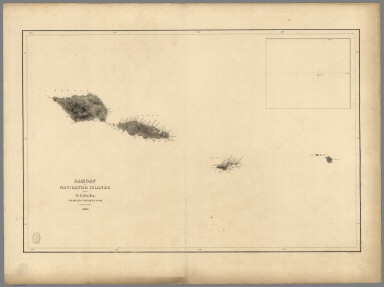
1841 Samoan or Navigator Islands. Chart Map Samoan or Navigator Islands by the U.S. … |

1841 Harbour of Pago Pago, Island of Tutuila. Chart Map Harbour of Pago Pago, Island of Tutuila … |

1841 Port Ludlow, Port Gamble, Hoods Canal, O … Chart Map Port Ludlow, Hoods Canal, Oregon Territo … |

1841 St. Juan Harbour, Straits of Fuca, Vanco … Chart Map St. Juan Harbour, Straits of Fuca, Vanco … |

1841 Channel of the North Side of Vanua Levu … Chart Map Channel of the North Side of Vanua Levu … |

1840 Channel on the South Western Side of Van … Chart Map Channel on the South Western Side of Van … |

1839 Island of Upolu, Samoan Group. Chart Map Island of Upolu, Samoan Group by the U.S … |

1841 Scabock (Seabeck) Harbour, Hooetzen Harb … Chart Map Scabock Harbour, Hoods Canal, Oregon Ter … |

1932 Plate 1. Natural Environment. [Historical Atlas, National Atlas] Plate 1. Natural Environment: Natural Re … |

1968 World Political. [School Atlas, World Atlas] World Political. |

1968 Atlantic Ocean. [School Atlas, World Atlas] Atlantic Ocean. |

1968 Indian and Pacific Oceans Physical. [School Atlas, World Atlas] Indian and Pacific Oceans Physical. |

1907 Natural Vegetation & Ocean Currents. For … Statistical Atlas Natural Vegetation & Ocean Currents. For … |

1852 Chart of the World Showing the Forms and … Physical Atlas Chart of the World Showing the Forms and … |

1980 Oblique Map of the Gulf of Alaska. Geologic Atlas Oblique Map of the Gulf of Alaska. |

1972 The Aleutian-Kamchatka Convergence, Nort … Geologic Atlas The Aleutian-Kamchatka Convergence, Nort … |

1988 Central Aleutian Arc, Alaska. Geologic Atlas Central Aleutian Arc, Alaska. |

1969 Eastern Aleutian Trench and Northern Gul … Geologic Atlas Eastern Aleutian Trench and Northern Gul … |

1969 A Part of the Eastern Aleutian Trench. Geologic Atlas A Part of the Eastern Aleutian Trench. |

1981 Amlia Corridor, Alaska. Geologic Atlas Amlia Corridor, Alaska. |

1981 Barrow Canyon, Alaska. Geologic Atlas Barrow Canyon, Alaska. |

1980 Oblique Map of the Beaufort Sea and the … Geologic Atlas Oblique Map of the Beaufort Sea and the … |

1970 Bering Canyon, Aleutian Islands, Alaska. Geologic Atlas Bering Canyon, Aleutian Islands, Alaska. |

1974 Oblique Map of the Bering Sea. Geologic Atlas Oblique Map of the Bering Sea. |

1972 Northern Bering Sea. Geologic Atlas Northern Bering Sea. |

1975 Physiography Bering Sea Shelf, Alaska. Geologic Atlas Physiography Bering Sea Shelf, Alaska. |

1975 Physiography and Cross Sections Bering S … Geologic Atlas Physiography and Cross Sections Bering S … |

1975 Pre-Tertiary Rocks Bering Sea Shelf, Ala … Geologic Atlas Pre-Tertiary Rocks Bering Sea Shelf, Ala … |

1976 Pre-Tertiary Rocks Southern Bering Sea S … Geologic Atlas Pre-Tertiary Rocks Southern Bering Sea S … |

1970 Buldir Depression, Aleutian Islands, Ala … Geologic Atlas Buldir Depression, Aleutian Islands, Ala … |

1979 Emperor Seamounts, North Pacific Ocean. Geologic Atlas Emperor Seamounts, North Pacific Ocean. |

1981 Oblique Map of Hess Rise and Vicinity, N … Geologic Atlas Oblique Map of Hess Rise and Vicinity, N … |

1975 Icy Bay, Alaska. Geologic Atlas Icy Bay, Alaska. |

1978 Kayak Trough, Gulf of Alaska. Geologic Atlas Kayak Trough, Gulf of Alaska. |

1970 Nuka Bay, Alaska. Geologic Atlas Nuka Bay, Alaska. |

1978 Pamplona Ridge, Gulf of Alaska. Geologic Atlas Pamplona Ridge, Gulf of Alaska. |

1964 Passage Canal, Alaska. Geologic Atlas Passage Canal, Alaska. |

1970 Pribilof Canyon, Bering Sea, Alaska. Geologic Atlas Pribilof Canyon, Bering Sea, Alaska. |

1970 Exploded Diagram Pribilof Canyon, Bering … Geologic Atlas Exploded Diagram Pribilof Canyon, Bering … |