Browse All

1922 No. 21: Puebla National Atlas Puebla. Secretaria de Agricultura y Fome … |

1922 No. 21A: Relief map of Puebla National Atlas (Relief map of Puebla). (to accompany) A … |

1922 No. 22: Queretaro National Atlas Queretaro. Secretaria de Agricultura y F … |

1922 No. 22A: Relief map of Queretaro National Atlas (Relief map of Queretaro). (to accompany … |

1922 No. 23: Quintana Roo National Atlas Quintana Roo. Secretaria de Agricultura … |

1922 No. 23A: Relief map of Quintana Roo National Atlas (Relief map of Quintana Roo). (to accomp … |

1922 No. 24: San Luis Potosi National Atlas S. Luis Potosi. Secretaria de Agricultur … |

1922 No. 24A: Relief map of San Luis Potosi National Atlas (Relief map of S. Luis Potosi). (to acco … |

1922 No. 25: Sianloa National Atlas Sinaloa. Secretaria de Agricultura y Fom … |

1922 No. 25A: Relief map of Sinaloa National Atlas (Relief map of Sinaloa). (to accompany) … |

1922 No. 26: Sonora National Atlas Sonora. Secretaria de Agricultura y Fome … |

1922 No. 26A: Relief map of Sonora National Atlas (Relief map of Sonora). (to accompany) A … |

1922 No. 27: Tabasco National Atlas Tabasco. Secretaria de Agricultura y Fom … |

1922 No. 27A: Relief map of Tabasco National Atlas (Relief map of Tabasco). (to accompany) … |

1922 No. 28: Tamaulipas National Atlas Tamaulipas. Secretaria de Agricultura y … |

1922 No. 28A: Relief map of Tamaulipas National Atlas (Relief map of Tamaulipas). ( to accompa … |

1922 No. 29: Tlaxcala National Atlas Tlaxcala. Secretaria de Agricultura y Fo … |

1922 No. 29A: Relief map of Tlaxcala National Atlas (Relief map of Tlaxcala). (to accompany) … |

1922 No. 30: Veracruz National Atlas Veracruz. Secretaria de Agricultura y Fo … |

1922 No. 30A: Relief map of Veracruz National Atlas (Relief map of Veracruz). (to accompany) … |

1922 No. 31: Yucatan National Atlas Yucatan. Secretaria de Agricultura y Fom … |

1922 No. 31A: Relief map of Yucatan National Atlas (Relief map of Yucatan). (to accompany) … |

1922 No. 32: Zacatecas National Atlas Zacatecas. Secretaria de Agricultura y F … |

1922 No. 32A: Relief map of Zacatecas National Atlas (Relief map of Zacatecas). (to accompany … |

1909 No.1b. Relef i rastitelnyi pokrov zemnoy … World Atlas No.1b. Relef i rastitelnyi pokrov zemnoy … |

1857 IV. Isothermal chart of the Atlantic Oce … Physical Atlas IV. Isothermal chart of the Atlantic Oce … |
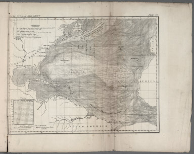
1857 VI. Gulf stream and drift Physical Atlas VI. Gulf Stream and drift. (to accompany … |

1857 VII. Geological agency of the winds Physical Atlas VII. Geological agency of the winds. D. … |

1857 VIII. Winds and routes Physical Atlas VIII. Winds and routes. (to accompany) T … |

1857 IX. Sea drift and whales Physical Atlas IX. Sea drift and whales, on which the m … |

1857 X. August and September Hurricane of 184 … Physical Atlas X. August and September Hurricane of 184 … |

1857 XI. Basin of the North Atlantic Ocean Physical Atlas XI. Basin of the North Atlantic Ocean. E … |

1915 West sheet. Physical map of the Dominion … National Atlas West Sheet. (on upper margins) Physical. … |

1915 East sheet. Physical map of the Dominion … National Atlas Physical map of the Dominion of Canada. … |

1864 World land surface. School Atlas The World showing the diversities of the … |

1827 Vents (Asie) Physical Atlas Theorie des vents (Asie, Ocean Indien, O … |

1827 Vents (Ocean Pacifique) Physical Atlas Theorie des vents (Ocean Pacifique). Gra … |

1827 Gulf-Stream. Physical Atlas Carte du courant qui sort par le Canal d … |

1827 La Manche. Physical Atlas Carte et coupe du Canal de la Manche. Bo … |

1827 Distribution primitive du genre humain. Physical Atlas Distribution primitive du genre humain a … |

1827 Carte des glaces boreales. Physical Atlas Carte des glaces, circompolaires boreale … |

1827 Carte des glaces australes. Physical Atlas Carte des glaces, circompolaires austral … |

1827 Vents (Amerique) Physical Atlas Theorie des vents (Amerique. A Paris, Ch … |

1827 Vents (Afrique) Physical Atlas Theorie des vents (Afrique, Ocean Atlant … |

1827 Virginie, Pensylvanie. Physical Atlas Carte des montagnes coupees par des rivi … |

1827 La Charente. Physical Atlas Cours de la Charente avec ses oscillatio … |

1827 La Charente. Physical Atlas (Cours de la Charente avec ses oscillati … |

1827 La Seine. Physical Atlas Plan incline et bords escarpes de deux o … |

1827 La Marne. Physical Atlas Plan du confluent de la Marne. Grave par … |

1827 La Seine, l'Oise. Physical Atlas Plan du confluent de la Seine et de l'Oi … |