Who What Where WhenREMOVEWHERE
|
Author
Schoyer, Solomon
Full Title
Map Of The United States Drawn from the most approved Surveys. Published by Solomon Schoyer. New York. Engraved by G.W. Merchant Albany.
Publisher
Solomon, Schoyer
Author
Lloyd, H.H.
Full Title
Lloyd's Dollar Map Of The United States. Published By H.H. Lloyd & Co. 170 Fulton Street. New York. Copyright 1876, By H.H. Lloyd & Co.
Publisher
H.H. Lloyd
Author
Goldthwait, J.H.
Full Title
Goldthwait's Map Of The United States, British Provinces, Mexico, Central America, W. India Is. &c. Exhibiting The Railroads ... by J.H. Goldthwait. Published by D. Chester, 119 & 121 Nassau St. New York. Entered ... 1861 by J.H. Goldthwait ... New York. (inset) Great Rail Road Routes from the Middle Atlantic Ports To The Mississippi River by J.H. Goldthwait. (inset) Of The Railroads Of New England And Eastern N . York by J.H. Goldthwait.
Publisher
D. Chester
Author
Perris, William
Full Title
A New And Complete Rail Road Map Of The United States, Compiled from Reliable Sources by William Perris, C.E. & Surveyor, New York. Presented by the Home Insurance Company of New York ... Office Nos. 112 & 114 Broadway ... Korff Brothers Practical Lithographers 54 William St. New York.
Publisher
Korff Brothers
Author
Colton, G.W. & C.B.
Full Title
Colton's Railroad & Commercial Atlas Of The United States, Canada Etc. Map No. 5. Michigan, Wisconsin & Minnesota. Published by G.W. & C.B. Colton. & Co. New York, 1869.
Publisher
G.W. & C.B. Colton
Author
Colton, J.H.
Full Title
Colton's Map Of The Oil District Of West Virginia And Ohio. Published By J.H. Colton 172 William St. N.Y. 1865. Second Edition. Entered ... 1864 by J.H. Colton ... New York.
Publisher
J.H. Colton
Author
Lloyd, J.T.
Full Title
Lloyd's New Map of the United States The Canadas And New Brunswick From the latest Surveys Showing Every Railroad & Station Finished to June 1863 And The Atlantic And Gulf Coasts ... 1863 ... Address J.T. Lloyd, No. 164 Broadway, New York, and 1 Strand, London, England. Entered ... 1863, by J.T. Lloyd ... New York.
Publisher
J.T. Lloyd
Author
Ohman, August R.
Full Title
Map Of The United States Showing Territorial Expansion Of A Century - 1804 To 1904. Designed and drawn for Judge Wm. T. Hall, Richmond, Me. by August R. Ohman 97-101 Warren Street, N.Y. Copyright, 1904, by August R. Ohman. (with 12 inset maps).
Publisher
A.R. Ohman
Author
Watson, Gaylord
Full Title
Watson's New Map Of The Western States, Territories, Mexico, And Central America. Published by Gaylord Watson, 16 Beekman Street, New York. Chicago: W.W. Wadsworth, 135 So. Water St. Entered ... 1869, by Gaylord Watson ... New York. (inset) Central America.
Publisher
W.W. Wadsworth
Author
Watson, Gaylord
Full Title
(Covers to) Watson's New Map Of The Western States, Territories, Mexico, And Central America. Published by Gaylord Watson, 16 Beekman Street, New York. Chicago: W.W. Wadsworth, 135 So. Water St. Entered ... 1869, by Gaylord Watson ... New York. (inset) Central America.
Publisher
W.W. Wadsworth
Author
Blanchard, Rufus
Full Title
(West half) Cabinet Map Of The United States And Territories On A Rectangular Projection Showing The Location Of Gold Silver And Other Minerals The Railroads And Principal Cities ... Compiled From Government Maps And Published By Rufus Blanchard. 146 Lake St. Chicago, Ill. 1868. Entered ... 1868, by R. Blanchard ... Ill. Engraved by Jerome T. Gouget, at R. Blanchard's Map Establishment ... Lith. Printing by Chas. Shober & Co. Chicago. (inset) A Map of The Western Part of the Territories belonging to the United States of America. (inset) Map Of The World Showing the Great Throughfare Between Europe & Asia Through the United States.
Publisher
Rufus Blanchard
Author
Blanchard, Rufus
Full Title
(East half) Cabinet Map Of The United States And Territories On A Rectangular Projection Showing The Location Of Gold Silver And Other Minerals The Railroads And Principal Cities ... Compiled From Government Maps And Published By Rufus Blanchard. 146 Lake St. Chicago, Ill. 1868. Entered ... 1868, by R. Blanchard ... Ill. Engraved by Jerome T. Gouget, at R. Blanchard's Map Establishment ... Lith. Printing by Chas. Shober & Co. Chicago. (inset) A Map of The Western Part of the Territories belonging to the United States of America. (inset) Map Of The World Showing the Great Throughfare Between Europe & Asia Through the United States.
Publisher
Rufus Blanchard
Author
Dawson Brothers
Full Title
New Map Of The Dominion Of Canada. Dawson Brothers, Montreal. 1870. Engraved & Printed in Colours by J. Bartholomew, Edinburgh. (inset) Newfoundland. (inset) Environs Of Montreal.
Publisher
Dawson Brothers
Author
[Atwood, J.M., Thayer, Bridgman & Fanning]
Full Title
Map Of The United States, Canada, Mexico And The West Indies with Central America, Showing all the routes to California with a table of Distances. New York, Thayer, Bridgman & Fanning, 156, William St. cor. of Ann St. 1853. D. McLellan, Lithogr. 26 Spruce St. N.Y.
Publisher
Thayer, Bridgman & Fanning
Author
[Dripps, Matthew, Rand McNally and Company]
Full Title
New Official Railroad Map Of The United States And Canada. Address, M. Dripps, 111 & 113, Fulton Street, New York. Copyright, 1883, by Rand, McNally & Co. Map Publishers, Chicago. (inset) Map Of Atlantic Coast States Engraved On Enlarged Scale. (with 8 additional inset maps).
Publisher
M. Dripps
Author
Rand McNally and Company
Full Title
Rand, McNally & Co.'s New Commercial Map Of The United States And Canada Showing All The Railroads, Counties and Principal Towns Up To Date. Constructed from the latest Government and Railroad Surveys. 1883. Engraved And Published By Rand, McNally & Co., Map Publishers, Chicago. Copyright, 1883, by Rand, McNally & Co. ...
Publisher
Rand McNally and Co.
Author
Duval, P.S. and Son
Full Title
Military Map Of The United States & Territories Showing The Location of the Military Posts, Arsenals, Navy Yards, & Ports of Entry. Compiled from Pub - Doc - 1861. Published by P.S. Duval & Son. Nos. 22&24 South 5th St. Philada. Entered ... 1861 by P.S. Duval & Son ... Penna. (inset) Pensacola & Perdido Bays. (untitled inset map of Key West).
Publisher
P.S. Duval & Son
Author
Colton, G.W. & C.B.
Full Title
Colton's Map Of The United States Of America, The British Provinces, Mexico and the West Indies. Showing the Country from the Atlantic to the Pacific Ocean. Engraved, Printed & Published by G.W. & C.B. Colton & Co. New York. 1885. Entered ... 1884 by G.W. & C.B. Colton & Co. ... Washington.
Publisher
G.W. & C.B. Colton
Author
Lloyd, H.H.
Full Title
New Map Of The United States. Published By H.H. Lloyd & Co. 21 John St. New York. (with) New Map Of The U.S. Territories And Pacific States. Published By H.H. Lloyd & Co. 21 John St. New York. 1866. Entered ... 1862 by H.H. Lloyd ... New York. 1866. Entered ... 1866 by H.H. Lloyd ... New York. (with 3 inset profiles).
Publisher
Lloyd, H.H.
Author
Lloyd, H.H.
Full Title
New Map Of The U.S. Territories And Pacific States. Published By H.H. Lloyd & Co. 21 John St. New York. 1866. Entered ... 1862 by H.H. Lloyd ... New York. (with) New Map Of The United States. Published By H.H. Lloyd & Co. 21 John St. New York. 1866. Entered ... 1866 by H.H. Lloyd ... New York. (with 3 inset profiles).
Publisher
Lloyd, H.H.
Author
Colton, G.W. & C.B.
Full Title
Colton's Railroad & Commercial Atlas Of The United States, Canada Etc. Map No. 6. Delaware, Maryland, Virginia, West Virginia, N. Carolina, Kentucky & Tennessee. Published by G.W. And C.B. Colton, & Co. 172 William St. New York. 1870. Entered ... 1866, by G.W. & C.B. Colton & Co ... N.Y.
Publisher
G.W. & C.B. Colton
Author
Poor, Henry Varnum
Full Title
Map of all the Railroads In The United States in Operation and Progress. Published by H.V. Poor, Editor of "The American Railroad Journal," 9 Spruce St., N.Y. D. McLellan, Lithographer, 26 Spruce St. New York.
Publisher
H.V. Poor
Author
[Rand McNally and Company, Smith, J.L.]
Full Title
Rand, McNally & Co.'s New Official Railroad Map Of The United States, Canada And Mexico. Engraved And Printed By Rand, McNally & Co., Chicago. 1889. Rand, McNally & Co., Map Publishers and Engravers, Chicago And New York. Copyright, 1889, by Rand, McNally & Co. Map Publishers, Chicago. (inset) Map Of Atlantic Coast States Engraved On Enlarged Scale. (with 8 additional inset maps).
Publisher
J.L. Smith
Author
Ensign, Bridgman & Fanning
Full Title
Ensign, Bridgman & Fanning's Rail Road Map Of The United States Showing the Depots & Stations. Published at No. 156 William St. N.Y. 1860. Printed by D. & J. McLellan, 26 Spruce St. N.Y. Entered ... 1856, by Ensign, Bridgman & Fanning ... New York. (inset) Plan of the New England States.
Publisher
Ensign, Bridgman & Fanning
Author
Bromme, Traugott
Full Title
Post-Kanal-Und Eisenbahnkarte Der Vereinigten Staaten Von Nord-Amerika. Nach Smith, Tanner, Mitchell und den Berichten des General-Postamts bearbeitet Von Traugott Bromme in Stahl gestochen v. J.A. Buhler. Philadelphia Chestnut-Street 195, John Weik, Publisher & Importer. Stuttgart Hoffmann'fche Verlagshandlung. 1855. (inset) Oregon, California Und Der Mormonen-Staat: Deseret. (with 6 additional inset maps).
Publisher
[John Weik, Hoffmann'fche Verlagshandlung.]
Author
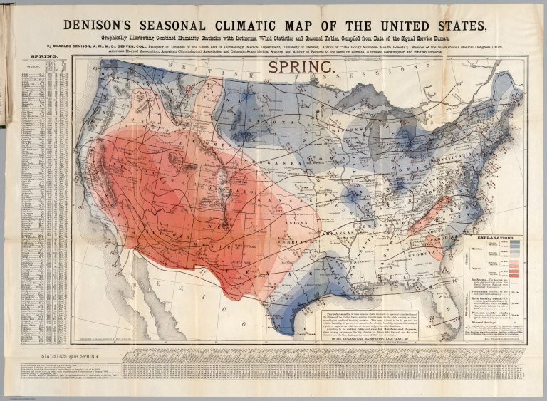
Denison, Charles
Full Title
Spring. Denison's seasonal climatic map of the United States, Graphically illustrating combined humidity statistics with isotherms, wind statistics and seasonal tables, compiled from data of the Signal Service Bureau. By Charles Denison, A.M.M.D, Denver, Col. ... Copyright, 1884, by Charles Denison, A.M.M.D, Denver, Col. Rand McNally & Co. Engr's., Chicago. (to accompany) Descriptive circular of the annual and seasonal climatic maps of the United States.
Publisher
Rand, McNally & Co.
Author
Denison, Charles
Full Title
Summer. Denison's seasonal climatic map of the United States, Graphically illustrating combined humidity statistics with isotherms, wind statistics and seasonal tables, compiled from data of the Signal Service Bureau. By Charles Denison, A.M.M.D, Denver, Col. ... Copyright, 1884, by Charles Denison, A.M.M.D, Denver, Col. Rand McNally & Co. Engr's., Chicago. (to accompany) Descriptive circular of the annual and seasonal climatic maps of the United States.
Publisher
Rand, McNally & Co.
Author
Denison, Charles
Full Title
Autumn. Denison's seasonal climatic map of the United States, Graphically illustrating combined humidity statistics with isotherms, wind statistics and seasonal tables, compiled from data of the Signal Service Bureau. By Charles Denison, A.M.M.D, Denver, Col. ... Copyright, 1884, by Charles Denison, A.M.M.D, Denver, Col. Rand McNally & Co. Engr's., Chicago. (to accompany) Descriptive circular of the annual and seasonal climatic maps of the United States.
Publisher
Rand, McNally & Co.
Author
Denison, Charles
Full Title
Winter. Denison's seasonal climatic map of the United States, Graphically illustrating combined humidity statistics with isotherms, wind statistics and seasonal tables, compiled from data of the Signal Service Bureau. By Charles Denison, A.M.M.D, Denver, Col. ... Copyright, 1884, by Charles Denison, A.M.M.D, Denver, Col. Rand McNally & Co. Engr's., Chicago. (to accompany) Descriptive circular of the annual and seasonal climatic maps of the United States.
Publisher
Rand, McNally & Co.
Author
Denison, Charles
Full Title
Denison's annual climatic map of the United States, Graphically illustrating cloudiness with isotherms, precipitation lines, winds (arrows) and annual tables. Compiled from data of the Signal Service Bureau. by Charles Denison, A.M.M.D, Denver, Col. ... Copyright, 1884, by Charles Denison, A.M.M.D, Denver, Col. Rand McNally & Co. Engr's., Chicago. (to accompany) Descriptive circular of the annual and seasonal climatic maps of the United States.
Publisher
Rand, McNally & Co.
Author
Rand McNally and Company
Full Title
Pennsylvania Railroad Great Trunk Line, and United States mail route ... copyright, 1881, by Rand, McNally & Co., Chicago ... (inset) Vicinity of Boston. (inset) Vicinity of New York and Philadelphia.
Publisher
Rand McNally & Co.
Author
[Central Pacific Railroad Company, Union Pacific Railroad Company]
Full Title
New map of the American Overland Route showing its connections, and land grants of 30,000,000 acres. Rand, McNally & Co., Chicago. (1879)
Author
[New York Central Railroad Company, Rand McNally and Company]
Full Title
Map of the United States showing the New York Central Lines and connections ... Copyright, Rand McNally & Company. (inset map) Atlantic Ocean and surrounding countries. (inset map) The water level route, New York Central Lines. (1929)
Publisher
Rand McNally
Author
American Airlines, inc.
Full Title
American Airlines system map. Route of the flagships ... in relation to the air transport system of the United States ... Prepared for American Airlines, Inc. Copyright, General Drafting Co., Inc., 21 West Street, New York, N.Y. ... (with 12 strip maps on verso.) (1945?)
Publisher
General Drafting Co.
Author
American Airlines, inc.
Full Title
(Verso of) American Airlines system map. Route of the flagships ... in relation to the air transport system of the United States ... Prepared for American Airlines, Inc. Copyright, General Drafting Co., Inc., 21 West Street, New York, N.Y. ... (with 12 strip maps on verso.) (1945?)
Publisher
General Drafting Co.
Author
Colton, George Woolworth, 1827-1901
Full Title
G. Woolworth Colton's map of the country 500 miles around the city of Washington : showing the seat of war in the East. Drawn, engraved & published by G. Woolworth Colton, 18 Beekman Street, New York 1861. (inset) Vicinity of Ft. Monroe & Norfolk. Entered ... 1861 by G. Woolworth Colton ... New York.
Publisher
G. Woolworth Colton
Author
Rand McNally and Company
Full Title
Rand, McNally & Co's. New Commercial Railroad Map Of The United States With Portions Of The Dominion Of Canada, The Republic Of Mexico, And The West Indies. Compiled from the most reliable sources, and engraved by Rand, McNally & Co., Map Engravers and Publishers, 160-174 Adams Street, Chicago, Ill. 1907.
Publisher
Rand McNally & Co.
Author
American Telephone and Telegraph Company
Full Title
Lines And Metallic Circuit Connections. American Telephone and Telegraph Company. 15 Dey St., New York September 1898. (inset) Maine.
Publisher
No Publisher
Author
Andriveau-Goujon, E.
Full Title
Carte Generale Des Etats - Unis Et Du Mexique Comprenant L'Amerique Centrale Et Les Antilles. E. Andriveau-Goujon, Editeur. Paris, Rue Du Bac, 21. 1865 ... (with four inset maps).
Publisher
Andriveau-Goujon
Author
Atwood, J.M.
Full Title
Map Of The United States, Canada, Mexico, Central America, and the West India Islands With a Portion of Venezuela & New Granada; Showing the routes overland and by the Isthmus to California and Oregon, Also the new Boundaries of California, Utah, & New Mexico, Compiled from the latest Authorities. Engraved & Published By J.M. Atwood, No. 19 Beekman Street, New York. 1851. D. McLellan, Printr. Spruce St ... Entered ... 1851, by J.M. Atwood ... New York.
Publisher
J.M. Atwood
Author
Barber, John Warner
Full Title
Map Of The United States exhibiting the principal Rail Road & Steam boat Routes.
Publisher
J.W. Barber
Author
[Mitchell, Samuel Augustus, Young, James H.]
Full Title
Mitchell's Travellers Guide Through The United States. A Map Of The Roads, Distances, Steam Boat & Canal Routes &c. By J.H. Young. Philadelphia. Published by S. Augustus Mitchell. 1832. Engraved On Steel By J.H. Young And D. Haines. Entered ... 1832, by S. Augustus Mitchell ... Pennsylvania. (with 9 inset maps).
Publisher
S.A. Mitchell
Author
Clason Map Company
Full Title
(Covers to) Radio Broadcasting Stations Of The United States Showing Calls And Divisions Of Time. Copyrighted The C.M. Co. All Rights Reserved.
Publisher
Clason Map Company
Author
Colton, J. H.
Full Title
(Covers to) Map Of The United States The British Provinces Mexico &c. Showing the Routes of the U.S. Mail Steam Packets to California, & A Plan of the Gold Region. Published By J.H. Colton, 86 Cedar St. New York. 1849. Drawn & Engraved by J.M. Atwood. New York. Entered ... 1849 by J.H. Colton ... New York. (inset) Map Of The Gold Region. California. (untitled inset of South America).
Publisher
J.H. Colton
Author
Colton, J. H.
Full Title
(Covers to) Map Of The United States Of America, The British Provinces, Mexico, the West Indies and Central America, with part of New Grenada and Venezuela. New York, Published By J.H. Colton, No. 86 Cedar St. 1849. Map Drawn by Geo. W. Colton, Engraved by John M. Atwood, Border Desigd. & Engd. by W.S. Barnard. Entered ... 1848 by J.H. Colton ... New York. (inset) A Map Of The Atlantic Ocean Showing The American & European Ports and the Routes Of The Ocean Steamers.
Publisher
J.H. Colton
Author
Keeler, William J.
Full Title
(Covers to) National Map Of The Territory Of The United States From The Mississippi River To The Pacific Ocean. Made by the authority of the Hon. O.H. Browning, Secretary of the Interior. ... Compiled from authorized explorations of Pacific Rail Road Routes, Public Surveys, and other reliable data from the Departments of the Government at Washington, D.C. by W.J. Keeler, Civil Engineer. 1868. Entered ... 1867 by Wm. J. Keeler ... Columbia. N. DuBois Draughtsman.
Publisher
No Publisher
Author
G.W. & C.B. Colton & Co.
Full Title
(Covers to) Colton's Railroad And Military Map Of The United States, Mexico, The West Indies &c. Published By G.W. & C.B. Colton, 172 William St. New York. 1865. Printed by Cooper 117 Fulton St. N.Y. (inset) Colton's Map Of The Americas, Africa And A Portion Of Europe, Showing The Atlantic And Part Of The Pacific Oceans. (8 additional inset maps).
Publisher
G.W. & C.B. Colton
Author
Colton, G.W & C.B.
Full Title
(Covers to) Colton's Railroad And Military Map Of The United States, Mexico, The West Indies &c. By J.H. Colton, New York, 1862. Entered ... 1862, by J.H. Colton ... New York.
Publisher
G.W. & C.B. Colton.
Author
[Finley, Anthony, Grigg, John, Young, James H.]
Full Title
(Covers to) United States. J.H. Young Sc. XXIX.
Publisher
John Grigg
Author
[Mitchell, Samuel Augustus, Drake, Ira S.]
Full Title
Mitchell's New Traveller's Guide Through The United States, Containing The Principal Cities, Towns &c. ... Illustrated By An Accurate Map Of The United States. Philadelphia: Thomas, Cowperthwait & Co. 1853. (on verso) Entered ... 1848, by Thomas, Cowperthwait & Co. ... Pennsylvania. Stereotyped by J. Fagan. Printed by Smith & Peters. (with map) Mitchell's New Traveller's Guide Through The United States, Showing the Rail Roads, Canals, Stage Roads &c. ... Drawn and Engraved by Ira S. Drake. Philadelphia 1854. Published by Thomas, Cowperthwait & Co. Entered ... 1848, by Thomas, Cowperthwait, & Co. ... Pennsylvania. (with 5 inset maps).
Publisher
Thomas, Cowperthwait & Co.
|