Who What Where WhenREMOVEWHO
WHEN
|
Author
Kenyon Company
Full Title
(Title Page to) Map Of The State Of Oklahoma With Latest Official Census Copyrighted 1914. The Kenyon Company, Map Makers, Des Moines, Iowa. Chief Auto Roads Shown in Green. (on verso) Index Of Oklahoma With latest Census, and Shipping and Postal Guide.
Publisher
Kenyon Company
Author
Kenyon Company
Full Title
(Index Page) Index Of Oklahoma With latest Census, and Shipping and Postal Guide. (on verso) Map Of The State Of Oklahoma With Latest Official Census Copyrighted 1914. The Kenyon Company, Map Makers, Des Moines, Iowa. Chief Auto Roads Shown in Green.
Publisher
Kenyon Company
Author
Brown & Gross
Full Title
(Covers to) Map Of Connecticut. From Actual Survey. Published by Brown & Gross, Hartford, Conn. Engraved by Daggett & Ely New Haven. (inset) Plan of the City of New Haven. (inset) Plan of the City of Hartford. (inset) New England States.
Publisher
Brown & Gross
Author
Brown & Parsons
Full Title
(Covers to) Map of Connecticut. From Actual Survey. Published by Brown & Parsons, Hartford, Conn. Engraved by Daggett & Ely New Haven. (inset) Plan of the City of New Haven. (inset) Plan of the City of Hartford. (inset) New England States.
Publisher
Brown & Parsons
Author
DeSilver, Robert
Full Title
(Covers to) The State of Massachusetts.
Publisher
Robert, DeSilver
Author
DeSilver, Robert
Full Title
The State of Massachusetts.
Publisher
Robert, DeSilver
Author
Morse, Sidney E.
Full Title
(Covers to) Massachusetts, Rhode-Island And Connecticut. On the Improved Plan of Sidney E. Morse, A.M. Entered ... second day of May, 1827, By Sidney E. Morse ... Connecticut. Published by N. & S.S. Jocelyn, New-Haven, Con. 1827. N. & S.S. Jocelyn Sc. (inset) Boston and its Vicinity.
Publisher
N. & S.S. Jocelyn
Author
Thompson, Zadock
Full Title
(Covers to) Map Of The State Of Vermont. By Zadock Thompson. Eng. by J.H. Hills.
Publisher
Z. Thompson
Author
[Ranney, A., Morse, Charles]
Full Title
(Covers to) Ohio.
Publisher
A. Ranney
Author
Boardman, Harvey
Full Title
(Covers to) Map of the White Mountains New Hampshire From Original Surveys by Harvey Boardman, Griswold, Conn. Entered ... 1858 by Harvey Boardman ... Massachusetts.
Publisher
H. Boardman
Author
[Phelps, Humphrey, Miller, James]
Full Title
(Covers to) New York City Map. Published By James Miller, 436 Broadway, New York. Entered ... 1857, by Humphrey Phelps ... New York.
Publisher
James, Miller
Author
Andrus & Judd
Full Title
(Covers to) The States Of Massachusetts, Connecticut And Rhode Island From the best Authorities. Published by Andrus & Judd Hartford, Conn. 1832. Copy Right secured according to Act of Congress.
Publisher
Andrus & Judd
Author
Andrus & Judd
Full Title
The States Of Massachusetts, Connecticut And Rhode Island From the best Authorities. Published by Andrus & Judd Hartford, Conn. 1832. Copy Right secured according to Act of Congress.
Publisher
Andrus & Judd
Author
Viele, Egbert L.
Full Title
(Covers to) The West End Plateau Of New York. Herman K. Viele Civil Engineer & City Surveyor. Johnson & Pratt Print. New York. (with text titled) The West End Plateau Of The City Of New York. By Egbert L. Viele.
Publisher
Johnson & Pratt
Author
Viele, Egbert L.
Full Title
(Title Page) (text title) The West End Plateau Of The City Of New York. By Egbert L. Viele. (to accompany) The West End Plateau Of New York. Herman K. Viele Civil Engineer & City Surveyor. Johnson & Pratt Print. New York.
Publisher
Johnson & Pratt
Author
Nevers, Roderick
Full Title
(Covers to) The State Of Connecticut Including Parts Of New York And New Jersey. Hartford, Published by Roderick Nevers. 1852.
Publisher
Roderick Nevers
Author
[Carpenter, J., Carey Mathew]
Full Title
(Covers to) The State of Tennessee, 1832. Publd. by J. Carpenter 129 Clinton Hall, N.Y.
Publisher
J. Carpenter
Author
Thayer, Bridgman & Fanning
Full Title
(Covers to) Map Of Illinois. New York, Published By Thayer, Bridgman & Fanning, 156 William Street. 1853. Entered ... 1852 by Horace Thayer & Co. ... New York. (inset) Chicago.
Publisher
Thayer, Bridgman & Fanning
Author
Viele, Egbert L.
Full Title
(Covers to) The Transval Of New York.
Publisher
Johnson & Co., Printers
Author
Viele, Egbert L.
Full Title
(Title Page to) (text) the Transval of the City of New York, By Egbert L. Viele. New York: Johnson & Co., Printers, 2 Liberty Street. 1880. (to accompany) The Transval Of New York.
Publisher
Johnson & Co., Printers
Author
Hamersley & Co.
Full Title
(Covers to) Map Of Connecticut By Hamersley & Co. Kellogg & Bulkeley Lith. Hartfd. Con.
Publisher
Kellogg & Bulkeley Lith.
Author
[Wells, John G., Morse, Charles]
Full Title
(Covers to) Indiana.
Publisher
J.G. Wells
Author
Barnes, R.L.
Full Title
(Covers to) Barnes's Rail Road, Canal & County Map Of Pennsylvania, New Jersey & Adjoining States. Published by R.L. Barnes No. 27 Sth. 6th St. Philadelphia 1865. Entered ...1864 by R.L. Barnes ... Pennsylvania.
Publisher
R.L. Barnes
Author
DeSilver, Robert
Full Title
(Covers to) The State of New Jersey, Compiled from the most Authentic Information. Compiled by Samuel Lewis. Engraved by W. Barker.
Publisher
Robert DeSilver
Author
Ensign, Bridgman & Fanning
Full Title
(Covers to) Map Of The City Of New York, With The Adjacent Cities Of Brooklyn, Jersey City, And Williamsburgh. Published By Ensign, Bridgman & Fanning. 156 William St. New York. 1860. Drawn & Engraved by John M. Atwood. 19 Beekman St. N.Y. Entered ... 1844 by Humphrey Phelps ... New York. (with two inset maps). (with index titled) A Map Of The City And County Of New York, With The Adjacent Cities Of Brooklyn And Jersey City, And The Village Of Williamsburg: With A Street Directory Of The City Of New York. New York: Thayer, Bridgman & Fanning, 156 William Street ... And 8 Exchange St., Buffalo. 1854. Entered ... 1849, by H. Wilson ... New-York.
Publisher
Ensign, Bridgman & Fanning
Author
Ensign, Bridgman & Fanning
Full Title
(Title Page to) A Map Of The City And County Of New York, With The Adjacent Cities Of Brooklyn And Jersey City, And The Village Of Williamsburg: With A Street Directory Of The City Of New York. New York: Thayer, Bridgman & Fanning, 156 William Street ... And 8 Exchange St., Buffalo. 1854. Entered ... 1849, by H. Wilson ... New-York. (to accompany) Map Of The City Of New York, With The Adjacent Cities Of Brooklyn, Jersey City, And Williamsburgh. Published By Ensign, Bridgman & Fanning. 156 William St. New York. 1860. Drawn & Engraved by John M. Atwood. 19 Beekman St. N.Y. Entered ... 1844 by Humphrey Phelps ... New York. (with two inset maps).
Publisher
Ensign, Bridgman & Fanning
Author
[Cavis, C.H.V., Eastman, Edison]
Full Title
(Covers to) Map of the White Mountains, And Vicinity. N.H. Prepared for Eastman's White Mountain Guide by C.H.V. Cavis. J.H. Bufford's Lith. Boston.
Publisher
Edison, Eastman
Author
Rockwell, George
Full Title
(Covers to) Map of part of the Thousand Islands Of The St. Lawrence River Near Alexandria Bay, N.Y. Corrected from an old Canada Map of 1815-16. (Names as known in 1874-5). Entered ... 1875 by Geo. Rockwell ... Washington. U.S.
Publisher
No Publisher
Author
Brown & Parsons
Full Title
(Covers to) Map Of Maine New Hampshire And Vermont, From the most authentic Sources. Published by Brown & Parsons Hartford Ct. 1847. (inset) North Part of Maine.
Publisher
Brown & Parsons
Author
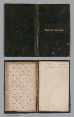
Colesworthy, S.H.
Full Title
(Covers to) A Plan Of Portland, Engraved As A Directory. Pub. By S.H. Colesworthy. 1846.
Publisher
S.H. Colesworthy
Author
[Gaston, Samuel N., Morse, Charles W.]
Full Title
(Covers to) Morse's Map Of Wisconsin. Published by Morse & Gaston, 115 and 117 Nassau St., New-York. Printed by Nic. Muller, 55 Beckman Street, New-York.
Publisher
Morse & Gaston
Author
Beers, Frederick W.
Full Title
(Covers to) Plan Of Berkshire Co. Massachusetts. Published Expressly For S. E. Nichols, Bookseller & Stationer, Pittsfield, Mass. Copyrighted 1876, by F. W. Beers & Co. (inset) Pittsfield. Scale 160 Rods to the inch.
Publisher
F.W. Beers & Co.
Author
Smith, J.L.
Full Title
(Covers to) Driving Map of Philadelphia and Vicinity. Published by J.L. Smith, 27 South Sixth St. Phila., Pa. 1882. Entered ... 1882 by J.L. Smith ... Washington.
Publisher
J.G. Wells
Author
Page, H.R. & Co.
Full Title
(Covers to) Map Of Michigan Compiled from the latest Authentic Sources. Published by H.R. Page & Co. Chicago, Ill. 1882. (with 2 inset maps).
Publisher
Page, H.R. & Co.
Author
Cram, George
Full Title
(Covers to) Karte Von Louisiana Mit Angabe der Bodenbeschaffenheit, aller Hauptortschaften, deren Einwohnerzahl, sowie den Eisenbahnentfernungen. Herausgegeben von der Staats Ackerbaubehorde Charles Schuler, Kommissionar. George F. Cram, Engraver and Printer, Chicago and New York. Copyright, 1908, by George F. Cram, Chicago. (with inset) Umgebung von New Orleans.
Publisher
George F. Cram
Author
Cram, George
Full Title
(Text Page) Eine Landwirtschaftliche und Physiographische Beschreibung des Staate Louisiana. (to accompany) Karte Von Louisiana Mit Angabe der Bodenbeschaffenheit, aller Hauptortschaften, deren Einwohnerzahl, sowie den Eisenbahnentfernungen. Herausgegeben von der Staats Ackerbaubehorde Charles Schuler, Kommissionar. George F. Cram, Engraver and Printer, Chicago and New York. Copyright, 1908, by George F. Cram, Chicago. (with inset) Umgebung von New Orleans.
Publisher
George F. Cram
Author
Smith, J.L.
Full Title
(Composite of) Driving Map of Philadelphia and Vicinity. Published by J.L. Smith, 27 South Sixth St. Phila., Pa. 1882. Entered ... 1882 by J.L. Smith ... Washington.
Publisher
J.L. Smith
Author
MacCormac, Walter S.
Full Title
(Covers to) Map Of The Peninsula, Embracing Delaware And The Eastern Shore Of Maryland And Virginia, Compiled from U.S. Coast, and other Actual Surveys, and recent information obtained from various sources. By Walter S. MacCormac, Civ. Eng. Published by Smith & Stroup, Nos. 52 & 54 North Sixth Street, Philadelphia. 1879. Entered ... 1878, by E.W Smith ... Washington.
Publisher
Smith & Stroup
Author
Dearborn, Nathaniel
Full Title
(Covers to) New Map Of Massachusetts Compiled from The Latest and Best Authorities And Corrected by Permission From the Survey ordered by the Legislature in 1830. Carefully Revised And Additions Made In 1839. Boston. 3d. Edition Published By Nathl. Dearborn, Engraver & Printer, 53 Washington St. 1840. (inset) Boston. (4 additional inset maps).
Publisher
N. Dearborn
Author
Cooke, D.B & Co.
Full Title
(Covers to) D.B. Cooke & Co.'s Great Western Railway Guide. Exhibiting All Stations With Distances From Each other. Chicago, 1856. Entered ... 1856 by D.B. Cooke & Company. Middleton Wallace & Co. Lith. Cincinnati.
Publisher
Cooke, D.B & Co.
Author
Lloyd, J.T.
Full Title
(Covers to) Lloyd's Official Map Of The State Of Kentucky Compiled from Actual Surveys and Official Documents, Showing Every Rail Road & Rail Road Station with the distances between each station ... 1863. New York J.T. Lloyd, Publisher, 164 Broadway. Price. 50 Cents each, colored in sheets. Entered ... 1862 by J.T. Lloyd ...
Publisher
J.T. Lloyd
Author
Lloyd, J.T.
Full Title
(Covers to) Lloyd's Official Map Of The State Of Kentucky Compiled from Actual Surveys and Official Documents, Showing Every Rail Road & Rail Road Station with the distances between each station ... 1863. New York, J.T. Lloyd, Publisher, 164 Broadway. Entered ... 1862 by J.T. Lloyd... New York.
Publisher
J.T. Lloyd
Author
Farmer, John
Full Title
(Covers to) Map Of The Surveyed Part Of Michigan, By John Farmer. Published by J.H. Colton & Co. New-York. 1837. Engraved by S. Stiles & Co. New-York. Entered ... 1836, by J.H. Colton & Co ... New York. (inset) The Unsurveyed Part Of Michigan. (inset) Map Of The Straits Of Mackinaw. From Actual Survey. (inset) Map Of Mackinaw Isle.
Publisher
J.H. Colton & Co.
Author
MacCormac, Walter S.
Full Title
(Composite of) Map Of The Peninsula, Embracing Delaware And The Eastern Shore Of Maryland And Virginia, Compiled from U.S. Coast, and other Actual Surveys, and recent information obtained from various sources. By Walter S. MacCormac, Civ. Eng. Published by Smith & Stroup, Nos. 52 & 54 North Sixth Street, Philadelphia. 1879. Entered ... 1878, by E.W Smith ... Washington.
Publisher
Smith & Stroup
Author
Dodge, J.R.
Full Title
(Covers to) Township and Railroad Map Of New Hampshire, Compiled from the best authorities ... 1854. Published by J.R. Dodge, Nashua, N.H. L.H. Bradford & Co.'s Boston. Entered ... 1854 by J.R. Dodge ... New Hampshire.
Publisher
J.R. Dodge
Author
[Colton, G.W. & C.B., Howland, S.A.]
Full Title
(Covers to) Commercial Map of New England. Worcester Mass. S.A. Howland 1871. G.W. & C.B. Colton & Co. New York. (inset) The Northern Portion Of Maine. (with an 18 page index) Commercial Travelers' Pocket Map Of New England, Eastern New York And Long Island, Together With A Complete Census Of The New England States In 1860 and 1870. Worcester, Mass., Published By S.A. Howland. 1871. Entered ... 1871, by S.A. Howland, of Massachusetts ...
Publisher
S.A. Howland
Author
[Colton, G.W. & C.B., Howland, S.A.]
Full Title
(Title Page to) Commercial Map of New England. Worcester Mass. S.A. Howland 1871. G.W. & C.B. Colton & Co. New York. (inset) The Northern Portion Of Maine. (with an 18 page index) Commercial Travelers' Pocket Map Of New England, Eastern New York And Long Island, Together With A Complete Census Of The New England States In 1860 and 1870. Worcester, Mass., Published By S.A. Howland. 1871. Entered ... 1871, by S.A. Howland, of Massachusetts ...
Publisher
S.A. Howland
Author
Dawson, James
Full Title
(Covers to) Nova Scotia, And Prince Edward's Island. 1847. Published By James Dawson Pictou N.S. W. Nichol & Co. Lithogrs. Edinr.
Publisher
James, Dawson
Author
[Hunter, C.M., Pleasant Hill Land Association]
Full Title
(Covers to) Plan Of Building Lots Of The Pleasant Hill Land Asso. 23rd Ward Philada, Pa. C.M. Hunter, Map Publisher 2326 Master St. Philada. (In: Pleasant Hill Land Association Receipt Book and Terms of Sale).
Publisher
C.M. Hunter
Author
[Hunter, C.M., Pleasant Hill Land Association]
Full Title
(Title page to) Terms and Conditions of Sale of Lots of the Pleasant Hill Land Association, of 23d. Ward. Philadelphia. Philadelphia: Lewis & Grossmann, Printers, 112 s. Seventh St. 1887. (to accompany) Plan Of Building Lots Of The Pleasant Hill Land Asso. 23rd Ward Philada, Pa. C.M. Hunter, Map Publisher 2326 Master St. Philada. (In: Pleasant Hill Land Association Receipt Book and Terms of Sale).
Publisher
C.M. Hunter
|