Who What Where WhenREMOVEWHO
WHEN
|
Author
Lee, Alex. Y.
Full Title
Lee's Map Of The Industries Of Western Pennsylvania. No. 1, being an Indexed Map Of The Connellsville Coke Field and Pittsburgh Gas Coal Beds, also showing the Various Transportation Lines traversing this field and centering at Pittsburgh, Pa. In connection with this map is issued A Detailed Map No.2 of Pittsburgh. Copyright 1884 by Alex. Y. Lee C.E. Pittsburgh, Pa. ... The Railway Map and Publishing Co. 88 Warren St. New York.
Publisher
: The Railway Map and Publishing Co.
Author
Bromley, G.W.
Full Title
Driving Road Chart Of Westchester County Compiled Expressly For The Atlas Of Westchester County N.Y. By Geo. W. Bromley & Co. 243 Broadway, N.Y. 1881. Extra Copies By Subscription Only. Photo-lith. by Robert A. Welcke, 176 William St. N.Y. (inset map) Pelham Manor. 9-1/2 Miles From Harlem River Via N.Y. & N.H. Branch R.R. ...
Publisher
G.W. Bromley
Author
[Rand McNally and Company, Watson, Gaylord]
Full Title
New Railroad, County and Township Map Of New York Showing Every Railroad Station and Post Office in the State. Address, Gaylord Watson, 278 Pearl Street, New York. 1887. Copyright, 1887, by Rand, McNally & Co., Map Publishers, Chicago. (with 3 inset maps).
Publisher
Gaylord Watson
Author
Green-Wood Cemetery
Full Title
Green-Wood Cemetery. 1855. Snyder, Black & Sturn, Lith. 87 Fulton St. N.Y.
Publisher
Snyder, Black & Sturn
Author
[Dripps, Matthew, Rand McNally and Company]
Full Title
New Official Railroad Map Of The United States And Canada. Address, M. Dripps, 111 & 113, Fulton Street, New York. Copyright, 1883, by Rand, McNally & Co. Map Publishers, Chicago. (inset) Map Of Atlantic Coast States Engraved On Enlarged Scale. (with 8 additional inset maps).
Publisher
M. Dripps
Author
Rand McNally and Company
Full Title
Rand, McNally & Co.'s New Commercial Map Of The United States And Canada Showing All The Railroads, Counties and Principal Towns Up To Date. Constructed from the latest Government and Railroad Surveys. 1883. Engraved And Published By Rand, McNally & Co., Map Publishers, Chicago. Copyright, 1883, by Rand, McNally & Co. ...
Publisher
Rand McNally and Co.
Author
Blanchard, Rufus
Full Title
Blanchard's Guide Map of Kansas. Published by Rufus Blanchard 132 Clark Street Chicago 1872.
Publisher
Rufus Blanchard
Author
Duval, P.S. and Son
Full Title
Military Map Of The United States & Territories Showing The Location of the Military Posts, Arsenals, Navy Yards, & Ports of Entry. Compiled from Pub - Doc - 1861. Published by P.S. Duval & Son. Nos. 22&24 South 5th St. Philada. Entered ... 1861 by P.S. Duval & Son ... Penna. (inset) Pensacola & Perdido Bays. (untitled inset map of Key West).
Publisher
P.S. Duval & Son
Author
Asher & Company
Full Title
The Historical War Map. Asher & Co. Entered ... 1862, by Asher & Co. ... Indiana. E.R. Jewett & Co. Engravers, Buffalo, N.Y.
Publisher
Asher & Company
Author
Colton, G.W. & C.B. & Co.
Full Title
Colton's Minnesota. Published By G.W. And C.B. Colton & Co. No. 182 William St. New York. 1886. Copy Right 1886 By G.W. & C.B. Colton & Co. N.Y. (inset) Continuation Of The North East Portion Of Minnesota.
Publisher
G.W. & C.B. Colton & Co.
Author
Dripps, Matthew
Full Title
Map of the Cities of New York, Brooklyn, Williamsburgh & Jersey City. Published by M. Dripps No. 103 Fulton St. New York 1854.
Publisher
M. Dripps
Author
[Mitchell, Samuel Augustus, Thomas, Cowperthwait & Co.]
Full Title
Map Of Connecticut. Published By Thomas, Cowperthwait & Co. No. 253 Market Street Philadelphia. 1852. Entered ... 1850, by Thomas, Cowperthwait & Co. ... Pennsylvania. (inset) Hartford &c. (inset) New Haven &c.
Publisher
Thomas, Cowperthwait & Co.
Author
Magnus, Charles
Full Title
Vicinity Of New York. Publ. & Sold by Chs. Magnus.
Publisher
Charles Magnus
Author
Colton, G.W. & C.B.
Full Title
Colton's Map Of The United States Of America, The British Provinces, Mexico and the West Indies. Showing the Country from the Atlantic to the Pacific Ocean. Engraved, Printed & Published by G.W. & C.B. Colton & Co. New York. 1885. Entered ... 1884 by G.W. & C.B. Colton & Co. ... Washington.
Publisher
G.W. & C.B. Colton
Author
Straus Brothers Company
Full Title
(Central States farm locations.) The Straus Bros. Co. The World's Largest Dealers in Improved Farms. ... (title on cover) Central States Map Showing location of the sections in which more than Four Hundred of the choicest and most productive farms in America are offered for sale by The Straus Brothers Company, Farm Merchants, Capital $1,000,000...Write For Catalogue.
Publisher
The Straus Brothers Company
Author
Colton, G.W. & C.B.
Full Title
Colton's Sectional Map Of The State of Iowa, Compiled From The U.S. Surveys & Other Authentic Sources. Exhibiting The Sections, Fractional Sections, Counties, Cities, Towns, Villages, Post Offices, Railroads & other Internal Improvements. Published By G.W. & C.B. Colton, 172 William St. New York, 1869. Entered ... 1864, by J.H. Colton ... New York.
Publisher
G.W. & C.B. Colton
Author
Blanchard, Rufus
Full Title
Cabinet Map Of The Western States And Territories On A Rectangular Projection Showing The Location Of Gold Silver And Other Minerals The Railroads And Principal Cities...Compiled From Government Maps And Published By Rufus Blanchard. 146 Lake St. Chicago, Ill. 1869. Entered ... 1868, by R. Blanchard ... Ill. Engraved by Jerome T. Gouget, at R. Blanchard's Map Establishment ... (inset) Map Of The World Showing the Great Throughfare Between Europe & Asia Through the United States.
Publisher
Rufus Blanchard
Author
Hammond, C.S.
Full Title
1912 War Map. The Balkan States. C.S. Hammond & Co., Publishers New York. Copyright, 1912, by C.S. Hammond & Co., N.Y.
Publisher
C.S.Hammond & Co.
Author
Lloyd, H.H.
Full Title
New Map Of The United States. Published By H.H. Lloyd & Co. 21 John St. New York. (with) New Map Of The U.S. Territories And Pacific States. Published By H.H. Lloyd & Co. 21 John St. New York. 1866. Entered ... 1862 by H.H. Lloyd ... New York. 1866. Entered ... 1866 by H.H. Lloyd ... New York. (with 3 inset profiles).
Publisher
Lloyd, H.H.
Author
Lloyd, H.H.
Full Title
New Map Of The U.S. Territories And Pacific States. Published By H.H. Lloyd & Co. 21 John St. New York. 1866. Entered ... 1862 by H.H. Lloyd ... New York. (with) New Map Of The United States. Published By H.H. Lloyd & Co. 21 John St. New York. 1866. Entered ... 1866 by H.H. Lloyd ... New York. (with 3 inset profiles).
Publisher
Lloyd, H.H.
Author
Disturnell, John
Full Title
Mapa de los Estados Unidos De Mejico, Segun lo organizado y definido por las varias actas del Congreso de dicha Republica ... Lo Publican J. Disturnell, 102 Broadway. Nuevo York. 1847. Revised Edition. (inset) Carto De Los Caminos &c. Desde Vera Cruz Y Alvarado A Mejico. (inset) Chart of the Bay of Vera Cruz. (inset) Map Showing The Battle Grounds of the 8th and 9th May 1846.
Publisher
J. Disturnell
Author
Watson, Gaylord
Full Title
Guide Map To Summer Resorts Around New York. Gaylord Watson Map Publisher 61 Beekman St. N.Y. Copyright 1880 by Gaylord Watson. (On verso: Moller & Schumann's Descriptive Catalogue of Fine Varnishes, Japan Lacquers, and Wood Fillers).
Publisher
Gaylord Watson
Author
[Ensign & Thayer, Atwood, J. M.]
Full Title
Map Of The City Of New York, With The Adjacent Cities Of Brooklyn & Jersey City, And The Village Of Williamsburg. Published By Ensign & Thayer, 50 Ann St. New York. 1849. Entered ... 1844 by Humphrey Phelps ... Drawn & Engraved by John M. Atwood. 19 Beekman St. N.Y. (inset) Jersey City. (inset) New York Island. (with street directory titled) A Map Of The City And County Of New York, With The Adjacent Cities Of Brooklyn And Jersey City, And The Village Of Williamsburg: With A Street Directory Of The City Of New York. New York: Published By Ensigns & Thayer, 50 Ann Street. 1849.
Publisher
Ensign & Thayer
Author
Caylor, E.H.
Full Title
Wayne Co. Ind. 1898. E.H. Caylor, Columbus, Ohio.
Publisher
E.H. Caylor
Author
Colton, G.W. & C.B.
Full Title
Colton's Railroad & Commercial Atlas Of The United States, Canada Etc. Map No. 6. Delaware, Maryland, Virginia, West Virginia, N. Carolina, Kentucky & Tennessee. Published by G.W. And C.B. Colton, & Co. 172 William St. New York. 1870. Entered ... 1866, by G.W. & C.B. Colton & Co ... N.Y.
Publisher
G.W. & C.B. Colton
Author
Poor, Henry Varnum
Full Title
Map of all the Railroads In The United States in Operation and Progress. Published by H.V. Poor, Editor of "The American Railroad Journal," 9 Spruce St., N.Y. D. McLellan, Lithographer, 26 Spruce St. New York.
Publisher
H.V. Poor
Author
Opperman, J.
Full Title
Map Showing portions of McKean, Warren, Forest and Elk Counties. By J. Opperman C.E. Bradford, Pa. Copy Right 1881 J. Opperman. AM. Photo-Litho. Co. N.Y.
Publisher
J. Opperman
Author
Magnus, Charles
Full Title
Battleground In Northern Italy. Published by Charles Magnus & Co. N. York. Charles Magnus & Co., Printers, Engravers, Lithographers, Publishers; New-York Office, No. 12 Frankfort Street ...
Publisher
Charles Magnus
Author
Colton, J.H.
Full Title
J.H. Colton's Map Of The Southern States. Maryland, Delaware, Virginia, Kentucky, Tennessee, Missouri, North Carolina, South Carolina, Georgia, Alabama, Mississippi, Arkansas, Louisiana, And Texas. Showing Also Part Of Adjoining States & Territories Locating The Forts & Military Stations Of The U. States & Showing All The Railroads, R.R. Stations & Other Internal Improvements. Published By J.H. Colton, 172 William Street, New York. 1864. Entered ... 1863 by J.H. Colton ... New York. Printed by Lang & Cooper, 117 Fulton St. (inset) Colton's Map of the United States Showing the Proposed Railroad Routes To The Pacific Ocean. (inset) Southern Part Of Florida.
Publisher
J.H. Colton
Author
[United States. Post Office Dept., Von Haake, A.]
Full Title
Post Route Map Of The State Of New Jersey Showing Post Offices With The Intermediate Distances On Mail Routes In Operation On The 1st Of March, 1904. Published By Order Of Postmaster General Henry C. Payne Under The Direction Of A. Von Haake, Topographer P.O. Dept. (seal) Post Office Department. United States Of America With Celerity, Certainty And Security.
Publisher
U.S. Post Office
Author
[Rand McNally and Company, Smith, J.L.]
Full Title
Rand, McNally & Co.'s New Official Railroad Map Of The United States, Canada And Mexico. Engraved And Printed By Rand, McNally & Co., Chicago. 1889. Rand, McNally & Co., Map Publishers and Engravers, Chicago And New York. Copyright, 1889, by Rand, McNally & Co. Map Publishers, Chicago. (inset) Map Of Atlantic Coast States Engraved On Enlarged Scale. (with 8 additional inset maps).
Publisher
J.L. Smith
Author
Johnson, A.J.
Full Title
Johnson's County, Township And Sectional Kansas And Nebraska From The Latest & Best Information. Published By Johnson & Browning, 172 William St. N.Y. Revised & Corrected by R. Quinn, Survr. Gens. Offe. Entered ... 1858, by A.J. Johnson ... New York.
Publisher
Johnson & Browning.
Author
Ensign, Bridgman & Fanning
Full Title
Ensign, Bridgman & Fanning's Rail Road Map Of The United States Showing the Depots & Stations. Published at No. 156 William St. N.Y. 1860. Printed by D. & J. McLellan, 26 Spruce St. N.Y. Entered ... 1856, by Ensign, Bridgman & Fanning ... New York. (inset) Plan of the New England States.
Publisher
Ensign, Bridgman & Fanning
Author
Dripps, Matthew
Full Title
Topographical Map Of New York City, County And Vicinity, Showing the Original High Water Lines, Permanent Pier Lines, and the Present Wharves & Piers, compiled from authentic surveys. Published By M. Dripps, No. 103 Fulton St. New York 1855. Entered ... 1853 by M. Dripps ... N.Y. (inset map) New York-County North of 155 Street. (inset) Nieuw Amsterdam opt Eylant Manhattans 1656. Map Of New Netherlands. (inset) New Yorke 1695.
Publisher
M. Dripps
Author
[Colton, G.W. & C.B., Ely, W.W.]
Full Title
Map Of The New York Wilderness And The Adirondacks. By W.W. Ely, M.D. Engraved, Printed and Published By G.W. & C.B. Colton & Co. No. 172 William St. New York. 1879. Entered ... 1873 by G.W. & C.B. Colton & Co. ... Washington. (untitled inset of the New York State and New England states).
Publisher
G.W. & C.B. Colton
Author
Magnus, Charles
Full Title
City Of Brooklyn with Part of New York. Publh. & sold by Chs. Magnus No. 22 North William St. (with map) Vicinity of New York. Publ. & Sold by Magnus & Co. 77 Chatham St. (with map) Map of the City of Williamsburgh with Part of Greenpoint. Lith. of Chs. Magnus, N.Y. (Three small maps on one sheet).
Publisher
Charles Magnus
Author
Bromme, Traugott
Full Title
Post-Kanal-Und Eisenbahnkarte Der Vereinigten Staaten Von Nord-Amerika. Nach Smith, Tanner, Mitchell und den Berichten des General-Postamts bearbeitet Von Traugott Bromme in Stahl gestochen v. J.A. Buhler. Philadelphia Chestnut-Street 195, John Weik, Publisher & Importer. Stuttgart Hoffmann'fche Verlagshandlung. 1855. (inset) Oregon, California Und Der Mormonen-Staat: Deseret. (with 6 additional inset maps).
Publisher
[John Weik, Hoffmann'fche Verlagshandlung.]
Author
[C.F. Weber & Co., Punnett Brothers]
Full Title
Weber's Map of Santa Cruz County, California ; showing towns, steam and electric railroads, wagon and automobile roads, township and section lines, rivers, creeks, reclamation and irrigation districts, etc. Compiled from the latest official and private sources. Published by C.F. Weber & Co., San Francisco, Los Angeles. Copyright 1914 by Punnett Brothers. (2 insets) City of Santa Cruz, and Watsonville.
Publisher
C.F. Weber & Co.
Author
[C.F. Weber & Co., Punnett Brothers]
Full Title
Weber's Map of Plumas County, California ; showing towns, steam and electric railroads, wagon and automobile roads, township and section lines, rivers, creeks, reclamation and irrigation districts, etc. Compiled from the latest official and private sources. Published by C.F. Weber & Co., San Francisco, Los Angeles. Copyright 1914 by Punnett Brothers.
Publisher
C.F. Weber & Co.
Author
Nishimuraya, Yohachi
Full Title
Edo oezu : Nishimuraya Yohachi. Kansei 3 (1863).
Publisher
Nishimuraya, Yohachi
Author
Colton, J.H.
Full Title
Texas. Published by J.H. Colton & Co. No. 171 William St. New York. Entered according to Act of Congress in the year 1855, by J.H. Colton & Co. ... New York (insets) Plan of Galveston Bay -- Plan of Sabine Lake.
Publisher
J.H. Colton & Co.
Author
Colton, J.H.
Full Title
Mapa de Mejico J. H. Colton, Nueva York 1862. Entered ... 1862 by J. H. Colton ... New York. (inset map) Territory and Isthmus of Tehuantepec.
Publisher
H. J. Colton
Author
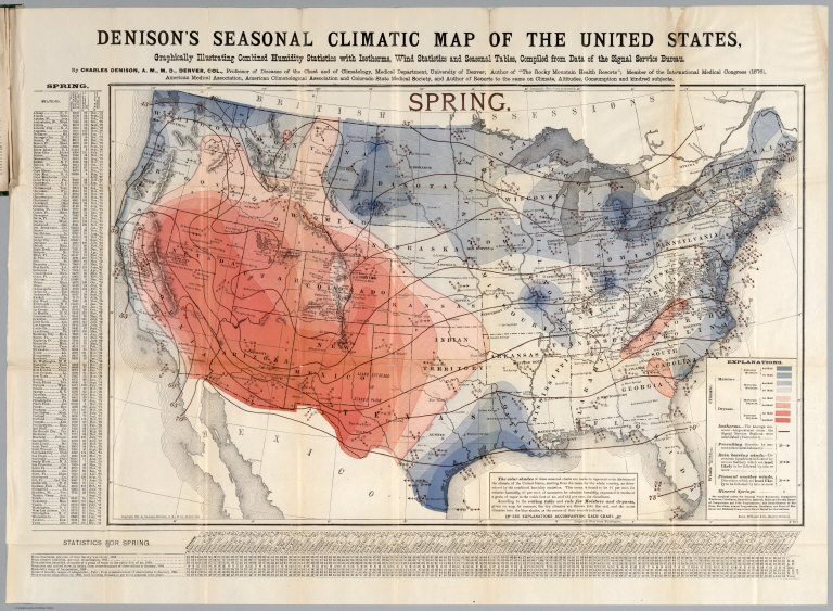
Denison, Charles
Full Title
Spring. Denison's seasonal climatic map of the United States, Graphically illustrating combined humidity statistics with isotherms, wind statistics and seasonal tables, compiled from data of the Signal Service Bureau. By Charles Denison, A.M.M.D, Denver, Col. ... Copyright, 1884, by Charles Denison, A.M.M.D, Denver, Col. Rand McNally & Co. Engr's., Chicago. (to accompany) Descriptive circular of the annual and seasonal climatic maps of the United States.
Publisher
Rand, McNally & Co.
Author
Denison, Charles
Full Title
Summer. Denison's seasonal climatic map of the United States, Graphically illustrating combined humidity statistics with isotherms, wind statistics and seasonal tables, compiled from data of the Signal Service Bureau. By Charles Denison, A.M.M.D, Denver, Col. ... Copyright, 1884, by Charles Denison, A.M.M.D, Denver, Col. Rand McNally & Co. Engr's., Chicago. (to accompany) Descriptive circular of the annual and seasonal climatic maps of the United States.
Publisher
Rand, McNally & Co.
Author
Denison, Charles
Full Title
Autumn. Denison's seasonal climatic map of the United States, Graphically illustrating combined humidity statistics with isotherms, wind statistics and seasonal tables, compiled from data of the Signal Service Bureau. By Charles Denison, A.M.M.D, Denver, Col. ... Copyright, 1884, by Charles Denison, A.M.M.D, Denver, Col. Rand McNally & Co. Engr's., Chicago. (to accompany) Descriptive circular of the annual and seasonal climatic maps of the United States.
Publisher
Rand, McNally & Co.
Author
Denison, Charles
Full Title
Winter. Denison's seasonal climatic map of the United States, Graphically illustrating combined humidity statistics with isotherms, wind statistics and seasonal tables, compiled from data of the Signal Service Bureau. By Charles Denison, A.M.M.D, Denver, Col. ... Copyright, 1884, by Charles Denison, A.M.M.D, Denver, Col. Rand McNally & Co. Engr's., Chicago. (to accompany) Descriptive circular of the annual and seasonal climatic maps of the United States.
Publisher
Rand, McNally & Co.
Author
Denison, Charles
Full Title
Denison's annual climatic map of the United States, Graphically illustrating cloudiness with isotherms, precipitation lines, winds (arrows) and annual tables. Compiled from data of the Signal Service Bureau. by Charles Denison, A.M.M.D, Denver, Col. ... Copyright, 1884, by Charles Denison, A.M.M.D, Denver, Col. Rand McNally & Co. Engr's., Chicago. (to accompany) Descriptive circular of the annual and seasonal climatic maps of the United States.
Publisher
Rand, McNally & Co.
Author
[United States. Post Office Dept., Von Haake, A.]
Full Title
Post route map of the states of California and Nevada showing post offices with the intermediate distances and mail routes in operation on the 1st of June, 1896. (Lower sheets) Published by order of Postmaster General William L. Wilson under the direction of A. von Haake, Topographer, P.O. Dept. (Washington, D.C., 1896)
Publisher
U.S. Post Office
Author
[United States. Post Office Dept., Von Haake, A.]
Full Title
Post route map of the states of California and Nevada showing post offices with the intermediate distances and mail routes in operation on the 1st of June, 1896. (Upper sheets) Published by order of Postmaster General William L. Wilson under the direction of A. von Haake, Topographer, P.O. Dept. (Washington, D.C., 1896)
Publisher
U.S. Post Office
Author
United States. Post Office Dept.
Full Title
Post route map of the states of California and Nevada, showing post offices with the intermediate distances between them, and mail routes. (Northwest sheet. Washington, D.C., 1901)
Publisher
U.S. Post Office
|