REFINE


Who What Where When


WHERE

  1. Afghanistan (1)
  2. Africa (11)
  3. Africa, Northeast (1)
  4. Africa, Southern (1)
  5. Africa, West (1)
  6. Alabama (5)
  7. Alaska (3)
  8. Albania (1)
  9. Albany (N.Y.) (1)
  10. Allegheny (Pittsburgh, Pa … (1)
  11. Amsterdam (Netherlands) (1)
  12. Arabia (1)
  13. Arabian Peninsula (3)
  14. Argentina (2)
  15. Arizona (5)
  16. Arkansas (5)
  17. Asia (12)
  18. Asia Minor (1)
  19. Australasia (1)
  20. Australia (4)
  21. Austria (4)
  22. Bahamas (1)
  23. Baltimore (Md.) (3)
  24. Bangladesh (1)
  25. Beaufort Region (N.C.) (1)
  26. Beijing (China) (1)
  27. Belarus (2)
  28. Belgium (1)
  29. Berlin (Germany) (1)
  30. Bermuda Islands (1)
  31. Black Sea (1)
  32. Bolivia (1)
  33. Boston (Mass.) (4)
  34. Brazil (1)
  35. British Columbia (2)
  36. British Isles (2)
  37. Brooklyn (N.Y.) (1)
  38. Brussels (Belgium) (1)
  39. Buffalo (N.Y.) (1)
  40. Bulgaria (2)
  41. California (7)
  42. Canada (8)
  43. Canada, Western (1)
  44. Cape Breton Island (1)
  45. Caribbean (4)
  46. Central Africa (1)
  47. Central America (6)
  48. Central Europe (3)
  49. Charleston (S.C.) (2)
  50. Chicago (Ill.) (2)
  51. Chicago (Illinois) (2)
  52. Chile (2)
  53. China (6)
  54. Cincinnati (Ohio) (1)
  55. Cleveland (Ohio) (1)
  56. Colombia (1)
  57. Colorado (5)
  58. Connecticut (5)
  59. Corsica (France) (1)
  60. Costa Rica (1)
  61. Crete (1)
  62. Cuba (3)
  63. Cuyahoga County (Ohio) (1)
  64. Cyprus (1)
  65. Czech Republic (6)
  66. Delaware (5)
  67. Democratic Republic of Co … (1)
  68. Denmark (2)
  69. District of Columbia (3)
  70. Dominica (1)
  71. East Africa (1)
  72. East Asia (1)
  73. East Indies (2)
  74. Eastern Hemisphere (4)
  75. Ecuador (1)
  76. Egypt (2)
  77. England (5)
  78. Eurasia (3)
  79. Europe (22)
  80. Falkland Islands (Islas M … (1)
  81. Faroe Islands (1)
  82. Fiji Islands (1)
  83. Finland (3)
  84. Florida (5)
  85. Florida Keys (1)
  86. France (6)
  87. Galveston (Tex.) (1)
  88. Georgetown (D.C.) (1)
  89. Georgia (5)
  90. Germany (7)
  91. Gibraltar (1)
  92. Great Britain (5)
  93. Greece (2)
  94. Guatemala (1)
  95. Guayana (1)
  96. Hamburg (Germany) (1)
  97. Havana (Cuba) (1)
  98. Hawaii (1)
  99. Hawaii Island (Hawaii) (1)
  100. Henrico County (Va.) (1)
  101. Hoboken (N.J.) (1)
  102. Honduras (1)
  103. Hungary (1)
  104. Iceland (1)
  105. Idaho (5)
  106. Illinois (6)
  107. India (3)
  108. Indian Territory (3)
  109. Indiana (5)
  110. Indonesia (1)
  111. Ionian Islands (1)
  112. Iowa (6)
  113. Iran (3)
  114. Iraq (2)
  115. Ireland (5)
  116. Israel (2)
  117. Italy (2)
  118. Jamaica (1)
  119. Japan (4)
  120. Jersey City, (N.J.) (1)
  121. Jordan (2)
  122. Kansas (4)
  123. Kazakhstan (2)
  124. Kentucky (4)
  125. Kenya (1)
  126. Korea (3)
  127. Lake Superior (3)
  128. Lebanon (1)
  129. Lesotho (1)
  130. Lesser Antilles (1)
  131. Liberia (1)
  132. Lima (Peru) (1)
  133. London (England) (1)
  134. Long Island (2)
  135. Los Angeles Area (Calif.) (1)
  136. Louisiana (7)
  137. Louisiana Purchase (3)
  138. Louisville (Ky.) (1)
  139. Lower Canada (1)
  140. Madagascar (4)
  141. Maine (4)
  142. Malaysia (1)
  143. Malta (1)
  144. Maritime Provinces (1)
  145. Maryland (6)
  146. Massachusetts (5)
  147. Mediterranean (3)
  148. Mexico (8)
  149. Michigan (9)
  150. Middle East (8)
  151. Milwaukee (Wis.) (1)
  152. Minnesota (5)
  153. Mississippi (6)
  154. Missouri (6)
  155. Mongolia (3)
  156. Montana (5)
  157. Mozambique (1)
  158. Myanmar (1)
  159. Namibia (1)
  160. Near East (1)
  161. Nebraska (5)
  162. Netherlands (2)
  163. Nevada (5)
  164. New Brunswick (5)
  165. New Granada (1)
  166. New Hampshire (5)
  167. New Jersey (5)
  168. New Mexico (4)
  169. New Orleans (La.) (1)
  170. New York (9)
  171. New York (N.Y.) (3)
  172. New Zealand (4)
  173. Newfoundland (3)
  174. Nicaragua (1)
  175. Nigeria (1)
  176. Nile Delta (1)
  177. North Africa (1)
  178. North America (17)
  179. North Carolina (6)
  180. North Dakota (3)
  181. Northeast Africa (1)
  182. Northern Europe (1)
  183. Northwest United States (1)
  184. Norway (3)
  185. Nova Scotia (4)
  186. Oceania (5)
  187. Oceanica (5)
  188. Ohio (6)
  189. Oklahoma (4)
  190. Oman (1)
  191. Ontario (3)
  192. Oregon (5)
  193. Orkney (Scotland) (1)
  194. Oswego County (N.Y.) (1)
  195. Pacific (6)
  196. Pacific Ocean (2)
  197. Pakistan (2)
  198. Palestine (2)
  199. Panama Canal (Panama) (1)
  200. Panama Canal Zone (1)
  201. Paraguay (1)
  202. Paris (France) (1)
  203. Patagonia (Argentina and … (1)
  204. Pennsylvania (6)
  205. Persia (1)
  206. Peru (2)
  207. Philadelphia (Pa.) (2)
  208. Philippines (1)
  209. Pittsburgh (Pa.) (1)
  210. Poland (4)
  211. Polynesia (2)
  212. Portugal (2)
  213. Prince Edward Island (7)
  214. Prussia (1)
  215. Prussia (Germany) (1)
  216. Puerto Rico (3)
  217. Quebec (3)
  218. Rhode Island (6)
  219. Rio de Janeiro (Brazil) (1)
  220. Rochester (N.Y.) (1)
  221. Romania (1)
  222. Rumania (1)
  223. Russia (6)
  224. Sabine Pass (Tex.) (1)
  225. Sacramento (Calif.) (2)
  226. Saint Louis (Mo.) (3)
  227. San Francisco (Calif.) (2)
  228. San Francisco Bay Area (C … (2)
  229. Saskatchewan (1)
  230. Saudi Arabia (2)
  231. Saudi Arabian Peninsula (1)
  232. Savannah (Ga.) (1)
  233. Saxony (Germany) (1)
  234. Scandanavia (1)
  235. Scilly, Isles of (England … (1)
  236. Scotland (4)
  237. Shetland Islands (1)
  238. Sinai (1)
  239. Singapore (1)
  240. Slovakia (5)
  241. South Africa (1)
  242. South America (10)
  243. South Asia (1)
  244. South Carolina (5)
  245. South Dakota (5)
  246. South Georgia and South S … (1)
  247. South Orkney Islands (1)
  248. South Pacific (1)
  249. Southeast Asia (2)
  250. Southern Africa (1)
  251. Southern Europe (3)
  252. Southern New England (1)
  253. Southern South America (1)
  254. Southwest Asia (2)
  255. Spain (2)
  256. Sri Lanka (1)
  257. Sudan (1)
  258. Swaziland (1)
  259. Sweden (3)
  260. Switzerland (3)
  261. Syria (2)
  262. Tanzania (2)
  263. Tehuantepec (1)
  264. Tennessee (4)
  265. Texas (5)
  266. Thailand (1)
  267. Tibet (1)
  268. Toronto (Ontario) (1)
  269. Turkey (5)
  270. U.S. North East (2)
  271. U.S. South (1)
  272. Uganda (1)
  273. Ukraine (4)
  274. United States (50)
  275. Uruguay (2)
  276. Utah (5)
  277. Venezuela (1)
  278. Vermont (5)
  279. Vienna (Austria) (1)
  280. Vietnam (1)
  281. Virgin Islands (1)
  282. Virginia (6)
  283. Wales (4)
  284. Washington (5)
  285. Washington (D.C.) (1)
  286. Washington D.C. (2)
  287. West Indies (7)
  288. West Virginia (4)
  289. Western Europe (1)
  290. Western Hemisphere (3)
  291. Western Pacific (1)
  292. Western U. S. (1)
  293. Western U.S. (1)
  294. Western United States (1)
  295. Wisconsin (5)
  296. World (14)
  297. Wyoming (4)
  298. Yellowstone National Park (1)
Show Less 
REFINE 

Browse All : Political

101-150 of 457
1 2 3 4 5  
Dominion of New Zealand.
New Zealand -- Physical
1951
Wall Map
Author
The London Geographical Institute
Full Title
Dominion of New Zealand.
Publisher
George Philip & Son, Ltd.
Africa, Wenschow Relief-Like Map.
Africa -- Physical-Political
1990
Wall Map
Author
Wenschow - Franzis, Karl
Full Title
Africa, Wenschow Relief-Like Map.
Publisher
Rand McNally Co.
Africa.
Africa -- Political
1998
Wall Map
Author
Klett-Perthes
Full Title
Africa.
Publisher
Justus Perthes Verlag Gotha GmbH
Africa.
Africa -- Physical
1998
Wall Map
Author
Klett-Perthes
Full Title
Africa.
Publisher
Justus Perthes Verlag Gotha GmbH
Naher Osten.
Near East -- Physical-Political
1984
Wall Map
Author
[Justus Perthes, Haack]
Full Title
Naher Osten.
Publisher
Justus Perthes
Vorderasien - Arabien.
Southwest Asia -- Physical
1970
Wall Map
Author
Paul List Verlag
Full Title
Vorderasien - Arabien.
Publisher
Wenschow - Reliefkarte
Israel und Seine Arabischen Nachbarn.
Israel & Its Arab Neighbors -- Physical
1980
Wall Map
Author
[Haack-Painke, Riede, H.]
Full Title
Israel und Seine Arabischen Nachbarn.
Publisher
Justus Perthes Darmstadt
North Africa.
North Africa -- Physical
1978
Wall Map
Author
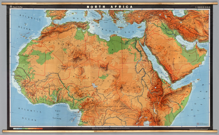
[Haack, Hermann, Perit, H., Peuckert, H., Anstalt Gotha]
Full Title
North Africa.
Publisher
Haack/Gotha
East Africa, Philips' Regional Wall Map ...
East Africa -- Physical-Political
1962
Wall Map
Author
[Denoyer-Geppert Company, London Geographical Institute, Georg Philip & Son]
Full Title
East Africa, Philips' Regional Wall Map of....
Publisher
Georg Philip & Son
Sectional Map of the United States, Sout...
United States: Western -- Physical-Polit...
1963
Wall Map
Author
Denoyer-Geppert Company
Full Title
Sectional Map of the United States, Southwestern/Northwestern United States.
Publisher
Denoyer-Geppert Company
The United States.
United States -- Political
1986
Wall Map
Author
[National Geographic Society, Garver Jr., John B., Garrett, Wilbur E.]
Full Title
The United States.
Publisher
National Geographic Society
Pacific Northwest.
Northwest United States -- Physical
1965
Wall Map
Author
[Smith, Ronald, Babcock, Chester]
Full Title
Pacific Northwest.
Publisher
AJ Nystrom & Co
Natural Environment Physical Political M...
California -- Physical-Political
1960
Wall Map
Author
Fairbanks, Harold W.
Full Title
Natural Environment Physical Political Map California.
Publisher
A.J. Nystrom & Co.
Iowa, Physical and Political.
Iowa -- Physical-Political
1940
Wall Map
Author
[Denoyer, L.P., Blair, R. Baxter]
Full Title
Iowa, Physical and Political.
Publisher
Denoyer-Geppert Company
World.
World.
1966
National Atlas
Author
[Götz, Antonín, Československá akademie věd., Czechoslovakia. Ústřední správa geodézie a kartografie.]
Full Title
World.
Publisher
Czechoslovakia. Ústřední správa geodézie a kartografie.
(Czechoslovakia in Europe).
1966
National Atlas
Author
[Götz, Antonín, Československá akademie věd., Czechoslovakia. Ústřední správa geodézie a kartografie.]
Full Title
(Czechoslovakia in Europe).
Publisher
Czechoslovakia. Ústřední správa geodézie a kartografie.
Prehledna Mapa. (General Map).
1966
National Atlas
Author
[Götz, Antonín, Československá akademie věd., Czechoslovakia. Ústřední správa geodézie a kartografie.]
Full Title
Prehledna Mapa. (General Map).
Publisher
Czechoslovakia. Ústřední správa geodézie a kartografie.
Development of Territorial Organisation.
1966
National Atlas
Author
[Götz, Antonín, Československá akademie věd., Czechoslovakia. Ústřední správa geodézie a kartografie.]
Full Title
Development of Territorial Organisation.
Publisher
Czechoslovakia. Ústřední správa geodézie a kartografie.
Europa, Politische Ubersicht. Sept. 1905...
Europa, Politische Ubersicht
1905
World Atlas
Author
[Andree, Richard, Scobel, Albert]
Full Title
Europa, Politische Ubersicht. Sept. 1905.
Publisher
Velhagen & Klasing
Plate 102. Presidential Elections. Elect...
1932
[Historical Atlas, National Atlas]
Author
[Paullin, Charles O., Wright, John K.]
Full Title
Plate 102. Presidential Elections. Electoral Vote for President, 1789. Electoral Vote for President, 1792. Electoral Vote for President, 1796. Presidential and Other Elections, 1800. Presidential and Other Elections, 1804. Presidential and Other Elections, 1808. Presidential and Other Elections, 1812. Presidential and Other Elections, 1816.
Publisher
[Carnegie Institution of Washington, American Geographical Society of New York]
Plate 103. Presidential Elections. Presi...
Plate 103. Presidential Election 1820 - ...
1932
[Historical Atlas, National Atlas]
Author
[Paullin, Charles O., Wright, John K.]
Full Title
Plate 103. Presidential Elections. Presidential Election 1820. Presidential Election 1824. Presidential Election 1828. Presidential Election 1832.
Publisher
[Carnegie Institution of Washington, American Geographical Society of New York]
Plate 104. Presidential Elections. Presi...
Plate 104. Presidential Election 1836 - ...
1932
[Historical Atlas, National Atlas]
Author
[Paullin, Charles O., Wright, John K.]
Full Title
Plate 104. Presidential Elections. Presidential Election 1836. Presidential Election 1840. Presidential Election 1844. Presidential Election 1848.
Publisher
[Carnegie Institution of Washington, American Geographical Society of New York]
Plate 105. Presidential Elections. Presi...
Plate 105. Presidential Election 1852 - ...
1932
[Historical Atlas, National Atlas]
Author
[Paullin, Charles O., Wright, John K.]
Full Title
Plate 105. Presidential Elections. Presidential Election 1852. Presidential Election 1856. Presidential Election 1860. Presidential Election 1864.
Publisher
[Carnegie Institution of Washington, American Geographical Society of New York]
Plate 106. Presidential Elections. Presi...
Plate 106. Presidential Election 1868 - ...
1932
[Historical Atlas, National Atlas]
Author
[Paullin, Charles O., Wright, John K.]
Full Title
Plate 106. Presidential Elections. Presidential Election 1868. Presidential Election 1872.
Publisher
[Carnegie Institution of Washington, American Geographical Society of New York]
Plate 107. Presidential Elections. Presi...
Plate 107. Presidential Election 1876 - ...
1932
[Historical Atlas, National Atlas]
Author
[Paullin, Charles O., Wright, John K.]
Full Title
Plate 107. Presidential Elections. Presidential Election 1876. Presidential Election 1880.
Publisher
[Carnegie Institution of Washington, American Geographical Society of New York]
Plate 108. Presidential Elections. Presi...
Plate 108. Presidential Election 1884 - ...
1932
[Historical Atlas, National Atlas]
Author
[Paullin, Charles O., Wright, John K.]
Full Title
Plate 108. Presidential Elections. Presidential Election 1884. Presidential Election 1888. Presidential Election 1892. Presidential Election 1896.
Publisher
[Carnegie Institution of Washington, American Geographical Society of New York]
Plate 109. Presidential Elections. Presi...
Plate 109. Presidential Elections, 1900 ...
1932
[Historical Atlas, National Atlas]
Author
[Paullin, Charles O., Wright, John K.]
Full Title
Plate 109. Presidential Elections. Presidential Election 1900. Presidential Election 1904.
Publisher
[Carnegie Institution of Washington, American Geographical Society of New York]
Plate 110. Presidential Elections. Presi...
Plate 110. Presidential Election 1908 - ...
1932
[Historical Atlas, National Atlas]
Author
[Paullin, Charles O., Wright, John K.]
Full Title
Plate 110. Presidential Elections. Presidential Election 1908. Presidential Election 1912.
Publisher
[Carnegie Institution of Washington, American Geographical Society of New York]
Plate 111. Presidential Election. Presid...
Plate 111. Presidential Election 1916 - ...
1932
[Historical Atlas, National Atlas]
Author
[Paullin, Charles O., Wright, John K.]
Full Title
Plate 111. Presidential Election. Presidential Election 1916. Presidential Election 1920. Presidential Election 1924. Presidential Election 1928.
Publisher
[Carnegie Institution of Washington, American Geographical Society of New York]
Plate 112. Congressional Measures. Assum...
Plate 112. Congressional Measures, 1790 ...
1932
[Historical Atlas, National Atlas]
Author
[Paullin, Charles O., Wright, John K.]
Full Title
Plate 112. Congressional Measures. Assumption of State Debts, July 26, 1790. Act Incorporating U.S. Bank, February 8, 1791. Alien and Sedition Acts, February 25, 1799. Embargo Act, December 21, 1807.
Publisher
[Carnegie Institution of Washington, American Geographical Society of New York]
Plate 113. Congressional Measures. Decla...
Plate 113. Congressional Measures, 1812 ...
1932
[Historical Atlas, National Atlas]
Author
[Paullin, Charles O., Wright, John K.]
Full Title
Plate 113. Congressional Measures. Declaration of War, June 4, 1812. General Tariff Act, April 8, 1816. "Bonus" Bill, February 8, 1817. Missouri Compromise, March 2, 1820.
Publisher
[Carnegie Institution of Washington, American Geographical Society of New York]
Plate 114. Congressional Measures. Gener...
Plate 114. Congressional Measures 1828 -...
1932
[Historical Atlas, National Atlas]
Author
[Paullin, Charles O., Wright, John K.]
Full Title
Plate 114. Congressional Measures. General Tariff Act, April 22, 1828. Maysville Road Bill, April 29, 1830. General Tariff Act, June 28, 1832. Independent Treasury Act, June 30, 1840. Public Land Act, July 6, 1841. Annexation of Texas, January 25, 1845. Walker Tariff Act, July 3, 1846. Compromise of 1850, September 6, 1850.
Publisher
[Carnegie Institution of Washington, American Geographical Society of New York]
Plate 115. Congressional Measures. Kansa...
Plate 115. Congressional Measures, 1854 ...
1932
[Historical Atlas, National Atlas]
Author
[Paullin, Charles O., Wright, John K.]
Full Title
Plate 115. Congressional Measures. Kansas - Nebraska Act, May 22, 1854. General Tariff Act, March 2, 1857.
Publisher
[Carnegie Institution of Washington, American Geographical Society of New York]
Plate 116. Congressional Measures. Thirt...
Plate 116. Congressional Measures, 1865 ...
1932
[Historical Atlas, National Atlas]
Author
[Paullin, Charles O., Wright, John K.]
Full Title
Plate 116. Congressional Measures. Thirteenth Amendment, January 31, 1865. Reconstruction Act, March 2, 1867.
Publisher
[Carnegie Institution of Washington, American Geographical Society of New York]
Plate 117. Congressional Measures. Enfor...
Plate 117. Congressional Measures 1871 -...
1932
[Historical Atlas, National Atlas]
Author
[Paullin, Charles O., Wright, John K.]
Full Title
Plate 117. Congressional Measures. Enforcement Act, April 6, 1871. Resumption of Specie Payments, January 7, 1875. Silver Purchase Act, February 28, 1878. General Tariff Act, March 2, 1883.
Publisher
[Carnegie Institution of Washington, American Geographical Society of New York]
Plate 118. Congressional Measures. Reaga...
Plate 118. Congressional Measures, 1885 ...
1932
[Historical Atlas, National Atlas]
Author
[Paullin, Charles O., Wright, John K.]
Full Title
Plate 118. Congressional Measures. Reagan Interstate Commerce Bill, January 8, 1885. Bland Free Coinage Bill, March 24, 1892.
Publisher
[Carnegie Institution of Washington, American Geographical Society of New York]
Plate 119. Congressional Measures. Dingl...
Plate 119. Congressional Measures, 1897 ...
1932
[Historical Atlas, National Atlas]
Author
[Paullin, Charles O., Wright, John K.]
Full Title
Plate 119. Congressional Measures. Dingley Tariff Act, March 31, 1897. Gold Standard Act, December 18, 1899.
Publisher
[Carnegie Institution of Washington, American Geographical Society of New York]
Plate 120. Congressional Measures. Payne...
Plate 120. Congressional Measures, 1909 ...
1932
[Historical Atlas, National Atlas]
Author
[Paullin, Charles O., Wright, John K.]
Full Title
Plate 120. Congressional Measures. Payne - Aldrich Tariff Act, July 31, 1909. Canadian Reciprocity Act, April 21, 1911. Underwood Tariff Act, May 8, 1913. War Resolution, April 5, 1917.
Publisher
[Carnegie Institution of Washington, American Geographical Society of New York]
Plate 121. Congressional Measures. Prohi...
Plate 121. Congressional Measures, 1917 ...
1932
[Historical Atlas, National Atlas]
Author
[Paullin, Charles O., Wright, John K.]
Full Title
Plate 121. Congressional Measures. Prohibition Resolution, December 17, 1917. Woman Suffrage Resolution, May 21, 1919.
Publisher
[Carnegie Institution of Washington, American Geographical Society of New York]
Plate 122. Congressional Measures. Fordn...
Plate 122. Congressional Measures, 1921 ...
1932
[Historical Atlas, National Atlas]
Author
[Paullin, Charles O., Wright, John K.]
Full Title
Plate 122. Congressional Measures. Fordney Tariff Act, July 21, 1921. Smoot-Hawley Tariff Act, June 14, 1930.
Publisher
[Carnegie Institution of Washington, American Geographical Society of New York]
Plate 123. Reforms. Abolition of Slavery...
1932
[Historical Atlas, National Atlas]
Author
[Paullin, Charles O., Wright, John K.]
Full Title
Plate 123. Reforms. Abolition of Slavery, 1800. Abolition of Slavery, 1820. Abolition of Slavery, 1850. Abolition of Slavery, 1854. Abolition of Slavery.1863.
Publisher
[Carnegie Institution of Washington, American Geographical Society of New York]
Plate 124. Reforms. Abolition of Slavery...
1932
[Historical Atlas, National Atlas]
Author
[Paullin, Charles O., Wright, John K.]
Full Title
Plate 124. Reforms. Abolition of Slavery, 1865. Property Qualifications for Suffrage, 1775. Property Qualifications for Suffrage, 1800.
Publisher
[Carnegie Institution of Washington, American Geographical Society of New York]
Plate 125. Reforms. Property Qualificati...
1932
[Historical Atlas, National Atlas]
Author
[Paullin, Charles O., Wright, John K.]
Full Title
Plate 125. Reforms. Property Qualifications for Suffrage, 1830. Property Qualifications for Suffrage, 1860.
Publisher
[Carnegie Institution of Washington, American Geographical Society of New York]
Plate 126. Reforms. Property Qualificati...
1932
[Historical Atlas, National Atlas]
Author
[Paullin, Charles O., Wright, John K.]
Full Title
Plate 126. Reforms. Property Qualifications for Suffrage, 1890. Property Qualifications for Suffrage, 1920. Woman Suffrage, 1875. Woman Suffrage, 1900.
Publisher
[Carnegie Institution of Washington, American Geographical Society of New York]
Plate 127. Reforms. Woman Suffrage, 1915...
1932
[Historical Atlas, National Atlas]
Author
[Paullin, Charles O., Wright, John K.]
Full Title
Plate 127. Reforms. Woman Suffrage, 1915. Woman Suffrage, 1919.
Publisher
[Carnegie Institution of Washington, American Geographical Society of New York]
Plate 128. Woman Suffrage, 1920. Prohibi...
1932
[Historical Atlas, National Atlas]
Author
[Paullin, Charles O., Wright, John K.]
Full Title
Plate 128. Woman Suffrage, 1920. Prohibition, 1845.
Publisher
[Carnegie Institution of Washington, American Geographical Society of New York]
Plate 129. Reforms. Prohibition, 1855. P...
Plate 129. Reforms. Prohibition, 1855 - ...
1932
[Historical Atlas, National Atlas]
Author
[Paullin, Charles O., Wright, John K.]
Full Title
Plate 129. Reforms. Prohibition, 1855. Prohibition, 1875. Prohibition, 1890. Prohibition, 1905.
Publisher
[Carnegie Institution of Washington, American Geographical Society of New York]
Plate 130. Reforms. Prohibition, 1915. P...
Plate 130. Reforms. Prohibition, 1915, 1...
1932
[Historical Atlas, National Atlas]
Author
[Paullin, Charles O., Wright, John K.]
Full Title
Plate 130. Reforms. Prohibition, 1915. Prohibition, 1919.
Publisher
[Carnegie Institution of Washington, American Geographical Society of New York]
Plate 131. Reforms. Prohibition, 1920. S...
1932
[Historical Atlas, National Atlas]
Author
[Paullin, Charles O., Wright, John K.]
Full Title
Plate 131. Reforms. Prohibition, 1920. Schools: Expenditures per Capita, 1870-1871. Schools: Expenditures per Capita, 1902-1903. Schools: Expenditures per Capita, 1927-1928. Schools: Compulsory Attendance, 1852-1918, and Minimum Term, 1930.
Publisher
[Carnegie Institution of Washington, American Geographical Society of New York]
Plate 132. Reforms. Women's Compensation...
Plate 132. Reforms, 1931.
1932
[Historical Atlas, National Atlas]
Author
[Paullin, Charles O., Wright, John K.]
Full Title
Plate 132. Reforms. Women's Compensation, 1931. Vocational Rehabilitation, 1931. Mothers' Pensions, 1931. Old Age Pensions, 1931. Women's Working Hours, 1931. One Day of Rest in Seven, 1931. Minimum Age for Children in Factories and Stores, 1931. Civil Service Requirements for Employees of State Departments of Labor, 1931. State Public Employment Officesm 1931.
Publisher
[Carnegie Institution of Washington, American Geographical Society of New York]
101-150 of 457
1 2 3 4 5