Browse All

1877 Deer Creek Township. Miami, Indiana. County Atlas Map of Deer Creek Township. Miami (India … |

1877 Peru Township, Indiana. County Atlas Map of Peru Township. |

1877 Clay Township, Miami County, Indiana. Wa … County Atlas Map of Clay Township. Waupecong. |

1877 Pipe Creek Township, Miami County, India … County Atlas Map of Pipe Creek Township. Leonida. |

1877 Harrison Township, Miami County, Indiana … County Atlas Map of Harrison Township. North Grove. |

1877 Jackson Township, Miami County, Indiana. … County Atlas Map of Jackson Township. Amboy. |

1877 Xenia. Birmingham. Lincoln, Indiana. County Atlas Xenia. Birmingham. Lincoln. |

1877 Perry Township, Miami County, Indiana. County Atlas Map of Perry Township. |

1877 Bunker Hill, Bennetts Switch, Stockdale, … County Atlas Bunker Hill, Bennetts Switch, Stockdale. |

1877 Washington Township, Miami County, India … County Atlas Map of Washington Township. |

1877 Jefferson Township, Miami County, Indian … County Atlas Map of Jefferson Township. |

1877 Mexico (Indiana). Denver (Indiana). County Atlas Mexico (Indiana). Denver (Indiana). |

1877 Allen Township, Miami County, Indiana. G … County Atlas Map of Allen Township. Gilead. |

1877 Union Township, Miami County, Indiana. P … County Atlas Map of Union Township. Perrysburg. Union … |

1877 Butler Township. Santafee. Peoria, Reser … County Atlas Map of Butler Township. Santafee. Peoria … |

1877 Erie Township, Miami County, Indiana. Ch … County Atlas Map of Erie Township. Chili. |

1877 Richland Township, Miami County, Indiana … County Atlas Map of Richland Township. Paw Paw. |

1873 Washington Township, Des Moines County, … County Atlas Map of Washington Township. |

1873 Yellow Springs Township, Des Moines Coun … County Atlas Map of Yellow Springs Township. (insets) … |

1873 Huron Township. Jackson Township, Des Mo … County Atlas Map of Huron Township. Map of Jackson To … |

1873 Benton Township, Des Moines County, Iowa … County Atlas Map of Benton Township. |

1873 Franklin Township, Des Moines County, Io … County Atlas Map of Franklin Township. |

1873 Pleasant Grove Township, Des Moines Coun … County Atlas Map of Pleasant Grove Township. |

1873 Danville Township, Des Moines County, Io … County Atlas Map of Danville Township. |

1873 Flint River Township, Des Moines County, … County Atlas Map of Flint River Township. |

1873 Burlington, Des Moines County, Iowa. County Atlas Map of the City of Burlington, Des Moine … |

1873 Burlington Township, Des Moines County, … County Atlas Map of Burlington Township. (insets) Map … |

1873 Union Township, Des Moines County, Iowa. County Atlas Map of Union Township. |

1873 Augusta Township, Des Moines County, Iow … County Atlas Map of Augusta Township. (inset) Map of … |

1882 Brookville, Indiana. County Atlas Brookville. |

1882 Cedar Grove Formerly Rochester, Pepperto … County Atlas Cedar Grove Formerly Rochester, Pepperto … |

1882 Metamora Township, Franklin County, Indi … County Atlas Map of Metamora Township. Metamora. St. … |

1882 Brookville Township, Franklin County, In … County Atlas Map of Brookville Township, Franklin Cou … |

1882 Springfield Township, Franklin County, I … County Atlas Map of Springfield Township. |

1882 Bath Township and Fairfield Township, Fr … County Atlas Map of Bath Township. Map of Fairfield T … |

1882 Blooming Grove Township, Franklin County … County Atlas Map of Blooming Grove Township. Blooming … |

1882 Laurel Township, Franklin County, Indian … County Atlas Map of Laurel Township. |

1882 Posey Township, Franklin County, Indiana … County Atlas Map of Posey Township. Andersonville (Fo … |

1882 Laurel, Indiana. County Atlas Laurel. |

1882 Salt Creek Township, Franklin County, In … County Atlas Map of Salt Creek Township. |

1882 Ray Township. Oldenburg. Enochsburg. Hun … County Atlas Map of Ray Township. Oldenburg. Enochsbu … |

1882 Butler Township. County Atlas Map of Butler Township. |

1882 Highland Township. Village and Catholic … County Atlas Map of Highland Township. Village and Ca … |

1882 Map of White Water Township, Franklin Co … County Atlas Map of White Water Township. |
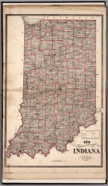
1882 Sectional and Township Map of Indiana. 1 … County Atlas Sectional and Township Map of Indiana. 1 … |

1882 New Railroad Map of the United States. County Atlas New Railroad Map of the United States. |

1882 Western Hemisphere. Eastern Hemisphere. County Atlas Western Hemisphere. Eastern Hemisphere. |

1897 Cady, Saint Croix County, Wisconsin. County Atlas Plat of Cady. |

1897 Springfield, Saint Croix County, Wiscons … County Atlas Plat of Springfield. |

1897 Glenwood, Saint Croix County, Wisconsin. County Atlas Plat of Glenwood. |