Browse All

1877 I.R.5. Molunkus. I.R.4. Macwahoc Plantat … County Atlas I.R.5. Molunkus. I.R.4. Macwahoc Plantat … |

1877 Glenwood, Reed, and Bancroft Plantations … County Atlas Glenwood Plantation. Reed Plantation. Pa … |

1877 Benedicta & Silver Ridge II R. 5, Aroost … County Atlas Benedicta & Silver Ridge II R. 5. |

1877 Sherman III, R.5, Aroostook County, Main … County Atlas Sherman III, R.5. |

1877 R.3. IV, III. R.2. Letter A Plantation, … County Atlas R.3. IV, III. R.2. Letter A Plantation. … |

1877 PL'T' N11. R1 & Amity. R.1, Aroostook Co … County Atlas PL'T' N11. R1 & Amity. R.1. |

1877 R. 5 Hersey V. Crystal Plantation IV. R. … County Atlas R. 5 Hersey V. Crystal Plantation IV. R. … |

1877 V. R. 3. Oakfield Plantation, Aroostook … County Atlas V. R. 3. Oakfield Plantation. |

1877 R.4 III II. Linneus, Aroostook County, M … County Atlas R.4 III II. Linneus. |

1877 Hodgdon, Aroostook County, Maine. County Atlas Hodgdon. |

1877 R. 5 VII. Moro Plantation VI. R.4 VII. M … County Atlas R. 5 VII. Moro Plantation VI. R.4 VII. M … |

1877 R. 3 VII. Smyrna VI. R.2 "B", Aroostook … County Atlas R. 3 VII. Smyrna VI. R.2 "B". (inset) Sh … |

1877 Ludlow & New Limerick. R. 2, Aroostook C … County Atlas Ludlow & New Limerick. R. 2. |

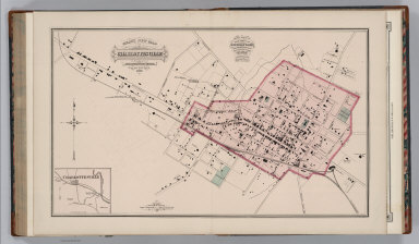
1877 Houlton, Aroostook County, Maine. County Atlas Houlton. |

1877 Houlton Village, Maine. Hodgdon Village. County Atlas Houlton Village. (inset) Hodgdon Village … |

1877 R. 5. 9. 8. R. 4.9. 8, Aroostook County, … County Atlas R. 5. 9. 8. R. 4.9. 8. |

1877 R. 3 IX VIII. R. 2 D C, Aroostook County … County Atlas R. 3 IX VIII. R. 2 D C. |

1877 Littleton R. 1, Aroostook County, Maine. County Atlas Littleton R. 1. |

1877 Monticello R. 1, Aroostook County, Maine … County Atlas Monticello R. 1. |

1877 Bridgewater R. 1, Aroostook County, Main … County Atlas Bridgewater R. 1. |

1877 K, R.2. Ox Bow Plantation. Pleasant Ridg … County Atlas K, R.2. Ox Bow Plantation. Pleasant Ridg … |

1877 Ashland XI, R. 5, Aroostook County, Main … County Atlas Ashland XI, R. 5. |

1877 R. 4 XI X. R. 3 Chapman Plantation XI X, … County Atlas R. 4 XI X. R. 3 Chapman Plantation XI X. |

1877 R. 7 Eagle Lake Plantation XVI XV. R. 2 … County Atlas R. 7 Eagle Lake Plantation XVI XV. R. 2 … |

1877 Mars Hill. Blaine, Aroostook County, Mai … County Atlas Mars Hill. Blaine. |

1877 Presque Isle F, R. 2, Aroostook County, … County Atlas Presque Isle F, R. 2. |

1877 Presque Isle Village, Maine. County Atlas Presque Isle Village. |

1877 Easton T. C, R. 1, Aroostook County, Mai … County Atlas Easton T. C, R. 1. |

1877 R. 6 Portage Lake Plantation XIII Nashvi … County Atlas R. 6 Portage Lake Plantation XIII Nashvi … |

1877 Wade Plantation XIII, R. 4. Castle Hill … County Atlas Wade Plantation XIII, R. 4. Castle Hill … |

1877 Maysville G. R. 2, Aroostook County, Mai … County Atlas Maysville G. R. 2. |

1877 Fort Fairfield, Aroostook County, Maine. County Atlas Fort Fairfield. |

1877 Perham Plantation XIV, R. 4, Aroostook C … County Atlas Perham Plantation XIV, R. 4. |

1877 Woodland Plantation XIV, R. 3, Aroostook … County Atlas Woodland Plantation XIV, R. 3. |

1877 Caribou H & I R. 2, Aroostook County, Ma … County Atlas Caribou H & I R. 2. |

1877 Limestone E, R. 1, Aroostook County, Mai … County Atlas Limestone E, R. 1. |

1877 Map of Swedish Colony, Aroostook County, … County Atlas Map of Swedish Colony. Landkarte von New … |

1877 R. 9 Saint Francis Plantation XVII. R. 8 … County Atlas R. 9 Saint Francis Plantation XVII. R. 8 … |

1877 Fort Kent R. 7 XVIII, R. 6 XVII. Wallagr … County Atlas Fort Kent R. 7 XVIII, R. 6 XVII. Wallagr … |

1877 Frenchville XVIII. Madawaska XVIII, Aroo … County Atlas Frenchville XVIII. Madawaska XVIII. (ins … |

1877 Grand Isle XVIII, R. 3, Aroostook County … County Atlas Grand Isle XVIII, R. 3. (inset) Monticel … |

1877 R. 2 Van Buren Plantation M, Cyr Plantat … County Atlas R. 2 Van Buren Plantation M, Cyr Plantat … |

1877 Fort Fairfield Village. Caribou. Spaguev … County Atlas Fort Fairfield Village. Caribou. Spaguev … |

1877 Lexington, Virginia. World Atlas Gray's New Map of Lexington, Rockingham … |
1877 Charlottesville,Virginia. World Atlas Gray's New Map of Charlottesville, Albem … |

1877 Harrisonburg, Virginia. World Atlas Gray's New Map of Harrisonburg, Rockingh … |

1877 Bridgewater, Virginia. World Atlas Gray's New Map of Bridgewater, Rockingha … |

1877 Text Page (1): Professional Directory of … World Atlas (Text Page) The National Atlas. Professi … |

1877 Text Page (2-3): Professional Directory … World Atlas (Text Page) The National Atlas. Professi … |

1877 Text Page (4-5): Professional Directory … World Atlas (Text Page) The National Atlas. Professi … |