Browse All

1876 Railway Map of the State of Pennsylvania … County Atlas Railway Map of the State of Pennsylvania … |

1875 Pittsburg, Cincinnati and St. Louis R.R. … County Atlas Map of the Pittsburg, Cincinnati and St. … |

1922 British Isles - railways & industrial. World Atlas British Isles - railways & industrial. ( … |

1883 Railway, statistical England, Wales. World Atlas Railway & statistical map of England & W … |

1883 Geological map England, Wales. World Atlas Geological map of England & Wales, with … |

1883 Liverpool. World Atlas Plan of Liverpool. (with) Plan, section … |

1883 Ireland. World Atlas Railway & statistical map of Ireland. Le … |

1883 Scotland. World Atlas Railway & statistical map of Scotland. L … |

1883 France. World Atlas Railway and statistical map of France. L … |

1883 U.S. Western. World Atlas United States of North America, and part … |

1883 U.S. Eastern. World Atlas United States of North America, and part … |

1875 Kansas. National Atlas Cram's Rail Road & Township Map of Kansa … |
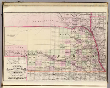
1875 Nebraska. National Atlas Cram's Rail Road & Township Map of Nebra … |

1875 Minnesota. National Atlas Cram's Rail Road & Township Map of Minne … |

1875 Dakota. National Atlas Cram's Rail Road & Township Map of Dakot … |

1875 Arkansas. National Atlas Cram's Rail Road & Township Map of Arkan … |

1875 Louisiana. National Atlas Cram's Rail Road & Township Map of Louis … |

1875 Texas. National Atlas Cram's Rail Road & Township Map of Texas … |

1929 4-5. Linee di comunicazione, Oceano Atla … World Atlas Linee di comunicazione del Oceano Atlant … |

1929 6-8. Linee di comunicazione, oceano Indi … World Atlas Linee di comunicazione degli oceani Indi … |

1929 9-10. Linee di comunicazione, Europa cen … World Atlas Linee di comunicazione dell'Europa centr … |

1873 New railroad map of the states of Maryla … State Atlas New railroad map of the states of Maryla … |

1834 Etats-Unis d'Amerique. National Atlas Carte generale des Etats-Unis d'Amerique … |

1898 60. Railroad systems 1890. Statistical Atlas 372. Railroad systems of the United Stat … |

1890 Railroad map U.S. World Atlas Railroad map of the United States, showi … |

1890 Mexico, Central America, West Indies. World Atlas Map of Mexico, Central America, and the … |

1870 Mexico, Central America, West Indies. [State Atlas, World Atlas] Map of Mexico, Central America, and the … |

1943 Surface Transport Facilities 22. World Atlas Surface Transport Facilities 22. |

1943 Railroads and Population 25. World Atlas Railroads and Population 25. |

1853 Deutschland .... (Germany, Netherlands, … World Atlas No. XXVI. Stieler's Hand-Atlas (No. 20.) … |

1940 United States Railroad map National Atlas Rand McNally handy Railroad map United S … |

1881 Das Deutsche Reich und Seine Nachbarland … World Atlas Stieler's Hand-Atlas No. 18. Das Deutsch … |

1850 (Germany, Netherlands, Belgium, and Swit … World Atlas No. XXVI. Stieler's Hand-Atlas (No. 20.) … |

1907 Commercial Highways of the World. Statistical Atlas Commercial Highways of the World. |

1881 England and Wales to Illustrate the Rail … Statistical Atlas England and Wales to Illustrate the Rail … |

1881 Scotland to Illustrate the Railway Syste … Statistical Atlas Scotland to Illustrate the Railway Syste … |

1881 Ireland to Illustrate the Railway System … Statistical Atlas Ireland to Illustrate the Railway System … |

1875 Deutschland Und Benachbarte Lander. Zur … World Atlas Deutschland Und Benachbarte Lander. Zur … |

1883 Railroad and County Map of New Jersey. World Atlas Railroad and County Map of New Jersey. |

1883 New Rail Road and County Map of Deleware … World Atlas New Rail Road and County Map of Deleware … |

1883 New Rail Road and Count Map of North Car … World Atlas New Rail Road and Count Map of North Car … |

1883 New Rail Road and County Map of Alabama, … World Atlas New Rail Road and County Map of Alabama, … |

1883 New Rail Road and County Map of Kentucky … World Atlas New Rail Road and County Map of Kentucky … |

1883 New Rail Road and County Map of Missouri … World Atlas New Rail Road and County Map of Missouri … |

1883 New Rail Road and County Map of Michigan … World Atlas New Rail Road and County Map of Michigan … |

1871 Massachusetts. State Atlas Map of Massachusetts comprising counties … |

1838 United States, exhibiting the railroads … World Atlas United States, exhibiting the railroads … |

1872 Penn. railway map. State Atlas Railway map of the state of Pennsylvania … |

1873 Railroad and County Map of Oregon, Calif … World Atlas Gray's Atlas New Rail Road and County Ma … |

1878 Illinois. National Atlas Cram's Rail Road & Township Map of Illin … |