Who What Where WhenWHOShow More |
REFINE
Browse All : Railroad and Case Map of U.S. West
1-5 of 5
Author
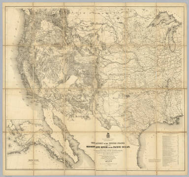
Warren, Gouverneur Kemble, 1830-1882
Full Title
Map Of The Territory Of The United States From The Mississippi River To The Pacific Ocean; Originally prepared to accompany the Reports of the Explorations For A Pacific Railroad Route ... Compiled from authorized explorations and other reliable data by Lieut. G.K. Warren, Top'l. Eng'rs. In the Office of Pacific R.R. Surveys, War Dept. under the direction of Bvt. Maj. W.H. Emory, Top'l. Eng'rs. in 1854. Capt. A.A. Humphreys, Top'l. Eng'rs. in 1854-58. And partly recompiled and redrawn under the direction of the Engineer Bureau in 1865-66-67. Engineer Bureau, War Department. Engraved on stone by Julius Bien, New York.
Publisher
Julius Bien
Author
[Freyhold, Edward, Warren, Gouverneur Kemble, 1830-1882]
Full Title
Territory Of The United States From The Mississippi River To The Pacific Ocean; Originally prepared to accompany the Reports of the Explorations For A Pacific Railroad Route ... Compiled from authorized explorations and other reliable data by Lieut. G.K. Warren, Top'l. Eng'rs. In the Office of Pacific R.R. Surveys, War Dept. under the direction of Bvt. Maj. W.H. Emory, Top'l. Eng'rs. in 1854. Capt. A.A. Humphreys, Top'l. Eng'rs. in 1854-58. Recompiled and redrawn under the direction of the Chief of Corps of Engineers By Edward Freyhold 1865-66-67-68. Head Quarters Corp Of Engineers, War Department. Engraved & printed by Julius Bien, N.Y. (inset) Territory Of Alaska Ceded By Russia To The United States 1868.
Publisher
Julius Bien
Author
Rand McNally and Company
Full Title
(Composite Map of) (Western section of Rand, McNally & Co.'s New Shippers' Railroad Map of the United States. Scale: 18 miles to one inch).
Publisher
Rand McNally & Co.
Author
Watson, Gaylord
Full Title
Watson's New County and Railroad Map of the Western States and Territories, With the Cities of New York, Chicago, St. Louis and San Francisco, 1874. Published by Gaylord Watson, 16 Beekman St., New York. Entered ... 1871, by Gaylord Watson ... Washington. (with) 5 inset maps: City of San Francisco; City of New York to 110th Street; City of Chicago; City of St. Louis; War Department Weather Map.
Publisher
Gaylord Watson
Author
Watson, Gaylord
Full Title
(Covers to) Watson's New County and Railroad Map of the Western States and Territories, With the Cities of New York, Chicago, St. Louis and San Francisco, 1874. Published by Gaylord Watson, 16 Beekman St., New York. Entered ... 1871, by Gaylord Watson ... Washington. (with) 5 inset maps: City of San Francisco; City of New York to 110th Street; City of Chicago; City of St. Louis; War Department Weather Map.
Publisher
Gaylord Watson
1-5 of 5
|