|
REFINE
Browse All : Railroad of Virginia
1-26 of 26
Author
Cram, George Franklin
Full Title
Western Half of Virginia and West Virginia, Engraved Expressly for the Standard Atlas of the World.
Publisher
George F. Cram
Author
Cram, George Franklin
Full Title
Eastern Half of Virginia and West Virginia, Engraved Expressly for the Standard Atlas of the World.
Publisher
George F. Cram
Author
Cram, George Franklin
Full Title
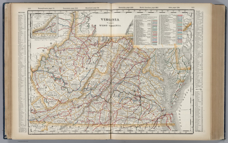
(Composite of) Virginia and West Virginia.
Publisher
George F. Cram
Author
Cram, George Franklin
Full Title
A Railroad and County Map, Virginia, W. Virginia.
Publisher
George F. Cram
Author
Cram, George Franklin
Full Title
Western Half of Virginia and West Virginia.
Publisher
George F. Cram
Author
Cram, George Franklin
Full Title
Eastern Half of Virginia and West Virginia.
Publisher
George F. Cram
Author
Cram, George Franklin
Full Title
(Composite of) Virginia and West Virginia.
Publisher
George F. Cram
Author
Cram, George Franklin
Full Title
Virginia and West Virginia.
Publisher
George F. Cram
Author
Hotchkiss, Jedidiah
Full Title
Virginia Hot Springs Company Map Of The Warm Springs Valley Showing Railways, Roads, And Paths Leading To The Healing, Hot And Warm Springs Compiled from U.S. Geol. Survey and other Maps. Eng. Office of Jed. Hotchkiss, Staunton, Va. 1895. With Revisions, 1903. The Norris Peters Co. Photo-Litho., Washington, D.C. (inset map) Virginia Hot Springs and Vicinity. (inset geological section) Section on Line A-B of Map.
Publisher
The Norris Peters Co. Photo Litho.
Author
Cram, George Franklin
Full Title
(Covers to) Cram's Railroad & County Map Of Virginia, W. Virginia, Maryland & Delaware. Published By Geo. F. Cram. Proprietor Of The Western Map Depot. 262-264 Wabash, Ave. Chicago, Ills. 1881. Entered ... 1878, by G.F. Cram... Washington D.C.
Publisher
George F. Cram
Author
Cram, George Franklin
Full Title
Cram's Railroad & County Map Of Virginia, W. Virginia, Maryland & Delaware. Published By Geo. F. Cram. Proprietor Of The Western Map Depot. 262-264 Wabash, Ave. Chicago, Ills. 1881. Entered ... 1878, by G.F. Cram... Washington D.C.
Publisher
George F. Cram
Author
Cram, George Franklin
Full Title
Cram's Rail Road & Township Map of Virginia & W.V. Published by Geo. F. Cram. Proprietor of the Western Map Depot. 66, Lake St. Chicago Ills. 1875.
Publisher
Cram Atlas Company
Author
Leahy, J.F.
Full Title
(Index to) Leahy's Hotel Guide and Railway Distance Maps. Virginia.
Publisher
American Hotel register Co.
Author
Leahy, J.F.
Full Title
Leahy's Hotel Guide and Railway Distance Map of the State of Virginia. Published by American Hotel Register Company. Leahy Build., 228-234 W. Ontario St., Chicago, Ill. Copyrighted by J.F. Leahy, Jan., 1934.
Publisher
American Hotel register Co.
Author
[Desilver, Charles, Young, James H.]
Full Title
(Covers to) A New Map Of The State Of Virginia Exhibiting Its Internal Improvements Roads Distances &c. by J.H. Young. Philadelphia: Published By Charles DeSilver 714 Chestnut St. 1859. Entered ... 1856 by Charles Desilver ... Pennsylvania. (inset) District Of Columbia.
Publisher
Charles Desilver.
Author
[Desilver, Charles, Young, James H.]
Full Title
A New Map Of The State Of Virginia Exhibiting Its Internal Improvements Roads Distances &c. by J.H. Young. Philadelphia: Published By Charles DeSilver 714 Chestnut St. 1859. Entered ... 1856 by Charles Desilver ... Pennsylvania. (inset) District Of Columbia.
Publisher
Charles Desilver.
Author
Colton, G.W. & C.B.
Full Title
(Covers to) Colton's Railroad & Commercial Atlas Of The United States, Canada Etc. Map No. 6. Delaware, Maryland, Virginia, West Virginia, N. Carolina, Kentucky & Tennessee. Published by G.W. And C.B. Colton, & Co. 172 William St. New York. 1870. Entered ... 1866, by G.W. & C.B. Colton & Co ... N.Y.
Publisher
G.W. & C.B. Colton
Author
Colton, G.W. & C.B.
Full Title
Colton's Railroad & Commercial Atlas Of The United States, Canada Etc. Map No. 6. Delaware, Maryland, Virginia, West Virginia, N. Carolina, Kentucky & Tennessee. Published by G.W. And C.B. Colton, & Co. 172 William St. New York. 1870. Entered ... 1866, by G.W. & C.B. Colton & Co ... N.Y.
Publisher
G.W. & C.B. Colton
Author
Cram, George Franklin
Full Title
New Rail Road and County Map of Deleware (Delaware), Maryland, Virginia & West Virginia.
Publisher
A.C. Shewey and Co.
Author
Cram, George Franklin
Full Title
Cram's Rail Road & County Map of Virginia & W. Va.
Publisher
George F. Cram
Author
Rand McNally and Company
Full Title
(Covers to) Rand, McNally & Co.'s New Shippers' Railroad Map of the United States. Scale: 8 miles to one inch. Showing all railroads, each in a separate color, and all railroad stations in large, plain type. (Below the neatline) Rand, McNally & Co.'s New Shippers' Railroad Map of the United States, Copyright, 1888 by Rand, McNally & Co. Copyright, 1891 by Rand, McNally & Co.
Publisher
Rand McNally & Co.
Author
Rand McNally and Company
Full Title
Rand, McNally & Co.'s New Shippers' Railroad Map of the United States. Scale: 8 miles to one inch. Showing all railroads, each in a separate color, and all railroad stations in large, plain type. (Below the neatline) Rand, McNally & Co.'s New Shippers' Railroad Map of the United States, Copyright, 1888 by Rand, McNally & Co. Copyright, 1891 by Rand, McNally & Co.
Publisher
Rand McNally & Co.
Author
Rand McNally and Company
Full Title
Rand, McNally & Co.'s New Shippers' Railroad Map of the United States. Scale: 8 miles to one inch. Showing all railroads, each in a separate color, and all railroad stations in large, plain type. This is the Richmond section, only, of the above-named map. (Below the neatline) Rand, McNally & Co.'s New Shippers' Railroad Map of the United States, Copyright, 1888 by Rand, McNally & Co. Copyright, 1891 by Rand, McNally & Co.
Publisher
Rand McNally & Co.
Author
Rand McNally and Company
Full Title
(Covers to) Rand, McNally & Co.'s New Shippers' Railroad Map of the United States. Scale: 8 miles to one inch. Showing all railroads, each in a separate color, and all railroad stations in large, plain type. This is the Richmond section, only, of the above-named map. (Below the neatline) Rand, McNally & Co.'s New Shippers' Railroad Map of the United States, Copyright, 1888 by Rand, McNally & Co. Copyright, 1891 by Rand, McNally & Co.
Publisher
Rand McNally & Co.
Author
Rand McNally and Company
Full Title
Commercial Atlas of America. Rand McNally Standard Map of Virginia.
Publisher
Rand McNally and Company
1-26 of 26
|