Who What Where WhenREMOVEWHO
WHEN
|
Author
Rand McNally and Company
Full Title
Rand, McNally & Co.'s Wyoming. Rand, McNally & Co., Map Publishers and Engravers, Chicago, 1909. Rand, McNally & Co.'s Indexed Atlas of the World Map of Wyoming. Copyright, 1909, ... 1895 ... (with 15 page index) Rand McNally & Co.'s Indexed County And Railroad Pocket Map And Shippers' Guide Of Wyoming ... Chicago And New York: Rand McNally & Co. ... (on verso) Copyright, 1909, Rand, McNally & Co., Chicago.
Publisher
Rand McNally & Co.
Author
Rand McNally and Company
Full Title
(Covers to) Rand McNally New Official Railroad Map Of The United States And Southern Canada. Copyright, by Rand McNally & Co.
Publisher
Rand McNally & Co.
Author
Rand McNally and Company
Full Title
Rand McNally New Official Railroad Map Of The United States And Southern Canada. Copyright, by Rand McNally & Co.
Publisher
Rand McNally & Co.
Author
Cram, George Franklin
Full Title
(Title Page to) Cram's Standard American Railway System Atlas Of The World. Accompanied with a Complete and Simple index of the United States ... Maps Of The United States Are The Largest Scale And Clearest Print Of Any Atlas Maps Published. Foreign Maps Are Compiled Largely From Charts Of The Royal Geographical Society, And Are Geographically Correct. Published by George F. Cram, 61-63 Plymouth Place, Chicago, Ill. 130 Fulton Street, New York. 1901. (on verso) Copyright Secured By George F. Cram, 1901.
Publisher
George F. Cram
Author
Cram, George Franklin
Full Title
(Table of Contents to) Cram's Standard American Railway System Atlas Of The World. Accompanied with a Complete and Simple index of the United States ... Maps Of The United States Are The Largest Scale And Clearest Print Of Any Atlas Maps Published. Foreign Maps Are Compiled Largely From Charts Of The Royal Geographical Society, And Are Geographically Correct. Published by George F. Cram, 61-63 Plymouth Place, Chicago, Ill. 130 Fulton Street, New York. 1901. (on verso) Copyright Secured By George F. Cram, 1901.
Publisher
George F. Cram
Author
Cram, George Franklin
Full Title
Maine.
Publisher
George F. Cram
Author
Cram, George Franklin
Full Title
New Hampshire and Vermont.
Publisher
George F. Cram
Author
Cram, George Franklin
Full Title
Commercial Railroad and County Map of Massachusetts and Rhode Island. (inset) (Boston and Vicinity).
Publisher
George F. Cram
Author
Cram, George Franklin
Full Title
Connecticut.
Publisher
George F. Cram
Author
Cram, George Franklin
Full Title
New York, Western Half. (inset) (Long Island).
Publisher
George F. Cram
Author
Cram, George Franklin
Full Title
New York, Eastern Half.
Publisher
George F. Cram
Author
Cram, George Franklin
Full Title
(Composite of) New York. (inset) (Long Island).
Publisher
George F. Cram
Author
Cram, George Franklin
Full Title
New York.
Publisher
George F. Cram
Author
Cram, George Franklin
Full Title
Western Half of Pennsylvania.
Publisher
George F. Cram
Author
Cram, George Franklin
Full Title
Eastern Half of Pennsylvania.
Publisher
George F. Cram
Author
Cram, George Franklin
Full Title
(Composite of) Pennsylvania.
Publisher
George F. Cram
Author
Cram, George Franklin
Full Title
Pennsylvania. Copyright 1899, by Geo. F. Cram.
Publisher
George F. Cram
Author
Cram, George Franklin
Full Title
New Jersey. Copyright, 1901, by Geo. F. Cram. (inset) Environs of Hudson County.
Publisher
George F. Cram
Author
Cram, George Franklin
Full Title
Maryland and Delaware. (inset) Baltimore County.
Publisher
George F. Cram
Author
Cram, George Franklin
Full Title
Western Half of Virginia and West Virginia.
Publisher
George F. Cram
Author
Cram, George Franklin
Full Title
Eastern Half of Virginia and West Virginia.
Publisher
George F. Cram
Author
Cram, George Franklin
Full Title
(Composite of) Virginia and West Virginia.
Publisher
George F. Cram
Author
Cram, George Franklin
Full Title
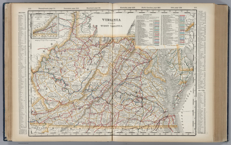
Virginia and West Virginia.
Publisher
George F. Cram
Author
Cram, George Franklin
Full Title
Ohio. (inset) Map of Hamilton County.
Publisher
George F. Cram
Author
Cram, George Franklin
Full Title
Michigan. (inset) Isle Royale.
Publisher
George F. Cram
Author
Cram, George Franklin
Full Title
Indiana.
Publisher
George F. Cram
Author
Cram, George Franklin
Full Title
Map of Illinois. George F. Cram, Publisher, 61-63 Plymouth Place, Chicago. (inset) Chicago and Vicinity.
Publisher
George F. Cram
Author
Cram, George Franklin
Full Title
Missouri. (inset) Vicinity of St. Louis.
Publisher
George F. Cram
Author
Cram, George Franklin
Full Title
Kansas.
Publisher
George F. Cram
Author
Cram, George Franklin
Full Title
Nebraska.
Publisher
George F. Cram
Author
Cram, George Franklin
Full Title
Colorado.
Publisher
George F. Cram
Author
Cram, George Franklin
Full Title
Wisconsin. (inset) Vicinity of Milwaukee.
Publisher
George F. Cram
Author
Cram, George Franklin
Full Title
Minnesota. (inset) Environs of St. Paul and Minneapolis.
Publisher
George F. Cram
Author
Cram, George Franklin
Full Title
North Dakota.
Publisher
George F. Cram
Author
Cram, George Franklin
Full Title
South Dakota.
Publisher
George F. Cram
Author
Cram, George Franklin
Full Title
Kentucky and Tennessee, Western Half.
Publisher
George F. Cram
Author
Cram, George Franklin
Full Title
Kentucky and Tennessee, Eastern Half.
Publisher
George F. Cram
Author
Cram, George Franklin
Full Title
(Composite of) Kentucky and Tennessee.
Publisher
George F. Cram
Author
Cram, George Franklin
Full Title
Kentucky. Tennessee. (inset) Vicinity of Covington and Newport.
Publisher
George F. Cram
Author
Cram, George Franklin
Full Title
Western Part of North and South Carolina.
Publisher
George F. Cram
Author
Cram, George Franklin
Full Title
Eastern Part of North and South Carolina.
Publisher
George F. Cram
Author
Cram, George Franklin
Full Title
(Composite of) North and South Carolina.
Publisher
George F. Cram
Author
Cram, George Franklin
Full Title
North and South Carolina.
Publisher
George F. Cram
Author
Cram, George Franklin
Full Title
Georgia.
Publisher
George F. Cram
Author
Cram, George Franklin
Full Title
Florida. (inset) (extension of main map), North-Western Portion of Florida.
Publisher
George F. Cram
Author
Cram, George Franklin
Full Title
Alabama.
Publisher
George F. Cram
Author
Cram, George Franklin
Full Title
Mississippi.
Publisher
George F. Cram
Author
Cram, George Franklin
Full Title
Louisiana.
Publisher
George F. Cram
|