Browse All

1840 Text Page: (Continues) Catalogue of Text … Guide Book (Text Page to) Catalogue of atlases, map … |

1840 Text Page: (Continues) Catalogue of atla … Guide Book (Text Page to) Catalogue of atlases, map … |

1840 Map of the canals & railroads of the Uni … Guide Book Map of the canals & railroads of the Uni … |

1888 Correct map of Dakota. Timetable Map Correct map of Dakota compiled from Unit … |

1888 Cover: Central Dakota. Timetable Map (Covers to) Answers to your questions ab … |

1888 Text Page: Central Dakota. Timetable Map (Text Page to) Answers to your questions … |

1915 Transcontinental Railways National Atlas Transcontinental Railways. (on upper rig … |

1915 Quebec and Maritime Provinces railway te … National Atlas Quebec and Maritime Provinces railway te … |

1915 Ontario and Quebec railway territories National Atlas Ontario and Quebec railway territories. … |

1915 Manitoba, Saskatchewan and Alberta railw … National Atlas Manitoba, Saskatchewan and Alberta railw … |

1915 Alberta, British Columbia and Yukon rail … National Atlas Alberta, British Columbia and Yukon rail … |

1915 Railways National Atlas Railways. (on upper margin). Atlas of Ca … |

1915 Railways: earning, Train Mileage National Atlas Railways: Earning. (and) Railways: Train … |

1915 Government railways National Atlas Government railways. (on upper margin). … |

1875 Township and Rail Road Map of Missouri. County Atlas Township & Rail Road Map of Missouri Sho … |

1876 Railway Map of the State of Pennsylvania … County Atlas Railway Map of the State of Pennsylvania … |

1875 Pittsburg, Cincinnati and St. Louis R.R. … County Atlas Map of the Pittsburg, Cincinnati and St. … |

1852 No.1. Map of the Isthmus of Tehuantepec Separate Map Map of the Isthmus of Tehuantepec, embra … |

1895 Iron clads, Engine "Hero," rebel lines, … Military Atlas Position of iron clads, January 15th, 18 … |

1922 British Isles - railways & industrial. World Atlas British Isles - railways & industrial. ( … |

1883 Railway, statistical England, Wales. World Atlas Railway & statistical map of England & W … |

1883 Geological map England, Wales. World Atlas Geological map of England & Wales, with … |

1883 Liverpool. World Atlas Plan of Liverpool. (with) Plan, section … |

1883 Ireland. World Atlas Railway & statistical map of Ireland. Le … |

1883 Scotland. World Atlas Railway & statistical map of Scotland. L … |

1883 France. World Atlas Railway and statistical map of France. L … |

1883 U.S. Western. World Atlas United States of North America, and part … |

1883 U.S. Eastern. World Atlas United States of North America, and part … |

1875 Kansas. National Atlas Cram's Rail Road & Township Map of Kansa … |
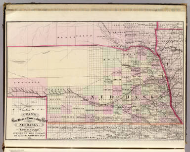
1875 Nebraska. National Atlas Cram's Rail Road & Township Map of Nebra … |

1875 Minnesota. National Atlas Cram's Rail Road & Township Map of Minne … |

1875 Dakota. National Atlas Cram's Rail Road & Township Map of Dakot … |

1875 Arkansas. National Atlas Cram's Rail Road & Township Map of Arkan … |

1875 Louisiana. National Atlas Cram's Rail Road & Township Map of Louis … |

1875 Texas. National Atlas Cram's Rail Road & Township Map of Texas … |

1929 4-5. Linee di comunicazione, Oceano Atla … World Atlas Linee di comunicazione del Oceano Atlant … |

1929 Legend: 6-8. Linee di comunicazione, oce … World Atlas (Legend) Linee di comunicazione degli oc … |

1929 6-8. Linee di comunicazione, oceano Indi … World Atlas Linee di comunicazione degli oceani Indi … |

1929 Legend: 9-10. Linee di comunicazione, Eu … World Atlas (Legend) Linee di comunicazione dell'Eur … |

1929 9-10. Linee di comunicazione, Europa cen … World Atlas Linee di comunicazione dell'Europa centr … |

1873 New railroad map of the states of Maryla … State Atlas New railroad map of the states of Maryla … |

1834 Etats-Unis d'Amerique. National Atlas Carte generale des Etats-Unis d'Amerique … |

1898 60. Railroad systems 1890. Statistical Atlas 372. Railroad systems of the United Stat … |

1890 Railroad map U.S. World Atlas Railroad map of the United States, showi … |

1890 Mexico, Central America, West Indies. World Atlas Map of Mexico, Central America, and the … |

1892 Station, Concord & Montreal Railroad, Co … State Atlas Passenger station and general offices, C … |

1870 Mexico, Central America, West Indies. [State Atlas, World Atlas] Map of Mexico, Central America, and the … |

1925 Cover: Mapa de los ferrocarriles en expl … Case Map (Covers to) Mapa de los ferrocarriles en … |

1925 Mapa de los ferrocarriles en explotacion … Case Map Mapa de los ferrocarriles en explotacion … |

1884 Railway, steamship lines Southern Pacifi … Timetable Map Correct map of the railway & steamship l … |