Browse All

1776 An Exact Chart of the River St. Laurence … National Atlas An Exact Chart of the River St. Laurence … |

1776 Course Of The River Mississipi, from the … National Atlas Course Of The River Mississipi, from the … |

1825 Rivieres. National Atlas Carte des principales rivieres du globe. … |

1832 Length, rivers of Scotland. National Atlas A comparative view of the lengths of the … |

1966 Road Network. National Atlas Road Network. |

1915 Drainage basins National Atlas Drainage basins. (on upper right margin) … |
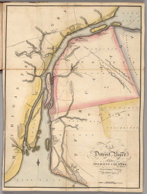
1813 Map of Detroit River and Adjacent Countr … National Atlas Map of Detroit River and Adjacent Countr … |

1901 Stanford's Useful Maps, England, Outline … National Atlas Stanford's Useful Maps, England, Outline … |

1840 Mapas fisicos de Venezuela. National Atlas Mapa fisico de Venezuela divida en hoyas … |

1796 General Map of the Course of the Ohio. National Atlas General Map of the Course of the Ohio fr … |

1796 A General Map of the River Ohio, Plate t … National Atlas A General Map of the River Ohio, Plate t … |

1796 A General Map of the River Ohio, Plate t … National Atlas A General Map of the River Ohio, Plate t … |

1796 A General Map of the River Ohio, Plate t … National Atlas A General Map of the River Ohio, Plate t … |

1796 A General Map Of The River Ohio, From it … National Atlas A General Map Of The River Ohio, From it … |

1796 Composite: Ohio River (pl. 1-4) National Atlas (Composite of) A General Map Of The Rive … |

1796 Plan of the Rapids or Falls of the Ohio … National Atlas Plan of the Rapids or Falls of the Ohio … |

1796 Passage of a Branch of the river Juniata … National Atlas Passage of a Branch of the river Juniata … |

1796 Map of the Course of The Mississippi fro … National Atlas Map of the Course of The Mississippi fro … |

1885 Carta Hydrografica. National Atlas Carta Hydrografica. VII. A. Garcia Cubas … |

1873 Carte, cours du Haut Uruguay, 1. flle. C … National Atlas Carte du cours du Haut Uruguay depuis la … |

1873 Carte, cours du Haut Uruguay, 2. flle. U … National Atlas Carte du cours du Haut Uruguay depuis la … |

1873 Rio Paraguay; chutes, Rio Parana et Y-Gu … National Atlas Cours inferieur et bouches du Rio Paragu … |

1888 Mapa orohidrografico de la Republica Arg … National Atlas Mapa orohidrografico de la Republica Arg … |

1815 Map of Detroit River and Adjacent Countr … National Atlas Map of Detroit River and Adjacent Countr … |

1865 Lecho, Rio Amazonas; Corte vertical, cam … National Atlas Lecho del Rio Amazonas segun los sondeos … |