Who What Where WhenREMOVEWHO
|
Author
Berghaus, Heinrich
Full Title
Asia-Europa; in Beziehung auf das Fliessende, und seine Vertheilung in Stromgebiete. 2te Abtheilung: Hydrographie, No. 7. Potsdam, gez. u. gest. in der geograph. Kunstschule. Gotha bei J. Perthes. 1841.
Publisher
Justus Perthes
Author
Berghaus, Heinrich
Full Title
Stromgebiete Der Neuen Welt. 2te Abtheilung: Hydrographie, No. 8. Potsdam, gez. u. gest. in der geogr. Kunstschule. Gotha, bei Justus Perthes. 1842.
Publisher
Justus Perthes
Author
Berghaus, Heinrich
Full Title
Ubersicht der bekannteren Gabeltheilungen des Stromenden Wassers. 2te Abtheilung: Hydrographie, No. 9. Potsdam, bearbeitet in der geographischen Kunstschule. Gotha, J. Perthes. 1839.
Publisher
Justus Perthes
Author
Berghaus, Heinrich
Full Title
Vermischtes zur Hydrographie: Schwankungen des Ostsee Standes, Strom Neigungen, &c. &c. 2te Abtheilung: Hydrographie, No. 10. Potsdam, gez. u. gest. in der geogr. Kunstschule. Gotha, bei Justus Perthes. 1843.
Publisher
Justus Perthes
Author
Berghaus, Heinrich
Full Title
Hydro-Historische Darstellung vom Zustande der Elbe in dem Halbjahrhundert 1731-1780. 2te Abtheilung: Hydrographie, No. 11. Nach Berghaus' Entwurf gez. von G. Haase. Gestochen von K. Kolbe. Gotha, J. Perthes. 1837.
Publisher
Justus Perthes
Author
Berghaus, Heinrich
Full Title
Hydro-Historische Ubersicht vom Zustande der Elbe in dem Halbjahrhundert 1781-1830. 2te Abtheilung: Hydrographie, No. 12. Nach Berghaus' Entwurf gez. von G. Haase. Gestochen von K. Kolbe. Gotha, J. Perthes. 1837.
Publisher
Justus Perthes
Author
Berghaus, Heinrich
Full Title
Hydro-Historische Ubersicht vom Zustande der Oder in dem Halbjahrhundert 1781-1830. 2te Abtheilung: Hydrographie, No. 13. Nach Berghaus' Entwurf gez. von G. Haase. Gestochen von K. Kolbe. Gotha, J. Perthes. 1837.
Publisher
Justus Perthes
Author
Berghaus, Heinrich
Full Title
Vergleichende Ubersicht Vom Zustande Des Rheins, Der Weser, Der Elbe Und Oder, Wahrend Der Zehn Jahre Von 1831-1840. 2te Abtheilung: Hydrographie, No. 14. Gez. u. gest. in der geograph. Kunstschule zu Potsdam. Gotha bei Justus Perthes. 1841.
Publisher
Justus Perthes
Author
Berghaus, Heinrich
Full Title
Die Deutschen Strome Rhein, Elbe, Oder; nach ihrem Verhalten Innerhalb Eines Jahres; gegrundet auf die Beobachtungen der Pegel zu Emmerich, Koln, Magdeburg, Dresden, Kustrin. Nebst der Darstellung von dem Fahresstande dieser Strome seit 1728 &c. 2te Abtheilung: Hydrographie, No. 15. Entw.und gez. von H. Berghaus. Gest. von K. Kolbe. Gotha, J. Perthes. 1838.
Publisher
Justus Perthes
Author
Berghaus, Heinrich
Full Title
Hydrographisches Tableau Der Weser, Weichsel, Und Des Memelstroms. 2te Abtheilung: Hydrographie, No. 16. Potsdam, gez. u. gest. in der geograph. Kunstschule. Gotha bei Justus Perthes. 1842.
Publisher
Justus Perthes
Author
Hayden, F.V.
Full Title
Drainage Map of Colorado. Topography by A.D. Wilson, G.R. Bechler, Henry Gannett, G.B. Chittenden and S.B. Ladd. Department of the Interior, U.S. Geological and Geographical Survey of the Territories, F.V. Hayden, U.S. Geologist in Charge. March 1877. Sheet II.
Publisher
Department of The Interior. United States Geological and Geographical Surveys of the Territories.
Author
Jefferys, Thomas
Full Title
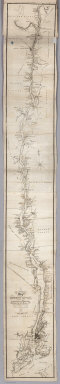
An Exact Chart of the River St. Laurence, from Fort Frontenac to the Island of Anticosti shewing the Soundings, Rocks, Shoals &c with Views of the Lands and all necessary Instructions for navigating that River to Quebec. To the Rt. Honble. Fn. Montagu El. of Sandwich, First Lord Commisioner to the other Honble. Commissioners for executing the Office of Lord High Admiral of Great Britain. This Chart is most Humbly Inscribed By their Lordships most Obedient most devoted Humble Servt. Thos. Jefferys. (with) Six inset maps [described in notes field]. London. Printed for Robt. Sayer ... 25 May, 1775.
Publisher
Sayer and Bennett
Author
Jefferys, Thomas
Full Title
Course Of The River Mississipi, from the Balise to Fort Chartres; Taken on an Expedition to the Illinois, in the latter end of the Year 1765. By Lieut. Ross of the 34th Regiment: Improved from the Surveys of that River made by the French. London Printed for Robt. Sayer ... 1 June 1775.
Publisher
Sayer and Bennett
Author
Morse, Jedidiah
Full Title
A Map of the Tennessee Government. 1794. Published Sep. 20 1794 by I. Stockdale, Piccadilly.
Publisher
John Stockdale
Author
Nicollet, J. N. (Joseph Nicolas), 1786-1843
Full Title
(Title Page to) Report Intended To Illustrate A Map Of The Hydrographical Basin of the Upper Mississippi River, Made by I.N. Nicollet ... February 16, 1841. Washington: Blair and Rives, Printers. 1843. [Senate.] 26th Congress, 2d Session. [237].
Publisher
Blair and Rives
Author
Nicollet, J. N. (Joseph Nicolas), 1786-1843
Full Title
Hydrographical Basin of the Upper Mississippi River From Astronomical and Barometrical Observations Surveys and Information by J.N. Nicollet ... assisted ... by Lieut. J.C. Fremont ... Reduced and compiled under the direction of Col. J.J. Abert in the Bureau of the Corps of Topl. Engrs. by Lieut. W.H. Emory ... 1843 ... W.J. Stone Sc.
Publisher
Blair and Rives
Author
Colton, G.W.
Full Title
(Text Page) Principal Rivers and Lakes in the World.
Publisher
G. W & C. B. Colton & Co.
Author
Colton, G.W.
Full Title
Mountains & Rivers. Published by G. W. & C. B. Colton & Co., No. 182 William St. New York.
Publisher
G. W & C. B. Colton & Co.
Author
Colton, G.W.
Full Title
(Text Page) Principal Rivers and Lakes in the world.
Publisher
G. W & C. B. Colton & Co.
Author
Colton, G.W.
Full Title
Mountains & Rivers.
Publisher
G. W & C. B. Colton & Co.
Author
Society for the Diffusion of Useful Knowledge (Great Britain)
Full Title
A map of the principal rivers shewing their courses, countries, and comparative lengths. Engraved by Thos. Starling, Wilmington Square, London. Published by Baldwin & Cradock, 47 Paternoster Row, under the superintendence of the Society for the Diffusion of Useful Knowledge, April 1st. 1834. (London: Chapman & Hall, 1844)
Publisher
Chapman and Hall
Author
Colton, G.W.
Full Title
Mountains & Rivers. Published by G.W. & C.B. Colton, No. 172 William St., New York.
Publisher
G.W. & C.B. Colton
Author
Colton, G.W.
Full Title
(Text Page) Principal Rivers and Lakes in the world.
Publisher
G.W. & C.B. Colton
Author
[Colton, J. H., Norman, B.M., Persac, A.]
Full Title
Norman's Chart Of The Lower Mississippi River By A. Persac. Published by B.M. Norman, New Orleans, La. 1858. Entered ... 1858 by B.M. Norman ... Louisiana. Engraved, Printed & Mounted By J.H. Colton & Co. New York. (At top) From Natchez to New Orleans.
Publisher
B.M. Norman
Author
Raisz, Erwin
Full Title
10. Sea, Lakes, And Rivers. Sources: Florida's Water Resources, 1957. U.S. Coast and Geodetic Survey Charts. Central and Southern Florida Flood Control Project Maps. Water Resources Study Commission Report. (to accompany) Atlas of Florida by Erwin Raisz and associates with text by John R. Dunkle. Prepared in the Department of Geography, University of Florida. University of Florida Press, Gainesville, 1964. (on verso) 1964 Board of Commissioners of State Institutions of Florida.
Publisher
Un. Of Florida Press
Author
Featherstonhaugh, G.W.
Full Title
A Reconnoissance Of The Minnay Sotor Watapah; Or St. Peter's River to its sources: Made in the Year 1835, by G.W. Featherstonhaugh U.S. Geologist.
Publisher
U.S.
Author
[Thomson, John, Wyld, James, 1790-1836]
Full Title
Table of the Comparative Lengths of the Principal Rivers in the World. Drawn by Wyld. Hewitt,Sc. Buckingham Place... (to accompany) A General Atlas, Containing Maps illustrating some important periods in Ancient History; and distinct Maps of the several Empires, Kingdoms and States In The World, From Original Drawings according to the latest Treaties by J. Wyld and Engraved by N.R. Hewitt. Edinburgh, Printed for John Thomson & Co for Baldwin, Cradock & Joy, London & John Cumming, Dublin.
Publisher
John Thomson
Author
Meyer, Joseph, 1796-1856
Full Title
Vergleichende Ubersicht der grossten Strome der Erde nach ihrer Lauflange geordnet mit Angabe ihrer Quellen, Mundungen, Nebenflusse und Hauptuferplatze ... (Grosser Hand-Atlas uber alle Theile der Erde in 170 Karten. Herausgegeben von J. Meyer. Hildburghausen Verlag des Bibliographischen Instituts, 1860)
Publisher
Bibliographischen Instituts
Author
Colton, G.W.
Full Title
Principal rivers and lakes in the World. (Published by J.H. Colton & Co. 1856)
Publisher
J.H. Colton
Author
Coloney, Fairchild & Co.
Full Title
Coloney & Fairchild's Patent Ribbon Maps ... Ribbon Map Of The Father Of Waters. Geographical and Scenic Maps upon this plan of all the rivers, rail road routes, stage and coast lines in the country are in preparation.
Publisher
Gast, Moeller & Co. Lith.
Author
Radefeld, Carl Christian Franz, 1788-1874
Full Title
Flusskarte von Asien. Nach den besten Quellen. Entw. u. gez. vom Major Radefeld. 1848. Stich, Druck und Verlag des Bibliographischen Instituts in Hildburghausen, (1860)
Publisher
Bibliographischen Instituts
Author
Radefeld, Carl Christian Franz, 1788-1874
Full Title
Stromgebiet von Nordamerica. Nach den besten Quellen entworfen und gezeichnt. vom Hauptm. Radefeld. 1847. Stich, Druk und Verlag des Bibliographischen Instituts zu Hildburghausen, (1860)
Publisher
Bibliographischen Instituts
Author
[Walling, H.F., Hitchcock, C.H.]
Full Title
(Text Page) The River Systems.
Publisher
Comstock & Cline (Bien)
Author
[Walling, H.F., Hitchcock, C.H.]
Full Title
(Text Page) The River Systems (concluded).
Publisher
Comstock & Cline (Bien)
Author
Confederate States of America. Army
Full Title
Parts of Arkansas and Louisiana. Respectfully forwarded, Richd. M. Venable ... Accompanying the report of Gen. E. Kirby Smith, C.S. Army. Section including falls and dam in Red River. Prepared by order of B'v't. Brig. Gen. J. Bailey by Lieut. W.S. Trask ... (with) Sketch of the battle-field of Ocean Pond, Fla., February 20th, 1864. M.B. Grant, Lieut., Corps Engrs., C.S.A., del. (with) Part of Louisiana. Sketch of General Liddell's plan, January, 1864. Accompanying letter of Maj. Gen. R. Taylor, C.S. Army. Julius Bien & Co., Lith., N.Y. (1891-1895)
Publisher
U.S. Government Printing Office
Author
[Edward Stanford Ltd., Stanford, Edward]
Full Title
A hydrographical map of the British Isles. (with) Diagram showing the comparative fall of the principal rivers of the British Isles. London atlas series. Stanford's Geographical Establishment. London : Edward Stanford, 12, 13 & 14, Long Acre, W.C. (1901)
Publisher
Edward Stanford
Full Title
Carte des principales rivieres du globe. Grave par Le Gagneur, Rue du Marche-Neuf, No. 8. Fonderie et Imprimerie de J. Carez. (1825)
Publisher
J. Carez
Author
Desjardins, Constant
Full Title
Hydrographische Karte von Europa, oder darstellende Karte der beiden grossen Abdachungen, der Meer- und Flussgebiete etc., etc. der europaischen Halbinsel. Der Jugend gewidmet von C. Desjardins, Mitglied der Pariser Gesellschaften der Geographie ... Zu haben in Wien bei dem Verfasser, Bauernmarkt, Nr. 579, und in allen soliden Buch- und Kunsthandlungen (1837)
Publisher
Verfasser
Author
Gannett, Henry, 1846-1914
Full Title
River basins. Based on the reports of the tenth census. Forestry. Ratio of estimated timber supply, in cords, to total area. By Henry Gannett. 1880. Copyright, 1883, by Charles Scribner's Sons.
Publisher
Charles Scribner's Sons
Author
[Lizars, William Home, Thomson, John]
Full Title
A comparative view of the lengths of the principal rivers of Scotland. (with) Comparative view of the height of the falls of Foyers and Corba Linn. Drawn by W.H. Lizars. Engd. by W.H. Lizars. Published by John Thomson, Edinburgh, 1831. (1832)
Publisher
[Baldwin & Cradock, John Cumming, John Thomson & Co.]
Author
Wyld, James, 1812-1887
Full Title
Table of the Comparative Lengths of the Principal Rivers in the World. Compiled and Drawn in the Quarter Master Generals Department. By James Wyld. London, Published by James Wyld (Successor to Mr. Faden) Charing Cross East. (to accompany) An Atlas of the World, Comprehending Separate Maps of its various Countries, Constructed & drawn from the latest Astronomical & Geographical Observations. By James Wyld, Geographer to Her Majesty and H. Late R.H. Prince Albert. London. Published by James Wyld (Successor to Mr. Faden) Charing Cross East. 1864.
Publisher
James Wyld
Author
Vandewater, Robert J.
Full Title
(Covers to) The Tourist, Or Pocket Manual For Travellers On The Hudson River, The Western Canal, And Stage Road ... New-York: Printed By J. & J. Harper, No. 82 Cliff-street. 1830. (with map) An Improved Map of the Hudson River, with the Post Roads between N. York & Albany. Published by S. Mahon & Co. Drawn & Engraved Expressly For The Tourist. 1830. W. Chapin Sc.
Publisher
J. & J. Harper
Author
Vandewater, Robert J.
Full Title
An Improved Map of the Hudson River, with the Post Roads between N. York & Albany. Published by S. Mahon & Co. Drawn & Engraved Expressly For The Tourist. 1830. W. Chapin Sc. (with) The Tourist, Or Pocket Manual For Travellers On The Hudson River, The Western Canal, And Stage Road ... New-York: Printed By J. & J. Harper, No. 82 Cliff-street. 1830.
Publisher
J. & J. Harper
Author
Lloyd, J.T.
Full Title
Lloyd's Map of the Lower Mississippi River From St. Louis To The Gulf Of Mexico. Compiled From Government Surveys In The Topographical Bureau, Washington, D.C. Revised and corrected to the present time by Captains Bart and William Bowen ... Price, in sheets, Colored, 50 Cents per copy. Pocket Edition, $1.00. Mounted Edition on Rollers and Varnished, $1.00 ... J.T. Lloyd, Publisher. 164 Broadway, New York 1863. Entered ... 1862, by J.T. Lloyd ... New York. (on verso) Lloyd's New Map of the United States, The Canadas And New Brunswick ... 1864 ... Entered ... 1863, by J.T Lloyd ... New York. (untitled inset map of Southern Florida).
Publisher
J.T. Lloyd
Author
Lloyd, J.T.
Full Title
Lloyd's New Map of the United States, The Canadas And New Brunswick ... 1864 ... Entered ... 1863, by J.T Lloyd ... New York. (untitled inset map of Southern Florida). (on verso) Lloyd's Map of the Lower Mississippi River From St. Louis To The Gulf Of Mexico. Compiled From Government Surveys In The Topographical Bureau, Washington, D.C. Revised and corrected to the present time by Captains Bart and William Bowen ... Price, in sheets, Colored, 50 Cents per copy. Pocket Edition, $1.00. Mounted Edition on Rollers and Varnished, $1.00 ... J.T. Lloyd, Publisher. 164 Broadway, New York 1863. Entered ... 1862, by J.T. Lloyd ... New York.
Publisher
J.T. Lloyd
Author
[Götz, Antonín, Československá akademie věd., Czechoslovakia. Ústřední správa geodézie a kartografie.]
Full Title
Road Network.
Publisher
Czechoslovakia. Ústřední správa geodézie a kartografie.
Author
Raynolds, W.F.
Full Title
(Title Page to) Report of the Secretary of War, communicating ... the report of Brevet Brigadier General W.F. Raynolds, on the exploration of the Yellowstone and the country drained by that river. (Senate. 40th Congress, 2nd session, Ex. Doc. No. 77.) July 19, 1867. - Read; ordered to lie on the table.
Publisher
War Dept.
Author
Raynolds, W.F.
Full Title
U.S. War Department : Map of the Yellowstone and Missouri Rivers and their tributaries. Explored by Capt. W. F. Raynolds, TopL. Engrs. and 1st. Lieut. H. E. Maynadier, 10th. Infy. Assistant 1859-60. To accompany a report to the Bureau of Engineers 1867. Engraved in the Engineer Bureau, War Dept. (to accompany) Report of the Secretary of War, communicating ... the report of Brevet Brigadier General W.F. Raynolds, on the exploration of the Yellowstone and the country drained by that river.
Publisher
War Dept.
|