|
REFINE
Browse All : Roads of Minnesota
1-8 of 8
Author
Shell Oil Company
Full Title
Shell Map of Michigan (cover title). Shell Highway Map of Minnesota (southern portion). 7-DD-1956-2. (inset) Enlarged Map of the Minneapolis, St. Paul District.
Publisher
Shell Oil Company
Author
Shell Oil Company
Full Title
Shell Highway Map of Minnesota (northern portion). (Verso to) Shell Highway Map of Minnesota (southern portion).
Publisher
Shell Oil Company
Author
Rand McNally and Company
Full Title
Rand McNally auto road map Minnesota ... Copyright by Rand McNally & Co. Chicago, Ill. Made In U.S.A.
Publisher
Rand McNally
Author
Rand McNally and Company
Full Title
(Covers to) Rand McNally auto road map Minnesota ... Copyright by Rand McNally & Co. Chicago, Ill. Made In U.S.A.
Publisher
Rand McNally
Author
Rand McNally and Company
Full Title
(Title Page to) Rand McNally auto road map Minnesota ... Copyright 1932 by Rand McNally & Co. Chicago, Ill. Made In U.S.A.
Publisher
Rand McNally
Author
[Rand McNally and Company, State Farm Insurance Companies Travel Bureau]
Full Title
Rand McNally Road map, Minnesota. Copyright by Rand McNally & Company, Chicago, Ill. Lithographed in the U.S.A. (inset map) Northeastern Minnesota. (to accompany) State Farm Road Atlas: United States, Canada, Mexico,Central and South America. Copyright 1940 by Rand McNally & Company, Chicago, Ill.
Publisher
State Farm Insurance Companies Travel Bureau
Author
Campbell, Albert
Full Title
Map of the Fort Ridgely & South Pass Road. To accompany the report of William H. Nobles, Superintendent, by Samuel A. Medary, Engr. 1858. T.S. Wagner's Lith., Philada. Drawn by John R. Key. (Sen. Ex. Doc. No. 36. Ho. Ex. Doc. No. 108 - 2nd Sess. 35 Cong.)
Publisher
T.S. Wagner's Lith.
Author
Campbell, Albert
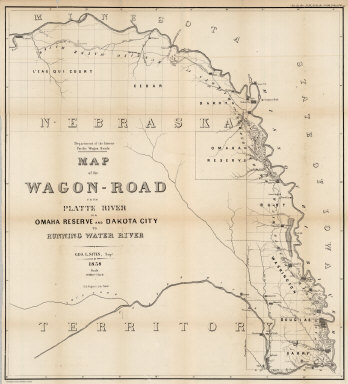
Full Title
Map of the Wagon-Road from Platte River via Omaha Reserve and Dakota City to Running Water River. Geo. L. Sites, Supt. 1858. T.S. Wagner's Lith. Philada. Department of the Interior, Pacific Wagon Roads. (Sen. Ex. Doc. No. 36. Ho. Ex. Doc. No. 108 - 2nd Sess. 35 Cong.)
Publisher
T.S. Wagner's Lith.
1-8 of 8
|