Browse All

1835 A Plan of the Solar System. Celestial Atlas A Plan of the Solar System Exhibiting it … |

1835 (The constellations in) October - March. Celestial Atlas (The constellations in) March, February, … |

1823 Maine. [Manuscript Map, National Atlas] Maine. |

1823 New Hampshire. [Manuscript Map, National Atlas] New Hampshire. |

1823 Vermont. [Manuscript Map, National Atlas] Vermont. |

1823 Massachusetts. [Manuscript Map, National Atlas] Massachusetts. |

1823 Connecticut. [Manuscript Map, National Atlas] Connecticut. |

1823 Rhode Island. [Manuscript Map, National Atlas] Rhode Island. |

1823 New York. [Manuscript Map, National Atlas] New York. |

1823 New Jersey. [Manuscript Map, National Atlas] New Jersey. |

1823 Pensylvania. [Manuscript Map, National Atlas] Pensylvania. |

1823 Maryland. [Manuscript Map, National Atlas] Maryland. |

1823 Delaware. [Manuscript Map, National Atlas] Delaware. |

1823 Virginia. [Manuscript Map, National Atlas] Virginia. |

1823 North Carolina. [Manuscript Map, National Atlas] North Carolina. |

1823 South Carolina. [Manuscript Map, National Atlas] South Carolina. |
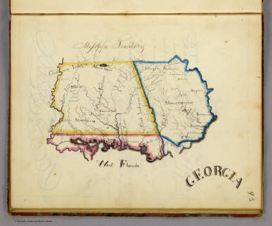
1823 Georgia. [Manuscript Map, National Atlas] Georgia. |

1823 Tennessee. [Manuscript Map, National Atlas] Tennessee. |

1823 Kentucky. [Manuscript Map, National Atlas] Kentucky. |

1823 Ohio. [Manuscript Map, National Atlas] Ohio. |

1823 Indiana. [Manuscript Map, National Atlas] Indiana. |

1824 The World School Atlas The World. Engraved by A. Willard & J.W. … |

1824 Chart Of The Inhabited World School Atlas Chart Of The Inhabited World. Exhibiting … |

1824 Physical Chart Of The World School Atlas Physical Chart Of The World: Or View Of … |

1824 North America School Atlas North America. Engraved by A. Willard & … |

1824 United States School Atlas United States. Entered ... 1821, by Will … |

1824 South America School Atlas South America. Entered ... 1821, by Will … |

1824 Europe School Atlas Europe. Engraved by A. Willard & J.W. Ba … |

1824 Asia School Atlas Asia. Engraved by A. Willard & J.W. Barb … |

1824 Africa School Atlas Africa. Engraved by A. Willard & J.W. Ba … |

1849 Map Of The World. Adapted To Woodbridge' … School Atlas Map Of The World. Adapted To Woodbridge' … |

1849 Moral And Political Chart Of The Inhabit … School Atlas Moral And Political Chart Of The Inhabit … |

1849 Isothermal Chart Or View Of Climates School Atlas Isothermal Chart Or View Of Climates: Sh … |

1849 Physical Map Of North America School Atlas Physical Map Of North America. Adapted T … |

1849 Political Map Of North America School Atlas Political Map Of North America. Adapted … |

1849 Physical Map Of The United States School Atlas Physical Map Of The United States. Adapt … |

1849 Political Map Of The United States, Mexi … School Atlas Political Map Of The United States, Mexi … |

1849 Physical And Political Map Of The N. Eas … School Atlas Physical And Political Map Of The N. Eas … |

1849 Political Map Of The Northern Division O … School Atlas Political Map Of The Northern Division O … |

1849 Physical & Political Map Of The Southern … School Atlas Physical & Political Map Of The Southern … |

1849 Physical Map Of America & Africa And the … School Atlas Physical Map Of America & Africa And the … |

1849 Political Map Of South America And Afric … School Atlas Political Map Of South America And Afric … |

1849 Physical Map Of Europe School Atlas Physical Map Of Europe. Adapted To Woodb … |

1849 Political Map Of Europe School Atlas Political Map Of Europe. Adapted To Wood … |

1849 Political Map Of Great Britain And Irela … School Atlas Political Map Of Great Britain And Irela … |

1849 Political Map Of Germany School Atlas Political Map Of Germany. Adapted To Woo … |

1849 Physical Map Of Asia School Atlas Physical Map Of Asia. Adapted To Woodbri … |

1849 Political Map Of Asia School Atlas Political Map Of Asia. Adapted To Woodbr … |

1849 Oceanica And The Pacific Ocean School Atlas Oceanica And The Pacific Ocean. Adapted … |

1814 Elementary Map School Atlas Elementary Map. (engraved by) H.S. Tanne … |