Who What Where WhenWHERE |
REFINE
Browse All : School and Timeline
1-5 of 5
Author
Willard, Emma
Full Title
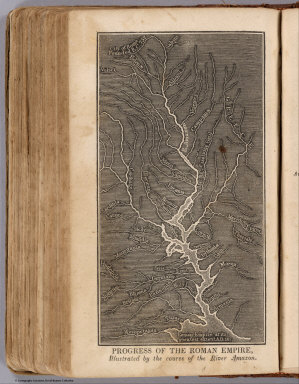
Progress Of The Roman Empire, Illustrated By The course Of The River Amazon. (Accompany) A System of Universal Geography, On The Principles of Comparison and Classification; By William Channing Woodbridge ... Illustrated With Maps and Engravings; And Accompanied by an Atlas ... (with) Ancient Geography, As Connected With Chronology, And Preparatory to the Study of Ancient History: By Emma Willard ... Hartford: Oliver D. Cooke & Sons. 1824. (on verso) ... on the eleventh day of June ... (1824) ... William C. Woodbridge ... and Emma Willard ... have deposited ... a Book ... Connecticut.
Publisher
Oliver D. Cooke & Sons
Full Title
The World on a globular projection. A chart exhibiting the progress of Christianity from the birth of our Saviour to the present time. Entered according to act of Congress. (1837)
Publisher
Robinson, Pratt & Co.
Author
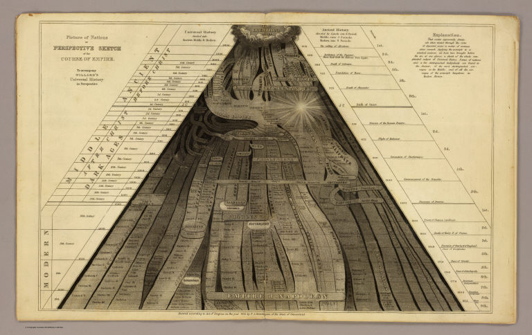
Willard, Emma
Full Title
Picture of nations or perspective sketch of the course of empire. To accompany Willard's Universal history in perspective. Entered ... 1835, by F.J. Huntington ... Connecticut. (1836)
Publisher
F.J. Huntington
Full Title
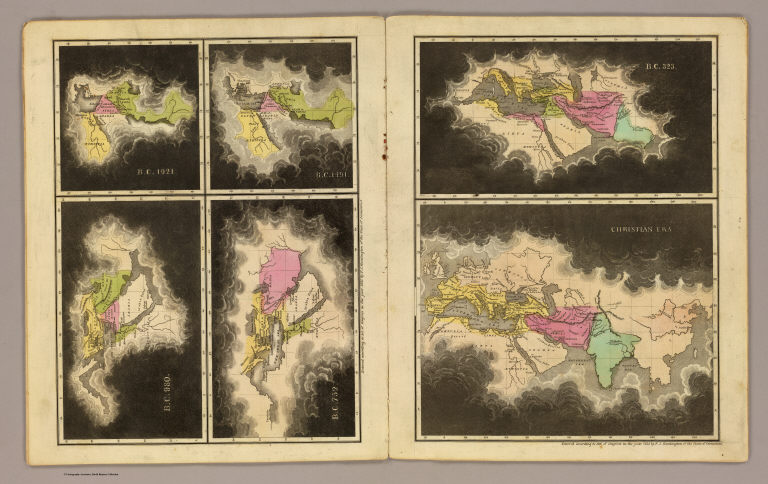
B.C. 1921. B.C. 1491. B.C. 980. B.C. 752. B.C. 323. Christian era. Entered ... 1835, by F.J. Huntington ... Connecticut. (1836)
Publisher
F.J. Huntington
1-5 of 5
|