Browse All

1820 Map Of The State Of Ohio Separate Map Map Of The State Of Ohio. Drawn by A. Bo … |

1820 Hohen Charte oder bildlich vergleichende … Separate Map Hohen Charte oder bildlich vergleichende … |

1820 Map Of Illinois. Separate Map Map of Illinois Constructed from the Sur … |

1820 Composite: United States of Nth. America … Separate Map (Composite of) United States of Nth. Ame … |

1820 Sheet 1: United States of Nth. America. Separate Map (Sheet 1) United States of Nth. America. … |

1820 Sheet 2: United States of Nth. America. Separate Map (Sheet 2) United States of Nth. America. … |

1820 Sheet 3: United States of Nth. America. Separate Map (Sheet 3) United States of Nth. America. … |

1820 Sheet 4: United States of Nth. America. Separate Map (Sheet 4) United States of Nth. America. … |

1820 Sheet 5-6: United States of Nth. America … Separate Map (Sheet 5-6) United States of Nth. Americ … |

1820 Northern Half, Western Hemisphere. Separate Map Mappe Monde en deux Hemispheres presenta … |

1820 Southern Half, Western Hemisphere. Separate Map Mappe Monde en deux Hemispheres presenta … |

1820 Northern Half, Eastern Hemisphere. Separate Map Mappe Monde en deux Hemispheres presenta … |

1820 Southern Half, Eastern Hemisphere. Separate Map Mappe Monde en deux Hemispheres presenta … |

1820 Map of Louisiana and Mexico (northern po … Separate Map A Map of Louisiana and Mexico (northern … |

1820 Map of Louisiana and Mexico (southern po … Separate Map A Map of Louisiana and Mexico (southern … |
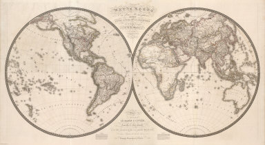
1820 Composite: Hemispheres. Separate Map (Composite of) Mappe Monde en deux Hemis … |

1820 Title Page: Le Monde en Deux Hemispheres Separate Map (Title Page to) Mappe Monde en deux Hemi … |

1820 Composite: Map of Louisiana and Mexico. Separate Map (Composite of) A Map of Louisiana and Me … |