|
REFINE
Browse All : Separate Map of Mississippi River
1-7 of 7
Author
U.S. War Department, Topographical Engineers
Full Title
Map Of The United States And Their Territories Between The Mississippi and the Pacific Ocean And Of Part of Mexico. Compiled in the Bureau of the Corps of Topogl. Engs. under a Resolution of the U.S. Senate. From the best authorities which could be obtained. 1850. Engraved by Sherman and Smith, New-York.
Publisher
Sherman and Smith
Author
Coloney, Fairchild & Co.
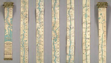
Full Title
Coloney & Fairchild's Patent Ribbon Maps ... Ribbon Map Of The Father Of Waters. Geographical and Scenic Maps upon this plan of all the rivers, rail road routes, stage and coast lines in the country are in preparation.
Publisher
Gast, Moeller & Co. Lith.
Author
Magnus, Charles
Full Title
Panorama Of The Mississippi Valley And Its Fortifications. Published by C. Magnus, 12 Frankfort Street, New York. Eng. by F.W. Boell.
Publisher
Charles Magnus
Author
[Bowen, Bart, Bowen, William, Lloyd, J. T.]
Full Title
Lloyd's map of the Lower Mississippi River from St. Louis to the Gulf of Mexico. Compiled from government surveys in the Topographical Bureau, Washington, D.C. Revised and corrected to the present time by Captains Bart and William Bowen, pilots of twenty years' experience on that River. Exhibiting the sugar and cotton plantations, cities, towns, landings, sand bars, islands, bluffs, bayous, cut-offs, the steamboat channel, mileage, fortifications, railroads. &c. along the River. J.T. Lloyd, Publisher. 164 Broadway, New York 1862. Entered ... 1862, by J.T. Lloyd ... New York.
Publisher
J.T. Lloyd
Author
Coloney, Fairchild & Co.
Full Title
Coloney & Fairchild's Patent Ribbon Maps ... Ribbon Map Of The Father Of Waters. Geographical and Scenic Maps upon this plan of all the rivers, rail road routes, stage and coast lines in the country are in preparation.
Publisher
Gast, Moeller & Co. Lith.
Author
Lloyd, J.T.
Full Title
Lloyd's Map of the Lower Mississippi River From St. Louis To The Gulf Of Mexico. Compiled From Government Surveys In The Topographical Bureau, Washington, D.C. Revised and corrected to the present time by Captains Bart and William Bowen ... Price, in sheets, Colored, 50 Cents per copy. Pocket Edition, $1.00. Mounted Edition on Rollers and Varnished, $1.00 ... J.T. Lloyd, Publisher. 164 Broadway, New York 1863. Entered ... 1862, by J.T. Lloyd ... New York. (on verso) Lloyd's New Map of the United States, The Canadas And New Brunswick ... 1864 ... Entered ... 1863, by J.T Lloyd ... New York. (untitled inset map of Southern Florida).
Publisher
J.T. Lloyd
Author
Lloyd, J.T.
Full Title
Lloyd's New Map of the United States, The Canadas And New Brunswick ... 1864 ... Entered ... 1863, by J.T Lloyd ... New York. (untitled inset map of Southern Florida). (on verso) Lloyd's Map of the Lower Mississippi River From St. Louis To The Gulf Of Mexico. Compiled From Government Surveys In The Topographical Bureau, Washington, D.C. Revised and corrected to the present time by Captains Bart and William Bowen ... Price, in sheets, Colored, 50 Cents per copy. Pocket Edition, $1.00. Mounted Edition on Rollers and Varnished, $1.00 ... J.T. Lloyd, Publisher. 164 Broadway, New York 1863. Entered ... 1862, by J.T. Lloyd ... New York.
Publisher
J.T. Lloyd
1-7 of 7
|