Who What Where WhenREMOVEWHATWHERE
WHOShow More |
REFINE
Browse All : Separate Map and Covers and Literary from 1988
1-3 of 3
Author
Reid, John
Full Title
Plan of the City of Washington in the Territory of Columbia ceded by the States of Virginia And Maryland to the United States of America and by them established as the Seat of their Government, after the Year 1800. Rollinson sculp. N. York. Published by J. Reid L. Wayland and C. Smith 1795.
Publisher
J. Reid, L. Wayland and C. Smith
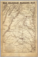
Author
U.S. War Department, Topographical Engineers
Full Title
"Surveys For Military Defences" Map Of N. Eastern Virginia And Vicinity Of Washington compiled in Topographical Engineers Office at Division Head Quarters Of General Irvin McDowell Arlington, January 1th 1862 corrected from recent Surveys and Reconnaissances under the direction of the Bureau Of Topographical Engineers August 1st 1862. Drawn By J.J. Young, W. Hesselbach. Engr. On Stone By J. Schedler, No. 120 Pearl St. N.Y. ...
Publisher
J. Schedler
1-3 of 3
|