Browse All

1887 National City, San Diego Co. [Separate Map, View] Birds-eye view of National City, San Die … |

1942 Dated events, World War map, by Stanley … Separate Map Dated events, World War map, by Stanley … |
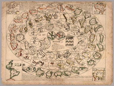
1645 Le Jeu du Monde (Game of the World) [Game, Separate Map] Le Jeu du Monde dédié à Monsieur, Monsie … |

1923 Post route map of the state of Colorado Separate Map Post route map of the state of Colorado … |

1886 California. Separate Map Map of the state of California, compiled … |

1888 Geographical climatic map California. Separate Map Geographical & climatic map of the state … |

1782 Composite: Steven's facsimile of British … [Manuscript Map, Separate Map] (Composite of) B.F. Steven's Facsimile o … |
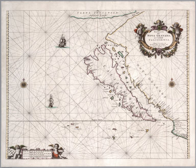
1666 Paskaerte van Nova Granada, en t'Eylandt … [Chart Map, Separate Map] Paskaerte van Nova Granada, en t'Eylandt … |

1780 Action Huberton. Separate Map Plan of the action at Huberton under Bri … |
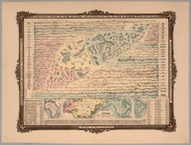
1855 Vergleichendes Tableau der Lange der Str … Separate Map Vergleichendes Tableau der Lange der Str … |
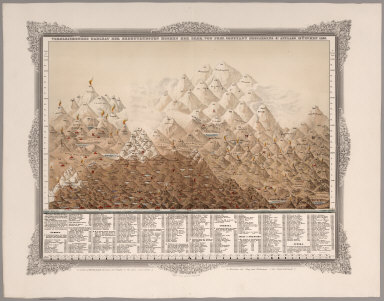
1855 Vergleichendes Tableau der bedeutendsten … Separate Map Vergleichendes Tableau der bedeutendsten … |

1900 Map of Part of California Separate Map Map of Part of California Compiled from … |
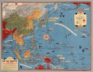
1944 Dated Events. On To Tokyo. Map of the Pa … Separate Map Dated Events. On To Tokyo. Map of the Pa … |

1873 Topographical Map of Central California … Separate Map Topographical Map of Central California … |

1873 Topographical Map of Central California … Separate Map Topographical Map of Central California … |

1873 Topographical Map of Central California … Separate Map Topographical Map of Central California … |

1873 Topographical Map of Central California … Separate Map Topographical Map of Central California … |

1915 Explorations on the northern frontier of … Separate Map Explorations on the northern frontier of … |
1782 Steven's facsimile of British head quart … [Manuscript Map, Separate Map] B.F. Steven's Facsimile of the Unpublish … |

1898 Map of Alaska Separate Map Map of Alaska. Compiled from the officia … |
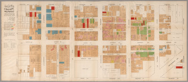
1885 Official Map of Chinatown in San Francis … Separate Map Official Map of Chinatown in San Francis … |

1890 Helena, Mont. [Separate Map, View] Perspective map of the city of Helena, M … |

2002 (Lewis and Clark Expedition 200th annive … Separate Map (Lewis and Clark Expedition 200th annive … |

1868 San Francisco, surrounding country. [Separate Map, View] Birds eye view of the city of San Franci … |
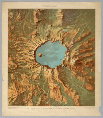
1915 Panoramic View of the Crater Lake Nation … Separate Map Panoramic View of the Crater Lake Nation … |

1914 Panoramic View of the Mesa Verde Nationa … Separate Map Panoramic View of the Mesa Verde Nationa … |

1914 Panoramic View of the Yosemite National … Separate Map Panoramic View of the Yosemite National … |

1914 Panoramic View of the Rocky Mountain Nat … Separate Map Panoramic View of the Rocky Mountain Nat … |

1914 Panoramic View of the Mount Rainier Nati … Separate Map Panoramic View of the Mount Rainier Nati … |

1914 Panoramic View of the Glacier National P … Separate Map Panoramic View of the Glacier National P … |

1868 Map of Lands of the Saucelito Land and F … Separate Map Map of Lands of the Saucelito Land and F … |
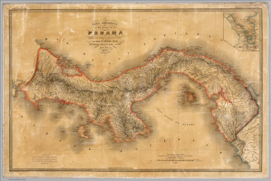
1865 Carta corografica del Estado de Panama Separate Map Carta corografica del Estado de Panama. … |

1938 Mississippi the magnolia state Separate Map Mississippi the magnolia state. Copyrigh … |
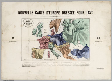
1870 Carte drolatique d'Europe pour 1870 Separate Map Carte drolatique d'Europe pour 1870 ; dr … |

1859 Department of Oregon. Map of the state o … Separate Map Department of Oregon. Map of the state o … |

1909 Map of Alaska By the Alaska Road Commiss … Separate Map Map of Alaska By the Alaska Road Commiss … |

1909 Map of Alaska By the Alaska Road Commiss … Separate Map Map of Alaska By the Alaska Road Commiss … |

1909 Map of Alaska By the Alaska Road Commiss … Separate Map Map of Alaska By the Alaska Road Commiss … |

1909 Map of Alaska By the Alaska Road Commiss … Separate Map Map of Alaska By the Alaska Road Commiss … |
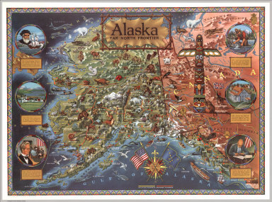
1959 Alaska: Far North frontier Separate Map Alaska: Far North frontier. Published an … |
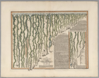
1817 Comparative View of the Lengths of the P … [Separate Map, View] Comparative View of the Lengths of the P … |
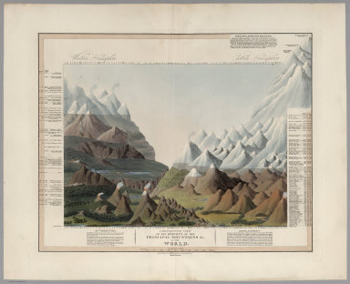
1816 Comparative View of the Heights of the P … [Separate Map, View] Comparative View of the Heights of the P … |

1816 Top Sheet: Germany. Separate Map (Top Sheet to) To His Royal Highness the … |

1816 Middle Sheet: Germany. Separate Map (Middle Sheet to) To His Royal Highness … |

1816 Bottom Sheet: Germany. Separate Map (Bottom Sheet to) To His Royal Highness … |

1806 United States. West Indies. Separate Map A Map of the United States, Canada, New- … |

1914 The Famous Wonderground Map of London To … Separate Map The Wonderground Map of London Town. Dra … |

1955 Here took place the adventures of Robin … Separate Map Here took place the adventures of Robin … |

1944 Map I, The Russian Front Separate Map [World War II battlefronts]. Map I, The … |

1944 Map II, The Balkans Separate Map [World War II battlefronts]. Map II, The … |