Browse All

1936 A pictorial map of Switzerland, by Ernes … Separate Map A pictorial map of Switzerland, by Ernes … |

1935 A pictorial map of Spain and Portugal, b … Separate Map A pictorial map of Spain and Portugal, b … |

1935 France as drawn by Ernest Dudley Chase Separate Map France as drawn by Ernest Dudley Chase o … |

1926 Booklovers Map of America Separate Map Booklovers Map of America: A Chart of Ce … |

1967 Alaska. W. D. Berry. Copyright Griffins, … Separate Map Alaska. W. D. Berry. Copyright Griffins, … |

1967 Key to Alaska plant and wildlife map, by … Separate Map Key to Alaska plant and wildlife map, by … |

1936 The story map of England. Egbert G. Jaco … Separate Map The story map of England. Egbert G. Jaco … |

1936 Story map of France. Colortext Publicati … Separate Map Story map of France. Colortext Publicati … |

1942 War map of the world : specially execute … Separate Map War map of the world : specially execute … |

1935 Italy, with Vatican City : as drawn and … Separate Map Italy, with Vatican City : as drawn and … |

1935 France: as drawn and published by Ernest … Separate Map France: as drawn and published by Ernest … |

1942 The story map of flying : Being a chroni … Separate Map The story map of flying : Being a chroni … |

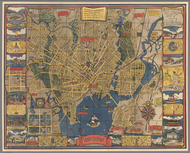
1931 Chicago. U.S.A. Designed by Charles Turz … Separate Map Chicago. U.S.A. Designed by Charles Turz … |

1942 Japan, the target : a pictorial Jap-map Separate Map Japan, the target : a pictorial Jap-map … |

1937 Southwestern National Monuments. Separate Map Southwestern National Monuments. Headqua … |

1950 World Air Transportation, Principal Rout … Separate Map World Air Transportation, Principal Rout … |

1985 Tectonic California. Separate Map Tectonic California. Dynamic Graphics, I … |

1953 United States Air Transportation System. Separate Map United States Air Transportation System, … |

1958 Baltimore & Ohio Railroad Geographically … Separate Map Baltimore & Ohio Railroad Geographically … |

1958 Geographically Correct Map of the United … Separate Map Geographically Correct Map of the United … |

1961 Airline Map of the United States 1961. Separate Map Airline Map of the United States 1961. C … |

1947 The Pictorial Map, Stamps of the U.S.A. Separate Map The Pictorial Map, Stamps of the U.S.A. … |

1935 Story Map of Scotland. Separate Map The Story Map of Scotland. |

1951 Pictorial Map and Visitor's Guide to For … Separate Map Pictorial Map and Visitor's Guide to For … |

1951 Routes of Pan American World Airways Sys … Separate Map Routes of Pan American World Airways Sys … |
1928 New Haven. Separate Map New Haven. Published by the Edward P. Ju … |

1940 Decorative Map of Cape Cod. Separate Map Decorative Map of Cape Cod. The Reaches … |

1938 Chicago. The Greatest Inland City in the … Separate Map Chicago. The Greatest Inland City in the … |

1930 Boston Common with Surrounding Streets & … Separate Map Map of Boston Common with Surrounding St … |

1942 Total War, Battle Map. Separate Map Total War, Battle Map. Designed and Draw … |

1963 New York (City). Separate Map New York (City). |

1963 New York City Picture Map - a 3-D Map of … Separate Map New York (City) Picture Map. |
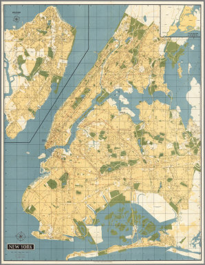
1962 New York (City). Separate Map New York (City). |

1962 New York City Picture Map - a 3-D Map of … Separate Map New York (City) Picture Map. |

1964 New York (City). Separate Map New York (City). |

1964 New York City Picture Map - a 3-D Map of … Separate Map New York (City) Picture Map. |

1856 Map Of Milwaukee. Separate Map Map Of Milwaukee. Population In 1835 Non … |

1815 A New Map Of The Seat Of War. Separate Map A New Map Of The Seat Of War. S. Lewis. … |

1863 Panorama Of The Mississippi Valley And I … Separate Map Panorama Of The Mississippi Valley And I … |

1864 One Hundred & Fifty Miles Around Richmon … Separate Map One Hundred & Fifty Miles Around Richmon … |

1820 Map Of Illinois. Separate Map Map of Illinois Constructed from the Sur … |

1817 Shelton & Kensett's Map Of The State Of … Separate Map Shelton & Kensett's Map Of The State Of … |

1821 United States. [Manuscript Map, Separate Map] United States. |

1868 California Map Showing San Francisco, Ne … Separate Map California Map Showing San Francisco, Ne … |

1855 Map of The City of Buffalo. Separate Map Map of The City of Buffalo. Chs. Magnus … |

1852 Map of San Francisco. Separate Map Map of San Francisco, Compiled from late … |

1886 Map Of McLean County, Ill. 1886. Separate Map The Weekly Pantagraph's Premium Map Of M … |

1773 A Map of the Province of South Carolina. Separate Map A Map of the Province of South Carolina … |

1861 Lloyd's Map Of The Southern States. Separate Map Lloyd's Map Of The Southern States Showi … |

1862 Part of the North Bank of the Rappahanno … Separate Map Part of the North Bank of the Rappahanno … |