Browse All

1906 No. 74, Marine National Atlas Marine. (on upper margin) Atlas of Canad … |

1906 No. 75, Marine National Atlas Marine. (on upper margin) Atlas of Canad … |

1906 No. 76, Marine : Shipping entered and cl … National Atlas Marine : Sea-going shipping entered and … |

1906 No. 77, Marine : Tonnage of vessels in c … National Atlas Marine : Tonnage of vessels in coasting … |

1905 The Bay near Fishermen's Wharf. City Atlas The Bay, looking north from proposed Out … |

1883 Railway, statistical England, Wales. World Atlas Railway & statistical map of England & W … |

1883 China. World Atlas China. Letts's popular atlas. Letts, Son … |

1883 Australia. World Atlas Statistical map of Australia. (with) The … |

1929 Legend: 4-5. Linee di comunicazione, Oce … World Atlas (Legend) Linee di comunicazione del Ocea … |

1929 4-5. Linee di comunicazione, Oceano Atla … World Atlas Linee di comunicazione del Oceano Atlant … |

1929 Legend: 6-8. Linee di comunicazione, oce … World Atlas (Legend) Linee di comunicazione degli oc … |

1929 6-8. Linee di comunicazione, oceano Indi … World Atlas Linee di comunicazione degli oceani Indi … |

1929 Legend: 9-10. Linee di comunicazione, Eu … World Atlas (Legend) Linee di comunicazione dell'Eur … |

1929 9-10. Linee di comunicazione, Europa cen … World Atlas Linee di comunicazione dell'Europa centr … |

1834 Baie de la Delaware. National Atlas Plan hydrographique de la partie de la B … |

1834 Floride, Delta du Mississippi canal. National Atlas Carte generale de la Floride et du Delta … |

1834 Baies, Florides, Golfe du Mexique. National Atlas Plans hydrographiques des baies, rades, … |

1834 Canal du Muscle-Shoal. National Atlas Canal du Muscle-Shoal. Plan general du t … |

1834 Canal Erie. National Atlas Plan du trace de Canal Erie et du Canal … |

1898 59. Navigable rivers, routes 1890. Statistical Atlas 370. Navigable rivers and principal tran … |

1880 Asia. World Atlas Map of Asia showing its gt. political di … |

1890 Railroad map U.S. World Atlas Railroad map of the United States, showi … |

1922 World - commerce. World Atlas World - commerce. Commercial development … |

1895 British Empire, routes, currents. World Atlas British Empire, showing the commercial r … |

1922 Western Europe - communications. World Atlas Western Europe - communications. The Edi … |

1922 Eastern Europe - communications. World Atlas Eastern Europe - communications. The Edi … |

1922 Composite: Europe - communications. World Atlas (Composite of) Western, Eastern Europe - … |

1881 Weltverkehrs, Meeresstromungen. World Atlas Karte des Weltverkehrs und der Meeresstr … |

1870 Asia. [State Atlas, World Atlas] Map of Asia showing its gt. political di … |

1896 Pacific Coast Steamship Company. Timetable Map Map showing routes of the Pacific Coast … |

1896 Cover: Pacific Coast Steamship Co. Timetable Map (Covers to) Pacific Coast Steamship Co. … |

1896 Text Page: Pacific Coast Steamship Co. Timetable Map (Text Page to) Pacific Coast Steamship C … |

1884 Railway, steamship lines Southern Pacifi … Timetable Map Correct map of the railway & steamship l … |

1884 Cover: "Sunset Route" Timetable Map (Covers to) "Sunset Route" The Southern … |

1943 Iron and Steel Trade, 1937, 20. World Atlas Iron and Steel Trade, 1937, 20. |

1884 Text Page: "Sunset Route" Timetable Map (Text Page to) "Sunset Route" The Southe … |

1943 Overseas Shipping Routes 24. World Atlas Overseas Shipping Routes 24. |

1856 Atlantic Ocean. Physical Atlas Physical chart of the Atlantic Ocean sho … |

1856 Indian Ocean. Physical Atlas Physical chart of the Indian Ocean showi … |

1856 Pacific Ocean. Physical Atlas Physical chart of the Pacific Ocean or G … |

1781 Jersey, Guernsey. World Atlas A chart of the islands of Jersey and Gue … |
1888 Intl. Steamship Co.'s routes. Timetable Map Map showing the International Steamship … |

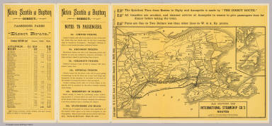
1888 Cover: Nova Scotia excursion route. Timetable Map (Covers to) Nova Scotia excursion route. … |

1888 Text Page: Nova Scotia excursion route. Timetable Map (Text Page to) Nova Scotia excursion rou … |

1890 N. America, W. Europe passenger lines. Pocket Map Map of North America and Western Europe … |

1898 Text Page: Yellowstone National Park. Timetable Map (Text Page to) The Yellowstone National … |

1881 Das Deutsche Reich und Seine Nachbarland … World Atlas Stieler's Hand-Atlas No. 18. Das Deutsch … |

1907 Commercial Highways of the World. Statistical Atlas Commercial Highways of the World. |

1907 Europe and Near East - General Commercia … Statistical Atlas Europe & Near East - General Commercial … |

1907 The Far East - Central Commercial Chart. … Statistical Atlas The Far East - Central Commercial Chart. … |