Browse All

1935 San Diego County. State Atlas San Diego County. |

1935 City of San Diego. State Atlas City of San Diego. |

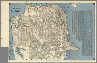
1935 City and County of San Francisco. State Atlas City and County of San Francisco. |

1935 San Joaquin County. State Atlas San Joaquin County. |

1935 San Luis Obisbo. State Atlas San Luis Obisbo. |

1935 San Mateo County. State Atlas San Mateo County. |

1935 Santa Barbara County. State Atlas Santa Barbara County. |

1935 Santa Clara County. State Atlas Santa Clara County. |

1935 Santa Cruz County. State Atlas Santa Cruz County. |

1935 Shasta County. State Atlas Shasta County. |

1935 Sierra County. State Atlas Sierra County. |

1935 Siskiyou County. State Atlas Siskiyou County. |

1935 Solano County. State Atlas Solano County. |

1935 Sonoma County. State Atlas Sonoma County. |

1935 Stanislaus County. State Atlas Stanislaus County. |

1935 Sutter County. State Atlas Sutter County. |

1935 Tehama County. State Atlas Tehama County. |

1935 Trinity County. State Atlas Trinity County. |

1935 Tulare County. State Atlas Tulare County. |

1935 Tuolumne County. State Atlas Tuolumne County. |

1935 Ventura County. State Atlas Ventura County. |

1935 Yolo County. State Atlas Yolo County. |

1935 Yuba County. State Atlas Yuba County. |

1829 Maine. State Atlas Map of the principal rivers, mountains a … |

1829 Upper & Lower Canada, Gaspe. State Atlas Sketch from Bouchette's maps of Upper & … |

1829 Maine highlands. State Atlas Sketch of the imaginary ranges of highla … |

1829 Maine vertical sections. State Atlas Vertical sections, exhibiting the compar … |

1829 Maine grants & land sales. State Atlas Map exhibiting the principal original gr … |

1829 Maine, inhabited part. State Atlas Map of the inhabited part of the State o … |

1938 (County and Road) Map of California. [State Atlas, Statistical Atlas] (County and Road) Map of California. |

1938 Highways of the Western States. [State Atlas, Statistical Atlas] Highways of the Western States. |

1938 Highway Map of the State of Oregon. [State Atlas, Statistical Atlas] Highway Map of the State of Oregon. |

1938 Thomas Bros. Highway Map, State of Washi … [State Atlas, Statistical Atlas] Thomas Bros. Highway Map, State of Washi … |

1938 Highway Map State of Idaho. [State Atlas, Statistical Atlas] Highway Map State of Idaho. (inset) City … |

1938 Highway Map States of Utah and Nevada. [State Atlas, Statistical Atlas] Highway Map States of Utah and Nevada. |

1938 Highway Map State of Arizona. [State Atlas, Statistical Atlas] Highway Map State of Arizona. |
1938 City and County of San Francisco. [State Atlas, Statistical Atlas] Thomas Bros. Map of the City and County … |

1938 Map of Oakland, Berkeley, Alameda, San L … [State Atlas, Statistical Atlas] Map of Oakland, Berkeley, Alameda, San L … |

1938 Daly City, South San Francisco, San Brun … [State Atlas, Statistical Atlas] Thomas Bros: Map of Daly City, South San … |

1938 Thomas Bros. Map of the Major Part of th … [State Atlas, Statistical Atlas] Thomas Bros. Map of the Major Part of th … |

1938 Map of Palo Alto, Redwood City, Mountain … [State Atlas, Statistical Atlas] Map of Palo Alto, Redwood City, Mountain … |

1938 San Mateo, Burlingame, Hillsborough, San … [State Atlas, Statistical Atlas] San Mateo, Burlingame, Hillsborough, San … |

1938 Los Altos. Saratoga. Monte Vista. Los Ga … [State Atlas, Statistical Atlas] (verso of) Thomas Bros Map of San Jose, … |

1938 Thomas Bros Map of San Jose, Santa Clara … [State Atlas, Statistical Atlas] Thomas Bros Map of San Jose, Santa Clara … |

1938 Thomas Bros. Map of Hayward and Vicinity … [State Atlas, Statistical Atlas] Thomas Bros. Map of Hayward and Vicinity … |

1938 Map of Richmond, El Cerrito, San Pablo, … [State Atlas, Statistical Atlas] Map of Richmond, El Cerrito, San Pablo, … |

1938 Thomas Bros Walnut Creek, Concord, Lafay … [State Atlas, Statistical Atlas] Thomas Bros Walnut Creek, Concord, Lafay … |

1938 Thomas Bros. Map of Stockton, California … [State Atlas, Statistical Atlas] Thomas Bros. Map of Stockton. |

1938 Thomas Bros. Map of City of Tracy, San J … [State Atlas, Statistical Atlas] Thomas Bros. Map of City of Tracy, San J … |

1938 Map of Sacramento, California. [State Atlas, Statistical Atlas] Map of Sacramento. |