Browse All

1873 Map of the United States of America. State Atlas Map of the United States of America. Ent … |

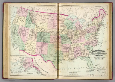
1873 Topographical map of the United States. State Atlas Topographical map of the United States. … |

1874 Population, United States Census, 1870: … State Atlas Population, United States Census, 1870: … |

1874 Agricultural productions colored ... to … State Atlas Agricultural productions colored by grad … |

1874 Vital statistics, United Census, 1870: D … State Atlas Vital statistics, United Census, 1870: D … |

1875 New railroad map of the United States, . … State Atlas New railroad map of the United States, t … |

1875 Population - United States census, 1870. … State Atlas Population - United States census, 1870. … |

1875 Agricultural productions colored by grad … State Atlas Agricultural productions colored by grad … |

1875 Vital statistics, United Census, 1870: D … State Atlas Vital statistics, United Census, 1870: D … |

1872 Covers: Atlases of the United States, Il … [National Atlas, State Atlas] (Covers to) Atlas of Whiteside Co. and t … |

1872 Title Page: Atlases of the United States … [National Atlas, State Atlas] (Title Page to) Atlas of Whiteside Co. a … |

1872 Table of Contents: Atlases of the United … [National Atlas, State Atlas] (Table of Contents to) Atlas of Whitesid … |

1872 Text: List of Post Offices in Illinois. … [National Atlas, State Atlas] (Text Page) List of Post Offices in Illi … |

1872 Map of the United States. [National Atlas, State Atlas] Map of the United States. Warner & Beers … |

1872 Atlas of the United States, New England, … [National Atlas, State Atlas] Atlas of the United States, New England, … |

1872 Atlas of the United States, Map of the C … [National Atlas, State Atlas] Atlas of the United States, Map of the C … |

1872 Atlas of the United States, Map of the W … [National Atlas, State Atlas] Atlas of the United States, Map of the W … |

1872 Atlas of the United States, Map of the S … [National Atlas, State Atlas] Atlas of the United States, Map of the S … |

1876 Map of the United States. State Atlas Map of the United States. 1876. (Publish … |

1877 Text Page: Population - United States. State Atlas (Text Page) Population - United States. |

1877 Text Page: Population - United States (c … State Atlas (Text Page) Population - United States ( … |

1877 Railroad Map of the United States. State Atlas Railroad Map of the United States. |

1909 United States. State Atlas Map of the United States. Published by G … |

1909 Presidents U.S., autographs, biographies … State Atlas The presidents of the United States. Aut … |

1909 (Presidents U.S., autographs, biographie … State Atlas (The presidents of the United States. Au … |

1909 (Presidents U.S., autographs, biographie … State Atlas (The presidents of the United States. Au … |
1870 U.S. & territories. State Atlas New topographical atlas and gazetteer of … |

1894 United States. State Atlas Gray's new map of the United States. (wi … |

1885 United States. State Atlas Gray's new map of the United States. (wi … |

1872 Delaware, Illinois, Indiana, Iowa ... No … State Atlas Atlas of the United States. Delaware, Il … |

1872 Map of the United States and Territories … State Atlas Map of the United States and territories … |

1876 New railroad map of the United States an … State Atlas New railroad map of the United States an … |

1876 Population - United States census, 1870. … State Atlas Population - United States census, 1870. … |

1876 Population - United States census, 1870. … State Atlas Population - United States census, 1870. … |

1876 Agricultural productions colored by grad … State Atlas Agricultural productions colored by grad … |

1876 Vital statistics, United States census, … State Atlas Vital statistics, United States census, … |

1873 U.S., Canada. State Atlas Map of the United States, and territorie … |

1873 Map of the United States and Territories … State Atlas Map of the United States and territories … |

1873 Delaware, Illinois, Indiana, Iowa ... No … State Atlas Atlas of the United States. Delaware, Il … |

1870 United States. [State Atlas, World Atlas] Map of the United States and territories … |

1871 United States & territories. State Atlas Map of the United States and territories … |

1872 United States. State Atlas Map of the United States and territories … |

1872 United States. State Atlas Map of the United States of America. 187 … |

1895 United States. State Atlas Map of the United States. Reduced from t … |

1895 Statistics U.S., N.Y. State Atlas Statistics, United States. Statistics, N … |

1876 New railroad map of the United States, a … State Atlas New railroad map of the United States, a … |

1876 Products raised in proportion to populat … State Atlas These maps show amount of products raise … |

1876 Agriculture and wealth by colors. Wealth … State Atlas Agriculture and wealth by colors. Wealth … |

1876 United States vitality maps, compiled fr … State Atlas United States vitality maps, compiled fr … |

1876 United States census maps, 1870: foreign … State Atlas United States census maps, 1870. Foreign … |