Browse All

1876 Residences and farm residences in Putnam … State Atlas Farm residence of Joseph Brennemann, Gra … |

1876 Map of Livingston County and Pontiac. State Atlas Map of Livingston County. (with) Pontiac … |

1876 Map of Stark and west part of Marshall c … State Atlas Map of Stark and west part of Marshall c … |

1876 Map of Mercer County, Rock Island and Pl … State Atlas Map of Mercer County. (with) Rock Island … |

1876 Map of Henderson County and Oquawka. State Atlas Map of Henderson County. (with) Oquawka. … |

1876 Map of Warren County, Abingdon, Yates Ci … State Atlas Map of Warren County. (with) Abingdon. ( … |

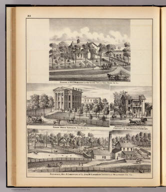
1876 Central Park farm & residence of Geo. S. … State Atlas Central Park farm & residence of Hon. Ge … |

1876 Map of Knox County. State Atlas Map of Knox County. (Union Atlas Co., Wa … |

1876 Map of Galesburg City, and Monmouth and … State Atlas Map of Galesburg City. (with) Monmouth. … |

1876 Peoria, Oneida, Knoxville and Dallas. State Atlas Peoria. (with) Oneida. (with) Knoxville. … |

1876 Map of Peoria County and Minonk. State Atlas Map of Peoria County. (with) Minonk. (Un … |

1876 Map of Woodford County, El Paso and Meta … State Atlas Map of Woodford County. (with) El Paso. … |

1876 Residence and farm residence in Magnolia … State Atlas Residence of John Haws, Magnolia Tp., Pu … |

1876 Residences, farms and factory, Vandalia, … State Atlas Farm residence of H.L. White, Hennepin T … |

1876 Map of Tazewell County and Pekin. State Atlas Map of Tazewell County. (with) Pekin. (U … |

1876 Map of McLean County and Le Roy. State Atlas Map of McLean County. (with) Le Roy. (Un … |

1876 Residences and farms in Edgar, Hardin, M … State Atlas Res. of W.O. Pinnel ... Kansas Tp., Edga … |

1876 Map of Edgar County. State Atlas Map of Edgar County. (Union Atlas Co., W … |

1876 Map of Clark County. State Atlas Map of Clark County. (Union Atlas Co., W … |

1876 Map of Coles County. State Atlas Map of Coles County. (Union Atlas Co., W … |

1876 Counties of Platt, De Witt, Macon, Shelb … State Atlas Counties of Platt, De Witt, Macon, Shelb … |

1876 Map of Douglas County. Map of Cumberland … State Atlas Map of Douglas County. Map of Cumberland … |

1876 Lake Zurich & residence, Lake Co., and f … State Atlas Lake Zurich & Residence of John Robertso … |

1876 Church, residences & flouring mill, Cair … State Atlas The F.W.B. Church, Cairo, Ill. (with) Re … |

1876 Map of Decatur City, and Sullivan and Ma … State Atlas Map of Decatur City. (with) Sullivan. (w … |

1876 Map of Logan County. State Atlas Map of Logan County. (Union Atlas Co., W … |

1876 Danville, Shelbyville, Atlanta and Monti … State Atlas Danville. (with) Shelbyville. (with) Atl … |

1876 Map of Schuyler, Mason, Brown, Cass & Me … State Atlas Map of Schuyler, Mason, Brown, Cass & Me … |

1876 Watseka, Paris, Mt. Sterling, Beardstown … State Atlas Watseka. (with) Paris. (with) Mt. Sterli … |

1876 Residences of F. Gaines, Vermilion Co., … State Atlas Res. of Francis Gaines, Sec. 32, Caroll … |
1876 Residences and buildings in Poplar Grove … State Atlas Residence of W.S. Webster, Poplar Grove, … |

1876 Map of Fulton County and Lewistown. State Atlas Map of Fulton County. (with) Lewistown. … |

1876 Map of McDonough County, Rushville, Wind … State Atlas Map of McDonough County. (with) Rushvill … |

1876 Hamilton, Carthage, Bushnell, Lincoln an … State Atlas Hamilton. (with) Carthage. (with) Bushne … |

1876 Warsaw, Macomb, Marshall, Canton, Nauvoo … State Atlas Warsaw. (with) Macomb. (with) Marshall. … |

1876 Map of Hancock County. State Atlas Map of Hancock County. (Union Atlas Co., … |

1876 Map of Adams County. State Atlas Map of Adams County. (Union Atlas Co., W … |

1876 Quarry, hospital, residences, Pulaski, H … State Atlas Ullin Lime & Rock Co's. Works, Ullin ... … |

1876 Music Conservatory, school, church, hote … State Atlas The Illinois Conservatory of Music ... ( … |

1876 Map of Quincy City. State Atlas Map of Quincy City. (Union Atlas Co., Wa … |

1876 Map of Pike County and Pittsfield. State Atlas Map of Pike County. (with) Pittsfield. ( … |

1876 Map of Morgan & Scott counties. State Atlas Map of Morgan & Scott counties. (Union A … |

1876 Map of Sangamon County and Taylorville. State Atlas Map of Sangamon County. (with) Taylorvil … |

1876 Map of Christian County. State Atlas Map of Christian County. (Union Atlas Co … |

1876 Map of Montgomery County, Hillsboro and … State Atlas Map of Montgomery County. (with) Hillsbo … |

1876 (Portraits of) Mrs. D.L.R. Wardner, Hora … State Atlas (Portraits of) Mrs. D.L.R. Wardner, Hora … |

1876 Residences, farms and church, Centralia … State Atlas Residence of Joel F. Allison Esq., Centr … |

1876 Map of Macoupin County. State Atlas Map of Macoupin County. (Union Atlas Co. … |

1876 Map of Green County and Carrollton. State Atlas Map of Greene County. (with) Carrollton. … |

1876 Map of Calhoun County, Winchester, Barry … State Atlas Map of Calhoun County. (with) Winchester … |