|
|
REFINE
Browse All : Title Page from 1872
1-10 of 10
Author
[Lloyd, H.H., Warner & Beers]
Full Title
(Title Page to) Atlas of Whiteside Co. and the State of Illinois To Which Is Added An Atlas Of The United States, Maps of The Hemispheres &c. &c. &c. Warner & Beers. Publishers 62 & 64 West Lake Street, Chicago. 1872. Union Lith. & Printg. Co. Chicago. Assistants: Jos. H. Cox, W.H. Bishop, G.R. Hoffman, L.W. Wight, A.D. Miner, E.C. Moore ... H.R. Belden, John I. Moore, Chas. H. Sharp, R.T. Higgins, Wm. H. Beers, Frank W. Rorh. Entered ... 1872 by Warner & Beers ... Washington D.C.
Publisher
Warner & Beers
Author
Fullarton, A. & Co.
Full Title
(Title Page to) The Royal Illustrated Atlas, Of Modern Geography With An Introductory Notice By Dr. N. Shaw, Secretary To The Royal Geographical Society &c. A. Fullarton And Co. London And Edinburgh. (title page only) W.B. Scott. W. Holl.
Publisher
A. Fullarton & Co.
Author
Everts, Baskin and Stewart
Full Title
(Title Page) Combination Atlas Map Of Ogle County, Illinois. Compiled, Drawn and Published From Personal Examinations and Surveys By Everts, Baskin and Stewart. Chicago, Ill. 1872. Duval & Hunter Pr. Phila. N. Friend Engr. Philad. C.L. Smith, Del.
Publisher
Everts, Baskin and Stewart
Author
[Gray, Ormando Willis, Lloyd, H.H., Walling, H. F.]
Full Title
(Title Page to) New topographical atlas of the State of Ohio. With descriptions historical, scientific, and statistical, together with maps of the Untied States and territories. By H.F. Walling, and O.W. Gray, civil and topographical engineers. Published by Stedman, Brown & Lyon, Cincinnati. 1872. Entered ... 1872, by H.F. Walling, and O.W. Gray, and H.H. Lloyd & Co. ... Washington.
Publisher
Stedman, Brown & Lyon
Author
[Gray, Ormando Willis, Lloyd, H.H., Walling, H. F.]
Full Title
(Title Page Verso to) New topographical atlas of the State of Ohio. With descriptions historical, scientific, and statistical, together with maps of the Untied States and territories. By H.F. Walling, and O.W. Gray, civil and topographical engineers. Published by Stedman, Brown & Lyon, Cincinnati. 1872. Entered ... 1872, by H.F. Walling, and O.W. Gray, and H.H. Lloyd & Co. ... Washington.
Publisher
Stedman, Brown & Lyon
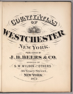
Author
Beers, J.B.
Full Title
(Title Page) County Atlas Of Westchester New York. Published By J.B. Beers & Co. Assisted By S.W. Wilson And Others, 36 Vesey Street, New York. 1872. Entered ... 1872 by J.B. Beers & Co. ... Washington.
Publisher
J.B. Beers & Co.
Author
G.M. Hopkins & Co.
Full Title
(Title Page to) Atlas of the cities of Pittsburgh, Allegheny, and the adjoining boroughs. From actual surveys & official records, compiled & published by G.M. Hopkins & Co. 320 Walnut St., Philadelphia. 1872. Assistant surveyors: H.W. Hopkins, W.S. MacCormac, Edward Vansciver, Weston R. Smith, Samuel Huff, Robert Foust, L. Cunningham. Assistant publishers: Richard Clark, M.S. Converse, S.T.C. Bell, L.J. Richards, J.C. Martin, W.G. Carter, Isaac Borneman, James Wilson, A.R. Whipple. Engraved by Edward Busch, 320 Walnut St. Entered ... 1872 by G.M. Hopkins ... Washington D.C. F. Bourquin Lith. 320 Chestnut St. Phila.
Publisher
G.M. Hopkins & Co.
Author
[Gray, Ormando Willis, Walling, H. F.]
Full Title
(Title Page to) New topographical atlas of the state of Pennsylvania with descriptions historical, scientific and statistical. Together with a map of the United States and territories. By Professor Henry F. Walling, Lafayette College, Easton, Pa. and O.W. Gray, Civil & Top'l. Engineer, 10 North Fifth Street, Philadelphia. Published by Stedman, Brown & Lyon, Philadelphia, 1872.
Publisher
Stedman, Brown & Lyon
Author
Beers, F. W. (Frederick W.)
Full Title
(Title Page to) State atlas of New Jersey based on State Geological Survey and from additional surveys by and under the direction of F.W. Beers. Published by Beers, Comstock & Cline, 36 Vesey Street, New York. 1872. Lithogc. Power Press Printg. of Charles Hart, 36 Vesey St., N.Y. Engraved on stone by Louis E. Neuman, 36 Vesey St., N.Y.
Publisher
Beers, Comstock & Cline
Author
Andreas, A. T. (Alfred Theodore), 1839-1900
Full Title
(Title Page) Atlas Map Of Adams County, Illinois. Compiled, Drawn, And Published From Personal Examinations And Surveys, By Andreas, Lyter & Co. Davenport, Iowa. 1872.
Publisher
Andreas, Lyter & Co.
1-10 of 10
|