Who What Where WhenREMOVEWHO
WHEN |
REFINE
Browse All : Title Page from 1882
1-9 of 9
Author
Rand McNally and Company
Full Title
(Title page to) Rand McNally & Co.'s Dakota. Copyright, 1882, by Rand, McNally & Co., Map Publishers, Chicago, Ill. Rand, McNally & Co., Engr's. Chicago. (with 15 page index) Rand McNally & Co.'s Indexed County And Township Map Of Dakota... Chicago, U.S.A.: Rand, McNally & Co. ... (on verso) Entered ... 1882, by Rand, McNally & Co. ... Washington.
Publisher
Rand McNally & Co.
Author
Becker, George F.
Full Title
(Title Page to) Department Of The Interior, United States Geological Survey, Clarence King Director. Atlas To Accompany The Monograph On The Geology Of The Comstock Lode And The Washoe District By George F. Becker. Washington 1882. Julius Bien & Co. Lith. New York.
Publisher
Julius Bien & Co.
Author
Mills & Co.
Full Title
(Title page to) Mills & Co.'s New Railroad Post Office And Sectional Map Of Iowa Published by Mills & Co. Des Moines Iowa 1882.
Publisher
Mills & Co.
Author
Edwards, John P.
Full Title
(Title Page) Historical Atlas Of Sedgwick County Kansas. Compiled Drawn & Published From Personal Examinations And Surveys By John P. Edwards, No. 31 South 6th Street. Philadelphia, 1882. Branch Office Wichita, Kansas. Engraved by Win. Bracher, 27 So. 6th St. Philada. Printed by F. Bourquin, 31 Sth. 6th St. Philada.
Publisher
John P. Edwards
Author
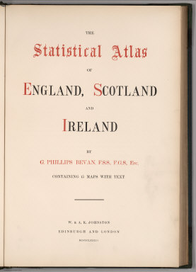
Bevan, G. Phillips
Full Title
(Title Page) The Statistical Atlas of England, Scotland and Ireland. By G. Phillips Bevan, F.S.S., F.G.S., Etc. Containing 45 Maps with Text. W. & A.K. Johnston, Edinburgh and London, MDCCCLXXXII.
Publisher
W. &. A.K. Johnston
Author
Beers, J.H. & Co.
Full Title
(Title Page) Atlas of Franklin Co. Indiana. To Which Are Added Various General Maps History, Statistics, Illustrations. &c. &c. &c. J.H. Beers & Co. Publishers, Lakeside Building Cor. of Clark & Adams Sts. Chicago. 1882.
Publisher
J.H. Beers
Author
Dutton, Clarence E. (Clarence Edward), 1841-1912
Full Title
(Title Page to) Department Of The Interior, United States Geological Survey, J.W. Powell Director. Atlas To Accompany The Monograph On The Tertiary History Of The Grand Canon District By Capt. Clarence E. Dutton U.S.A. Washington 1882. Julius Bien & Co. Lith. New York.
Publisher
Bien, Julius & Co.
Author
Jouvet et Cie.
Full Title
(Title Page to) Atlas Universel de Geographie Moderne. Physique, Politique, Historique, Industriel, Commercial et Militaire. Adopte par le Ministere de la Guerre pour L'Ecole de Saint-Cyr. Paris. Furne, Jouvet et Cie, Editeurs. Jouvet et Cie, Successeurs. 45 Rue Saint-Andre des Arts. MDCCCLXXXII. (1882)
Publisher
Jouvet et Cie
Author
[Conder, C.R. (Claude Reignier), Kitchener, H.R. (Horatio Herbert)]
Full Title
(Title Page) Map of Western Palestine in 26 Sheets from surveys conducted for the Committee of the Palestine Exploration Fund by Lieutenants C.R. Conder and H.H. Kitchener, R.E. During the Years 1872 - 1877. [Bound with] Map of West Palestine... Special Edition Illustrating The Old Testament, the Apocropha and Josephus... by Trelawney Saunders. [Bound with] Map of West Palestine... Special Edition Illustrating the New Testament also the Talmud and Josephus(after the Birth of Jesus)... [Bound with] Map of West Palestine... Reduced from the One Inch Map. [Bound with] Map of West Palestine... Special Edition Illustrating the Divisions of the Natural Drainage and the Mountain Ranges... by Trelawney Saunders. (Five works bound in in one; (main map) London: Committee of the Palestine Exploration Fund, 1880; (the other maps) London Edward Stanford, 1881-2.)
Publisher
Committee of the Palestine Exploration Fund
1-9 of 9
|