Who What Where WhenREMOVEWHEREShow More |
REFINE
Browse All : Title Page of New York
1-34 of 34
Author
Viele, Egbert L.
Full Title
(Title Page) (text title) The West End Plateau Of The City Of New York. By Egbert L. Viele. (to accompany) The West End Plateau Of New York. Herman K. Viele Civil Engineer & City Surveyor. Johnson & Pratt Print. New York.
Publisher
Johnson & Pratt
Author
Viele, Egbert L.
Full Title
(Title Page to) (text) the Transval of the City of New York, By Egbert L. Viele. New York: Johnson & Co., Printers, 2 Liberty Street. 1880. (to accompany) The Transval Of New York.
Publisher
Johnson & Co., Printers
Author
Ensign, Bridgman & Fanning
Full Title
(Title Page to) A Map Of The City And County Of New York, With The Adjacent Cities Of Brooklyn And Jersey City, And The Village Of Williamsburg: With A Street Directory Of The City Of New York. New York: Thayer, Bridgman & Fanning, 156 William Street ... And 8 Exchange St., Buffalo. 1854. Entered ... 1849, by H. Wilson ... New-York. (to accompany) Map Of The City Of New York, With The Adjacent Cities Of Brooklyn, Jersey City, And Williamsburgh. Published By Ensign, Bridgman & Fanning. 156 William St. New York. 1860. Drawn & Engraved by John M. Atwood. 19 Beekman St. N.Y. Entered ... 1844 by Humphrey Phelps ... New York. (with two inset maps).
Publisher
Ensign, Bridgman & Fanning
Author
Beers, F. W. (Frederick W.)
Full Title
(Title Page to) Atlas of New York and vicinity from actual surveys by and under the direction of F.W. Beers, assisted by A.B. Prindle & others. (2nd Westchester County ed.) Published by F.W. Beers, A.D. Ellis & G.G. Soule. Assistants F.S. Fulmer, W.T. Comstock, A.M., A.J. Bingham, W.S. Roe, J.A. Cline. 95 Maiden Lane, New York. 1868. Entered ... 1868 by Beers, Ellis & Soule ... New York. Engd. by Worley & Bracher, 320 Chestnut St. Philada. Printed by James McGuigan, Cor. 3d & Dock Sts. Phila.
Publisher
Beers, Ellis, & Soule
Author
[Disturnell, John, Smith, J. Calvin, Tanner, T.R.]
Full Title
(Title Page to) A Guide To The City Of New-York; Containing An Alphabetical List Of Streets, &c. Accompanied By A New And Correct Map. New-York: Published By Tanner & Disturnell. 1840. (on verso) Entered ... 1839, by Tanner & Disturnell ... New-York. Sackett & Sargent, Printers, No. 1 Nassau-street, corner of Wall. (with) New Map of the City Of New York, With Brooklyn & Parts Of Williamsburgh; By J. Calvin Smith. Engraved on steel by Stiles, Sherman & Smith. Published By Tanner & Disturnell. No. 124 Broadway. 1840. Entered ... 1839 by J. Disturnell ... New York.
Publisher
Tanner & Disturnell
Author
Rand McNally and Company
Full Title
(Title Page to) (51 page index) Rand, McNally & Co.'s Indexed Map Of The State Of New York ... Chicago: Rand, McNally & Co., Printers And Engravers, 77 and 79 Madison Street. (on verso) Entered ... 1879, by Rand, McNally & Co. ... Washington. (with map) Rand, McNally & Co.'s New York. (untitled inset map of the Long Island Sound, Suffolk, and Queens area).
Publisher
Rand McNally & Co.
Author
Rand McNally and Company
Full Title
(Title Page to) Rand McNally Standard Map Of New York. The Rand McNally New Commercial Atlas Map of New York. Copyright by Rand McNally & Co. (inset) Northern Portion Of New York. (inset) Long Island Extension. (on verso) Rand McNally Main Highway Map Of New York ... (with 86 page index) Rand McNally Indexed Pocket Map Tourists' And Shippers' Guide Of New York ... Rand McNally & Company, Chicago 536 S. Clark St., New York 42 E. 22 St. (on verso) Copyright, 1921, by Rand, McNally & Co., Chicago.
Publisher
Rand McNally & Co.
Author
Asher & Adams
Full Title
(Title Page to) Asher & Adams' New Topographical Atlas And Gazetteer Of New York, Comprising A Topographical View Of The Several Counties Of The State ... Including a Fine Copper Plate Railroad Map of the United States And Territories, Drawn on the Polyconic Projection, Expressly for this Work. Compiled From The Latest Astronomical Observations, Official Surveys And Records Of The United States And Territories, And The Several States, As Well As From Counties, Towns And Personal Observations. Engraved on Copper Plate, and Lithographed from Original Drawings. New York: Asher & Adams, 335 Broadway, Indianapolis, Ind. Asher, Adams & Higgins.
Publisher
Asher & Adams
Author
[Chapin, Gardner S., Rand McNally and Company, Schumacher, Arthur H.]
Full Title
(Title Page to) Photo-auto maps. (New York to Albany and Saratoga Springs, Saratoga Springs to Albany and New York). Photographs of every turn, together with a topographical outline of road showing railroad crossings, bridges, school houses and all landmarks, with accurate distances between. Compiled by Gardner S. Chapin and Arthur H. Schumacher. Copyright, 1907, by G.S. Chapin, Chicago. Published by the Motor Car Supply Co. ... The Automobile Supply Co. ... Chicago, Ill.
Publisher
The Motor Car Supply Co., Automobile Supply Co.
Author
[Chapin, Gardner S., Rand McNally and Company, Schumacher, Arthur H.]
Full Title
(Dedication to) Photo-auto maps. (New York to Albany and Saratoga Springs, Saratoga Springs to Albany and New York). Photographs of every turn, together with a topographical outline of road showing railroad crossings, bridges, school houses and all landmarks, with accurate distances between. Compiled by Gardner S. Chapin and Arthur H. Schumacher. Copyright, 1907, by G.S. Chapin, Chicago. Published by the Motor Car Supply Co. ... The Automobile Supply Co. ... Chicago, Ill.
Publisher
The Motor Car Supply Co., Automobile Supply Co.
Author
[Chapin, Gardner S., Rand McNally and Company, Schumacher, Arthur H.]
Full Title
(Title Page to) Photo-auto maps. New York to Albany and Saratoga Springs, Saratoga Springs to Albany and New York. Press of Walton & Spencer Company, Chicago. (1907)
Publisher
The Motor Car Supply Co., Automobile Supply Co.
Author
[Disturnell, John, David H., 1803-1875]
Full Title
(Title page to) Guide To The Environs Of The City Of New York ... Accompanied By A Correct Map. Price 50 Cents. Published By J. Disturnell. 1836. (with) Map Of New-York and its Vicinity, Drawn by D.H. Burr, for New York as it is, in 1836. Published by J. Disturnell, No. 156 Broadway, New-York. Engraved by S. Stiles & Co. Merchs. Exch. N.Y. Entered ... 1834, by J. Disturnell ... New York.
Publisher
J. Disturnell.
Author
Disturnell, John
Full Title
(Title Page to) The Hudson River Guide, And Tour To The Springs...Accompanied By A Correct Map. New York: Published By Colton & Disturnell, No. 124 Broadway. MDCCCXXXIX. (with map) Hudson River & Vicinity. Drawn By David H. Burr. Published By H.S. Tanner, Agt. 237 Broadway, New-York, 1845. Entered ... 1834, by J. Disturnell ... New York. S. Stiles & Co. N.Y.
Publisher
Colton & Disturnell
Author
Hall, John D.
Full Title
(Title Page to) How To Get There In New York City. ... Copyright, 1894, by John D. Hall. Published Only By The Hall Publishing Co., No. 6 East 42nd Street, New York. 1894. Third 10,000 Edition. (with map) How To Get There. Sectional And Ward Map Of New York City. Hall Publishing Co. 42nd St., New York. Copyright, 1893. By John D. Hall. E.F. Fisk, Engr., N.Y. (inset) Hunts Point.
Publisher
The Hall Publishing Company
Author
Tanner, Henry S.
Full Title
(Title Page to) The Traveller's Hand Book for the State of New York, The Province of Canada, and Parts of the Adjoining States ... By Which Every Interesting Object on the Leading Routes is Brought into View. With Maps, Etc. Third Edition. By H.S. Tanner. New York: Published at the Geographical Establishment ... 1845. (on verso) Entered ... 1843, by H.S. Tanner ... New York.
Publisher
H.S. Tanner
Author
Disturnell, John
Full Title
(Title Page to) The Traveller's Guide Through The State Of New York, Canada, &c. Embracing a General Description Of The City Of New York; The Hudson River Guide ... Accompanied By Correct Maps. New-York: Published By J. Disturnell, No. 156 Broadway. MDCCCXXXVI. Entered ... 1836, By John Disturnell ... New-York. J.W. Bell, Printer, 17 Ann-street. (with map) Miniature Plan of the City of New-York. Engraved by J.F. Morin. 1836. Published by Disturnell ... (with map) Hudson River & Vicinity. Drawn By David H. Burr. Published By J. Disturnell ... 1836. Entered ... 1834 by J. Disturnell ... New York. S. Stiles & Co. N.Y. (with map) Map Of The State of New York With the Latest Improvements ... Published by J. Disturnell. New York, 1836. Entered ... 1836 by John Disturnell ... New York.
Publisher
J. Disturnell
Author
[Disturnell, John, Smith, J. Calvin]
Full Title
(Title Page to) The New-York State Guide; Containing An Alphabetical List ... Compiled From Authentic Sources. Albany: Published By J. Disturnell. 1842. (on verso) Entered ... 1842, by John Disturnell ... New-York. Stereotyped And Printed By C. Van Benthuysen. (with) Map of the State of New York Showing the Boundaries of Counties & Townships, the location of Cities, Towns and Villages: Rail Roads, Canals & Stage Roads. By J. Calvin Smith. New York: J. Disturnell, 1842. Engraved on Steel by Sherman & Smith. Entered ... 1842 by J. Calvin Smith ... New York. (with 3 inset maps)
Publisher
J. Disturnell
Author
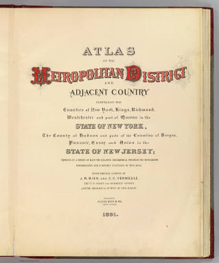
[Bien, Joseph Rudolf, Vermeule, C. C. (Cornelius Clarkson), 1858-1950]
Full Title
(Title Page to) Atlas of the Metropolitan District and adjacent country comprising the counties of New York, Kings, Richmond, Westchester and part of Queens in the state of New York, the County of Hudson and parts of the counties of Bergen, Passaic, Essex and Union in the state of New Jersey ... From original surveys by J.R. Bien and C.C. Vermeule, the U.S. Coast and Geodetic Survey and the Geological Survey of New Jersey. Published by Julius Bien & Co. New York. 1891.
Publisher
Julius Bien
Author
Beers, F. W. (Frederick W.)
Full Title
(Title Page to) Atlas of the Hudson River Valley from New York City to Troy, including a section of about 8 miles in width. Published by Watson & Co., 278 Pearl Street and 36 Vesey Street, New York. Compiled from official records and careful surveys, under the supervision of F.W. Beers, C.E., 1891. Copyright 1891, by Watson & Co.
Publisher
Watson & Co.
Author
[G.W. Bromley & Co., Geo. W. Bromley & E. Robinson]
Full Title
(Title Page to) Atlas of the entire city of New York. Complete in one volume. From actual surveys and official records by G.W. Bromley & Co., civil engineers. Published by Geo. W. Bromley & E. Robinson. 82 & 84 Nassau St., New York. 1879. Entered ... 1879, by G.W. Bromley & Co., ... Washington. Engraved by A.H. Mueller, Walnut St., Philadelphia. Printed by F. Bourquin, S. Sixth St., Philadelphia.
Publisher
G.W Bromley & E. Robinson
Author
G.W. Bromley & Co.
Full Title
(Title Page to) Atlas of Westchester County, N.Y. Pocket, desk and automobile edition. Volume II. Yonkers, Greenburg, Mt. Pleasant, Ossining, Cortlandt, New Castle, North Castle, Yorktown, Somers, Bedford, Poundridge, Lewisboro, and North Salem. 1914. G.W. Bromley & Co., 34 Pine Street, New York. Copyright 1914.
Publisher
G.W. Bromley & Co.
Author
[Bromley, George Washington, Bromley, Walter Scott, G.W. Bromley & Co.]
Full Title
(Title Page to) Atlas of the city of New York 23rd & 24th wards. From actual surveys and official plans by George W. and Walter S. Bromley, civil engineers. Published by G.W. Bromley and Co. 222 S. Fifth St. Philadelphia. 1893.
Publisher
G.W. Bromley and Co.
Author
Hyde, E. Belcher
Full Title
(Title Page to) Atlas of the rural country district north of New York City embracing the entire Westchester County, New York, also a portion of Connecticut. Greenwich, Stamford, New Canaan, Darien, Wilton and Ridgefield. Compiled from maps on file and surveyors notes and data, maps from actual surveys furnished by individual owners & final field observations by our own Corps of Engineers. Published by E. Belcher Hyde, No. 5 Beekman Street, Manhattan, and No. 97 Liberty Street, Brooklyn. 1908. Entered ... 1908 by E. Belcher Hyde.
Publisher
E. Belcher Hyde
Author
[Bromley, George Washington, Bromley, Walter Scott, G.W. Bromley & Co.]
Full Title
(Title Page to) Atlas of Westchester County, New York. From actual surveys and official records by G.W. Bromley & Co., Civil Engineers. Published by Geo. W. & Walter S. Bromley. 243 Broadway, New York. 1881. Engraved by A.H. Mueller, 530 Locust St., Phila. Printed by F. Bourquin, 31 So. 6th St., Phila. Entered ... 1881, by G.W. Bromley & Co. ... Washington.
Publisher
G.W. & W.S. Bromley
Author
[Kiser, Ellis, Mueller, A. H.]
Full Title
(Title Page to) Atlas of the city of Yonkers, Westchester County, New York. Also embracing north-west section of the borough of Bronx. Compiled from official records, private plans and actual surveys, by Ellis Kiser, C.E. Under the direct management and supervision of A.H. Mueller, Publisher, 530 Locust Street, Philadelphia, Pa., 1907. A.H. Mueller, Lithographer, 530 Locust St., Philadelphia. Copyright, A.D. 1907, by A.H. Mueller.
Publisher
A.H. Mueller
Author
[Bromley, George Washington, Bromley, Walter Scott, G.W. Bromley & Co.]
Full Title
(Title Page to) Atlas of Westchester County, New York. Volume one. From actual surveys and official plans by George W. and Walter S. Bromley, civil engineers. Published by G.W. Bromley and Co. 147 N. Fifth St., Philadelphia. 1910.
Publisher
Bromley & Co.
Author
G.W. Bromley & Co.
Full Title
(Title Page to) Atlas of Westchester County, N.Y. Pocket, desk and automobile edition. Volume I. Mt. Vernon, Pelham, New Rochelle, Mamaroneck, Rye, Harrison, White Plains, Scarsdale and Eastchester. 1914. G.W. Bromley & Co., 34 Pine Street, New York. Copyright 1914.
Publisher
G.W. Bromley & Co.
Author
Servoss, R. D.
Full Title
(Title Page to) Sectional road map of Westchester County, New York and part of Fairfield County, Conn. Indexed. Showing the good roads. Published by R.D. Servoss, 21 & 23 Centre St., New York. Copyright 1895, by R.D. Servoss.
Publisher
R.D. Servoss.
Author
[Great Britain. War Office, Stevens, Benjamin Franklin]
Full Title
(Map Title Page to) B.F. Steven's Facsimile of the Unpublished British Head Quarters Coloured Manuscript map of New York & Environs, 1782, Reproduced from the original drawing in the War Office, London. Issued only to subscribers at 4, Trafalgar Square, W.C., London. 1900. Malby and Sons. Engravers.
Publisher
Malby and Sons, engravers
Author
Servoss, R. D.
Full Title
(Title Page to) Servoss' sectional road map of Westchester County, New York with part of Fairfield County, Conn. Showing the good roads. Indexed. Published by Isaac H. Blanchard Co. 268-270 Canal St. New York. Copyright, 1902, by Isaac H. Blanchard Co.
Publisher
Isaac H. Blanchard Co.
Author
[Bromley, George Washington, Bromley, Walter Scott]
Full Title
(Title Page to) Atlas of the city of New York. Manhattan Island. From actual surveys and official plans by Geo. W. & Walter S. Bromley, civil engineers. Published by G.W. Bromley & Co., 120 Nth. Seventh St., Philadelphia. 1891. Engraved by Rudolph Spiel, 30 N. Fifth St., Phila. Printed by F. Bourquin, 31 S. Sixth St., Phila.
Publisher
G.W. Bromley and Co.
Author
Bien, Joseph Rudolf
Full Title
(Title Page to) Atlas of Westchester County, New York. Prepared under the direction of Joseph R. Bien, E.M., civil and topographical engineer from original surveys and official records. Published by Julius Bien & Company, New York, 1893. Copyright by Julius Bien & Company - 1893.
Publisher
Julius Bien & Co.
Author
Bien, Joseph Rudolf
Full Title
(Title Page to) Atlas of the state of New York. Prepared under the direction of Joseph R. Bien, E.M., civil and topographical engineer from original surveys and various local surveys revised and corrected. Published by Julius Bien & Company, New York, 1895.
Publisher
Julius Bien & Co.
Author
Burr, David H., 1803-1875
Full Title
(Title Page to) An atlas of the State of New York, containing a map of the State and of the several counties ... under the superintendance & direction of Simeon DeWitt, Surveyor General, pursuant to an Act of the Legislature, and also the physical geography of the State & of the several counties & statistical tables of the same, by David H. Burr. (with) View on the Hudson near Fishkill. New York, published by David H. Burr. 1829. Engravd. by Rawdon, Clark & Co. Albany & Rawdon, Wright & Co., New York.
Publisher
D.H. Burr
1-34 of 34
|