Who What Where WhenREMOVEWHERE
|
Author
Goodrich, S.G.
Full Title
(Title Page to) An economical atlas. For the use of families and young persons, containing thirty-four maps ... Boston: Gray & Bowen -- Philadelphia, Key & Meilke -- Baltimore, Charles Carter -- New York, Pendleton & Hill; Cincinnati, Morgan & Sanxay; New Orleans, E. Johns, & Co. (verso) Entered ... 1831 by S.G. Goodrich ... Massachusetts.
Publisher
Gray & Bowen
Author
Woodbridge, William C.
Full Title
(Title Page to) Modern atlas, on a new plan, to accompany the System of universal geography; a new edition, improved; by William Channing Woodbridge ... Entered ... 1831, by William C. Woodbridge ... Connecticut. For sale by the principal booksellers throughout the United States. Hartford: Published by Belknap & Hamersley. (1837?)
Publisher
Belknap & Hamersley
Author
Everts & Kirk
Full Title
(Title Page to) The official state atlas of Nebraska. Compiled from government surveys, county records and personal investigations. (with view of the State Capitol). Philadelphia, Everts & Kirk, 1885. (on verso) Copyright, 1885, Everts & Kirk.
Publisher
Everts & Kirk
Author
Wheeler, G.M.
Full Title
(Title Page to) Topographical Atlas Projected To Illustrate United States Geographical Surveys West Of The 100th Meridian Of Longitude Prosecuted In Accordance With Acts Of Congress Under The Authority Of The Honorable The Secretary Of War, And The Direction Of Brig. Genl. A.A. Humphreys, Chief Of Engineers, U.S. Army. Embracing Results Of the Different Expeditions Under The Command Of 1st Lieut. Geo. M. Wheeler, Corps Of Engineers. Julius Bien, lith.
Publisher
U.S.
Author
Faden, William, 1750?-1836
Full Title
(Title Page to) Geographical exercises; calculated to facilitate the study of geography, and, by an expeditious method, to imprint a knowledge of the science on the minds of youth. With a concise introduction, explaining the principles of geography. By William Faden. London: Printed for the proprietor (successor to the late Mr. Jefferys, Geographer to the King) at the Corner of St. Martin's Lane, Charing-Cross. MDCCLXXVII.
Publisher
William Faden
Author
Wheeler, G.M.
Full Title
(Title Page to) Geological Atlas Projected To Illustrate Geographical Explorations And Surveys West Of The 100th Meridian Of Longitude Prosecuted In Accordance With Acts Of Congress Under The Authority Of The Honorable The Secretary Of War, And The Direction Of Brig. Genl. A.A. Humphreys, Chief Of Engineers, U.S. Army. Embracing Results Of the Different Expeditions Under The Command Of 1st Lieut. Geo. M. Wheeler, Corps Of Engineers. Julius Bien, lith.
Publisher
U.S.
Author
Moore, M. B. (Marinda Branson), 1829-1864
Full Title
(Title Page to) The geographical reader, for the Dixie children. By Mrs. M.B. Moore. Raleigh: Branson, Farrar & Co., Publishers. Biblical Recorder Print. 1863.
Publisher
Branson, Farrar & Co.
Author
Mitchell, Samuel Augustus
Full Title
(Title Page to) Mitchell's school atlas: comprising the maps, etc., designed to illustrate Mitchell's school and family geography. Philadelphia: Thomas, Cowperthwait & Co., 1847. Second revised edition. Entered ... 1839 by S. Augustus Mitchell ... Connecticut.
Publisher
Thomas, Cowperthwait & Co.
Author
[United States. Census Office, Walker, Francis Amasa, 1840-1897]
Full Title
(Title Page to) Statistical atlas of the United States based on the results of the ninth census 1870 with contributions from many eminent men of science and several departments of the government. Compiled under authority of Congress by Francis A. Walker, M.A., Superintendent of the 9th Census, professor of political economy and history, Sheffield Scientific School of Yale College. Julius Bien, Lith., 1874.
Publisher
U.S.
Author
[Gannett, Henry, 1846-1914, United States. Census Office]
Full Title
(Title Page to) Statistical atlas of the United States, based upon results of the Eleventh Census (1890). By Henry Gannett. Washington: Government Printing Office. 1898. (At head of title:) Department of the Interior, Census Office. Robert P. Porter, Superintendent ... Carroll D. Wright, Commissioner of Labor in Charge ... (seal) Department of the Interior.
Publisher
U.S. Census Office
Author
Wheeler, G.M.
Full Title
(Title Page to) Report upon United States Geographical Surveys West of the One Hundredth Meridian, in charge of Capt. Geo. M. Wheeler, Corps of Engineers, U.S. Army ... In seven volumes and one supplement, accompanied by one topographic and one geologic atlas. Vol. I--Geographical report. Washington: Government Printing Office, 1889.
Publisher
U.S.
Author
[Gannett, Henry, 1846-1914, United States. Census Office]
Full Title
(Title Page to) Twelfth census of the United States, taken in the year 1900. William R. Merriam, Director. Statistical atlas. Prepared under the supervision of Henry Gannett, Geographer of the Twelfth Census. Washington: United States Census Office. 1903.
Publisher
U.S. Census Office
Author
Wheeler, G.M.
Full Title
(Title Page to) Report upon United States Geographical Surveys West of the One Hundredth Meridian, in charge of Capt. Geo. M. Wheeler, Corps of Engineers, U.S. Army ... In seven volumes and one supplement, accompanied by one topographic and one geologic atlas. Vol. II--Astronomy and barometric hypsometry. Washington: Government Printing Office, 1877.
Publisher
U.S.
Author
Mitchell, Samuel Augustus
Full Title
(Title Page to) Mitchell's new general atlas, containing maps of the various countries of the World, plans of cities, etc. Embraced in ninety-three quarto maps. Forming a series of one hundred and forty-seven maps and plans. Together with valuable statistical tables. Also a list of post-offices of the United States and territories, and also Census of 1880 for states, territories and counties, also of cities of over 10,000 inhabitants. John Y. Huber Company, Publishers, Philadelphia and St. Louis. 1890. (on verso) Entered ... 1886, by S. Augustus Mitchell ... Washington.
Publisher
John Y. Huber & Co.
Author
[Bartholomew, J. G. (John George), 1860-1920, John Bartholomew and Son]
Full Title
(Title Page to) Times survey atlas of the world. London: The Times, 1922.
Publisher
The Times
Author
[G.W. Bromley & Co., Geo. W. Bromley & E. Robinson]
Full Title
(Title Page to) Atlas of the entire city of New York. Complete in one volume. From actual surveys and official records by G.W. Bromley & Co., civil engineers. Published by Geo. W. Bromley & E. Robinson. 82 & 84 Nassau St., New York. 1879. Entered ... 1879, by G.W. Bromley & Co., ... Washington. Engraved by A.H. Mueller, Walnut St., Philadelphia. Printed by F. Bourquin, S. Sixth St., Philadelphia.
Publisher
G.W Bromley & E. Robinson
Author
[Andree, Richard, Times (London, England)]
Full Title
(Title Page to) The Times atlas. Containing 117 pages of maps, and comprising 173 maps and an alphabetical index to 130,000 names. Published at the office of "The Times," Printing House Square, London, E.C. 1895. (colophon:) Cassell & Company. Limited, Belle Sauvage Works, London, E.C.
Publisher
The Times
Author
Andree, Richard
Full Title
(Title Page to) Richard Andree's Allgemeiner Handatlas in sechsundachtzig Karten mit erlauterndem Text. Herausgegeben von der Geographischen Anstalt von Velhagen & Klasing in Leipzig. Bielefeld und Leipzig, Verlag Von Velhagen & Klasing 1881.
Publisher
Velhagen & Klasing
Author
D.H. Hurd & Co.
Full Title
(Title Page to) Town and city atlas of the state of New Hampshire. Compiled from government surveys, county records and personal investigations. D.H. Hurd & Co., Boston. 1892.
Publisher
D.H. Hurd & Co.
Author
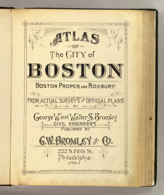
[Bromley, George Washington, Bromley, Walter Scott]
Full Title
(Title Page to) Atlas of the city of Boston, Boston proper and Roxbury. From actual surveys and official plans by George W. and Walter S. Bromley, civil engineers. G.W. Bromley and Co., 222 S. Fifth St., Philadelphia. 1895. Entered according to Act of Congress in 1895 by G.W. Bromley & Co. in the office of the Librarian of Congress at Washington, D.C.
Publisher
G.W. Bromley and Co.
Author
[Bromley, George Washington, Bromley, Walter Scott]
Full Title
(Title Page to) Atlas of the city of Cambridge, Massachusetts from actual surveys and official plans by George W. and Walter S. Bromley, civil engineers. Published by G.W. Bromley and Co., 222 S. Fifth St., Philadelphia. 1903. (Drawn by?) R. Spiel, Phila.
Publisher
G.W. Bromley and Co.
Author
[J.P. Brown & Co., Richards, L. J.]
Full Title
(Title Page to) Atlas of Dorchester, West Roxbury and Brighton, city of Boston. In one volume. Comprising forty-one plates compiled from official records, private plans and actual surveys, by a corps of twelve surveyors and draughtsmen. Published by L.J. Richards, as J.P. Brown & Co. 36 Columbus Avenue, Boston, Mass. 1899.
Publisher
L.J. Richards
Author
Seaman, James V.
Full Title
(Title Page to) A new general atlas, chiefly intended for the use of schools and private libraries; also calculated to accompany modern geographies and gazetteers. Containing twenty-six maps. New-York: Published by James V. Seaman, No. 296 Pearl-Street. 1821.
Publisher
James V. Seaman
Author
Clouet, J. B. L. (Jean-Baptiste Louis), b. 1730
Full Title
(Title Page to) Geographie moderne avec une introduction. Ouvrage utile a tous ceux qui veulent se perfectionner dans cette science ... Dediee a Messieurs de l'Academie Royale des Sciences et Belles-Lettres de Rouen. Par Mr. l'Abbe Clouet de la meme Academie avec approbation et P. du R. Corrigee et augmentee des nouvelles decouvertes du celebre Capitaine Cook et des changements arrives dans l'Amerique Septentrional. 1787. A Paris chez Mondhare et Jean rue St. Jean de Beauvais pres celle des Noyers. (title page engraved by) Berthault. S.
Publisher
Mondhare et Jean
Author
Morse, Sidney E. (Sidney Edwards), 1794-1871
Full Title
(Title Page to) An atlas of the United States, on an improved plan; consisting of ten maps, with a complete index to each, and a general map of the whole country. By Sidney E. Morse, A.M. New-Haven: engraved and published by N. & S.S. Jocelyn. 1823.
Publisher
N. & S.S. Jocelyn
Author
Bowen, Frances
Full Title
(Title Page to) A general atlas done by Frances Bowen under the care of her sister Eliza in the year 1810.
Publisher
Manuscript
Author
Jefferys, Thomas
Full Title
(Title Page to) The natural and civil history of the French dominions in North and South America. Giving a particular account of the climate, soil, minerals, animals, vegetables, manufactures, trade, commerce, and languages ... Illustrated by maps and plans of the principal places, collected from the best authorities, and engraved by T. Jefferys, Geographer to his Royal Highness the Prince of Wales. Part I. Containing a description of Canada and Louisiana. London, Printed for Thomas Jefferys at Charing-Cross. MDCCLX.
Publisher
Thomas Jefferys
Author
Dangeau, abbe de, 1643-1723
Full Title
(Title Page to) Nouvelle metode pour aprende facilement et sans maitre la geografie, et les premers principes du Blazon ... Compose par M. L'abbe de Dangeau, l'un des quarante de l'academie Francoise. 1693. (On cover) Cette geographie de la France par l'Abbe de Dangeau est le manuscript de l'auteur.
Publisher
Manuscript
Author
G.W. Bromley & Co.
Full Title
(Title Page to) Atlas of Westchester County, N.Y. Pocket, desk and automobile edition. Volume II. Yonkers, Greenburg, Mt. Pleasant, Ossining, Cortlandt, New Castle, North Castle, Yorktown, Somers, Bedford, Poundridge, Lewisboro, and North Salem. 1914. G.W. Bromley & Co., 34 Pine Street, New York. Copyright 1914.
Publisher
G.W. Bromley & Co.
Author
Carey, Mathew
Full Title
(Title Page to) Carey's American Pocket Atlas; Containing The Following Maps... With A Concise Description Of Each State. Philadelphia: Printed For Mathew Carey, By Lang and Ustick, 1796.
Publisher
Lang and Ustick
Author
[Bromley, George Washington, Bromley, Walter Scott, G.W. Bromley & Co.]
Full Title
(Title Page to) Atlas of the city of New York 23rd & 24th wards. From actual surveys and official plans by George W. and Walter S. Bromley, civil engineers. Published by G.W. Bromley and Co. 222 S. Fifth St. Philadelphia. 1893.
Publisher
G.W. Bromley and Co.
Author
Hyde, E. Belcher
Full Title
(Title Page to) Atlas of the rural country district north of New York City embracing the entire Westchester County, New York, also a portion of Connecticut. Greenwich, Stamford, New Canaan, Darien, Wilton and Ridgefield. Compiled from maps on file and surveyors notes and data, maps from actual surveys furnished by individual owners & final field observations by our own Corps of Engineers. Published by E. Belcher Hyde, No. 5 Beekman Street, Manhattan, and No. 97 Liberty Street, Brooklyn. 1908. Entered ... 1908 by E. Belcher Hyde.
Publisher
E. Belcher Hyde
Author
Mitchell, Samuel Augustus
Full Title
(Title Page to) Mitchell's new general atlas, containing maps of the various countries of the World, plans of cities, etc., embraced in sixty-three quarto maps, forming a series of one hundred maps and plans, together with valuable statistical tables. Philadelphia: published by S. Augustus Mitchell, Jr., No. 31 South Sixth Street. 1870. Entered ... 1870, by S. Augustus Mitchell, Jr. ... Pennsylvania.
Publisher
[R.A. Campbell, S.A. Mitchell, Jr.]
Author
[Campbell, R.A., Walling, H. F.]
Full Title
(Title Page to) Campbell's new atlas of the state of Illinois with descriptions historical, scientific and statistical. Maps drawn by R.A. Campbell, C.E., and Prof. H.F. Walling ... Chicago: R.A. Campbell, 131 South Clark Street. Philadelphia: S. Augustus Mitchell, Jr. 1870. Entered ... 1870 by R.A. Campbell ... Northern District of Illinois.
Publisher
[R.A. Campbell, S.A. Mitchell, Jr.]
Author
Mitchell, Samuel Augustus
Full Title
(Title Page to) Mitchell's new general atlas, containing maps of the various countries of the World, plans of cities, etc., embraced in ninety-three quarto maps. Forming a series of one hundred and forty-seven maps and plans. Together with valuable statistical tables. Also, a list of post-offices of the United States and territories, and census of 1860 and 1870. Philadelphia: Published by S. Augustus Mitchell, No. 815 Arch Street. 1880. Entered ... 1879, by S. Augustus Mitchell ... Washington.
Publisher
S.A. Mitchell
Author
[Bromley, George Washington, Bromley, Walter Scott, G.W. Bromley & Co.]
Full Title
(Title Page to) Atlas of Westchester County, New York. From actual surveys and official records by G.W. Bromley & Co., Civil Engineers. Published by Geo. W. & Walter S. Bromley. 243 Broadway, New York. 1881. Engraved by A.H. Mueller, 530 Locust St., Phila. Printed by F. Bourquin, 31 So. 6th St., Phila. Entered ... 1881, by G.W. Bromley & Co. ... Washington.
Publisher
G.W. & W.S. Bromley
Author
Chevalier, August
Full Title
(Title Page to) The commercial, pictorial and tourist map of San Francisco. Copyrighted by Aug. Chevalier, Publisher, 331 Kearny Street. 1st edition 1904.
Publisher
Aug. Chevalier
Author
[Kiser, Ellis, Mueller, A. H.]
Full Title
(Title Page to) Atlas of the city of Yonkers, Westchester County, New York. Also embracing north-west section of the borough of Bronx. Compiled from official records, private plans and actual surveys, by Ellis Kiser, C.E. Under the direct management and supervision of A.H. Mueller, Publisher, 530 Locust Street, Philadelphia, Pa., 1907. A.H. Mueller, Lithographer, 530 Locust St., Philadelphia. Copyright, A.D. 1907, by A.H. Mueller.
Publisher
A.H. Mueller
Author
Bruyset, Jean-Marie
Full Title
(Title Page to) Atlas des enfans, ou nouvelle methode pour apprendre la geographie, avec un nouveau traite de la Sphere, et XXIV cartes enluminees. Nouvelle edition, corrigee & augmentee. A Lyon, Chez Jean-Marie Bruyset, Pere & Fils. M.DCC.LXXXIV.
Publisher
Jean-Marie Bruyset
Author
Fer, Nicolas de
Full Title
(Title Page to) Introduction a la geographie avec une description historique sur toutes les parties de la Terre. Par N. de Fer, Geographe de sa Majeste Catholique. A Paris: Chez le Sr. Danet -- gendre de l'Auteur sur le Pont Notre Dame a la Sphere Royale avec P. du R. M.DCC.XVII. Seconde edition, augmentee des longitudes et latitudes des principales villes suivant les dernieres observations.
Publisher
Danet
Author
[Brudin, J. L., Stieler, Adolf]
Full Title
(Title Page to) Skol-atlas ofver jordens alla delar i 24 illuminerade kartor. Efter Stielers Hand-Atlas. Stockholm, J.L. Brudin, 1852.
Publisher
J.L. Brudin
Author
[Fenner, Rest., Thomas, Joseph, publisher]
Full Title
(Title Page to) Thomas's library atlas, embodying a complete set of maps, illustrative of modern & ancient geography ... London, Joseph Thomas, 1, Finch Lane, 1835. Sold by Simpkin & Marshall, Stationers Court.
Publisher
Joseph Thomas
Author
Greenleaf, Jeremiah
Full Title
(Title Page to) A New Universal Atlas; Comprising Separate Maps Of all the Principal Empires, Kingdoms & States Throughout the World: and forming a distinct Atlas Of The United States. Carefully Compiled from the best Authorities Extant by Jeremiah Greenleaf. a new edition revised and corrected to the present time. 1840. Printed by G.R. French Brattleboro Vt.
Publisher
G.R. French
Author
[Bromley, George Washington, Bromley, Walter Scott, G.W. Bromley & Co.]
Full Title
(Title Page to) Atlas of Westchester County, New York. Volume one. From actual surveys and official plans by George W. and Walter S. Bromley, civil engineers. Published by G.W. Bromley and Co. 147 N. Fifth St., Philadelphia. 1910.
Publisher
Bromley & Co.
Author
G.W. Bromley & Co.
Full Title
(Title Page to) Atlas of Westchester County, N.Y. Pocket, desk and automobile edition. Volume I. Mt. Vernon, Pelham, New Rochelle, Mamaroneck, Rye, Harrison, White Plains, Scarsdale and Eastchester. 1914. G.W. Bromley & Co., 34 Pine Street, New York. Copyright 1914.
Publisher
G.W. Bromley & Co.
Author
[Isaacs, John D., Bascom]
Full Title
(Title Page) Preliminary Report on Harbors, Havens, and Anchorages of the Pacific Coast from San Francisco to the Straits of Juan de Fuca.
Publisher
Department of Engineering, University of California
Author
Carey, Mathew
Full Title
(Title Page to) Carey's General Atlas ... Philadelphia: Published By M. Carey. April, 1811. (Price Ten Dollars Plain - Twelve Dollars Coloured.) N.B. The maps marked with a star, are not in any London Atlas.
Publisher
M. Carey
Author
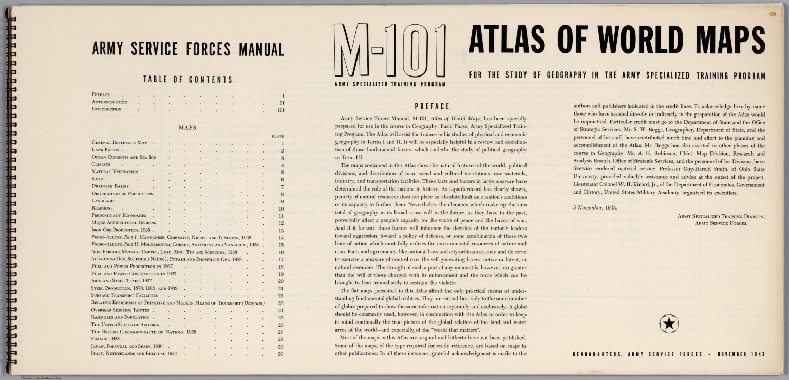
United States Army Service Forces
Full Title
(Title Page) Atlas of World Maps for the Study of Geography in the Army Specialized Training Program. Army Services Forces Manual. M-101. Headquarters, Army Service Forces. November, 1943. (Index Page) Table of Contents. (Text Page) Preface.
Publisher
United States Army Service Forces
Author
Stieler, Adolf
Full Title
(Title Page) Hand - Atlas Uber Alle Theile Der Erde nach dem neuesten Zustande Und Uber Das Weltgebaude. Herausgegebenn von Adolf Stieler, berbeitet von Demselben, so wie von F.v. Stulpnagel, H. Berghaus u. I.C. Bar. Gotha bei Justus Perthes. (title page only) gez. v. Bar. gest. v. Edler in Gotha.
Publisher
Justus Perthes
Author
Bradstreet Company
Full Title
(Title Page to) Bradstreet's Pocket Atlas Of The United States. Published Exclusively for Macullar, Parker & Company, Boston, Massachusetts ... New York: The Bradstreet Company, 1885. (on verso) Entered ... 1879, by The Bradstreet Company ... Washington.
Publisher
Bradstreet Co.
|