Browse All

1932 Plate 64. States, Territories and Cities … [Historical Atlas, National Atlas] Plate 64. States, Territories and Cities … |

1932 Plate 65. States, Territories and Cities … [Historical Atlas, National Atlas] Plate 65. States, Territories and Cities … |

1932 Plate 66. States, Territories and Cities … [Historical Atlas, National Atlas] Plate 66. States, Territories and Cities … |

1932 Plate 67. States and Cities: Population, … [Historical Atlas, National Atlas] Plate 67. States and Cities: Population. … |

1892 California. County Atlas Map of the state of California, compiled … |

1892 Tulare County, California. County Atlas Map of Tulare County, California. 1892. … |

1892 T.15S R.25E. County Atlas Township 15 South, Range 25 East, Tulare … |

1892 T.15S R.26E. County Atlas Township 15 South, Range 26 East, Tulare … |

1892 T.15S R.27E. County Atlas Township 15 South, Range 27 East, Tulare … |

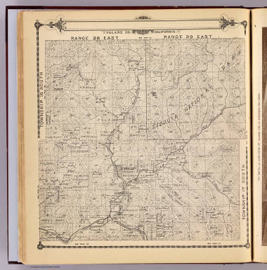
1892 T.14-15S R.28-29E. County Atlas Township 15 South, Township 14 South, Ra … |

1892 T.14-15S R.30-31E. County Atlas Township 15 South, Township 14 South, Ra … |

1892 T.14-17S R.32-35E. County Atlas Township 17 South ... Township 14 South, … |

1892 T.16S R.22E. County Atlas Township 16 South, Range 22 East, Tulare … |

1892 T.16S R.23E. County Atlas Township 16 South, Range 23 East, Tulare … |

1892 T.16S R.24E. County Atlas Township 16 South, Range 24 East, Tulare … |

1892 T.16S R.24E. County Atlas Map of the town of Monson, Tulare County … |

1892 T.16S R.25E. County Atlas Township 16 South, Range 25 East, Tulare … |

1892 T.16S R.26E. County Atlas Township 16 South, Range 26 East, Tulare … |

1892 T.16S R.27E. County Atlas Township 16 South, Range 27 East, Tulare … |
1892 T.16-17S R.28-29E. County Atlas Township 16 South, Township 17 South, Ra … |

1892 T.16-17S R.30-31E. County Atlas Township 16 South, Township 17 South, Ra … |

1892 T.17S R.21E. County Atlas Township 17 South, Range 21 East, Tulare … |

1892 T.17S R.22E. County Atlas Township 17 South, Range 22 East, Tulare … |

1892 T.17S R.23E. County Atlas Township 17 South, Range 23 East, Tulare … |

1892 Traver, Tulare County. County Atlas Map of Traver, Tulare County. (with) Map … |
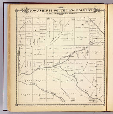
1892 T.17S R.24E. County Atlas Township 17 South, Range 24 East, Tulare … |

1892 T.17S R.25E. County Atlas Township 17 South, Range 25 East, Tulare … |

1892 T.17S R.26E. County Atlas Township 17 South, Range 26 East, Tulare … |

1892 T.17S R.27E. County Atlas Township 17 South, Range 27 East, Tulare … |

1866 Cover: Maps accompanying Report ... Gene … National Atlas (Covers to) Maps accompanying Report of … |

1866 Contents: Maps accompanying Report ... G … National Atlas (Contents to) Maps accompanying Report o … |

1866 State of Ohio. National Atlas State of Ohio. Department of Interior, G … |

1866 Indiana. National Atlas A Diagram of the State of Indiana. Depar … |

1866 Illinois. National Atlas Map of the State of Illinois. Department … |

1866 Michigan. National Atlas Sketch of the Public Surveys in Michigan … |

1866 Wisconsin. National Atlas Sketch of the Public Surveys in the Stat … |

1866 Minnesota. National Atlas Sketch of the Public Surveys in the Stat … |

1866 Iowa. National Atlas Diagram of the Public Surveys in Iowa. D … |

1866 Dakota Territory National Atlas Dakota Territory. Department of the Inte … |

1866 Missouri. National Atlas State of Missouri. Department of the Int … |

1866 Arkansas. National Atlas Map of Arkansas. Department of the Inter … |

1866 Louisiana. National Atlas Map of Louisiana. Department of the Inte … |

1866 Mississippi. National Atlas Sketch of the Public Surveys in the Stat … |

1866 Alabama. National Atlas State of Alabama. Department of the Inte … |

1866 Florida. National Atlas Map of the State of Florida, Showing the … |

1866 Kansas, Nebraska. National Atlas (12) Map Showing the progress of the Pub … |

1866 Colorado Territory. National Atlas Map of Public Surveys in Colorado Territ … |

1866 New Mexico, Arizona. National Atlas Sketch of Public Surveys in New Mexico & … |

1866 Utah. National Atlas Map of the Territory of Utah. To accompa … |

1866 Nevada. National Atlas Map of the State of Nevada. To accompany … |