Who What Where WhenWHO
|
REFINE
Browse All : View of Utah
1-42 of 42
Author
[Macomb, J.N., Newberry, J.S.]
Full Title
(View) Plate VI. Casa Colorado & La Sal-Mountains. Looking Northerly. J.J. Young from a sketch by Dr. J.S. Newberry. T. Sinclair & Son. lith. Phila.
Publisher
U.S. Government Printing Office
Author
[Macomb, J.N., Newberry, J.S.]
Full Title
(View) Ruins of Stone Houses Cliffs, Labyrinth Canyon. J.S.N. T. Sinclair & Son. lith. Phila.
Publisher
U.S. Government Printing Office
Author
[Macomb, J.N., Newberry, J.S.]
Full Title
(View) Plate VII. Head of Labyrinth Creek. Looking South-Easterly. J.J. Young from a sketch by Dr. J.S. Newberry. T. Sinclair & Son. lith. Phila.
Publisher
U.S. Government Printing Office
Author
[Macomb, J.N., Newberry, J.S.]
Full Title
(View) Plate IX. Lower San Juan, Looking West from Near Camp 35. J.J. Young from a sketch by Dr. J.S. Newberry. T. Sinclair & Son. lith. Phila.
Publisher
U.S. Government Printing Office
Full Title
Rain sculpture, Salt Creek Canon, Utah. (1875)
Publisher
U.S.
Full Title
Rock carved by drifting sand, near mouth of Grand Wash, Utah. (1875)
Publisher
U.S.
Full Title
Lava from valley of Lower Sevier, Utah. (1875)
Publisher
U.S.
Full Title
Cretaceous. P. Roetter del. J. Bien lith. (1877)
Publisher
U.S.
Author
C.C. Pierce & Co.
Full Title
Oregon and the Pacific Northwest. (Published by Ellis A. Davis. Berkeley, Cal. Seattle. 1909)
Publisher
E.A. Davis
Author
[Beckwith, Lieut., Schumann, C.]
Full Title
Weber Lower Canyon. April 5th at 2 P.M. from an island in Weber River; Valley of Great Salt Lake. C. Schumann from F.W. Egloffstein. Selmar Siebert's Engraving & Printing Establishment, Washington, D.C. U.S.P.R.R. Exp. & Surveys 41st Parallel. Expl. by Lieut. Beckwith. Vol. II.
Publisher
[A.O.P. Nicholson I-XI, T. Ford XII.]
Author
[Beckwith, Lieut., Hinshelwood, R., Schumann, C.]
Full Title
Second or Sheeprock Canyon of Weber River. April 6th at 1 P.M. View Looking East. C. Schumann from F.W. Egloffstein. R. Hinshelwood. U.S.P.R.R. Exp. & Surveys 41st Parallel. Expl. by Lieut. Beckwith. Vol. II.
Publisher
[A.O.P. Nicholson I-XI, T. Ford XII.]
Author
[Beckwith, Lieut., Schumann, C.]
Full Title
Porcupine Terrace. Uintah Mountains in the Distance. Camp. April 16th to 17th. C. Schumann from F.W. Egloffstein. Selmar Siebert's Engraving & Printing Establishment, Washington, D.C. U.S.P.R.R. Exp. & Surveys 41st Parallel. Expl. by Lieut. Beckwith. Vol. II.
Publisher
[A.O.P. Nicholson I-XI, T. Ford XII.]
Author
[Beckwith, Lieut., Schumann, C.]
Full Title
Round Prairie From Head of the Same. April 21st at 10 A.M. C. Schumann from F.W. Egloffstein. S.V. Hunt Sc. U.S.P.R.R. Exp. & Surveys 41st Parallel. Expl. by Lieut. Beckwith. Vol. II.
Publisher
[A.O.P. Nicholson I-XI, T. Ford XII.]
Author
[Beckwith, Lieut., Schumann, C.]
Full Title
Goshoot Passage showing 65 miles of the proposed line of railroad from the desert west of Great Salt Lake to the Humboldt Mountains. May 17th-20th. C. Schumann from F.W. Egloffstein. Selmar Siebert's Engraving & Printing Establishment, Washington, D.C. U.S.P.R.R. Exp. & Surveys 41st Parallel. Expl. by Lieut. Beckwith. Vol. II.
Publisher
[A.O.P. Nicholson I-XI, T. Ford XII.]
Author
Nichols, H. H.
Full Title
Scenery on the High Plateaus. H.H. Nichols. (1895)
Publisher
Flood & Vincent
Full Title
Tabernacle Crater and lava beds of the Basin Province. (1895)
Publisher
Flood & Vincent
Author
Nichols, H. H.
Full Title
View on Great Salt Lake Desert, showing mountains half buried by lake sediments. H.H. Nichols. (1895)
Publisher
Flood & Vincent
Full Title
Pavant Butte, over a submarine volcano of the Great Basin. (1895)
Publisher
Flood & Vincent
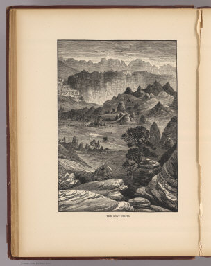
Author
Nichols, H. H.
Full Title
The Gray Cliffs. Nichols. (1895)
Publisher
Flood & Vincent
Full Title
Pink Cliffs, Paunsagunt Plateau. (1895)
Publisher
Flood & Vincent
Full Title
A Permian butte (Utah? 1895)
Publisher
Flood & Vincent
Full Title
Vermilion Cliffs at Kanab. (1895)
Publisher
Flood & Vincent
Full Title
A midsummerday's dream on the color (Utah? 1895)
Publisher
Flood & Vincent
Full Title
The Hurricane Fault. (1895)
Publisher
Flood & Vincent
Full Title
Towers of the Vermilion Cliffs. (1895)
Publisher
Flood & Vincent
Full Title
Temples and towers of the Rio Virgen. (1895)
Publisher
Flood & Vincent
Author
Moran, Thomas, 1837-1926
Full Title
The start from Green River Station. T(homas) M(oran. 1895)
Publisher
Flood & Vincent
Author
Nichols, H. H.
Full Title
Horseshoe Canyon. H.H. Nichols sc. (1895)
Publisher
Flood & Vincent
Full Title
Bird's-eye view of the Land of the Standing Rocks. (1895)
Publisher
Flood & Vincent
Full Title
Land of the Standing Rocks. (1895)
Publisher
Flood & Vincent
Author
Nichols, H. H.
Full Title
Recent lava flow on the Uinkaret. H.H. Nichols. (1895)
Publisher
Flood & Vincent
Full Title
Scene at mouth of Canon of the Virgin River near Shonesburg, Utah. Wriggle Trail at the right. (From a sketch made by John E. Weyss). 1872. U.S. Geographical Surveys West of the 100th Meridian. (1889)
Publisher
U.S.
Full Title
Dripping Pool, Kanab Canyon, near the Colorado. 1872. U.S. Geographical Surveys West of the 100th Meridian. Sinclair & Son. (1889)
Publisher
U.S.
Full Title
Headwaters of Paria Creek from rim of the basin--Southern Utah. U.S. Geographical Surveys West of the 100th Meridian. Sinclair & Son. (1889)
Publisher
U.S.
Full Title
El Vado de Los Padres, Colorado River. (From a sketch made by John E. Weyss). 1872. U.S. Geographical Surveys West of the 100th Meridian. (1889)
Publisher
U.S.
Full Title
Crossing of the Colorado River near mouth of Paria Creek. Eastern edge of the Grand Canon in the distance. (Sketched by Gilbert Thompson). 1873. U.S. Geographical Surveys West of the 100th Meridian. (1889)
Publisher
U.S.
Full Title
Plan and elevation of the astronomical observatory at Ogden, Utah. Erected 1873. Chs. Herman, del. U.S. Geographical Surveys West of the 100th Meridian. The Graphic Co., N.Y. (1877)
Publisher
U.S.
Author
[Scovel, James L., O'Brien, Emmett J]
Full Title
Domes & Basin. Centripetal Drainage. Burkes Garden, VA. (on opposite page) Cryptovocanic Domes. Upheaval Dome, Utah. (with inset view) Stereopair of Upheaaval Dome ...
Publisher
John Wiley & Sons Inc.
Author
[Scovel, James L., O'Brien, Emmett J]
Full Title
Folds. Plunging Anticlines and Synclines-Humid. Hollidysburg, PA. Belcher Islands, Canada. 1:250,000.
Publisher
John Wiley & Sons Inc.
Author
[Scovel, James L., O'Brien, Emmett J]
Full Title
Folds. Plunging Anticlinal and Synclinal Mountain-Arid. Dinosaur National Monument, Utah. Bou Khadra, Algeria. 1:50,000. (on opposite page) Anticlinal and Synclinal Mountain. (with three views).
Publisher
John Wiley & Sons Inc.
Author
[Gunnison, J.W., Preuss, C., Stansbury, Howard]
Full Title
(Title Page to) Exploration and Survey of the Valley of the Great Salt Lake of Utah, including a Reconnoissance of a new Route through the Rocky Mountains. By Howard Stansbury ... (with view) Fort Utah on the Timpanogas - Valley of the Great Salt Lake. Philadelphia: Lippincott, Grambo & Co. 1852.
Publisher
Lippincott, Grambo & Co.
Author
[Dutton, Clarence E. (Clarence Edward), 1841-1912, Holmes, William Henry, 1846-1933]
Full Title
The Temples and Towers of the Virgen. W(illiam) H. H(olmes). Atlas Sheet IV. Julius Bien & Co. lith. U.S. Geological Survey, Geology of the Grand Canon District.
Publisher
Bien, Julius & Co.
1-42 of 42
|