|
|
REFINE
Browse All : Wall Map of New York
1-8 of 8
Author
Ensign, Thayer & Co.
Full Title
The Empire State. New York: Published By Ensign, Thayer & Co., 50 Ann Street, And 127 Main Street, Buffalo. Entered ... 1851, by Ensign, Thayer & Co. ... New York. Lettered by O.H. Hall. - Morse's Cerography. (seal) Excelsior. Lossinc-Barritt Sc.
Publisher
Ensign, Thayer & Co.
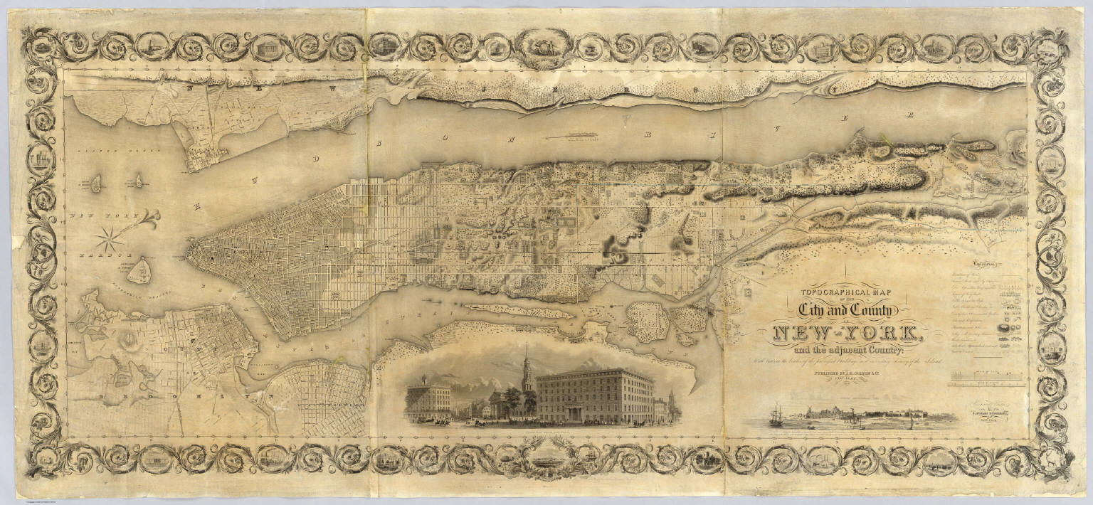
Author
Colton, J. H.
Full Title
Topographical Map Of The City and County Of New - York, and the adjacent Country: With Views in the border of the principal Buildings and interesting Scenery of the Island. Published By J.H. Colton & Co. No. 4 Spruce St. New-York. 1836. Engraved & Printed by S. Stiles & Company, New-York. Entered ... 1836, by J.H. Colton & Co. ... New York.
Publisher
J.H. Colton & Co.
Author
Dripps, Matthew
Full Title
Map of the City of New York Extending Northward to Fiftieth St. Surveyed and drawn by John F. Harrison C.E. Published by M. Dripps...1852.
Publisher
M. Dripps
Author
Dripps, Matthew
Full Title
Map Of That Portion Of The City And County Of New - York North Of 50th St. Surveyed & Drawn by R.A. Jones, C.E. Published by M. Dripps, 103 Fulton St. N.Y. 1851. (inset) Westchester County.
Publisher
M. Dripps
Author
Colton, G.W.
Full Title
Colton's New Map Of Long Island. Published By G.W. & C.B. Colton & Co. 182 William St. New York. 1888. Entered ... 1873 by G.W. & C.B. Colton & Co. ... Washington. (inset) Brooklyn, New York, Jersey City, Hoboken Etc.
Publisher
G.W. & C.B. Colton
Author
[French, C.E., Smith, Robert P.]
Full Title
The State of New York. From New And Original Surveys Under The Direction Of J.H. French, C.E. Robert Pearsall Smith, Publishers, No. 8 South Salina Street, Syracuse, 1860. Entered ... 1859 by Robert Pearsall Smith ... New York. (inset) Meteorological Map Of The State Of New York by Lorin Blodget ... (inset) Geological And Land Patent Map Of The State Of New York ... (with 12 additional inset maps).
Publisher
Robert P. Smith
Author
Damerum, William
Full Title
Map of the Southern part of the State of New York including Long Island, the Sound, the State of Connecticut, part of the State of New Jersey and Islands adjacent. Compiled from actual late Surveys. Designed, Drawn and Published 1815 by Wm. Damerum, General Surveyor, New York. Copy Secured. P. Maverick sct.
Publisher
W. Damerum
Author
[Nicholson, W. L., United States. Post Office Dept.]
Full Title
Post Route Map Of The State Of New York And Parts Of Vermont, Massachusetts, Connecticut, New Jersey And Pennsylvania, Showing Also The Adjacent Portions Of The Dominion Of Canada. Designed And Constructed Under The Orders Of Postmaster General Alex. W. Randall And Second Asst. Postmaster General Geo. Wm. McLellan By W.L. Nicholson, Topographer Of P.O. Dept. 1868. Drawn by Paul Goepel. Engraved by D. McClelland, Washn. D.C. (seal) Post Office Department United States Of America "With Celerity, Certainty And Security." (inset) Prov. Of Ontario. (inset) Postal Service Of Long Island With The Principal Mail Connections Of The City Of New York.
Publisher
U.S. Post Office
1-8 of 8
|