Browse All

1844 Map Of Massachusetts Wall Map Topographical Map Of Massachusetts, Comp … |

1809 Map of the World Wall Map Arrowsmith's Map of the World On A Globu … |

1834 New Map of the United States. Wall Map A New Map of the United States. By J.H. … |

1833 Map Of The United States Wall Map Map Of The United States Of North Americ … |

1845 Mitchell's Reference & Distance Map Of T … Wall Map Mitchell's Reference & Distance Map Of T … |

1834 Mitchell's Reference & Distance Map Of T … Wall Map Mitchell's Reference & Distance Map Of T … |

1848 Map of Africa Wall Map Map of Africa: Carefully Compiled From T … |

1868 Map of North America Wall Map Lloyd's Topographical Railway Map of Nor … |

1868 Map Of The United States Wall Map Lloyd's New Map of the United States The … |

1845 Mitchell's Reference & Distance Map Of T … Wall Map Mitchell's Reference & Distance Map Of T … |

1841 Mitchell's Reference & Distance Map Of T … Wall Map Mitchell's Reference & Distance Map Of T … |

1861 Washington Map of the United States. Wall Map The Washington Map Of The United States. … |

1818 United States Of North America. Wall Map A New and Correct Map of the United Stat … |

1806 A New Map of the United States. Wall Map A New Map of the United States, of Ameri … |

1829 Map of the United States. [Manuscript Map, Wall Map] Map Of The United States. Eliza S. Ordwa … |

1815 Map of the Southern part of the State of … Wall Map Map of the Southern part of the State of … |

1836 Map of the World. [Manuscript Map, Wall Map] Map of the World. Executed by Anna M. Bu … |

1873 Bancroft's Map Of California, Nevada, Ut … Wall Map Bancroft's Map Of California, Nevada, Ut … |

1876 Map of Oakland, Alameda and Vicinity Wall Map Map of Oakland, Alameda and Vicinity, Sh … |

1855 Map of the Town of Middleborough Wall Map Map of the Town of Middleborough, Plymou … |

1872 Post Route Map Of The State Of New York Wall Map Post Route Map Of The State Of New York … |

1833 Map of New London and Windham Counties Wall Map Map of New London and Windham Counties I … |

1849 Pictorial Map Of The United States. Wall Map Pictorial Map Of The United States. 1849 … |

1845 Alden's Pictorial Map Of The United Stat … Wall Map Alden's Pictorial Map Of The United Stat … |

1876 Map Of Tulare County California. Wall Map Map Of Tulare County California Compiled … |

1836 The World. [Manuscript Map, Wall Map] The World. By M. Anslin. Western Hemisph … |

1851 United States, Mexico, Central America, … Wall Map A map of the United States, Mexico, Cent … |

1842 Map of the United States Of North Americ … Wall Map Map of the United States Of North Americ … |

1860 Republics Of North America Wall Map Johnson's New Illustrated & Embellished … |

1858 New National Map Exhibiting The United S … Wall Map Mitchell's New National Map Exhibiting T … |

1860 New National Map Exhibiting The United S … Wall Map Mitchell's New National Map Exhibiting T … |

1819 A new and correct map of the United Stat … Wall Map The travellers guide. A new and correct … |

1815 State of Ohio. Wall Map A Map of the State of Ohio from Actual S … |

1869 California and Nevada Wall Map Map of the States Of California And Neva … |

1926 Official Map of Yolo County, California, … Wall Map Official Map of Yolo County California C … |

1900 Official Map of Yolo County, California, … Wall Map Official Map of the County of Yolo, Cali … |

1909 Official Map of Yolo County, California, … Wall Map Official Map of the County of Yolo, Cali … |

1891 Official Map of Yolo County, California, … Wall Map Official Map of Yolo County, California, … |

1915 Official Map of Yolo County, California, … Wall Map Official Map of Yolo County, California, … |

1871 Official Map of Yolo County, California, … Wall Map Map of Yolo County, California, Compiled … |

1939 Official Map of Yolo County, California, … Wall Map Official Map of Yolo County, California. … |

1859 Republics Of North America Wall Map Johnson's New Illustrated & Embellished … |

1852 Map Of The Town Of Plymouth Wall Map Map Of The Town Of Plymouth, Litchfield … |
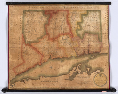
1813 Connecticut, From Actual Survey Wall Map Connecticut, From Actual Survey, Made in … |

1850 Plan Of The Township of Raritan Wall Map Plan Of The Township of Raritan, Hunterd … |

1852 A New Map of The States Of Texas & Calif … Wall Map A New Map of The States Of Texas & Calif … |

1846 A New Map of Texas Oregon and California … Wall Map A New Map of Texas Oregon And California … |

1860 State Of Vermont Wall Map Map Of The State Of Vermont From Surveys … |

1882 World On Mercator's Projection [Chart Map, Wall Map] Chart Of The World On Mercator's Project … |

1846 A New Map of Texas Oregon and California … Wall Map A New Map of Texas Oregon and California … |