Browse All

1964 Our Water Supply State Atlas 11. Our Water Supply. (to accompany) Atl … |

1825 Fluss - und Gebirgs Skizze von Europa. [School Atlas, World Atlas] Fluss - und Gebirgs Skizze von Europa. B … |

1825 Bur Orographie von Europe. [School Atlas, World Atlas] Bur Orographie von Europe. Berlin. 1825. … |

1825 Graenz und Oerter-Karte von Europa. [School Atlas, World Atlas] Graenz und Oerter-Karte von Europa. Berl … |

1824 Europaeisch Russland. [School Atlas, World Atlas] Europaeisch Russland. Berlin. 1824 von R … |

1825 Hydrographisches Netz von Deutschland. [School Atlas, World Atlas] Hydrographisches Netz von Deutschland. |

1948 California -- Central Valley Project. Wall Map Central Valley Project California, Three … |

1983 California -- Water Resources Developmen … Wall Map California Water Resources Development. |
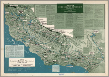
1963 California Water Resources Development. Separate Map California Water Resources Development, … |

1951 Existing and Proposed Water Developments … Separate Map Existing and Proposed Water Developments … |

1968 California Water Resources Developments. Separate Map California Water Resources Developments. … |

1974 California -- Water Resources Developmen … Wall Map Surface Water Resources Development in C … |

1966 Hydrology I. National Atlas Hydrology I. |

1966 Hydrology II. National Atlas Hydrology II. |

1966 Hydrogeology. National Atlas Hydrogeology. |

1966 Railway and Water Transport. National Atlas Railway and Water Transport. |

1943 Branch of Research and Analysis, OSS World Atlas Drainage Basins 7. |

1853 Berketten und Fluss_Systeme in Africa. ( … World Atlas Berketten und Fluss_Systeme in Africa. |

1850 Berketten und Fluss_Systeme in Africa. ( … World Atlas Berketten und Fluss_Systeme in Africa. |

1852 Comparative Form and Extent of the Inlan … Physical Atlas Comparative Form and Extent of the Inlan … |

1881 England and Wales to Illustrate the Hydr … Statistical Atlas England and Wales to Illustrate the Hydr … |

1881 Scotland to Illustrate the Hydrography ( … Statistical Atlas Scotland to Illustrate the Hydrography ( … |

1881 Ireland to Illustrate the Hydrography (W … Statistical Atlas Ireland to Illustrate the Hydrography (W … |

1846 131. Carte de la Chaine des Alpes. World Atlas 131. Carte de la Chaine des Alpes. |

1845 28. Carte Physique de L'Europe. World Atlas 28. Carte Physique de L'Europe. |

1845 36. Carte Physique de la France. World Atlas 36. Carte Physique de la France. |

1845 79. Carte Physique (Oro-Hydrographique) … World Atlas 79. Carte Physique (Oro-Hydrographique) … |

1967 Hydrography. Pergamon World Atlas. World Atlas Hydrography. Pergamon World Atlas. Perga … |

1967 Water Economics. Pergamon World Atlas. World Atlas Water Economics. Pergamon World Atlas. P … |

1875 Mappemonde. World Atlas Mappemonde projectee sur l'Horizon de Pa … |

1888 California Drainage Areas Separate Map Drainage Area Map to Accompany Report on … |

1887 Topographical and Irrigation Map of the … Separate Map California State Engineering Department. … |