|
|
Author
Schonberg & Co.
Full Title
Hindoostan.
Publisher
Schonberg & Co.
Author
Society for the Diffusion of Useful Knowledge (Great Britain)
Full Title
India. Bengal Presidency. (India VIII). J. & C. Walker sculpt. Published under the superintendence of the Society for the Diffusion of Useful Knowledge. London, published by Baldwin & Cradock, 47 Paternoster Row, June 1st. 1831. (London: Chapman & Hall, 1844)
Publisher
Chapman and Hall
Author
Colton, G.W.
Full Title
Colton's Hindostan or British India. Published By G. W & C. B. Colton & Co., No. 182 William St. New York.
Publisher
G. W & C. B. Colton & Co.
Author
Colton, G.W.
Full Title
Colton's Hindostan or British India. Published By G. W & C. B. Colton & Co., No. 172 William St. New York.
Publisher
G. W & C. B. Colton & Co.
Author
Cram, George Franklin
Full Title
India. (inset) South Eastern Provinces of India.
Publisher
George F. Cram
Author
Hall, S. (Sidney)
Full Title
Hindoostan. By Sidney Hall. London, published by Longman, Rees, Orme, Brown & Green, Paternoster Row, Novr. 1st. 1827.
Publisher
Longman, Rees, Orme, Brown and Green
Author
[Sonnenschein, W. Swan, Allen, Bevan, G.P.]
Full Title
Physical Map of the Indian Empire. W. Swan Sonnenschein & Allen's Plastic School Atlas. (inset) The British Isles on the same scale.
Publisher
Sonnenschein & Allen
Author
[Sonnenschein, W. Swan, Allen, Bevan, G.P.]
Full Title
Physical Map of the Indian Empire. W. Swan Sonnenschein & Allen's Plastic School Atlas. (inset) The British Isles on the same scale.
Publisher
Sonnenschein & Allen
Author
[Sonnenschein, W. Swan, Allen, Bevan, G.P.]
Full Title
Political Map of the Indian Empire. W. Swan Sonnenschein & Allen's Plastic School Atlas. (inset) The British Isles on the same scale.
Publisher
Sonnenschein & Allen
Author
Johnson, A.J.
Full Title
Johnson's Hindoostan and Farther India. Entered .... 1867.
Publisher
A.J. Johnson
Author
Ruhle von Lilienstern, August
Full Title
Hindustan. Berlin 1824. R.v.L.
Publisher
C.G. Luderitz
Author
[Edward Stanford Ltd., Stanford, Edward]
Full Title
India and the adjacent parts of Beluchistan, Afghanistan, Turkestan, the Chinese Empire, and Siam. India South. London atlas series. Stanford's Geogl. Estabt. London : Edward Stanford, 26 & 27, Cockspur St., Charing Cross, S.W. (1901)
Publisher
Edward Stanford
Author
[Edward Stanford Ltd., Stanford, Edward]
Full Title
Burma and adjacent countries. London atlas series. Stanford's Geogl. Estabt. London : Edward Stanford, 26 & 27, Cockspur St., Charing Cross, S.W. (1901)
Publisher
Edward Stanford
Author
Flemming, Carl
Full Title
Vorderindien. Lithographie, Druck u. Verlag von C. Flemming in Glogau. (1855)
Publisher
C. Flemming
Author
Arrowsmith, John
Full Title
India, by J. Arrowsmith. London, pubd. 15 Feby. 1832 by J. Arrowsmith, 35 Essex Street, Strand.
Publisher
John Arrowsmith
Author
Burr, David H., 1803-1875
Full Title
Hindostan. Entered ... 1835 by Thomas Illman ... New York.
Publisher
D.S. Stone
Author
W. & A.K. Johnston Limited
Full Title
India. East India Is.
Publisher
W. & A.K. Johnston Limited
Author
Mitchell, Samuel Augustus
Full Title
Hindoostan. (inset) Delta of the Ganges.
Publisher
Thomas, Cowperthwait & Co.
Author
Society for the Diffusion of Useful Knowledge (Great Britain)
Full Title
India.
Publisher
Edward Stanford
Author
[Tardieu, Ambroise, Vuillemin, A., Duvotenay, Erhard, Testarode, E.]
Full Title
Prequ'ile de L'Inde.
Publisher
Furne Et Cie
Author
Vandermaelen, Philippe, 1795-1869
Full Title
Bengale. Asie no. 95. (Dresse par Ph. Vandermaelen, lithographie par H. Ode. Deuxieme partie. - Asie. Bruxelles. 1827)
Publisher
Ph. Vandermaelen
Author
[Dower, John, Higgins, W.M.]
Full Title
India.
Publisher
[W.S. Orr, Chambers, W. & R.]
Author
[Covens et Mortier, Lisle, Guillaume de, 1675-1726]
Full Title
Carte des Cotes de Malabar et de Coromandel, presentee au Roy. Par Guillaume de l'Isle. A Amsterdam, Chez J. Covens et C. Mortier, Geographes. (Title in upper margin:) Orarum Malabariae, Coromandelae, &c. tabula accuratissima. (1742)
Publisher
Covens & Mortier
Author
Letts, Son & Co.
Full Title
General map of India. Letts's popular atlas. Letts, Son & Co. Limited, London. (1883)
Publisher
Letts, Son & Co.
Author
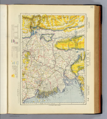
Letts, Son & Co.
Full Title
Statistical & general map of India. No. 8. Letts's popular atlas. Letts, Son & Co. Limited, London. (1883)
Publisher
Letts, Son & Co.
Author
[Rennell, James, 1742-1830, Robert Laurie & James Whittle]
Full Title
A map of the north part of Hindostan or a geographical survey of the provinces of Bengal, Bahar, Awd, Ellahabad, Agra and Delhi. By Major James Rennell, F.R.S., Engineer, Surveyor General to the Honourable the East India Company. Published 12th May, 1794 by Laurie & Whittle, 53, Fleet Street, London.
Publisher
Laurie & Whittle
Author
Robert Laurie & James Whittle
Full Title
(An actual survey, of the provinces of Bengal, Bahar &c. North half. By Major James Rennell, Engineer, Surveyor General to the Honourable the East India Company, published by permission of the court of directors, from a drawing in their possession; by A. Dury. Wm. Haydon sculpt. Published 12th May, 1794, by Laurie & Whittle, 53 Fleet Street, London)
Publisher
Laurie & Whittle
Author
[Dury, Andrew, Rennell, James, 1742-1830, Robert Laurie & James Whittle]
Full Title
An actual survey, of the provinces of Bengal, Bahar &c. (South half). By Major James Rennell, Engineer, Surveyor General to the Honourable the East India Company, published by permission of the court of directors, from a drawing in their possession; by A. Dury. Wm. Haydon sculpt. Published 12th May, 1794, by Laurie & Whittle, 53 Fleet Street, London.
Publisher
Laurie & Whittle
Author
[Bartholomew, J. G. (John George), 1860-1920, John Bartholomew & Co.]
Full Title
India - north-eastern section. (with Calcutta Region). The Edinburgh Geographical Institute, John Bartholomew & Co. "The Times" atlas. (London: The Times, 1922)
Publisher
The Times
Author
[Bartholomew, J. G. (John George), 1860-1920, John Bartholomew & Co.]
Full Title
Provinces of the Lower Ganges. The Edinburgh Geographical Institute, John Bartholomew & Co. "The Times" atlas. (London: The Times, 1922)
Publisher
The Times
Author
Lisle, Guillaume de, 1675-1726
Full Title
Carte des Cotes de Malabar et de Coromandel, presentee au Roy. Par son tres humble, tres obeissant et tres fidele sujet, G. Delisle. Marin sculpsit. A Paris, chez l'Auteur G. Delisle Premier Geographe de Sa Majeste de l'Academie Rle. des Sciences, sur le Quay de l'Horloge, av. Pr. 1723.
Publisher
Guillaume DeLisle, Quai de l'Horloge
Author
Anville, Jean Baptiste Bourguignon d, 1697-1782
Full Title
Carte de l'Inde. (Northern section). Dressee pour la Compagnie des Indies par le Sr. d'Anville, Secretaire de S.A.S.Mgr. le Duc d'Orleans. (Paris), Novembre 1752. (Grave par Guill? De-la-Haye).
Publisher
J.B.B. D'Anville.
Author
Anville, Jean Baptiste Bourguignon d, 1697-1782
Full Title
(Carte de l'Inde. Southern section. Dressee pour la Compagnie des Indies par le Sr. d'Anville, Secretaire de S.A.S.Mgr. le Duc d'Orleans. Paris, Novembre 1752. Grave par) Guill? De-la-Haye.
Publisher
J.B.B. D'Anville.
Author
[Stieler, Adolf, Stulpnagel, F.v.]
Full Title
No. XLIX. Stieler's Hand-Atlas (No. 44b). Vorder-Indien oder das Indo-Britische Reich.
Publisher
Justus Perthes
Author
[Stieler, Adolf, Stulpnagel, F.v.]
Full Title
No. XLIX. Stieler's Hand-Atlas (No. 44b). Vorder-Indien oder das Indo-Britische Reich.
Publisher
Justus Perthes
Author
[Stieler, Adolf, Petermann, A.]
Full Title
Stieler's Hand-Atlas No. 63. Indien & Inner-Asien in 2 Blattern. (Bombay. Calcutta. Madras. Point de Galle.)
Publisher
Justus Perthus
Author
Rennell, James, 1742-1830
Full Title
A map of Bengal, Bahar, Oude & Allahabad with part of Agra and Delhi exhibiting the course of the Ganges from Hurdwar to the Sea. By James Rennell, F.R.S., late Surveyor Genl. in Bengal. London: printed for Wm. Faden, Geogr. to the King, Charing Cross, Jany. 1st, 1786.
Publisher
William Faden
Author
Smith, Charles
Full Title
Hindoostan.
Publisher
C. Smith
Author
Kirkwood, Robert
Full Title
Hindoostan.
Publisher
[Robert Kirkwood, John Smith & Son]
Author
Wilkinson, Robert
Full Title
Hindoostan Divided into Soubahs according to the Ayin Acbaree.
Publisher
Robert Wilkinson
Author
Wilkinson, Robert
Full Title
Hindoostan Divided into Soubahs according to the Ayin Acbaree.
Publisher
R. Wilkerson
Author
[Oddy, S.A., Wallis, James]
Full Title
Hindoostan. London, Published by S.A. Oddy, No. 20 Warwick Lane. Engraved by Jas. Wallis.
Publisher
S.A. Oddy
Author
Cram, George Franklin
Full Title
Indian Empire.
Publisher
A.C. Shewey and Co.
Author
Dussieux, L.
Full Title
145. Cartes de l'Inde pour servir a l'Histoire de la rivalite de la France et de l'Angleterre dans l'Inde10. Epoque de la Puissance Francaise Sous Dupleix et de Bussy avant les traites de Madres et de Paris. 146. Cartes de l'Inde pour servir a l'Histoire de la rivalite de la France et de l'Angleterre dans l'Inde 20. Commencements de la Puissance Anglaise. Sous Clive et Warren Hastings jusqu'au traite de Versailles 1783.
Publisher
Jacques Lecoffre et Comp.
Author
Cummins Map Co.
Full Title
India. (inset) Bombay and Vicinity. Calcutta and Vicinity.
Publisher
Cummins Map Co.
Author
USSR (Union of Soviet Socialist Republics).
Full Title
137-138. North India, Nepal, East Pakistan. The World Atlas.
Publisher
USSR
Author
USSR (Union of Soviet Socialist Republics).
Full Title
142. Lower Ganga (Ganges) Valley. The World Atlas.
Publisher
USSR
Author
Colton, G.W.
Full Title
Colton's Hindoostan or British India. Published By G. W & C. B. Colton & Co. No. 172 William St. New York.
Publisher
G. W & C. B. Colton & Co.
Author
[Brue, Adrien Hubert, 1786-1832, Levasseur, E.]
Full Title
Carte Generale des Indes en Deca et au dela du Gange. Dresse par A. Brue, Geographe. Reoue par E. Levasseur, Membre de l'Institut, Institut Geographique de Paris. Ch. Delagrave. Editeur de la Societe de Geographie. 58 Rue des Ecoles. Atlas Universel en 67 feuilles No. 46. (inset) Punjab.
Publisher
Institut Geographique de Paris
Author
Polish Army Topography Service
Full Title
India - North. (inset) Bombay (Mumbai). (inset) Delhi. (inset) Calcutta. Pergamon World Atlas. Pergamon Press, Ltd. & P.W.N. Poland 1967. Sluzba Topograficzna W.P.
Publisher
Pergamon Press
|