Browse All

1805 England and Wales. World Atlas England and Wales. |

1805 France Divided into Provinces. World Atlas France Divided into Provinces. |

1805 France Divided into Departments. World Atlas France Divided into Departments. |

1805 Africa. World Atlas A new map of Africa, from the latest aut … |

1805 Egypt. World Atlas A new map of Egypt, from the latest auth … |

1805 Western Terr., Kentucky, Pennsylvania, e … World Atlas A new map of part of the United States o … |

1805 France. World Atlas France Divided into Provinces. |

1805 France. World Atlas France Divided into Departments. |

1806 Covers: Wilkinson's General Atlas of the … World Atlas (Covers to) Wilkinson's General Atlas of … |

1806 Title Page: Wilkinson's General Atlas of … World Atlas (Title Page) Wilkinson's General Atlas o … |

1806 Text: Geography. World Atlas (Text Page) Geography. |

1806 Table of Contents: Contents ... 1805. World Atlas (Table of Contents) Contents ... 1805. |

1800 World. World Atlas The World from the Discoveries & Observa … |

1800 Mercators Chart. World Atlas A New Mercator's Chart Drawn from the La … |

1802 Europe. World Atlas Europe. |

1794 A New Map of Great Britain and Ireland. World Atlas A New Map of Great Britain and Ireland. |

1794 A New and Accurate Map of Scotland. World Atlas A New and Accurate Map of Scotland. |

1806 Ireland. World Atlas Ireland as Represented in the Imperial P … |
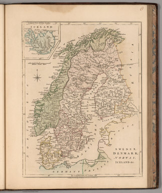
1794 Sweden, Denmark, Norway, Iceland &c. World Atlas Sweden, Denmark, Norway, Iceland &c. |

1800 A New Map of Denmark and Holstein. World Atlas A New Map of Denmark and Holstein. |

1801 The Russian Empire in Europe and Asia. World Atlas The Russian Empire in Europe and Asia. |

1799 Russia in Europe. World Atlas Russia in Europe with the Dismemberments … |

1799 Poland World Atlas Poland, with its Dismembered Provinces, … |

1791 A New Map of Prussia. World Atlas A New Map of Prussia. |

1791 Germany. World Atlas A New Map of Germany divided into Circle … |

1794 Upper Saxony with the Marquistate of Lus … World Atlas The Circle of Upper Saxony with the Marq … |

1794 Lower Saxony. World Atlas The Circle of Lower Saxony. |

1794 Wesphalia. World Atlas Circle of Wesphalia. |

1802 Rhine with Franconia World Atlas Lower & Upper Rhine with Franconia. |

1802 Swabia (Southern Germany). World Atlas Swabia. |

1806 Bavaria, (Southern Germany). World Atlas Bavaria. |

1794 Austria. World Atlas A Map of the Circle of Austria. |

1800 Bohemia including Moravia, Austrian Sile … World Atlas Bohemia including Moravia, Austrian Sile … |

1794 Silesia (Southern Poland). World Atlas A Map of the Dutchy of Silesia. |

1794 Hungary and Transilvania (Transylvania). World Atlas Hungary and Transilvania. |

1799 The Seven United Provinces with their De … World Atlas The Seven United Provinces with their De … |

1799 A New and Accurate Map of the Netherland … World Atlas A New and Accurate Map of the Netherland … |

1794 Spain and Portugal. World Atlas Spain and Portugal. |

1794 Switzerland. World Atlas Switzerland with its Subjects & Allies. |

1806 Italy, Sicily, Sardinia, Corsica &c. World Atlas Italy, Sicily, Sardinia, Corsica &c. |

1794 A New Map of the Dominions of the King o … World Atlas A New Map of the Dominions of the King o … |

1794 The North East Part of Italy Comprising … World Atlas The North East Part of Italy Comprising … |

1800 Estates of the Church, Grand Duchy of Tu … World Atlas Estates of the Church, Grand Duchy of Tu … |

1800 Naples and Sicily. World Atlas Naples and Sicily. (inset) Malta and Goz … |

1800 Turkey in Europe. World Atlas Turkey in Europe. |

1800 Asia. World Atlas Asia. |

1794 Turkey in Asia. World Atlas Turkey in Asia. |

1806 Hindoostan Divided into Soubahs accordin … World Atlas Hindoostan Divided into Soubahs accordin … |

1800 A New and Accurate Map of the Southern P … World Atlas A New and Accurate Map of the Southern P … |

1801 China. World Atlas China, Contains 15 Subject Provinces inc … |