1856
Alabama.
World Atlas
Alabama. Published By J.H. Colton & Co.
…
|

1865
Mississippi and Alabama.
World Atlas
Mississippi and Alabama.
|

1827
Partie des Etats Unis. Amer. Sep. 56.
World Atlas
Partie des Etats Unis. Amer. Sep. no. 56
…
|

1889
Alabama.
World Atlas
Railroad and County Map of Alabama. Geo.
…
|

1886
Alabama.
World Atlas
Colton's Alabama. Published by G. W & C.
…
|

1874
Alabama.
World Atlas
Colton's Alabama. Published by G. W & C.
…
|

1866
Alabama.
World Atlas
Colton's Alabama. Published by G.W. & C.
…
|

1901
Alabama.
World Atlas
Alabama.
|

1853
A New Map of Alabama
World Atlas
A New Map of Alabama, with its Roads and
…
|

1845
Alabama.
World Atlas
Neueste Karte von Alabama mit seinen Can
…
|

1864
Georgia And Alabama
World Atlas
Johnson's Georgia And Alabama Published
…
|

1855
A new map of Alabama
World Atlas
A new map of Alabama, with its Roads & D
…
|

1873
South Carolina, Georgia, Florida, Alabam
…
World Atlas
Map of South Carolina, Georgia, Florida,
…
|

1953
Alabama. Mississippi.
World Atlas
Alabama. Mississippi. U.S. States. (inse
…
|

1870
Georgia and Alabama.
World Atlas
Johnson's Georgia and Alabama. Entered .
…
|

1874
Georgia and Alabama.
World Atlas
Johnson's Georgia and Alabama. Published
…
|

1833
Louisiana and Mississippi.
World Atlas
Louisiana and Mississippi. By H.S. Tanne
…
|

1825
Georgia & Alabama.
World Atlas
Georgia and Alabama. By H.S. Tanner. 182
…
|

1848
Alabama.
World Atlas
A New Map of Alabama with its Roads & Di
…
|

1872
United States ... South Eastern States.
World Atlas
United States North America According to
…
|

1845
Alabama.
World Atlas
Alabama. (Written and engraved by Jos. P
…
|

1848
Map of the State of Alabama.
World Atlas
Map of the State of Alabama.
|

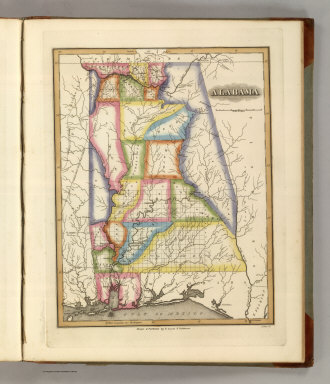
1822
Alabama.
World Atlas
Alabama. Drawn and Published by F. Lucas
…
|

1824
Map of the Country belonging to the Cher
…
World Atlas
Map of the Country belonging to the Cher
…
|

1835
Map of the State of Alabama.
World Atlas
Map of the State of Alabama. By David H.
…
|

1849
New Map of Alabama with its Roads & Dist
…
World Atlas
A New Map of Alabama with its Roads & Di
…
|

1865
County map of Georgia, and Alabama
World Atlas
County map of Georgia, and Alabama. Ente
…
|

1865
County map of North Carolina. Map of sou
…
World Atlas
County map of North Carolina. (Scale: 1:
…
|

1874
County map of the States of Georgia and
…
World Atlas
County map of the States of Georgia and
…
|

1877
County map of the States of Georgia and
…
World Atlas
County map of the States of Georgia and
…
|

1860
Georgia and Alabama.
World Atlas
Johnson's Georgia And Alabama By Johnson
…
|

1850
Alabama.
World Atlas
A New Map of Alabama.
|

1857
A New Map of Alabama
World Atlas
A New Map of Alabama. With its Roads & D
…
|

1868
County map of Georgia and Alabama
World Atlas
County map of Georgia and Alabama. Enter
…
|

1841
Alabama.
World Atlas
Alabama. Engraved by G.W. Boynton. Enter
…
|

1883
E. United States 8.
World Atlas
Eastern United States. No. 8. Letts's po
…
|

1883
E. United States 9.
World Atlas
Eastern United States. No. 9. Letts's po
…
|

1804
Mississippi Territory.
World Atlas
Mississippi Territory. Drawn by S. Lewis
…
|

1812
Mississippi Territory.
World Atlas
Mississippi Territory. Drawn by S. Lewis
…
|

1890
Georgia, Alabama.
World Atlas
County map of the states of Georgia and
…
|

1752
Carte de la Louisiane.
World Atlas
Carte de la Louisiane. Par le Sr. d'Anvi
…
|

1870
Georgia, Alabama.
[State Atlas, World Atlas]
County map of Georgia, and Alabama. Ente
…
|

1880
Georgia, Alabama.
World Atlas
County map of the states of Georgia and
…
|

1880
Florida, Mobile.
World Atlas
County map of Florida. (with) Mobile. En
…
|

1840
Map of the State of Alabama.
World Atlas
Map of the State of Alabama.
|

1823
Georgia and Alabama.
World Atlas
Georgia and Alabama By H.S. Tanner. Publ
…
|

1824
Georgia and Alabama.
World Atlas
Georgia and Alabama By H.S. Tanner. Publ
…
|

1825
Georgia and Alabama.
World Atlas
Georgia and Alabama By H.S. Tanner. Impr
…
|

1859
Alabama.
World Atlas
A New Map of Alabama with its Roads & Di
…
|

1883
New Rail Road and County Map of Alabama,
…
World Atlas
New Rail Road and County Map of Alabama,
…
|