Who What Where WhenREMOVEWHO
WHEN
|
Author
Letts, Son & Co.
Full Title
Watershed map of England & Wales. No. 6. Letts's popular atlas. Letts, Son & Co. Limited, London. (1883)
Publisher
Letts, Son & Co.
Author
Letts, Son & Co.
Full Title
London, West. London, East. Letts's popular atlas. Letts, Son & Co. Lim(it)ed, London. (1883)
Publisher
Letts, Son & Co.
Author
Letts, Son & Co.
Full Title
Geological map of the environs of London. Letts's popular atlas. Letts, Son & Co. Limited, London. (1883)
Publisher
Letts, Son & Co.
Author
Letts, Son & Co.
Full Title
Orographical map of the environs of London. Letts's popular atlas. Letts, Son & Co. Limited, London. (1883)
Publisher
Letts, Son & Co.
Author
Letts, Son & Co.
Full Title
Plan of Liverpool. (with) Plan, section of tunnel under River Mersey, now constructing. Letts's popular atlas. Letts, Son & Co. Limited, London. (1883)
Publisher
Letts, Son & Co.
Author
[Kitchin, Thomas, Robert Laurie & James Whittle]
Full Title
Great Britain and Ireland. Drawn from the best surveys &c. by Thos. Kitchin, Geographer. London, Published by Laurie & Whittle, 53 Fleet Street. 12th May 1794.
Publisher
Laurie & Whittle
Author
[Kitchin, Thomas, Phillips, J., Robert Laurie & James Whittle]
Full Title
A new map of England & Wales. (North half). Drawn from several surveys &c. on the new projection : corrected from astronomical observations & the places marked where the observatns. were made. By Thos. Kitchin, Geogr. The canals inserted to 1792 by J. Phillips, Surveyor. London, Published by Laurie & Whittle, No. 53, Fleet Street, as the act directs, 12th May, 1794.
Publisher
Laurie & Whittle
Full Title
(A new map of England & Wales. (South half). Drawn from several surveys &c. on the new projection : corrected from astronomical observations & the places marked where the observatns. were made. By Thos. Kitchin, Geogr. The canals inserted to 1792 by J. Phillips, Surveyor. London, Published by Laurie & Whittle, No. 53, Fleet Street, as the act directs, 12th May, 1794)
Publisher
Laurie & Whittle
Author
[Kitchin, Thomas, Phillips, J., Robert Laurie & James Whittle]
Full Title
(Composite of) A new map of England & Wales. Drawn from several surveys &c. on the new projection : corrected from astronomical observations & the places marked where the observatns. were made. By Thos. Kitchin, Geogr. The canals inserted to 1792 by J. Phillips, Surveyor. London, Published by Laurie & Whittle, No. 53, Fleet Street, as the act directs, 12th May, 1794.
Publisher
Laurie & Whittle
Author
[Enouy, Joseph Christopher, Robert Laurie & James Whittle]
Full Title
The invasions of England and Ireland with all their civil wars since the conquest. Compiled & drawn by J. Enouy, Geographer. London, Published by Laurie & Whittle, Fleet Street, 15th Septr. 1797. 2d edition, Augt. 12th, 1801. S. Neele sculpt.
Publisher
Laurie & Whittle
Author
Arrowsmith, Aaron
Full Title
United Kingdoms of Great Britain and Ireland. From Arrowsmith's map of the British Isles. Hooker sc. (Published by John Conrad & Co., Philadelphia. 1804)
Publisher
J. Conrad
Full Title
England and Wales. From the various surveys of England. (Benjamin?) Jones sc. (Published by John Conrad & Co., Philadelphia. 1804)
Publisher
J. Conrad
Full Title
Remote British Isles. 1. Shetland Islands. 2. Islands of Scilly. 3. Jersey and Guernsey. 1. From Donelly and others. 2. From various charts. 3. From Dobree. Marshall sculp. (Published by John Conrad & Co., Philadelphia. 1804)
Publisher
J. Conrad
Author
Arrowsmith, Aaron
Full Title
United Kingdoms of Great Britain and Ireland. From Arrowsmith's map of the British Isles. Hooker sc. (Boston: Published by Thomas & Andrews. 1812)
Publisher
Thomas & Andrews
Author
Touring club italiano
Full Title
(Legend to) Belgio e Olanda, Belgique, Belgie, Nederland. Gran Bretagna, Great Britain. Propr. Artistico-letteraria del T.C.I. Ufficio cartografico del T.C.I. (1929)
Publisher
Touring club italiano
Author
Touring club italiano
Full Title
Gran Bretagna, Great Britain. Propr. Artistico-letteraria del T.C.I. Ufficio cartografico del T.C.I. (1929)
Publisher
Touring club italiano
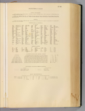
Author
Touring club italiano
Full Title
(Legend to) Inghilterra e Galles, England and Wales. Propr. Artistico-letteraria del T.C.I. Ufficio cartografico del T.C.I. (1929)
Publisher
Touring club italiano
Author
Touring club italiano
Full Title
Inghilterra e Galles, England and Wales. Propr. Artistico-letteraria del T.C.I. Ufficio cartografico del T.C.I. (1929)
Publisher
Touring club italiano
Author
Goodrich, S.G.
Full Title
Pacific Ocean. British Islands. G. Boynton Sc. Entered ... by S.G. Goodrich of Massachusetts. (Boston: Gray & Bowen ... 1831)
Publisher
Gray & Bowen
Author
Mitchell, Samuel Augustus
Full Title
County map of England, and Wales. Entered ... 1879 by S. Augustus Mitchell ... Washington. (1880)
Publisher
S.A. Mitchell
Full Title
County map of England, and Wales. Copyright 1887 by Wm. M. Bradley & Bro. (1890)
Publisher
John Y. Huber & Co.
Full Title
British Isles. (with) The Channel Islands. (with) The Shetland Islands. (Published at the office of "The Times," London, 1895)
Publisher
The Times
Full Title
England and Wales, north. (Published at the office of "The Times," London, 1895)
Publisher
The Times
Full Title
England and Wales, south. (Published at the office of "The Times," London, 1895)
Publisher
The Times
Author
[Bartholomew, J. G. (John George), 1860-1920, John Bartholomew & Co.]
Full Title
British Isles -- bathy-orographical. The Edinburgh Geographical Institute, John Bartholomew & Co. "The Times" atlas. (London: The Times, 1922)
Publisher
The Times
Author
[Bartholomew, J. G. (John George), 1860-1920, John Bartholomew & Co.]
Full Title
British Isles - vegetation & climate. The Edinburgh Geographical Institute, John Bartholomew & Co. "The Times" atlas. (London: The Times, 1922)
Publisher
The Times
Full Title
Grossbritannien und Irland. (with) Die Canal Inseln. (with) Die Shetland Inseln. (Richard Andree. Herausgegeben von der Geographischen Anstalt von Velhagen & Klasing in Leipzig. 1881)
Publisher
Velhagen & Klasing
Author
Moll, Herman, d. 1732
Full Title
A general map of Great Britain and Ireland, with part of Germany, Holland, Flanders, France &c. Agreeable to modern history. By H. Moll Geographer. (with Farro, Schetland and Orkney islands). (Printed for Tho: Bowles next ye Chapter House in St. Pauls Church Yard, & John Bowles at the Black Horse in Cornhill, London 1736?)
Publisher
Thos. Bowles and John Bowles
Author
Greenleaf, Jeremiah
Full Title
British Islands.
Publisher
G.R. French
Author
Seaman, James V.
Full Title
England and Wales. Published by J.V. Seaman, 296 Pearl St., N. York. (1821)
Publisher
James V. Seaman
Author
Mitchell, Samuel Augustus
Full Title
County map of England and Wales. Entered ... 1870 by S. Augustus Mitchell, Jr. ... Pennsylvania.
Publisher
[R.A. Campbell, S.A. Mitchell, Jr.]
Author
Fenner, Rest.
Full Title
Britannicae Insulae. Fenner Sc., Paternoster Row. (London, Joseph Thomas, 1835)
Publisher
Joseph Thomas
Author
Fenner, Rest.
Full Title
British Isles. Fenner Sc., Paternoster Row. (London, Joseph Thomas, 1835)
Publisher
Joseph Thomas
Author
[Stieler, Adolf, Stulpnagel, F.v.]
Full Title
(Composite of) No. XVII, XIX, XX. Stieler's Hand-Atlas (No. 15b, 15c, 15d.) England und Wales, Schotland, Ireland.
Publisher
Justus Perthes
Author
[Stieler, Adolf, Stulpnagel, F.v.]
Full Title
No. XVII. Stieler's Hand-Atlas (No. 15a.) Die Brittischen Inseln und Die Nord-See.
Publisher
Justus Perthes
Author
[Stieler, Adolf, Stulpnagel, F.v.]
Full Title
No. XVIII. Stieler's Hand-Atlas (No. 15b.) England und Wales.
Publisher
Justus Perthes
Author
Carey, Mathew
Full Title
An Accurate Map Of England and Wales With The Principal Roads from the best Authorities. Doolittle Sc. New Haven. Engraved for Carey's American Edition of Guthrie's Geography improved.
Publisher
Mathew Carey
Author
Carey, Mathew
Full Title
An Accurate Map Of England and Wales With The Principal Roads from the best Authorities. Doolittle Sc. New Haven. Engraved for Carey's American Edition of Guthrie's Geography improved.
Publisher
Mathew Carey
Author
[Bowen, Emanuel, Gibson, John]
Full Title
England And Wales. (to accompany) Atlas Minimus or a New Set of Pocket Maps of the Several Empires, Kingdoms and States of the Known World, with Historical Extracts relative to each. Drawn and Engraved by J. Gibson from the Best Authorities, Revis'd, Corrected and Improv'd by Eman: Bowen Geographer to His Majesty.
Publisher
J. Newberry
Author
[Andree, Richard, Scobel, Albert]
Full Title
Ubersichtskarte von Groszbritannien und Irland. Mai.1905. Bearb. v. G. Jungk. Lithogr. v. P. Franke, H. Anschutz u. A.Soeder. Flachentreue Azmut-Projektion. (insets : nebenkarten) Shetland und Orkney-Inseln ; Umgebung von London ; Britische Kolonien.
Publisher
Velhagen & Klasing
Author
[Andree, Richard, Scobel, Albert]
Full Title
England und Wales, Sudliche Halfte. Juni 1905. Bearbeitet v. M. Oschmann u. E. Umbreit. Lithogr. v. H. Anschutz, O. Simon u. G. Kirchner.
Publisher
Velhagen & Klasing
Author
[Andree, Richard, Scobel, Albert]
Full Title
England und Wales, Nordliche Halfte. Sept. 1905. Bearbeitet von. E. Umbreit. Lithogr. v. R. Wagner, K. Kung u. G. Kirchner.
Publisher
Velhagen & Klasing
Author
Mitchell, Samuel Augustus
Full Title
Map of England. Entered according to Act of Congress in the year 1859 by Charles Desilver in the Clerk's office if the District Court of the Eastern District of Pennsylvania. 49.
Publisher
Charles Desilver.
Author
[Geographisches Institut (Weimar, Germany), Kiepert, Heinrich, 1818-1899]
Full Title
Die Britischen Inseln, oder die Vereinigten Konigreich. (with) Die wichtigsten Fabrik-Districte im nordwestlichen England ... (with) Die wichtigsten Kohlen-Districte in Nordengland. (with Die Shetland Inseln). (with) Die Normannischen Inseln. Gezeichnet v. H. Kiepert. Gestochen v. E. Kratz.
Publisher
Weimar Geo Inst.
Author
[Geographisches Institut (Weimar, Germany), Graf, Carl, 1822-ca. 1897, Kiepert, Heinrich, 1818-1899]
Full Title
England. (with) London mit seinen nachsten Umgebungen. Gez. v. C. Graf, revidirt v. H. Kiepert. Weimar, Verlag des Geograph. Instituts, 1856.
Publisher
Weimar Geo Inst.
Author
Faden, William, 1750?-1836
Full Title
A map of England, Wales & Scotland, describing all the direct and principal cross roads in Great Britain, with the distances measured between the market towns and from London; to accompany Paterson's Book of the roads, by W. Faden, Geographer to the King, and to the Prince of Wales. Charing Cross, August 12th, 1801.
Publisher
William Faden
Author
[Delarochette, Louis Stanislas d'Arcy, Dicquemare, Abbe (Jacques Francois), 1733-1789, Faden, William, 1750?-1836]
Full Title
A chart of the British Channel and the Bay of Biscay, with a part of the North Sea, and the entrance of St. George's Channel. By Monsr. L. Abbe Diquemare (i.e. Dicquemare), with several emendations, and many useful additions &c. by L.S. De la Rochette. 3d. edition, MDCCXCIV. London, engraved & published as the Act directs by W. Faden, succr. to the late T. Jefferys, Geogr. to the King. Charing Cross, Sept. 17th, 1794.
Publisher
William Faden
Author
[Stieler, Adolf, Petermann, A.]
Full Title
Stieler's Hand-Atlas ... No. 15a. Die Britischen Inseln und das Umliegende Meer. (insets) London. Crystall Palast. Helgoland. Rockall (View).
Publisher
Justus Perthes
Author
Stieler, Adolf
Full Title
England, Schottland und Ireland; entw. u. gez. v. Ad. Stieler 1816. gest v. L. Hess. (on upper right margin) Hand Atl. No. 15. (to accompany) Hand-Atlas uber alle Theile der Erde, nach dem neuesten Zustande und uber das Weltgebaude. (insets) Umgebungen von London; Haf. v. Edinburgh; Hafen von Portsmouth.
Publisher
Justus Perthes
Author
Stieler, Adolf
Full Title
England; ohne die nordl spitze wetche Northumberland durham u. einen Theil v, Cumberland enthalt. entw. u. gez. v. Ad. Stieler 1817. L. Michaelis scupl. (on upper right margin) Hand Atl. No. 15b. (to accompany) Hand-Atlas uber alle Theile der Erde, nach dem neuesten Zustande und uber das Weltgebaude.
Publisher
Justus Perthes
|