Who What Where WhenREMOVEWHERE
WHOShow More |
Author
Dussieux, L.
Full Title
89. Carte de l'Empire d'Allemagne apres le recez de 1803.
Publisher
Jacques Lecoffre et Comp.
Author
Dussieux, L.
Full Title
90. Carte Physique et Politique des Etats Secondaires de la Confederation Germanique.
Publisher
Jacques Lecoffre et Comp.
Author
Dussieux, L.
Full Title
93. Carte pour servir a l'histoire de la formation territoriale de la Monarchie Prussienne.
Publisher
Jacques Lecoffre et Comp.
Author
Dussieux, L.
Full Title
94. Carte pour servir a l'histoire de la Formation Territoriale de l'Empire d'Autruche.
Publisher
Jacques Lecoffre et Comp.
Author
Andriveau-Goujon, J.
Full Title
Carte generale de l'Allemagne, comprenant l'ensemble des etats de l'Europe Centrale, publiee par J. Andriveau-Goujon, Geographe-Editeur, Rue du Bac, no. 21, Paris, 1850.
Publisher
J. Andriveau-Goujon
Author
Rizzi Zannoni, Giovanni Antonio Bartolomeo, 1736-1814
Full Title
L'Alemagne divisee par cercles. Par Mr. Rizzi Zannoni de la Societe Royale de Gottingue, proffesseur de geographie. A Paris, Chez Lattre Graveur, rue St. Jacques, pres la Fontaine St. Severin a la Ville de Bordeaux. Avec privil. du Roy. (178-?)
Publisher
Lattre & Delalain
Author
Rizzi Zannoni, Giovanni Antonio Bartolomeo, 1736-1814
Full Title
(Carte de l'Empire d'Alemagne avec les Etats de Boheme. 1ere feuille. Dressee d'apres la carte de l'Academie Royale de Berlin et d'apres plusieurs autres. Par Mr. Rizzi Zannoni de l'Acad. Rle. des Sc. et Belles Let. de Gottingue. A Paris, Chez Lattre, Rue St. Jacques a la Ville de Bordeaux. Avec priv. du Roi. 178-?) Dediee et presentee a S.E. Monseigneur J.D. Almoreau Tiepolo, Ambassadeur Ordinaire pour la Serenissime Republique de Venise a la Cour de France. Par son tres humble et tres obeissant serviteur J.A.B. Rizzi Zannoni.
Publisher
Lattre & Delalain
Author
Rizzi Zannoni, Giovanni Antonio Bartolomeo, 1736-1814
Full Title
(Carte de l'Empire d'Alemagne avec les Etats de Boheme. 2eme feuille. Dressee d'apres la carte de l'Academie Royale de Berlin et d'apres plusieurs autres. Par Mr. Rizzi Zannoni de l'Acad. Rle. des Sc. et Belles Let. de Gottingue. A Paris, Chez Lattre, Rue St. Jacques a la Ville de Bordeaux. Avec priv. du Roi. 178-? Dediee et presentee a S.E. Monseigneur J.D. Almoreau Tiepolo, Ambassadeur Ordinaire pour la Serenissime Republique de Venise a la Cour de France. Par son tres humble et tres obeissant serviteur J.A.B. Rizzi Zannoni)
Publisher
Lattre & Delalain
Author
Rizzi Zannoni, Giovanni Antonio Bartolomeo, 1736-1814
Full Title
Carte de l'Empire d'Alemagne avec les Etats de Boheme. (3eme feuille). Dressee d'apres la carte de l'Academie Royale de Berlin et d'apres plusieurs autres. Par Mr. Rizzi Zannoni de l'Acad. Rle. des Sc. et Belles Let. de Gottingue. A Paris, Chez Lattre, Rue St. Jacques a la Ville de Bordeaux. Avec priv. du Roi. (178-? Dediee et presentee a S.E. Monseigneur J.D. Almoreau Tiepolo, Ambassadeur Ordinaire pour la Serenissime Republique de Venise a la Cour de France. Par son tres humble et tres obeissant serviteur J.A.B. Rizzi Zannoni)
Publisher
Lattre & Delalain
Author
Rizzi Zannoni, Giovanni Antonio Bartolomeo, 1736-1814
Full Title
(Carte de l'Empire d'Alemagne avec les Etats de Boheme. 4eme feuille. Dressee d'apres la carte de l'Academie Royale de Berlin et d'apres plusieurs autres. Par Mr. Rizzi Zannoni de l'Acad. Rle. des Sc. et Belles Let. de Gottingue. A Paris, Chez Lattre, Rue St. Jacques a la Ville de Bordeaux. Avec priv. du Roi. 178-? Dediee et presentee a S.E. Monseigneur J.D. Almoreau Tiepolo, Ambassadeur Ordinaire pour la Serenissime Republique de Venise a la Cour de France. Par son tres humble et tres obeissant serviteur J.A.B. Rizzi Zannoni)
Publisher
Lattre & Delalain
Author
Rizzi Zannoni, Giovanni Antonio Bartolomeo, 1736-1814
Full Title
(Composite of) Carte de l'Empire d'Alemagne avec les Etats de Boheme. Dressee d'apres la carte de l'Academie Royale de Berlin et d'apres plusieurs autres. Par Mr. Rizzi Zannoni de l'Acad. Rle. des Sc. et Belles Let. de Gottingue. A Paris, Chez Lattre, Rue St. Jacques a la Ville de Bordeaux. Avec priv. du Roi. (178-?) Dediee et presentee a S.E. Monseigneur J.D. Almoreau Tiepolo, Ambassadeur Ordinaire pour la Serenissime Republique de Venise a la Cour de France. Par son tres humble et tres obeissant serviteur J.A.B. Rizzi Zannoni.
Publisher
Lattre & Delalain
Author
Colton, G.W.
Full Title
Colton's Germany, No. 1. (inset) Berlin and Hamburg. Published By J. H. Colton. No. 172 William St. New York.
Publisher
J. H. Colton.
Author
Colton, G.W.
Full Title
Colton's Germany, No. 2. Published By J. H. Colton. No. 172 William St. New York.
Publisher
J. H. Colton.
Author
Colton, G.W.
Full Title
Colton's Germany, No. 3. Published By J. H. Colton. No. 172 William St. New York.
Publisher
J. H. Colton.
Author
Society for the Diffusion of Useful Knowledge (Great Britain)
Full Title
Germany general map. Engraved by J. & C. Walker. Published by the Society for the Diffusion of Useful Knowledge, 59 Lincolns Inn Fields Augt. 1st, 1840. (London: Chapman & Hall, 1844)
Publisher
Chapman and Hall
Author
Colton, G.W.
Full Title
Colton's Prussia and Saxony. Published By G. W & C. B. Colton & Co. No. 172 William St. New York.
Publisher
G. W & C. B. Colton & Co.
Author
Colton, G.W.
Full Title
Colton's Germany, No. 1. (inset) Berlin and Hamburg. Published By G. W & C. B. Colton & Co. No. 172 William St. New York.
Publisher
G. W & C. B. Colton & Co.
Author
Colton, G.W.
Full Title
Colton's Germany, No. 2. Published By G. W & C. B. Colton & Co. Colton. No. 172 William St. New York.
Publisher
G. W & C. B. Colton & Co.
Author
Colton, G.W.
Full Title
Colton's Germany, No. 3. Published By G. W & C. B. Colton & Co. No. 172 William St. New York.
Publisher
G. W & C. B. Colton & Co.
Author
[Brue, Adrien Hubert, 1786-1832, Levasseur, E.]
Full Title
Carte des Iles Britanniques Anciennes. Dresse par A. Brue, Geographe. Reoue par E. Levasseur, Membre de l'Institut, Institut Geographique de Paris. Ch. Delagrave. Editeurs de la Societe de Geographie. 58 Rue des Ecoles. (inset) Illes Britanniques jusqu'a Ptolemee. Carte de Ia Germanie de la Rhetie, de Norique etc. Reoue par E. Levasseur, Membre de l'Institut. (inset) Guerres des Romains en Germanie. Atlas Universel en 67 feuilles No. 12.
Publisher
Institut Geographique de Paris
Author
[Brue, Adrien Hubert, 1786-1832, Levasseur, E.]
Full Title
Carte de l'Empire d'Allemagne Divisee en 10 Cercles avec les Possessions Allem-des et Autres de la Prusse et de l'Autriche en 1789. Dresse par A. Brue, Geographe. Reoue par E. Levasseur, Membre de l'Institut, Institut Geographique de Paris. Ch. Delagrave. Editeurs de la Societe de Geographie. 58 Rue des Ecoles. Atlas Universel en 67 feuilles No. 32.
Publisher
Institut Geographique de Paris
Author
[Brue, Adrien Hubert, 1786-1832, Levasseur, E.]
Full Title
Carte Generale de l'Europe Centrale comprenant l'Empire d'Allemagne et l;Empire Austro-Hungrois. Dresse par A. Brue, Geographe. Reoue par E. Levasseur, Membre de l'Institut, Institut Geographique de Paris. Ch. Delagrave & Cie. Editeurs de la Societe de Geographie. 58 Rue des Ecoles. Atlas Universel en 67 feuilles No. 33.
Publisher
Institut Geographique de Paris
Author
[Brue, Adrien Hubert, 1786-1832, Levasseur, E.]
Full Title
Empire Allemagne (Partie Occidentale). Dresse par A. Brue, Geographe. Reoue par E. Levasseur, Membre de l'Institut, Institut Geographique de Paris. Ch. Delagrave & Cie. Editeurs de la Societe de Geographie. 58 Rue des Ecoles. Atlas Universel en 67 feuilles No. 34.
Publisher
Institut Geographique de Paris
Author
[Brue, Adrien Hubert, 1786-1832, Levasseur, E.]
Full Title
Carte Generale de la Monarchie Prussienne. Dresse par A. Brue, Geographe. Reoue par E. Levasseur, Membre de l'Institut, Institut Geographique de Paris. Ch. Delagrave. Editeurs de la Societe de Geographie. 58 Rue des Ecoles. Atlas Universel en 67 feuilles No. 35.
Publisher
Institut Geographique de Paris
Author
Society for the Diffusion of Useful Knowledge (Great Britain)
Full Title
Germany. Deutschland I. Holstein, Hanover, Mecklenburg, the Prussian States, Saxony &c. Published under the superintendence of the Society for the Diffusion of Useful Knowledge. J. & C. Walker sculpt. London, published by Baldwin & Cradock, 47 Paternoster Row, March 1st, 1833. Printed by Russell, Penge. (London: Chapman & Hall, 1844)
Publisher
Chapman and Hall
Author
Society for the Diffusion of Useful Knowledge (Great Britain)
Full Title
Germany. Deutschland II. Eastern part of the Prussian States. Published under the superintendence of the Society for the Diffusion of Useful Knowledge. J. & C. Walker sculpt. London, published by Baldwin & Cradock, 47 Paternoster Row, Decr. 15th, 1832. Printed by E. Brain, Bartholomew Close. (London: Chapman & Hall, 1844)
Publisher
Chapman and Hall
Author
Society for the Diffusion of Useful Knowledge (Great Britain)
Full Title
Germany. Deutschland III. Baden, Wurtemberg, Bavaria, Tyrol, and Switzerland. Eastern part of the Prussian States. Published under the superintendence of the Society for the Diffusion of Useful Knowledge. J. & C. Walker sculpt. London, published by Baldwin & Cradock, 47 Paternoster Row, June 1st. 1832. (London: Chapman & Hall, 1844)
Publisher
Chapman and Hall
Author
[Andriveau-Goujon, J., Soulier, E.]
Full Title
Etats Secondaires de L'Allemagne. Atlas Elementaire Simplifie. Publie par J. Andriveau-Goujon. E. Soulier del. A Paris, chez Andriveau-Goujon, Editeur, Rue du Bac, No. 17.
Publisher
Andriveau-Goujon
Author
[Andriveau-Goujon, J., Soulier, E.]
Full Title
Monarchie Prussienne. Atlas Elementaire Simplifie. Publie par J. Andriveau-Goujon. E. Soulier del. A Paris, chez Andriveau-Goujon, Editeur, Rue du Bac, No. 17.
Publisher
Andriveau-Goujon
Author
Polish Army Topography Service
Full Title
Western Europe. Pergamon World Atlas. Pergamon Press, Ltd. & P.W.N. Poland 1967. Sluzba Topograficzna W.P.
Publisher
Pergamon Press
Author
Polish Army Topography Service
Full Title
Central Europe. Pergamon World Atlas. Pergamon Press, Ltd. & P.W.N. Poland 1967. Sluzba Topograficzna W.P.
Publisher
Pergamon Press
Author
Polish Army Topography Service
Full Title
Czechoslovakia, German Democratic Republic. Pergamon World Atlas. Pergamon Press, Ltd. & P.W.N. Poland 1967. Sluzba Topograficzna W.P.
Publisher
Pergamon Press
Author
Polish Army Topography Service
Full Title
Germany - North. Pergamon World Atlas. Pergamon Press, Ltd. & P.W.N. Poland 1964. Sluzba Topograficzna W.P.
Publisher
Pergamon Press
Author
Polish Army Topography Service
Full Title
German Democratic Republic. Pergamon World Atlas. Pergamon Press, Ltd. & P.W.N. Poland 1964. Sluzba Topograficzna W.P.
Publisher
Pergamon Press
Author
Polish Army Topography Service
Full Title
German Federal Republic. Pergamon World Atlas. Pergamon Press, Ltd. & P.W.N. Poland 1964. Sluzba Topograficzna W.P.
Publisher
Pergamon Press
Author
Polish Army Topography Service
Full Title
German Federal Republic. Pergamon World Atlas. Pergamon Press, Ltd. & P.W.N. Poland 1964. Sluzba Topograficzna W.P.
Publisher
Pergamon Press
Author
Polish Army Topography Service
Full Title
Germany - South. (inset) Munchen (Munich). Pergamon World Atlas. Pergamon Press, Ltd. & P.W.N. Poland 1964. Sluzba Topograficzna W.P.
Publisher
Pergamon Press
Author
Polish Army Topography Service
Full Title
German Federal Republic. (inset) Wilhelmshaven. Pergamon World Atlas. Pergamon Press, Ltd. & P.W.N. Poland 1964. Sluzba Topograficzna W.P.
Publisher
Pergamon Press
Author
Johnson, A.J.
Full Title
Johnson's Sweden And Norway Published by Johnson And Ward. Johnson's Denmark With Sleswick (Schleswig) & Holstein Published by Johnson And Ward.
Publisher
Johnson and Ward
Author
Johnson, A.J.
Full Title
Johnson's Prussia Published by Johnson and Ward.
Publisher
Johnson and Ward
Author
Johnson, A.J.
Full Title
Johnson's Germany Published By Johnson And Ward.
Publisher
Johnson and Ward
Author
Gray, Ormando Willis
Full Title
Gray's Atlas Map of Germany, Austria, and Switzerland. Entered ... 1874 ... Librarian of Congress at Washington. Drawn by F.A. Gray. Engraved by J.M. Atwood.
Publisher
Stedman, Brown & Lyon
Author
Rand McNally and Company
Full Title
Rand, McNally & Company's indexed atlas of the world map of Germany, western sheet. Copyright 1891, by Rand, McNally & Co. (Chicago, 1897)
Publisher
Rand McNally
Author
Rand McNally and Company
Full Title
Rand, McNally & Company's indexed atlas of the world map of Germany, eastern sheet. (with) Rhenish-Westphalian industry and mining district. (with) Berlin, Potsdam and environs. Copyright 1891, by Rand, McNally & Co. (Chicago, 1897)
Publisher
Rand McNally
Author
Mitchell, Samuel Augustus
Full Title
Germany.
Publisher
S.A. Mitchell
Author
Finley, Anthony
Full Title
Germany. Published by A. Finley Philada. Young & Delleker Sc.
Publisher
Anthony Finley
Author
Tanner, Henry S.
Full Title
Germany. Engraved by J. & W.W. Warr. Philadelphia: Published by H.S. Tanner. (above neat line) Tanner's Universal Atlas.
Publisher
H.S. Tanner
Author
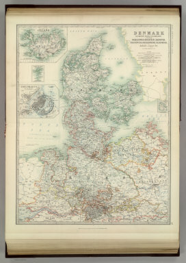
Johnston, Alexander Keith
Full Title
Denmark with Northwest portion of the German Empire. ... (with) Island of Iceland. (with) Copenhagen. (with) Faroe Islands. (with) Bornholm. (with) The Elbe from Hamburg to Cuxhaven). By Keith Johnston, F.R.S.E. Keith Johnston's General Atlas. Engraved, Printed, and Published by W. & A.K. Johnston, Edinburgh & London.
Publisher
W.& A.K. Johnston
Author
Johnston, Alexander Keith
Full Title
Empire of Germany (southern portion). By Keith Johnston, F.R.S.E. Keith Johnston's General Atlas. Engraved, Printed, and Published by W. & A.K. Johnston, Edinburgh & London.
Publisher
W.& A.K. Johnston
|