Browse All

1900 British Isles World Atlas British Isles. (with 2 insets) The Shetl … |

1900 Scotland Geological map. Ireland Geologi … World Atlas Scotland Geological map. (with inset) Sh … |

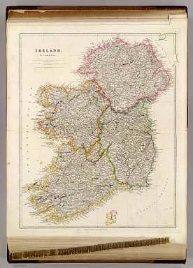
1900 Ireland World Atlas Ireland. ( (Published at the office of " … |

1874 Ireland in provinces and counties. Count … World Atlas Ireland in provinces and counties. Count … |

1827 Partie, l'Angleterre. Europe 7. World Atlas Partie de l'Angleterre. Europe no. 7. (D … |

1824 Iles Britanniques ... 1824. World Atlas Iles Britanniques ... 1824. |

1823 Norwege, Suede et Danemark ... 1823. World Atlas Norwege, Suede et Danemark ... 1823. |

1827 Partie, l'Angleterre. Europe 12. World Atlas Partie de l'Angleterre. Europe no. 12. ( … |

1848 Great Britain and Ireland. World Atlas Great Britain and Ireland. |

1848 Ireland. World Atlas Ireland. |

1850 Ireland. World Atlas Ireland. |

1865 Ireland, North Sheet. World Atlas Ireland, North Sheet. |

1865 Ireland, (South) Sheet. World Atlas Ireland, (South) Sheet. |

1857 Ireland World Atlas Ireland. Entered ... 1856 by Charles Des … |

1780 Carte des Isles Britanniques World Atlas Carte des Isles Britanniques : contenant … |

1860 Ireland ... Scotland. World Atlas Johnson's Ireland by Johnson & Browning. … |

1863 Iles Britanniques. World Atlas Iles Britanniques. |

1877 County Map Of Scotland (and) Ireland In … World Atlas County Map Of Scotland. (with inset map) … |

1909 No.39. Velikobritaniia i Irlandiia World Atlas No.39. Velikobritaniia i Irlandiia. Izda … |

1868 County map of Scotland World Atlas County map of Scotland. (inset map) 72. … |

1847 Iles Britanniques. World Atlas Carte des Iles Britanniques ... 1838. |

1832 British Isles. World Atlas British Isles. |

1832 Ireland. World Atlas Ireland. |

1827 Text Page: Tableau de l'Angleterre. Tabe … World Atlas (Text Page to) Tableau de l'Angleterre : … |

1826 Neue karte von Gross-Britannien von Irla … World Atlas Neue karte von Gross-Britannien von Irla … |
1844 Ireland. World Atlas Ireland, By J. Arrowsmith. (Map) 7. Lond … |

1815 Ireland. World Atlas Ireland. Neale (i.e. Neele) sculpt., Str … |

1829 Iles Britanniques. World Atlas Carte des Iles Britanniques comprenant l … |

1922 British Isles - railways & industrial. World Atlas British Isles - railways & industrial. ( … |

1922 British Isles - political. World Atlas British Isles - political. (with) Indust … |

1922 Ireland - northern section. World Atlas Ireland - northern section. The Edinburg … |

1922 Ireland - southern section. World Atlas Ireland - southern section. The Edinburg … |

1922 Composite: British Isles. World Atlas (Composite of) Section maps of the Briti … |

1742 Isles Britanniques. World Atlas Les Isles Britanniques ou sont le Royaum … |

1831 Ireland (northern) World Atlas Ireland. Published by D. Lizars, Edinbur … |

1831 Ireland southern. World Atlas Ireland, southern sheet. Published by D. … |

1831 Composite: Ireland. World Atlas (Composite of) Ireland. Published by D. … |

1883 Ireland. World Atlas Railway & statistical map of Ireland. Le … |

1883 Ireland 1. World Atlas Statistical map of Ireland. No. 1. Letts … |

1883 Ireland 2. World Atlas Statistical map of Ireland. No. 2. Letts … |

1883 Ireland 3. World Atlas Statistical map of Ireland. No. 3. Letts … |

1883 Ireland 4. World Atlas Statistical map of Ireland. No. 4. Letts … |

1883 Dublin. World Atlas Plan of the city of Dublin. Letts's popu … |

1883 Geological map Dublin. World Atlas Geological map of the environs of Dublin … |

1801 Invasions England, Ireland. World Atlas The invasions of England and Ireland wit … |

1794 Ireland (north) World Atlas A map of the Kingdom of Ireland divided … |

1794 Ireland (south) World Atlas (A map of the Kingdom of Ireland divided … |

1794 Composite: Ireland. World Atlas (Composite of) A map of the Kingdom of I … |

1804 United Kingdoms. World Atlas United Kingdoms of Great Britain and Ire … |

1804 Ireland. World Atlas Ireland. From various surveys of Ireland … |